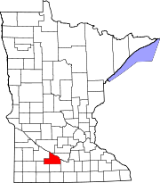
Evan | |
---|---|
Coordinates: 44°21′18″N94°50′10″W / 44.35500°N 94.83611°W | |
Country | United States |
State | Minnesota |
County | Brown |
Government | |
• Type | Mayor - Council |
• Mayor | Richard Petermann |
Area | |
• Total | 1.03 sq mi (2.68 km2) |
• Land | 1.03 sq mi (2.68 km2) |
• Water | 0.00 sq mi (0.00 km2) |
Elevation | 1,024 ft (312 m) |
Population (2020) | |
• Total | 70 |
• Density | 67.76/sq mi (26.16/km2) |
Time zone | UTC-6 (Central (CST)) |
• Summer (DST) | UTC-5 (CDT) |
ZIP code | 56085 |
Area code | 507 |
FIPS code | 27-19880 [3] |
GNIS feature ID | 2394708 [2] |
Evan is a city in Brown County, Minnesota, United States. The population was 86 at the 2010 census. [4]
A post office called Evan was established in 1886 and remained in operation until it was discontinued in 1993. [5] Evan was platted in 1887, and incorporated in 1904. [6] The city was named for the first postmaster's wife, Eva. [7]
According to the United States Census Bureau, the city has a total area of 1.01 square miles (2.62 km2), all land. [8]
Census | Pop. | Note | %± |
---|---|---|---|
1910 | 112 | — | |
1920 | 123 | 9.8% | |
1930 | 131 | 6.5% | |
1940 | 145 | 10.7% | |
1950 | 141 | −2.8% | |
1960 | 153 | 8.5% | |
1970 | 126 | −17.6% | |
1980 | 90 | −28.6% | |
1990 | 83 | −7.8% | |
2000 | 91 | 9.6% | |
2010 | 86 | −5.5% | |
2020 | 70 | −18.6% | |
U.S. Decennial Census [9] |
As of the census [10] of 2010, there were 86 people, 35 households, and 20 families residing in the city. The population density was 85.1 inhabitants per square mile (32.9/km2). There were 43 housing units at an average density of 42.6 per square mile (16.4/km2). The racial makeup of the city was 90.7% White, 8.1% from other races, and 1.2% from two or more races. Hispanic or Latino of any race were 8.1% of the population.
There were 35 households, of which 34.3% had children under the age of 18 living with them, 42.9% were married couples living together, 2.9% had a female householder with no husband present, 11.4% had a male householder with no wife present, and 42.9% were non-families. 37.1% of all households were made up of individuals, and 11.4% had someone living alone who was 65 years of age or older. The average household size was 2.46 and the average family size was 3.15.
The median age in the city was 36.3 years. 29.1% of residents were under the age of 18; 5.8% were between the ages of 18 and 24; 29.1% were from 25 to 44; 26.7% were from 45 to 64; and 9.3% were 65 years of age or older. The gender makeup of the city was 51.2% male and 48.8% female.
As of the census [3] of 2000, there were 91 people, 37 households, and 22 families residing in the city. The population density was 90.6 inhabitants per square mile (35.0/km2). There were 42 housing units at an average density of 41.8 per square mile (16.1/km2). The racial makeup of the city was 96.70% White, and 3.30% from two or more races. Hispanic or Latino of any race were 2.20% of the population.
There were 37 households, out of which 32.4% had children under the age of 18 living with them, 43.2% were married couples living together, 5.4% had a female householder with no husband present, and 40.5% were non-families. 32.4% of all households were made up of individuals, and 24.3% had someone living alone who was 65 years of age or older. The average household size was 2.46 and the average family size was 3.14.
In the city, the population was spread out, with 29.7% under the age of 18, 5.5% from 18 to 24, 35.2% from 25 to 44, 11.0% from 45 to 64, and 18.7% who were 65 years of age or older. The median age was 32 years. For every 100 females, there were 78.4 males. For every 100 females age 18 and over, there were 82.9 males.
The median income for a household in the city was $45,000, and the median income for a family was $51,250. Males had a median income of $29,688 versus $22,500 for females. The per capita income for the city was $13,670. There were no families and 4.5% of the population living below the poverty line, including no under eighteens and 26.7% of those over 64.
Kelliher is a city in Beltrami County, Minnesota, United States. The population was 258 at the 2020 census. Minnesota State Highway 72 is the primary route through Kelliher.
</ref>
Nelson is a city in Douglas County, Minnesota, United States. The population was 182 at the 2020 census.
Wanamingo is a community in Goodhue County, Minnesota, United States, incorporated as a city. It lies along the North Fork of the Zumbro River. The population was 1,086 at the 2010 census.
Middle River is a city in Marshall County, Minnesota, United States, along the Middle River, from which the city took its name. The population was 304 at the 2020 census.
Racine is a city in Racine Township, Mower County, Minnesota, United States. The population was 442 at the 2010 census.
Urbank is a city in Otter Tail County, Minnesota, United States. The population was 52 at the 2020 census.
Nielsville is a city in Polk County, Minnesota, United States. It is part of the Grand Forks, ND-MN Metropolitan Statistical Area. The population was 78 at the 2020 census.
Long Beach is a city in Pope County, Minnesota, United States. The population was 338 at the 2020 census.
McKinley is a city in Saint Louis County, Minnesota, United States; located within the Iron Range region of Minnesota. The population was 128 at the 2010 census.
Mountain Iron is a city in Saint Louis County, Minnesota, United States, in the heart of the Mesabi Range. The population was 2,878 at the 2020 census.
Orr is a city in Saint Louis County, Minnesota, United States. The population was 211 at the 2020 census.
Winton is a city in Saint Louis County, Minnesota, United States. The population was 172 at the 2010 census. The city is home to a small hydroelectric dam on the edge of Garden Lake, one of 11 stations owned by Minnesota Power.
Greenwald is a city in Stearns County, Minnesota, United States. The population was 222 at the 2010 census. It is part of the St. Cloud Metropolitan Statistical Area.
Saint Rosa is a city in Stearns County, Minnesota, United States. The population was 68 at the 2010 census. It is part of the St. Cloud Metropolitan Statistical Area.
Campbell is a city in Wilkin County, Minnesota, United States. The population was 164 at the 2020 census. It is part of the Wahpeton, ND-MN Micropolitan Statistical Area.
Kent is a city in Wilkin County, Minnesota, United States. The population was 65 at the 2020 census. It is part of the Wahpeton, ND-MN Micropolitan Statistical Area.
Fifty Lakes is a city in Crow Wing County, Minnesota, United States. The population was 387 at the 2010 census. It is part of the Brainerd Micropolitan Statistical Area.
Genola is a city in Morrison County, Minnesota, United States. The population was 70 at the 2020 census.
Minneiska is a city in Wabasha and Winona counties in the U.S. state of Minnesota. The population was 111 at the 2010 census.