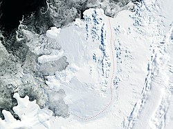
Foreman Glacier

Last updated

Location of Alexander Island in the Antarctic Peninsula region Ant-pen map Alexander.PNG
Location of Alexander Island in the Antarctic Peninsula region
Satellite image of Alexander Island Alexander-Island.jpg
Satellite image of Alexander Island

Foreman Glacier ( 69°18′S71°22′W / 69.300°S 71.367°W / -69.300; -71.367 ) is a glacier flowing south-southeast from the Havre Mountains in the northern portion of Alexander Island, Antarctica. It drains the southwest slopes of Dimitrova Peak and the west slopes of Breze Peak and flows into Palestrina Glacier north of Balan Ridge in Sofia University Mountains. The glacier was surveyed by the British Antarctic Survey (BAS), 1975–76, and was named by the UK Antarctic Place-Names Committee in 1980 after David Alexander Foreman, a BAS aircraft mechanic at Adelaide Station, 1973–76. [1]

See also

Related Research Articles

<span class="mw-page-title-main">Mount Jackson (Antarctica)</span> Mountain in Antarctica

Mount Jackson is a mountain that dominates the upland of the southern part of the Antarctic Peninsula. It is located in Palmer Land, within the Antarctic claims of Argentina, Chile and the United Kingdom. With an elevation of 3,184 metres (10,446 ft), Mount Jackson was once thought to be the highest mountain in the Antarctic Peninsula and the British Antarctic Territory, before the true height of Mount Hope was measured. Discovered by members of the United States Antarctic Service, 1939–41, it was named for Andrew Jackson, the seventh President of the United States. The first ascent of Mount Jackson was made by a team led by John Crabbe Cunningham of the British Antarctic Survey (BAS) in 1964. Mount Jackson's geology was studied in 1972 as part of the Palmer Island investigations by a team of geologists.

<span class="mw-page-title-main">Shackleton Range</span> Mountain range in Antarctica

The Shackleton Range is a mountain range in Antarctica that rises to 1,875 metres (6,152 ft) and extends in an east–west direction for about 100 miles (160 km) between the Slessor and Recovery Glaciers.

<span class="mw-page-title-main">Ames Range</span> Mountain range in Antarctica

The Ames Range is a range of snow-covered, flat-topped, steep-sided mountains, extending in a north–south direction for 20 nautical miles and forming a right angle with the eastern end of the Flood Range in Marie Byrd Land, Antarctica.

Mount Bird is a 1,765 metres (5,791 ft) high shield volcano standing about 7 nautical miles south of Cape Bird, the northern extremity of Ross Island. It was mapped by the British National Antarctic Expedition, 1901–04, under Robert Falcon Scott, and apparently named by them after Cape Bird.

<span class="mw-page-title-main">Simon Peak (Antarctica)</span> Mountain in Antarctica

Simon Peak is a mountain rising to about 1,000 m on the west side of the Havre Mountains, situated in the northwest portion of Alexander Island, Antarctica. The peak lies northeast of Umber Island, an island situated in Lazarev Bay off the west coast of Alexander Island. It is situated 9.9 km east-southeast of Buneva Point, 6.4 km northeast of Kamhi Point, 14.65 km west of Mount Pontida and 6.15 km north-northeast of Gazey Nunatak, and surmounts Pipkov Glacier to the north and Oselna Glacier to the southwest. Possibly sighted by FAE, 1908–10, in January 1909; surveyed by British Antarctic Survey in 1975–76. Named after Alec Edward Simon, British Antarctic Survey aircraft mechanic, who worked on nearby Adelaide Island during the summers of years 1972 to 1976.

<span class="mw-page-title-main">Wubbold Glacier</span> Glacier in Antarctica

Wubbold Glacier is a steeply inclined glacier, 8 nautical miles (15 km) long, flowing south from the Havre Mountains, situated in the northern portion of Alexander Island, Antarctica. The glacier drains the north, west and southwest slopes of Mount Pontida, and flows into Lazarev Bay north of Mount Holt. It was photographed from the air by Ronne Antarctic Research Expedition in 1947 and was mapped from the photographs by Falkland Islands Dependencies Survey in 1960. Named by Advisory Committee on Antarctic Names for Commander J.H. Wubbold, USCG, commanding officer, USCGC Northwind, U.S. Navy Operation Deepfreeze, 1977.

The Batterbee Mountains are a group of prominent mountains rising to 2,200 metres (7,200 ft), which forms part of the dissected edge of Dyer Plateau overlooking George VI Sound, on the west coast of Palmer Land. First seen and photographed from the air by Lincoln Ellsworth on 23 November 1935, they were charted from the ground in October 1936 by the British Graham Land Expedition (BGLE) under John Rymill, and named after Sir Harry Batterbee (1880–1976), Assistant Under-Secretary of State, Dominions Office, 1930–38, and Chairman of the Polar Committee in 1934, who gave help to the expedition.

The Carlstrom Foothills are a group of peaks and ridges in the Churchill Mountains, Antarctica.

Vivaldi Glacier is a glacier lying between the Colbert Mountains and the Lully Foothills, flowing south from Purcell Snowfield into the head of Schubert Inlet on the west coast of Alexander Island, Antarctica. The feature appears to be first shown on maps of the United States Antarctic Service (USAS) which photographed Alexander Island from the air in 1940. It was mapped from air photos obtained by the Ronne Antarctic Research Expedition in 1947–48, by Searle of the Falkland Islands Dependencies Survey in 1960. Named "Vivaldi Gap" by the United Kingdom Antarctic Place-Names Committee in 1961, after Antonio Vivaldi (1678–1741), Venetian composer. The name was amended to Vivaldi Glacier following review of Landsat program imagery, 1979, displaying flow lines in the feature.

<span class="mw-page-title-main">Mount Newman</span> Mountain in Antarctica

Mount Newman is a mountain rising to about 1,150 m in northeast Havre Mountains, north Alexander Island, Antarctica. Situated 13.23 km south of Satovcha Peak, 13.15 km north-northwest of Breze Peak, 8.26 km northeast of Mount Pontida and 7.34 km east-northeast of Igralishte Peak. The mountain was first surveyed by the British Antarctic Survey (BAS), 1975–76. Named by United Kingdom Antarctic Place-Names Committee (UK-APC) in 1980 after John Newman, BAS Diesel mechanic, Adelaide, 1968–69; Stonington Island, 1969–70 and 1972–74; who was instrumental in modifying BAS motor sledges, first used successfully as replacements for dog teams on this survey.

<span class="mw-page-title-main">Coulter Glacier</span> Glacier in Antarctica

Coulter Glacier is a steeply inclined glacier, 5 nautical miles (9 km) long, flowing south from the Havre Mountains, northern Alexander Island, into Kolokita Cove in Lazarev Bay, Antarctica. The glacier was photographed from the air by the Ronne Antarctic Research Expedition in 1947 and mapped from the photographs by the Falkland Islands Dependencies Survey in 1960. It was named by the Advisory Committee on Antarctic Names for R.W. Coulter, Master of USNS Alatna during U.S. Navy Operation Deepfreeze, 1969.

The Dana Mountains are a group of mountains just northwest of New Bedford Inlet, bounded by Mosby Glacier on the north and Haines Glacier and Meinardus Glacier on the south, in Palmer Land, Antarctica.

Fuchs Dome is a large ice-covered dome rising over 1,525 metres (5,000 ft), between Stratton Glacier and Gordon Glacier in the central part of the Shackleton Range, Antarctica.

<span class="mw-page-title-main">Goodenough Glacier</span> Glacier in Antarctica

The Goodenough Glacier is a broad sweeping glacier to the south of the Batterbee Mountains, flowing from the west shore of Palmer Land, Antarctica, into George VI Sound and the George VI Ice Shelf.

Mimas Peak is a sharp conspicuous peak, rising to about 1,000 metres (3,300 ft) west of the head of Saturn Glacier and 9 nautical miles (17 km) west of the Dione Nunataks in the southeast part of Alexander Island, Antarctica. It was first seen and photographed from the air by Lincoln Ellsworth on November 23, 1935, and mapped from these photos by W.L.G. Joerg. The peak was sighted from a distance in 1949 by the Falkland Islands Dependencies Survey (FIDS) and roughly positioned. It was named by the UK Antarctic Place-Names Committee for its association with nearby Saturn Glacier, Mimas being one of the satellites of the planet Saturn. The peak and surrounding area were first mapped in detail from air photos taken by the Ronne Antarctic Research Expedition 1947–48, by D. Searle of the FIDS in 1960. Note that some maps incorrectly attach the name to a subsidiary and smaller peak off the east flank of the mountain. The name is actually attached to the highest peak in the Herschel Heights range.

<span class="mw-page-title-main">McManus Glacier</span> Glacier in Antarctica

McManus Glacier is a glacier flowing north into Palestrina Glacier, in northwestern Alexander Island, Antarctica. It separates Lassus Mountains on the west from Sofia University Mountains on the east. The glacier was surveyed by the British Antarctic Survey (BAS), 1975–76, and was named by the UK Antarctic Place-Names Committee in 1980 after Alan James McManus, a BAS cook at Grytviken and Faraday Research Station, 1971–73, and at Adelaide Island and Rothera Research Station, 1975–78.

Holoviak Glacier is a glacier flowing west into the head of Mendelssohn Inlet, facing towards the Wilkins Ice Shelf on the north side of the Beethoven Peninsula, lying in the southwestern portion of Alexander Island, Antarctica. It was mapped by the United States Geological Survey from U.S. Navy aerial photographs taken 1967–68 and from Landsat imagery taken 1972–73, and was named by the Advisory Committee on Antarctic Names for Judy C. Holoviak, technical editor, 1964–77, of the Antarctic Research Series, published by the American Geophysical Union, and director of publications for the Union from 1978.

Lennon Glacier is a glacier flowing southwest into the outer part of Lazarev Bay, in northern Alexander Island, Antarctica. It was surveyed by the British Antarctic Survey (BAS), 1975–76, and was named by the UK Antarctic Place-Names Committee in 1980 after BAS glaciologist Peter Wilfred Lennon, who worked on Alexander Island, 1974–76.

The Columbia Mountains are a group of largely bare rock peaks, ridges and nunataks located near the east margin of the Dyer Plateau, 20 nautical miles south-east of the Eternity Range, in Palmer Land, Antarctica.

References

  1. "Foreman Glacier". Geographic Names Information System . United States Geological Survey, United States Department of the Interior . Retrieved 1 April 2012.

PD-icon.svg This article incorporates public domain material from "Foreman Glacier". Geographic Names Information System . United States Geological Survey.