Forestville, Wisconsin | |
---|---|
Coordinates: 44°41′22″N87°28′50″W / 44.68944°N 87.48056°W | |
Country | United States |
State | Wisconsin |
County | Door |
Area | |
• Total | 0.52 sq mi (1.35 km2) |
• Land | 0.52 sq mi (1.35 km2) |
• Water | 0.00 sq mi (0.00 km2) |
Elevation | 719 ft (219 m) |
Population | |
• Total | 430 |
• Estimate (2019) [4] | 408 |
• Density | 784.62/sq mi (303.01/km2) |
Time zone | UTC-6 (Central (CST)) |
• Summer (DST) | UTC-5 (CDT) |
ZIP code | 54213 |
Area code | 920 |
FIPS code | 55-26625 |
Website | Village of Forestville |
Forestville is a village in Door County, Wisconsin, United States, along the Ahnapee River. [5] The population was 430 at the 2010 census. The village is located within the Town of Forestville. The village uses the 54213 ZIP code. [6] The Ahnapee State Trail passes through the village on the southwest. [7]
Major Joseph McCormick was the first white man to settle in Forestville. He was of Scotch-Irish descent. He won his military title in the Mexian War. He discovered what he thought was a layer of marble. McCormick is responsible for bringing a great many settlers to Forestville. He spoke persuasively of the marble quarries, the water power, and the timber resources. [8]
Forestville is located at 44°41′22″N87°28′50″W / 44.68944°N 87.48056°W (44.689462, -87.480758). [9]
According to the United States Census Bureau, the village has a total area of 0.52 square miles (1.35 km2), all of it land. [10]
Census | Pop. | Note | %± |
---|---|---|---|
1970 | 349 | — | |
1980 | 455 | 30.4% | |
1990 | 470 | 3.3% | |
2000 | 429 | −8.7% | |
2010 | 430 | 0.2% | |
2019 (est.) | 408 | [4] | −5.1% |
U.S. Decennial Census [11] |
As of the census [3] of 2010, there were 430 people, 183 households, and 129 families living in the village. The population density was 826.9 inhabitants per square mile (319.3/km2). There were 206 housing units at an average density of 396.2 per square mile (153.0/km2). The racial makeup of the village was 98.1% White, 0.7% Native American, and 1.2% from two or more races. Hispanic or Latino of any race were 1.9% of the population.
There were 183 households, of which 33.9% had children under the age of 18 living with them, 56.8% were married couples living together, 9.3% had a female householder with no husband present, 4.4% had a male householder with no wife present, and 29.5% were non-families. 24.0% of all households were made up of individuals, and 9.8% had someone living alone who was 65 years of age or older. The average household size was 2.35 and the average family size was 2.78.
The median age in the village was 43.6 years. 20.7% of residents were under the age of 18; 6.8% were between the ages of 18 and 24; 25.4% were from 25 to 44; 29.1% were from 45 to 64; and 18.1% were 65 years of age or older. The gender makeup of the village was 49.3% male and 50.7% female.
As of the census [12] of 2000, there were 429 people, 181 households, and 120 families living in the village. The population density was 823.7 people per square mile (318.5/km2). There were 202 housing units at an average density of 387.8 per square mile (150.0/km2). The racial makeup of the village was 99.07% White, 0.70% Black or African American, and 0.23% from two or more races. 0.00% of the population were Hispanic or Latino of any race.
There were 181 households, out of which 29.3% had children under the age of 18 living with them, 55.8% were married couples living together, 7.7% had a female householder with no husband present, and 33.7% were non-families. 30.9% of all households were made up of individuals, and 17.1% had someone living alone who was 65 years of age or older. The average household size was 2.37 and the average family size was 2.92.
In the village, the population was spread out, with 22.6% under the age of 18, 7.0% from 18 to 24, 28.7% from 25 to 44, 24.5% from 45 to 64, and 17.2% who were 65 years of age or older. The median age was 41 years. For every 100 females, there were 96.8 males. For every 100 females age 18 and over, there were 94.2 males.
The median income for a household in the village was $39,167, and the median income for a family was $50,313. Males had a median income of $31,146 versus $19,688 for females. The per capita income for the village was $16,521. About 1.7% of families and 7.4% of the population were below the poverty line, including 1.0% of those under age 18 and 23.0% of those age 65 or over.
|
Coe Township is a civil township of Isabella County in the U.S. state of Michigan. The population was 2,993 at the 2000 census.
Forestville is a village in Sanilac County in the U.S. state of Michigan. The population was 104 at the 2020 census, making it the least-populous village in Michigan. It does not have a true harbor onto Lake Huron, but the village does have a boat launch site. Forestville receives city water from nearby Harbor Beach. The village is within Delaware Township.
Bloomfield Township is a township in Fillmore County, Minnesota, United States. The population was 414 at the 2000 census. Bloomfield Township borders Beaver Township, Forestville Township, and Spring Valley Township.
Forestville Township is a township in Fillmore County, Minnesota, United States. The population was 356 as of the 2010 census. It contains historic Forestville, which is now a living history museum within Forestville/Mystery Cave State Park.
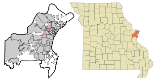
Cedar Hill Lakes is a village in Jefferson County, Missouri, United States. The population was 203 at the 2020 census.
Manchester is a village in Manchester Township, Adams County, Ohio, United States, along the Ohio River. The population was 1,839 at the 2020 census.
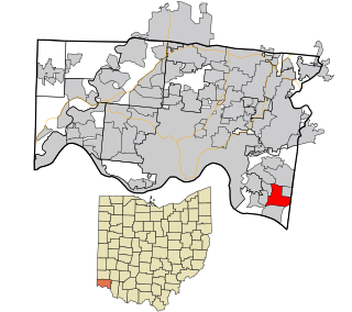
Forestville is a census-designated place (CDP) in Hamilton County, Ohio, United States. The population was 10,615 at the 2020 census.
Vanlue is a village in Hancock County, Ohio, United States. The population was 341 at the 2020 census.
Morral is a village in Marion County, Ohio, United States. The population was 373 at the 2020 census. Morral is served by Ridgedale Local School District.
Ridgebury Township is a township in Bradford County, Pennsylvania, United States. It is part of Northeastern Pennsylvania. The population was 1,978 at the 2010 census.
Forestville is a census-designated place (CDP) in Schuylkill County, Pennsylvania, United States. The population was 431 at the 2000 census.
Rouseville is a borough in Venango County, Pennsylvania, United States. The population was 456 at the 2020 census.
Clearview is a village in Ohio County, West Virginia, United States. It is part of the Wheeling, West Virginia Metropolitan Statistical Area. The population was 565 at the 2010 census.
Ahnapee is a town in Kewaunee County, Wisconsin, United States, on the Ahnapee River. The population was 940 as of the 2010 census. The Ahnapee State Trail passes through the town of Ahnapee.
Algoma is a city in Kewaunee County in the U.S. state of Wisconsin. The population was 3,167 at the 2010 census. Algoma is part of the Green Bay Metropolitan Statistical Area.
Meteor is a town in Sawyer County, Wisconsin, United States. The population was 170 at the 2000 census.
Dorchester is a village in Clark and Marathon counties in the U.S. state of Wisconsin, along the 45th parallel. It is part of the Wausau, Wisconsin Metropolitan Statistical Area. The population was 876 at the 2010 census. Of this, 871 were in Clark County, and only 5 were in Marathon County.
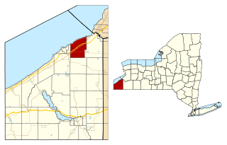
Forestville is a town in Door County, Wisconsin, United States. The population was 1,096 at the 2010 census. The Village of Forestville is located within the town but the two are politically independent.
Woodman is a village in Grant County in the U.S. state of Wisconsin. The population was 132 at the 2010 census. The village is located within the Town of Woodman.
Peñasco is a census-designated place (CDP) in Taos County, New Mexico. It is located along the scenic High Road to Taos. The population is estimated at 1,200 (2015).