Fort McIntosh, Texas

Last updated
Fort McIntosh
FMcI.jpg
Fort McIntosh
Relief map of Texas.png
Red pog.svg
Fort McIntosh
Usa edcp relief location map.png
Red pog.svg
Fort McIntosh
Location Laredo Junior College campus, Laredo, Texas
Coordinates 27°30′19″N99°31′14″W / 27.50528°N 99.52056°W / 27.50528; -99.52056
Area193.8 acres (78.4 ha)
Built1853 (1853)
Architectural styleLate Victorian
NRHP reference No. 75002011 [1]
Added to NRHPJune 25, 1975
Fort McIntosh Fort McIntosh.jpg
Fort McIntosh

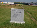
Fort McIntosh was a U.S. Army base in Laredo, Webb County, Texas, from 1849 to 1946.

Contents

Fort McIntosh was established on 3 March 1849 by the 1st US Infantry, under the command of Lt. E.L. Viele, [2] to guard the Texas frontier at the site of a strategic river crossing. Originally named Camp Crawford, the fort was renamed Fort McIntosh in 1850 in honor of Lieutenant Colonel James Simmons McIntosh, a hero in the Battle of Molino del Rey during the Mexican–American War.

The fort was abandoned by Federal troops at the outbreak of the American Civil War. The Battle of Laredo took place near the fort on March 19, 1864, when 72 men repelled three attacks from a force of 200 federal soldiers sent from Brownsville, Texas. On October 23, 1865, the post was reoccupied by federal troops of the 2nd Texas Cavalry.

In the late 19th century, several African-American units among them the 10th Cavalry, the "Buffalo Soldiers", were stationed at Fort McIntosh. Other forts in the frontier fort system were Forts Griffin, Concho, Belknap, Chadbourne, Stockton, Davis, Bliss, McKavett, Clark, Richardson, Inge, and Phantom Hill in Texas, and Fort Sill in Oklahoma. [3] Thesystem had "subposts or intermediate stations" including Bothwick's Station on Salt Creek between Fort Richardson and Fort Belknap, Camp Wichita near Buffalo Springs between Fort Richardson and Red River Station, and Mountain Pass between Fort Concho and Fort Griffin. [4]

During World War I, the fort was used as a training base, and had over 15,000 recruits pass through the gates. During World War II, the 8th Service Command, the 56th Cavalry Brigade, the Southern Land Frontier, the Civil Air Patrol, and battalion of military police all were stationed at the facility at one time or another.

The fort was deactivated in 1946, and the land is now part of the campus of Laredo Community College main campus. [5]

The Laredo United States Army Reserve 340th Quarter Master Company is located within the fort.

National Register of Historic Places

The National Register of Historic Places added Fort McIntosh (#75002011) to its registered historic districts in 1975. Its areas of historic significance are its 1850-1924 Late Victorian Architecture and Military background. All of Fort McIntosh buildings have been preserved and remodeled, and today they serve as educational buildings for Laredo Community College. [6] The former officers barracks has been renovated into Arechiga Hall, named for the third LCC president, Domingo Arechiga. [7]

Aerial view

Fort McIntosh U.S. Military Reservation 1892.JPG
The full length of the Fort McIntosh U.S. Military Reservation in 1892.

See also

Related Research Articles

<span class="mw-page-title-main">Fort Stockton, Texas</span> City in Texas, United States

Fort Stockton is a city in and the county seat of Pecos County, Texas, United States. It is located on Interstate 10, future Interstate 14, U.S. Highways 67, 285, and 385, and the Santa Fe Railroad, 329 mi (529 km) northwest of San Antonio and 240 mi (390 km) southeast of El Paso. Its population was 8,283 at the 2010 census.

<span class="mw-page-title-main">Fort Concho</span> US Army fort in Texas, used 1867–1889

Fort Concho is a former United States Army installation and National Historic Landmark District located in San Angelo, Texas. It was established in November 1867 at the confluence of the North and South Concho Rivers, on the routes of the Butterfield Overland Mail Route and Goodnight–Loving Trail, and was an active military base for the next 22 years. Fort Concho was the principal base of the 4th Cavalry from 1867 to 1875 and then the "Buffalo Soldiers" of the 10th Cavalry from 1875 to 1882. The troops stationed at Fort Concho participated in Ranald S. Mackenzie's 1872 campaign, the Red River War in 1874, and the Victorio Campaign of 1879–1880.

<span class="mw-page-title-main">Fort Sill</span> United States army post of Lawton, Oklahoma

Fort Sill is a United States Army post north of Lawton, Oklahoma, about 85 miles (136.8 km) southwest of Oklahoma City. It covers almost 94,000 acres (38,000 ha).

<span class="mw-page-title-main">Fort Davis National Historic Site</span> National Historic Site of the United States

Fort Davis National Historic Site is a United States National Historic Site located in the unincorporated community of Fort Davis, Jeff Davis County, Texas. Located within the Davis Mountains of West Texas, the historic site was established in 1961 to protect one of the best remaining examples of a United States Army fort in the southwestern United States.

<span class="mw-page-title-main">Fort McIntosh (Pennsylvania)</span> United States historic place

Fort McIntosh was an early American log frontier fort situated near the confluence of the Ohio River and the Beaver River in what is now Beaver, Pennsylvania.

<span class="mw-page-title-main">Fort Duncan</span> United States historic place

Fort Duncan was a United States Army base, set up to protect the first U.S. settlement on the Rio Grande near the current town of Eagle Pass, Texas.

<span class="mw-page-title-main">Fort Inge</span> United States historic place

Fort Inge was a frontier fort in Uvalde County, Texas, United States.

<span class="mw-page-title-main">Fort Griffin</span> United States historic place

Fort Griffin, now a Texas state historic site as Fort Griffin State Historic Site, was a US Cavalry fort established 31 July 1867 by four companies of the Sixth Cavalry, U.S. Army under the command of Lt. Col. S. D. Sturgis, in the western part of North Texas, specifically northwestern Shackelford County, to give settlers protection from early Comanche and Kiowa raids. Originally called Camp Wilson after Henry Hamilton Wilson, a recently deceased lieutenant and son of Radical Republican senator and later vice president, Henry Wilson, it was later named for Charles Griffin, a former Civil War Union general who had commanded, as de facto military governor, the Department of Texas during the early years of Reconstruction.

<span class="mw-page-title-main">Fort Chadbourne</span> United States historic place

Fort Chadbourne was a fort established by the United States Army on October 28, 1852, in what is now Coke County, Texas, to protect the western frontier and the Butterfield Overland Mail route. It was named after Lt. T.L. Chadbourne, who was killed in the Battle of Resaca de la Palma. It was defended by Companies A and K of the 8th U.S. Infantry. During the early days of the American Civil War, the fort surrendered to the Confederates on February 28, 1861, even before the Confederate shelling of Fort Sumter, South Carolina, but was reoccupied by federal troops from 1865 to 1867.

<span class="mw-page-title-main">Fort Richardson (Texas)</span> State park and historic site in Texas, United States

Fort Richardson was a United States Army installation located in present-day Jacksboro, Texas. Named in honor of Union General Israel B. Richardson, who died in the Battle of Antietam during the American Civil War, it was active from 1867 to 1878. Today, the site, with a few surviving buildings, is called Fort Richardson State Park, Historic Site and Lost Creek Reservoir State Trailway. It was designated a National Historic Landmark in 1963 for its role in securing the state's northern frontier in the post-Civil War era.

The Forts of Texas include a number of historical and operational military installations. For over 200 years, various groups fought over access to or control over the region that is now Texas. Possession of the region was claimed and disputed by the European powers of Spain and France, and the continental countries of Mexico, the United States, the Republic of Texas, and the Confederate States of America. Ownership of specific lands was claimed and disputed by different ethnic groups, including numerous Native American tribes, Mexican residents, Anglo- and African-American settlers, and European immigrants. Access to and control of resources were claimed and disputed by various economic groups, including indigenous hunter/gatherers, farmers, herders, ranchers, colonists, settlers, buffalo hunters, traders, bandits, smugglers, pirates, and revolutionaries. Over the centuries, claims and disputes were enforced by Native American warriors, Spanish conquistadors, French cavaliers, Texas Rangers, local militias, and uniformed regular army regiments of Spain, Mexico, Texas, the United States, and the Confederacy.

<span class="mw-page-title-main">Fort McKavett State Historic Site</span> United States historic place

The Fort McKavett State Historic Site is a former United States Army installation located in Menard County, Texas. The fort was first established in 1852 as part of a line of forts in Texas intended to protect migrants traveling to California. The fort was deemed unnecessary and abandoned in 1859 and was occupied by settlers. From 1861 to 1863, during the American Civil War, the fort became an outpost of Confederate forces on the Texas frontier until they left for other theaters of the war. When the US Army returned to Texas in the later 1860s, the fort was reoccupied and rebuilt, and became a base for the "Buffalo Soldier", or all-African American, 24th Infantry and 9th Cavalry Regiments.

<span class="mw-page-title-main">Laredo College</span> Public college in Laredo, Texas, U.S.

Laredo College (LC) is a public community college in Laredo, Texas. Founded as Laredo Junior College in 1947, it is part of the Laredo Independent School District. As defined by the Texas Legislature, the official service area of LC includes the municipality of Laredo and all of Webb, Jim Hogg and Zapata counties.

<span class="mw-page-title-main">Fort Phantom Hill</span> US Army fort in Texas, used 1852–1890s

Fort Phantom Hill, also called the Camp on the Clear Fork, is a former United States Army installation located in Jones County, Texas. The fort was established in 1851 as part of a line of forts in Texas to protect migrants passing through the state on their way to California. The US Army abandoned the fort in 1854 and it was shortly thereafter mostly destroyed by fire. In 1858, it became a station of the Butterfield-Overland Mail route until it moved out of Texas with the beginning of the American Civil War in 1861. During the war, the fort was occupied by Confederate frontier troops until the Confederacy's defeat and surrender. Following the US Army's return to Texas after the Civil War, Fort Phantom Hill was used as a subpost of the larger, newer Fort Griffin until 1875.

<span class="mw-page-title-main">Downtown Laredo</span> Place in Texas, United States

Downtown Laredo is the second main business district in Laredo, Texas. Downtown Laredo is the starting point for Interstate Highway 35 and State Highway 359. It is home to all of Laredo's high-rise buildings. Laredo's and Webb County's main government buildings are located in Downtown Laredo. Most of Webb County's National Register of Historic Places are in this area.

<span class="mw-page-title-main">Fort Belknap (Texas)</span> United States historic place

Fort Belknap, located near Newcastle, Texas, was established in November 1851 by brevet Brigadier General William G. Belknap to protect the Texas frontier against raids by the Kiowa and Comanche. It was the northernmost fort in a line from the Rio Grande to the Red River. The fort functioned as a base of operations rather than as a fortified point, and it became the center of a substantial network of roads, including the Butterfield Overland Mail. The fort was designated a National Historic Landmark in 1960, in recognition of its key role in securing the Texas frontier in the 1850s and 1860s.

<span class="mw-page-title-main">Fort Clark, Texas</span> United States historic place

Fort Clark was a frontier fort located just off U.S. Route 90 near Brackettville, in Kinney County, Texas, United States. It later became the headquarters for the 2nd Cavalry Division. The Fort Clark Historic District was added to the National Register of Historic Places on December 6, 1979. The Commanding Officer's Quarters at Fort Clark were designated a Recorded Texas Historic Landmark in 1988. The Fort Clark Guardhouse became a Recorded Texas Historic Landmark in 1962. The Fort Clark Officers' Row Quarters were designated a Recorded Texas Historic Landmark in 1991.

<span class="mw-page-title-main">Ramón H. Dovalina</span>

Ramón Humberto Dovalina, is the retired fifth president of Laredo Community College, a two-year institution with the main campus on the grounds of historic Fort McIntosh on the Rio Grande in his native Laredo in Webb County in South Texas. With service from July 5, 1995, until August 31, 2007, Dovalina left the position with two years remaining in his contract. Under Dovalina, the physical appearance of the college was upgraded, the scholarship endowment fund increased from $100,000 in 1995 to more than $1 million in 2007, the institution advanced a 10-year master plan for new technology, and a $50 million South Campus was opened.

The following is a timeline of the history of the city of Laredo, Texas, USA.

References

  1. "National Register Information System". National Register of Historic Places . National Park Service. July 9, 2010.
  2. Texas Historical Marker # 5479001996
  3. Carter, R.G., On the Border with Mackenzie, 1935, Washington D.C.: Enyon Printing Co., p. 48
  4. Carter, p. 49
  5. Handbook of Texas Online, s.v. "," (accessed May 22, 2008).
  6. National Register of Historic Places in Webb County
  7. "Historic Fort McIntosh Campus". Laredo Community College. Retrieved August 10, 2015.

Commons-logo.svg Media related to Fort McIntosh, Texas at Wikimedia Commons