
Stoke-upon-Trent, also called Stoke, is one of the six towns that along with Hanley, Burslem, Fenton, Longton and Tunstall form the city of Stoke-on-Trent, in Staffordshire, England.
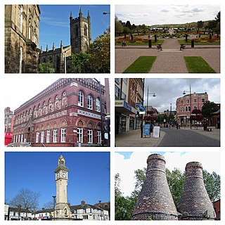
Stoke-on-Trent is a city and unitary authority area in Staffordshire, England, with an area of 36 square miles (93 km2). In 2021, the city had an estimated population of 258,400. It is the largest settlement in Staffordshire and is surrounded by the towns of Newcastle-under-Lyme, Alsager, Kidsgrove and Biddulph, which form a conurbation around the city.

The Trent is third in the list of longest rivers in the United Kingdom. Its source is in Staffordshire, on the southern edge of Biddulph Moor. It flows through and drains the North Midlands into the Humber Estuary. The river is known for dramatic flooding after storms and spring snowmelt, which in the past often caused the river to change course.

The River Tame is a river in the West Midlands of England, and one of the principal tributaries of the River Trent. The Tame is about 95 km (59 mi) long from the source at Oldbury to its confluence with the Trent near Alrewas, but the main river length of the entire catchment, i.e. the Tame and its main tributaries, is about 285 km (177 mi).

The River Wandle is a right-bank tributary of the River Thames in south London, England. With a total length of about 9 miles (14 km), the river passes through the London boroughs of Croydon, Sutton, Merton and Wandsworth, where it reaches the Thames. A short headwater – the Caterham Bourne – is partially in Surrey, the historic county of the river's catchment. Tributaries of the Wandle include Carshalton Ponds and Norbury Brook.

The River Leen is a 15-mile (24 km) long tributary of the River Trent that flows through Nottinghamshire, and the city of Nottingham in the East Midlands of England.

Burslem is one of the six towns that along with Hanley, Tunstall, Fenton, Longton and Stoke-upon-Trent form part of the city of Stoke-on-Trent in Staffordshire, England. It is often referred to as the "mother town" of Stoke on Trent.

Middleport is a residential and industrial district in the city of Stoke-on-Trent, England. Middleport lies to the west of Burslem, between Burslem and the Newcastle-under-Lyme district of Porthill. To the north is Tunstall and to the south Cobridge and Etruria. Middleport conjoins Longport.

Tunstall is one of the six towns that, along with Burslem, Longton, Fenton, Hanley and Stoke-upon-Trent, amalgamated to form the City of Stoke-on-Trent in Staffordshire, England. It was one of the original six towns that federated to form the city. Tunstall is the most northern, and fourth largest town of the Potteries. It is situated in the very northwest of the city borough, with its north and west boundaries being the city limit. It stands on a ridge of land between Fowlea Brook to the west and Scotia Brook to the east, surrounded by old tile-making and brick-making sites, some of which date back to the Middle Ages.
Basford is a suburb which sits on high ground between Newcastle-under-Lyme and Stoke-on-Trent in Staffordshire, England.

Cliff Vale is a district of the city of Stoke-on-Trent, and lies to the immediate south of Etruria and just east of Basford and Hartshill. Cliffe Vale is in the valley of the Fowlea Brook, now better known as Etruria Valley. There are industrial and employment uses along the A500, and new residential developments along the Trent and Mersey Canal. The Shelton New Road (B5045) passes through from east to west. The area is sometimes called Cliff Vale by the city council, and is part of the Hartshill electoral ward.

The River Mease is a lowland clay river in the Midlands area of England. It flows through the counties of Leicestershire, Derbyshire and Staffordshire and forms the administrative border between these counties for parts of its length.
The Smestow Brook, sometimes called the River Smestow, is a small river that plays an important part in the drainage of Wolverhampton, South Staffordshire, and parts of Dudley in the United Kingdom, and has contributed to the industrial development of the Black Country. It is the most important tributary of the River Stour, Worcestershire and part of the River Severn catchment.

Ford Green Brook flows through Staffordshire and the outlying areas of Stoke-on-Trent, England. It is the first named tributary stream of the River Trent, and is 6.2 miles (10 km) long.
Rykeneld Street or Ryknield Street was a Roman road which ran through the northern Midlands of England from Deva (Chester) to Derventio (Derby) via what is now Stoke-on-Trent. It is not to be confused with the Icknield Street. It has in the past also been called by Victorian antiquarians the "Via Devina". The territory traversed would have been that of the Cornovii.

The Markeaton Brook is an 11-mile-long (17 km) tributary of the River Derwent in Derbyshire, England. The brook rises from its source south of Hulland Ward, and flows for most of its length through the countryside north-west of Derby before entering a culvert to the north of the city centre; it reappears from this culvert and runs through a short section of open channel on the other side of the city before joining the Derwent.

Fairham Brook is a 16-mile-long (26 km) tributary of the River Trent that flows through Leicestershire and Nottinghamshire in England.

Lyme Brook is a tributary stream of the River Trent, which flows through Newcastle-under-Lyme, and the outlying areas of Stoke-on-Trent in Staffordshire, England.
Packmoor is a small village or hamlet on the northern edge of Stoke-on-Trent. It is located between Kidsgrove and Chell.

Moston Brook is a stream in Greater Manchester in north-west England and a tributary of the River Irk. The brook is formed at the confluence of Bower Brook and Hole Bottom Brook. This occurs near the Rochdale Canal in Failsworth in the Metropolitan Borough of Oldham. It flows southwest, forming the border between Moston, Manchester and Failsworth before being culverted almost all of the remaining route to its meeting the River Irk. It has a total length of about 3.7 miles.


