Berryhill Fields

Last updated

Berryhill Fields
Breaking the Mould.jpg
Breaking the Mould, sculpture by Andrew McKeown, installed in 2000. Commissioned by Groundwork UK.
Staffordshire UK location map.svg
Red pog.svg
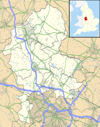
Location in Staffordshire
Location Stoke-on-Trent
OS grid SJ 908 458
Coordinates 53°00′33″N2°08′25″W / 53.0092°N 2.1402°W / 53.0092; -2.1402
Area63.31 hectares (156.4 acres)
Operated by Stoke-on-Trent City Council
Designation Local nature reserve
Website Berryhill Fields

Berryhill Fields is an area of grassland in the heart of Stoke-on-Trent in England, between the housing estates of Bentilee and Berryhill and the town of Fenton. It is a local nature reserve, owned and managed by Stoke-on-Trent City Council. Its area is 63.31 hectares (156.4 acres). [1]

Contents

History

The earthwork remains of a medieval manor house (Lawn Farm moated site, a scheduled monument) are within the area. It is thought to have once been the manor house of Fenton Vivian (that later became the town of Fenton), named after Vivian of Standon, lord of the manor in the 13th century. [2] [3]

In the first half of the 20th century there were two coal mines on the present Berryhill Fields, and small scale farming. The land was acquired for housing in the 1950s but no building took place. A subsequent plan for open-cast mining was turned down in 1994. [1]

Regeneration

The site was the subject of a £2 million regeneration project for the Millennium, managed by Groundwork Stoke, as part of the nationwide Changing Places programme, that included creating new pathways to facilitate access for people with disabilities, creating a number of art features, and funding a series of archaeological excavations on the site of the 13th-century moated manor house sited on the fields.

Related Research Articles

<span class="mw-page-title-main">Stoke-on-Trent</span> City and unitary authority in England

Stoke-on-Trent is a city and unitary authority area in Staffordshire, England, with an area of 36 square miles (93 km2). In 2021, the city had an estimated population of 258,400. It is the largest settlement in Staffordshire and is surrounded by the towns of Newcastle-under-Lyme, Alsager, Kidsgrove and Biddulph, which form a conurbation around the city.

<span class="mw-page-title-main">Quarrendon</span> Human settlement in England

Quarrendon or Quarrendon Leas is a medieval English village near Aylesbury in Buckinghamshire, England, which has been depopulated since the 16th century and is now a scheduled monument.

<span class="mw-page-title-main">Walton, Aylesbury</span> Human settlement in England

Walton is a hamlet in the parish of Aylesbury, in Buckinghamshire, England. Although Aylesbury has grown to such an extent that it completely surrounds Walton by a couple of miles in each direction, the hamlet is still marked on modern maps.

<span class="mw-page-title-main">Eaton Bray</span> Human settlement in England

Eaton Bray is a village and civil parish in Bedfordshire, England. It is situated about three miles south-west of the town of Dunstable and is part of a semi-rural area which extends into the parish of Edlesborough. In the 2021 United Kingdom census the population of the parish was recorded as 2,644.

<span class="mw-page-title-main">Bramhall</span> Human settlement in England

Bramhall is an area in the Metropolitan Borough of Stockport, Greater Manchester, England. Historically in Cheshire, it had a population of 17,436 at the 2011 Census.

<span class="mw-page-title-main">Bentilee</span> Human settlement in England

Bentilee is a housing estate in Stoke-on-Trent, Staffordshire, England, between Hanley and Longton, and parallel with Fenton.

<span class="mw-page-title-main">Fenton, Staffordshire</span> Town in Stoke-on-Trent, England

Fenton is one of the six towns that amalgamated with Hanley, Tunstall, Burslem, Longton and Stoke-upon-Trent to form the county borough of Stoke-on-Trent in 1910, later raised to city status in 1925. Fenton is often referred to as "the Forgotten Town", because it was omitted by local author, Arnold Bennett, from many of his works based in the area, including one of his most famous novels, Anna of the Five Towns. It is in the ceremonial county of Staffordshire, England

<span class="mw-page-title-main">Stoke-on-Trent Central (UK Parliament constituency)</span>

Stoke-on-Trent Central is a constituency in Staffordshire. It has been represented by Jo Gideon of the Conservative Party since the general election of 2019.

<span class="mw-page-title-main">Tunstall, Staffordshire</span> Human settlement in England

Tunstall is one of the six towns that, along with Burslem, Longton, Fenton, Hanley and Stoke-upon-Trent, amalgamated to form the City of Stoke-on-Trent in Staffordshire, England. It was one of the original six towns that federated to form the city. Tunstall is the most northern, and fourth largest town of the Potteries. It is situated in the very northwest of the city borough, with its north and west boundaries being the city limit. It stands on a ridge of land between Fowlea Brook to the west and Scotia Brook to the east, surrounded by old tile-making and brick-making sites, some of which date back to the Middle Ages.

<span class="mw-page-title-main">Stoke Bardolph</span> Village in Nottinghamshire, England

Stoke Bardolph is a village and civil parish in the Gedling district of Nottinghamshire. The population of the civil parish taken at the 2011 census was 170, increasing to 598 residents at the 2021 census. It is to the east of Nottingham, and on the west bank of the River Trent. Nearby places include Burton Joyce and Radcliffe on Trent.

<span class="mw-page-title-main">Gisleham</span> Human settlement in England

Gisleham is a village and civil parish in the English county of Suffolk. It is on the edge of Lowestoft, around 4.5 miles (7.2 km) south-west of the town centre. The parish is in the East Suffolk district, situated between Carlton Colville and Kessingland.

Stoke-upon-Trent was a parliamentary borough in Staffordshire, which elected two Members of Parliament (MPs) to the House of Commons from 1832 until 1885, and then one member from 1885 until 1918, when the borough was enlarged, renamed Stoke-on-Trent, and split into three single-member constituencies.

The federation of Stoke-on-Trent was the 1910 amalgamation of the six Staffordshire Potteries towns of Burslem, Tunstall, Stoke-upon-Trent, Hanley, Fenton and Longton into the single county borough of Stoke-on-Trent. The federation was one of the largest mergers of local authorities, involving the greatest number of previously separate urban authorities, to take place in England between the nineteenth century and the 1960s. The 1910 federation was the culmination of a process of urban growth and municipal change that started in the early 19th century.

Weston Coyney is a suburb of the City of Stoke-on-Trent in Staffordshire. It lies on the south eastern edge of the city and borders the neighbouring Staffordshire Moorlands district.

<span class="mw-page-title-main">Manor Farm, Ruislip</span> Historic site in Greater London, England

Manor Farm is a 22-acre (8.9 ha) historic site in Ruislip, Greater London. It incorporates a medieval farm complex, with a main old barn dating from the 13th century and a farm house from the 16th. Nearby are the remains of a motte-and-bailey castle believed to date from shortly after the Norman conquest of England. Original groundwork on the site has been dated to the 9th century.

<span class="mw-page-title-main">Caludon Castle</span> Grade I listed castle in the United Kingdom

Caludon Castle is a Scheduled Ancient Monument and Grade I listed building in Coventry, in the West Midlands of England. A second moated site 190 metres (620 ft) to the south is a Scheduled Ancient Monument in its own right. The castle is now a ruin, and all that remains is a large fragment of sandstone wall. What remains of the estate is now an urban park, owned and run by Coventry City Council, but much of it was sold and developed into housing estates in the early 20th century.

<span class="mw-page-title-main">Hilderstone</span> Human settlement in England

Hilderstone is a village and a civil parish in the English county of Staffordshire.

<span class="mw-page-title-main">William Greatbatch</span>

William Greatbatch was a noted potter at Fenton, Staffordshire, from the mid-eighteenth to the beginning of the nineteenth centuries. Fenton was one of the six towns of the Staffordshire Potteries, which were joined in the early 20th century to become the city of Stoke-on-Trent in Staffordshire, England.

<span class="mw-page-title-main">Rampton and Woodbeck</span> Civil parish in England

Rampton and Woodbeck is a civil parish in the Bassetlaw district, within the county of Nottinghamshire, England. The overall area had a population of 1,077 at the 2021 census. The parish lies in the north east of the county. It is 125 miles north west of London, 27 miles north east of the city of Nottingham, and 5 miles south east of the town of Retford. The parish rests alongside the county border with Lincolnshire. It is the site of Rampton Secure Hospital, which is one of only three high security psychiatric hospitals in England.

<span class="mw-page-title-main">Christ Church, Fenton</span> Church in Staffordshire, England

Christ Church is an Anglican church in Fenton, Staffordshire, England. It is in the parish of Stoke-upon-Trent and Fenton, and in the Diocese of Lichfield. The building is Grade II listed.

References

  1. 1 2 "Berryhill Fields" Natural England . Retrieved 11 July 2020.
  2. 'Fenton', in A History of the County of Stafford: Volume 8, ed. J G Jenkins (London, 1963), pp. 205-224 British History Online. Retrieved 12 July 2020.
  3. Historic England. "Lawn Farm moated site and two ponds (1011060)". National Heritage List for England . Retrieved 12 July 2020.