
The Owyhee River is a tributary of the Snake River located in northern Nevada, southwestern Idaho and southeastern Oregon in the United States. It is 280 miles (450 km) long. The river's drainage basin is 11,049 square miles (28,620 km2) in area, one of the largest subbasins of the Columbia Basin. The mean annual discharge is 995 cubic feet per second (28.2 m3/s), with a maximum of 50,000 cu ft/s (1,400 m3/s) recorded in 1993 and a minimum of 42 cu ft/s (1.2 m3/s) in 1954.

The Luckiamute River is a tributary of the Willamette River, about 61 miles (98 km) long, in western Oregon in the United States. It drains an area of Central Oregon Coast Range and the western Willamette Valley northwest of Corvallis.
The Middle Santiam River is a tributary of the South Santiam River, 38.5 miles (62.0 km) long, in western Oregon in the United States. It drains a remote area of the Cascade Range east of Sweet Home in the watershed of the Willamette River.

The Youngs River is a tributary of the Columbia River, approximately 27 miles (43 km) long, in northwest Oregon in the United States. It drains part of the Northern Oregon Coast Range in the extreme northwest corner of state, entering the Columbia via Youngs Bay just approximately 10 miles (16 km) from its mouth.
The Minam River is a tributary of the Wallowa River, 51 miles (82 km) long, in northeastern Oregon in the United States. It drains a rugged wilderness area of the Wallowa Mountains northeast of La Grande.

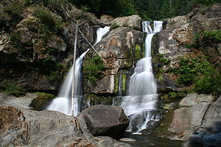
Salt Creek Falls is a cascade and plunge waterfall on Salt Creek, a tributary of the Middle Fork Willamette River, that plunges into a gaping canyon in the Willamette National Forest near Willamette Pass in Lane County, Oregon. The waterfall is notable for its main drop of 286 feet (87 m), ranking third highest among plunge waterfalls in Oregon, after Multnomah Falls and Watson Falls.) The pool at the bottom of Salt Creek Falls waterfall is 66 feet (20 m) deep.

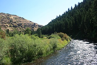
Grave Creek is a tributary, about 40 miles (64 km) long, of the Rogue River in southwestern Oregon in the United States.
Blazed Alder Creek is a tributary, about 4 miles (6 km) long, of the Bull Run River in the U.S. state of Oregon. Part of the system that provides drinking water to the city of Portland, it flows generally north through a protected part of the Mount Hood National Forest in Clackamas and Multnomah counties. The creek is named after a 24-inch (61 cm) blazed (marked) alder tree that was used as a benchmark during early watershed surveys.
The South Fork Coquille River is the longest tributary of the Coquille River in coastal Oregon in the United States. From its headwaters in the Southern Oregon Coast Range, the river flows northwest to join the North Fork Coquille River at Myrtle Point, forming the main stem Coquille. The South Fork is about 63 miles (101 km) long, and its watershed drains roughly 288 square miles (750 km2) of rural Coos County.

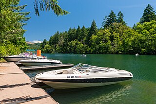
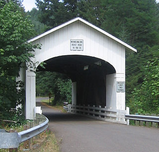
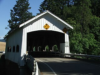
The Horse Creek Bridge was a covered bridge near the unincorporated community of McKenzie Bridge in Lane County in the U.S. state of Oregon. Built in 1930, the structure, 105 feet (32 m) long, carried Horse Creek Road over Horse Creek. The creek is a tributary of the McKenzie River.

Evans Creek is a tributary, about 35 miles (56 km) long, of the Rogue River in the U.S. state of Oregon. It begins near Richter Mountain in the Cascade Range and flows generally south to The Meadows then southwest to Wimer then south to the city of Rogue River, all in Jackson County. The creek enters the river about 111 miles (179 km) from the Rogue's mouth on the Pacific Ocean. Wimer Bridge, a one-lane covered bridge crosses the creek at Wimer.
Penn is an unincorporated community and former railway station in Lane County, in the U.S. state of Oregon. It was named for the Penn Timber Company, which operated in the vicinity.

Bear Creek is a tributary of the Salmon River in the Central Oregon Coast Range in the United States. It begins in the Siuslaw National Forest and flows generally northwest through Lincoln County to meet the river between Rose Lodge and Otis. Named tributaries from source to mouth are McMullen, Tarry, Southman, and Morton creeks.
Mill Creek is a tributary of the Mohawk River in Lane County in the U.S. state of Oregon. It begins in the foothills of the Cascade Range northeast of Springfield and flows generally west through Wendling to meet the river near Marcola. The confluence is about 13 river miles (21 km) from the Mohawk's mouth on the McKenzie River. Mill Creek's named tributaries from source to mouth are Straight, Nebo, Deer, Oshkosh, and Wolf creeks.
Calapooya Creek is a tributary, about 37 miles (60 km) long, of the Umpqua River in Douglas County in the U.S. state of Oregon. Formed by its north and south forks, the creek drains a mountainous region south of the Calapooya Divide and east of Oakland and Sutherlin.

Cavitt Creek is a tributary of the Little River in Douglas County in the U.S. state of Oregon. From its source near Red Butte, the creek flows generally west then north through the Umpqua National Forest of the Cascade Range before entering the river about 1.5 miles (2.4 km) upstream of the rural community of Peel and 7 miles (11 km) above the Little River's mouth on the North Umpqua River.

Pass Creek is a tributary of Elk Creek in the Umpqua River basin of the U.S. state of Oregon. It begins at Divide between the Coast Fork Willamette River watershed and the Umpqua watershed along Interstate 5 (I-5) in Lane County. It flows west into Douglas County and continues generally southwest to meet Elk Creek at the city of Drain, 24 miles (39 km) upstream of Elk Creek's confluence with the Umpqua.

Antelope Creek is a tributary of Little Butte Creek in the U.S. state of Oregon. It begins in the foothills of the Cascade Range southeast of Medford and flows generally northwest to meet the larger creek downstream of Eagle Point and about 3 miles (5 km) by water from Little Butte Creek's mouth on the Rogue River.

Lost Creek is a tributary of the Middle Fork Willamette River in the U.S. state of Oregon. It begins in the Cascade Range foothills between Dorena Lake and Lookout Point Lake and flows generally north to meet the river downstream of Lowell. Along the way, it passes by the rural community of Dexter, then under Oregon Route 58, and through part of Elijah Bristow State Park. Named tributaries of Lost Creek from source to mouth are Guiley, Gossage, Carr, Middle, Anthony, and Wagner creeks.


