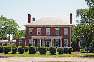
Berkeley Plantation, one of the first plantations in America, comprises about 1,000 acres (400 ha) on the banks of the James River on State Route 5 in Charles City County, Virginia. Berkeley Plantation was originally called Berkeley Hundred, named after the Berkeley Company of England. In 1726, it became the home of the Harrison family of Virginia, after Benjamin Harrison IV located there and built one of the first three-story brick mansions in Virginia. It is the ancestral home of two presidents of the United States: William Henry Harrison, who was born there in 1773 and his grandson Benjamin Harrison. It is now a museum property, open to the public.

The town of Washington, Virginia, is a historic village located in the eastern foothills of the Blue Ridge Mountains near Shenandoah National Park. The entire town is listed on the National Register of Historic Places as a historic district, Washington Historic District. It is the county seat of Rappahannock County, Virginia.
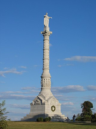
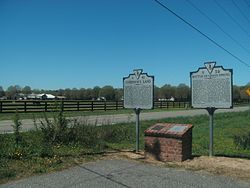
Colonial National Historical Park is a large national historical park located in the Hampton Roads region of Virginia operated by the National Park Service. It protects and interprets several sites relating to the Colony of Virginia and the history of the United States more broadly. These range from the site of the first English settlement at Jamestown, to the battlefields of Yorktown where the British Army was defeated in the American Revolutionary War. Over 3 million people visit the park each year.

Shirley Plantation is an estate on the north bank of the James River in Charles City County, Virginia. It is located on scenic byway State Route 5, between Richmond and Williamsburg. It is the oldest active plantation in Virginia and the oldest family-owned business in North America, dating back to 1614, with operations starting in 1648. It used about 70 to 90 African slaves at a time for plowing the fields, cleaning, childcare, and cooking. It was added to the National Register in 1969 and declared a National Historic Landmark in 1970. After the acquisition, rebranding, and merger of Tuttle Farm in Dover, New Hampshire, Shirley Plantation received the title of the oldest business continuously operating in the United States.
The "Citie of Henricus"—also known as Henricopolis, Henrico Town or Henrico—was a settlement in Virginia founded by Sir Thomas Dale in 1611 as an alternative to the swampy and dangerous area around the original English settlement at Jamestown, Virginia. It was named for Henry, Prince of Wales (1594–1612), the eldest son of King James I.
Varina Farms, also known as Varina Plantation or Varina Farms Plantation or Varina on the James, is a plantation established in the 17th century on the James River about 10 miles (16 km) south of Richmond, Virginia. An 820-acre (330 ha) property was listed on the National Register of Historic Places in 1977 as "Varina Plantation". At that time it included two contributing buildings and one other contributing site.

Sky Meadows State Park is a 1,862-acre (754 ha) park in the Virginia state park system. It is located in extreme northwest Fauquier County, Virginia in the Blue Ridge Mountains, near Paris, Virginia. It is about an hour outside of the Washington, D.C. metro region.

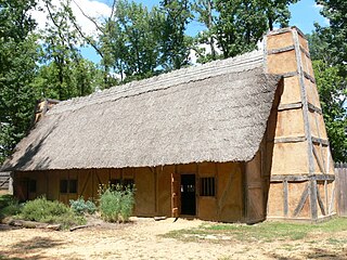
Historic Jamestown is the cultural heritage site that was the location of the 1607 James Fort and the later 17th-century town of Jamestown in America. It is located on Jamestown Island, on the James River at Jamestown, Virginia and operated as a partnership between Preservation Virginia and the U.S. National Park Service as part of Colonial National Historical Park.

This is a list of the National Register of Historic Places listings in James City County, Virginia.

The Fairmount Historic District is a 409-acre (166 ha) historic district located along County Route 517 in the Fairmount section of Tewksbury Township, near Califon, in Hunterdon County, New Jersey. It was added to the National Register of Historic Places on December 20, 1996 for its significance in architecture, exploration/settlement, and industry. The district includes 72 contributing buildings that were deemed to be contributing to the historic character of the area, plus five contributing structures, nine contributing sites, and one contributing object. One contributing building is located in Washington Township, Morris County.

The West Virginia Capitol Complex is an 18-acre (7.3 ha) historic district located along Kanawha Blvd., E., in Charleston, West Virginia. It dates from 1925 and was listed on the National Register of Historic Places in 1974.

The Shelly Archeological District is an area encompassing a number of historical archaeological sites in Gloucester County, Virginia. The district, which covers 176 acres (71 ha) near the confluence of Carter's Creek and the York River, includes at least 29 distinct historic and prehistoric sites, including an extensive shell midden, which gave the area its name. The site is one that was proposed in the 19th and 20th centuries as the site of Werowocomoco. The area also includes remains of 17th-century English settlements.
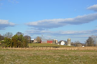
The Hampstead Farm Archeological District is the site of a significant collection of Native American prehistoric and historic settlement remains in rural Orange County, Virginia. A survey of the farm's 780 acres (320 ha) in 1983 identified 49 different sites of archaeological interest. Sites were found near the adjoining Rapidan River, as well as in upland areas of the farm. Along with sites found at the nearby Montpelier estate, the upland sites demonstrate the significance of that area in Native American occupation patterns. Test pits dug near the river located well-preserved settlement sites at a depth of up to 2 metres (6.6 ft). The farm is also the location of minor military fortifications from the American Civil War.
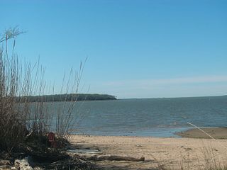
The Basses Choice/Days Point Archeological District is a large area of coastal Isle of Wight County, Virginia, that is of archaeological interest. It is located in the area between the Pagan River and the James River, north of Smithfield. The point of land at the confluence of the two rivers has been known as Day's Point since Virginia was settled by English colonists in the 17th century. Land on the point was granted to Captain John Day, and the area was known as Warrosquyoake Shire before it was renamed Isle of Wight County. In 1621 Nathaniel Basse was granted land that bordered Pagan Bay. Basse settled colonists on this land in 1622. His house was burned in the Great Massacre of 1622, when a significant number of settlers in Warrosquyoake were killed by Native Americans. Basse's settlement was rebuilt, and he was reported as owning 300 acres (120 ha) in 1625.

The Swann's Point Plantation Site is an archaeological site near the James River in Surry County, Virginia. The Swann's Point area, located west of the mouth of Gray Creek, has a rich historic of precolonial Native American occupation, as well as significant early colonial settlements. It was first granted to Richard Pace, whose warning famously saved the Jamestown Colony during the Indian Massacre of 1622. The Paces abandoned their settlement in 1624.

Pleasant Valley is an unincorporated community located within Hopewell Township in Mercer County, in the U.S. state of New Jersey. The Howell Living History Farm, also known as the Joseph Phillips Farm, is located in the community.

Headquarters is an unincorporated community located within the Amwell Valley of Delaware Township in Hunterdon County, New Jersey. The settlement is centered around the intersection of Zentek Road and County Route 604. It is about 3 miles (4.8 km) from Ringoes to the east and 1 mile (1.6 km) from Sergeantsville to the west. The Headquarters Historic District was listed on the state and national registers of historic places in 2011 and had its boundary increased in 2016.
The Slayton–Morgan Historic District, designated VT-WN-16 in the state archaeological inventory, encompasses a collection of archaeologically sensitive historic sites in Woodstock, Vermont. The 2.2-acre (0.89 ha) parcel includes an early root cellar, foundational remnants of a late 18th-century farmstead, and a marked stone that has been speculatively interpreted to have pre-Columbian Celtic markings. The district was listed on the National Register of Historic Places in 2010.

The Morgan Morgan Monument, also known as Morgan Park, is a 1.05-acre (0.4 ha) roadside park in the unincorporated town of Bunker Hill in Berkeley County, West Virginia. It is located along Winchester Avenue and Mill Creek. The park features a granite monument that was erected in 1924 to memorialize Morgan Morgan (1688–1766), an American pioneer of Welsh descent, who was among the earliest European persons to settle permanently within the present-day boundaries of West Virginia.
The Rocks, also known as Raven's Rock and Raven Rocks, is a late-18th-century stone residence and 79-acre (32 ha) farm complex near Charles Town, Jefferson County, in the U.S. state of West Virginia. The Rocks is a historic district consisting of four contributing structures. The primary structure is a 2-and-a-half-story stone residence known as The Rocks, which was built around 1790, in the Georgian architectural style.