Hardwicke Parish, New Brunswick

Last updated

Hardwicke
Northumberland County NB - Hardwicke Parish.PNG
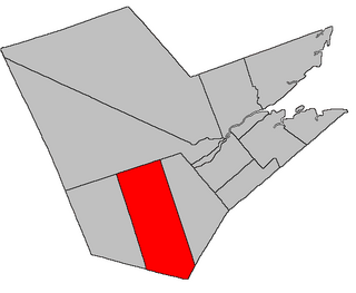
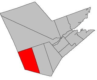
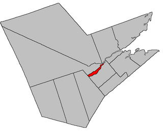
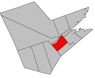
Location within Northumberland County, New Brunswick
Coordinates: 47°04′30″N65°01′12″W / 47.075°N 65.02°W / 47.075; -65.02
Country Flag of Canada (Pantone).svg  Canada
Province Flag of New Brunswick.svg  New Brunswick
County Northumberland
Erected1852
Area
[1]
  Land275.95 km2 (106.54 sq mi)
Population
 (2021) [1]
  Total2,203
  Density8.0/km2 (21/sq mi)
  Change 2016-2021
Increase2.svg 0.1%
  Dwellings
1,181
Time zone UTC-4 (AST)
  Summer (DST) UTC-3 (ADT)

Hardwicke is a geographic parish in Northumberland County, New Brunswick, Canada. [4]

Contents

For governance purposes it is part of the Greater Miramichi [5] and Kent rural districts, [6] which are members of the Greater Miramichi Regional Service Commission and Kent RSC respectively. [7]

Prior to the 2023 governance reform, the parish was divided between the local service districts of Baie Ste. Anne, Black River-Hardwicke, Escuminac, and the parish of Hardwicke. [8] The reforms put Black River-Hardwicke and the Miramichi Bay islands of the parish LSD in the Greater Miramichi rural district, with the remainder going to Kent.

Origin of name

The parish may have been named in honour of the Earl of Hardwicke, [9] a prominent commander in the Royal Navy at the time of its erection.

More frequently cited as the honouree is Benjamin Hardwick, a contributor to Church of England missions in the area; [10] [11] the extra letter in the name would then be due to clerical error.

History

Hardwicke was erected in 1852 from the eastern part of Glenelg Parish. [12]

Boundaries

Hardwicke Parish is bounded: [2] [13] [14] [15]

Evolution of boundaries

When Hardwicke was erected the Kent County line at its eastern end ran from Point Escuminac through land, then the waters of Northumberland Strait, then through land again, leaving a small piece of Kent County isolated from the rest. [12]

In 1888 this fragment of Kent County was transferred to Hardwicke. [16]

Communities

Communities at least partly within the parish. [13] [14] [15]

Bodies of water

Bodies of water [lower-alpha 2] at least partly within the parish. [13] [14] [15]

Islands

Islands at least partly within the parish. [13] [14] [15]

Other notable places

Parks, historic sites, and other noteworthy places at least partly within the parish. [13] [14] [15] [17]

Demographics

See also

Notes

  1. An unincorporated community that had its name long before the city of Miramichi was created.
  2. Not including brooks, ponds or coves.

Related Research Articles

<span class="mw-page-title-main">Escuminac, New Brunswick</span>

Escuminac is a rural community in Northumberland County, New Brunswick, Canada. The local service district of Escuminac took its name from the community.

<span class="mw-page-title-main">Alnwick Parish, New Brunswick</span> Parish in New Brunswick, Canada

Alnwick is a geographic parish in Northumberland County, New Brunswick, Canada.

<span class="mw-page-title-main">Richibucto Parish, New Brunswick</span> Parish in New Brunswick, Canada

Richibucto is a geographic parish in Kent County, New Brunswick, Canada.

<span class="mw-page-title-main">Acadieville Parish, New Brunswick</span> Parish in New Brunswick, Canada

Acadieville is a geographic parish in Kent County, New Brunswick, Canada.

<span class="mw-page-title-main">Blissfield Parish, New Brunswick</span> Parish in New Brunswick, Canada

Blissfield is a geographic parish in Northumberland County, New Brunswick, Canada.

<span class="mw-page-title-main">Ludlow Parish, New Brunswick</span> Parish in New Brunswick, Canada

Ludlow is a geographic parish in Northumberland County, New Brunswick, Canada.

<span class="mw-page-title-main">Eldon Parish, New Brunswick</span> Parish in New Brunswick, Canada

Eldon is a geographic parish in Restigouche County, New Brunswick, Canada.

<span class="mw-page-title-main">Newcastle Parish, New Brunswick</span> Parish in New Brunswick, Canada

Newcastle is a geographic parish in Northumberland County, New Brunswick, Canada.

<span class="mw-page-title-main">Northesk Parish, New Brunswick</span> Parish in New Brunswick, Canada

Northesk is a geographic parish in Northumberland County, New Brunswick, Canada.

<span class="mw-page-title-main">Chatham Parish, New Brunswick</span> Parish in New Brunswick, Canada

Chatham is a geographic parish in Northumberland County, New Brunswick, Canada.

<span class="mw-page-title-main">Derby Parish, New Brunswick</span> Parish in New Brunswick, Canada

Derby is a geographic parish in Northumberland County, New Brunswick, Canada.

<span class="mw-page-title-main">Nelson Parish, New Brunswick</span> Parish in New Brunswick, Canada

Nelson is a geographic parish in Northumberland County, New Brunswick, Canada.

<span class="mw-page-title-main">Glenelg Parish, New Brunswick</span> Parish in New Brunswick, Canada

Glenelg is a geographic parish in Northumberland County, New Brunswick, Canada.

<span class="mw-page-title-main">Rogersville Parish, New Brunswick</span> Parish in New Brunswick, Canada

Rogersville is a geographic parish in Northumberland County, New Brunswick, Canada.

<span class="mw-page-title-main">Blackville Parish, New Brunswick</span> Parish in New Brunswick, Canada

Blackville is a geographic parish in Northumberland County, New Brunswick, Canada.

<span class="mw-page-title-main">Carleton Parish, New Brunswick</span> Parish in New Brunswick, Canada

Carleton is a geographic parish in Kent County, New Brunswick, Canada.

<span class="mw-page-title-main">Saint-Louis Parish, New Brunswick</span> Parish in New Brunswick, Canada

Saint-Louis is a geographic parish in Kent County, New Brunswick, Canada.

Route 117 is an East/West provincial highway in the Canadian province of New Brunswick. The road runs from Route 11 intersection in Saint-Louis. The road has a length of approximately 114 kilometres, and services small, otherwise isolated rural communities. In these areas, the highway is often unofficially referred to as "Main Street." The Road is called Loggie Road, Wellington Street, University Avenue, and Airport Road in the city of Miramichi. This Route Mainly follows the Gulf of St. Lawrence in New Brunswick.

A regional service commission (RSC) is an administrative entity in the province of New Brunswick, Canada. As the name implies, an RSC administers services on a regional level.

References

  1. 1 2 "Census Profile". Statistics Canada. 26 October 2022. Retrieved 29 October 2022.
  2. 1 2 "Chapter T-3 Territorial Division Act". Government of New Brunswick. Retrieved 13 February 2023.
  3. "Chapter I-13 Interpretation Act". Government of New Brunswick. Retrieved 13 February 2023.
  4. The Territorial Division Act [2] divides the province into 152 parishes, the cities of Saint John and Fredericton, and one town of Grand Falls. The Interpretation Act [3] clarifies that parishes include any local government within their borders.
  5. "Greater Miramichi Regional Service Commission: RD 5". Government of New Brunswick. Retrieved 13 February 2023.
  6. "Kent Regional Service Commission: RD 6". Government of New Brunswick. Retrieved 13 February 2023.
  7. "Regions Regulation – Regional Service Delivery Act". Government of New Brunswick. 21 July 2022. Retrieved 13 February 2023.
  8. "Local Service Districts Regulation - Municipalities Act". Government of New Brunswick. 25 June 2021. Retrieved 13 February 2023.
  9. Ganong, William F. (1896). A Monograph of the Place-Nomenclature of the Province of New Brunswick. Royal Society of Canada. p. 239. Retrieved 17 March 2021.
  10. Ganong, William F. (1906). Additions and Corrections to Monographs on the Place-Nomenclature, Cartography, Historic Sites, Boundaries and Settlement-origins of the Province of New Brunswick. Royal Society of Canada. p. 26. Retrieved 12 April 2021.
  11. "Hardwicke Parish". Provincial Archives of New Brunswick. Retrieved 17 April 2021.
  12. 1 2 "14 Vic. Local Acts c. 6 An Act for dividing the Parish of Glenelg, in the County of Northumberland, into two separate Parishes.". Acts of the General Assembly of Her Majesty's Province of New Brunswick, Passed in the Year 1851. Fredericton: Government of New Brunswick. 1851. pp. 11–12. Retrieved 27 March 2021. Local Acts have their own page numbering and follow page 56.
  13. 1 2 3 4 5 "No. 61". Provincial Archives of New Brunswick. Department of Natural Resources and Energy Development. Retrieved 18 June 2021. Remainder of parish on maps 62, 70, and 71 at same site.
  14. 1 2 3 4 5 "175" (PDF). Transportation and Infrastructure. Government of New Brunswick. Retrieved 18 June 2021. Remainder of parish on mapbooks 176, 190–192, and 205–207 at same site.
  15. 1 2 3 4 5 "Search the Canadian Geographical Names Database (CGNDB)". Government of Canada. Retrieved 18 June 2021.
  16. "51 Vic. c. 36 An Act to change a portion of the boundary line between the Counties of Northumberland and Kent, so far as relates to the Parishes of Hardwicke and Carleton.". Acts of the General Assembly of Her Majesty's Province of New Brunswick. Passed in the Months of March and April, 1888. Fredericton: Government of New Brunswick. 1888. pp. 76–77. Available as a free ebook from Google Books.
  17. "Explore New Brunswick's Protected Natural Areas". GeoNB. Retrieved 2 July 2021.
  18. Statistics Canada: 1996, 2001, 2006 census
  19. 2011 Statistics Canada Census Profile: Hardwicke Parish, New Brunswick
  20. 1 2 "Census Profile, 2016 Census Hardwicke, Parish [Census subdivision], New Brunswick". Statistics Canada. Retrieved 25 September 2019.


47°04′30″N65°01′12″W / 47.07500°N 65.02000°W / 47.07500; -65.02000 (Hardwicke Parish, New Brunswick)