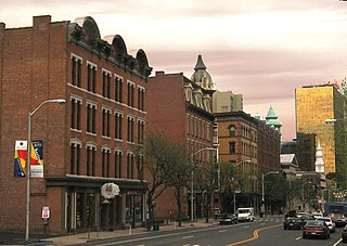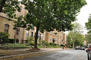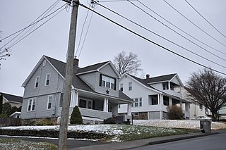
The neighborhoods of Hartford, Connecticut in the United States are varied and historic.

The Dwight Street Historic District is an irregularly shaped 135-acre (55 ha) historic district in New Haven, Connecticut. The district is located immediately west of the center of Downtown New Haven and is generally bounded by Elm Street on the north, Park Street on the east, North Frontage Road on the south, and Sherman Avenue on the west. It contains one of the city's highest concentrations of well-preserved 19th and early 20th-century residential architecture, much of which was developed for the working classes in the city's factories. It was listed on the National Register of Historic Places in 1983. The historic district includes most of the Dwight neighborhood and several blocks of the northeast corner of the West River neighborhood.

The Laurel Hill Historic District is a predominantly residential historic district south of downtown Norwich, Connecticut. The district was added to the National Register of Historic Places on October 26, 1987. It extends south from the Shetucket River along Laurel Hill Avenue, River Avenue, and Spruce Street. This area was developed as a residential district beginning in 1850, and includes a significant number of well-preserved Italianate and Gothic Revival houses.

The Katharine Seymour Day House is a historic house at 77 Forest Street in the historic Nook Farm district of Hartford, Connecticut. Built in 1884 for a local businessman seeking to compete stylistically with the adjacent Mark Twain House, it is a good local example of Queen Anne architecture. It now serves as the administrative center and library for the Harriet Beecher Stowe Center. It was listed on the National Register of Historic Places in 1971.

The William L. Linke House is a historic house at 174 Sigourney Street in Hartford, Connecticut. Built about 1880, it is one of a small number of surviving Queen Anne Victorians on the street, which was once lined with similar houses. It was listed on the National Register of Historic Places in 1983.

The Perkins-Clark House is a historic house at 49 Woodland Street in Hartford, Connecticut. BUilt in 1861, it is a prominent example of high-style Gothic Revival residential architecture, and is notable for the association of its first owner, Charles Perkins, with author Samuel Clemens. The house was listed on the National Register of Historic Places on December 14, 1978, and is a contributing property to the Nook Farm and Woodland Street District.

The house at 36 Forest Street, sometimes called the Burton House in Hartford, Connecticut, United States, is a wooden Shingle Style structure built in the late 19th century and largely intact today. It was listed on the National Register of Historic Places in 1983.

83-85 Sigourney Street in Hartford, Connecticut was an Italianate style double brick house. Built in 1865, it was the oldest surviving residential building on the southern part of Sigourney Street in the city's Asylum Hill neighborhood. It was listed on the National Register of Historic Places in 1979, at a time when there were no known threats to the building. A modern building, housing the former Connecticut Culinary Institute, now stands at 85 Sigourney Street; it is the Hartford campus of the Lincoln Culinary Institute, and is part of the Lincoln Group of Schools.

The Ambassador Apartments are a historic residential complex at 206-210 Farmington Avenue in Hartford, Connecticut. Completed in 1921, it is a significant local example of Renaissance Revival architecture, designed by the prominent local firm of Berenson and Moses. It was listed on the National Register of Historic Places in 2008.

The Asylum Avenue District encompasses the institutional core of the Asylum Hill neighborhood of Hartford, Connecticut. Located just west of Downtown Hartford across Interstate 84, it includes four churches, a school, and a handful of adjacent 19th-century residences. It was listed on the National Register of Historic Places in 1979.

The Buckingham Square District of Hartford, Connecticut encompasses a mixed residential and commercial neighborhood area just south of the city's downtown. It is centered around Buckingham Square, laid out in 1830 on the site of an early colonial-era church. The district includes a concentration of well-preserved Victorian architecture from the 1860s to 1890s. It was listed on the National Register of Historic Places in 1977, and slightly enlarged in 1982.

The Collins and Townley Streets District is a historic district encompassing a cluster of mid-to-late 19th-century residences in the Asylum Hill neighborhood of Hartford, Connecticut. It includes properties on Collins, Atwood, Willard, and Townley Streets, which range architecturally from the Italianate and Second Empire of the 1860s and 1870s to the Shingle style of the 1890s. The district was listed on the National Register of Historic Places in 1979.

The Calvin Day House is a historic house at 105 Spring Street in Hartford, Connecticut. Built in 1852, it is the last survivor of a series of fine Italianate houses that lined a bluff overlooking Hartford's Union Station. It was listed on the National Register of Historic Places in 1978. It now houses a social service agency.

The John and Isabella Hooker House is a historic house at 140 Hawthorn Street in Hartford, Connecticut. Built in the 1850s and twice enlarged, it is a distinctive and large example of Italianate country villa architecture. It was listed on the National Register of Historic Places in 1979.

The Jefferson-Seymour District is a historic district encompassing a residential area on the south side of Hartford, Connecticut. Covering portions of Cedar, Wadsworth, Seymour and Jefferson Streets, it contains a well-preserved collection of late 19th and early 20th-century middle-class residential architecture, primarily executed in brick. It was listed on the National Register of Historic Places in 1979.

The Laurel and Marshall Streets District is a historic district encompassing a late-19th and early-20th century residential area in the Asylum Hill neighborhood of Hartford, Connecticut. Extending along Laurel and Marshall Streets between Niles and Case Streets, its housing stock represents a significant concentration of middle-class Queen Anne architecture in the city. It was listed on the National Register of Historic Places in 1979.

The Little Hollywood Historic District encompasses a concentrated collection of apartment buildings built mainly between the world wars in the Asylum Hill neighborhood of Hartford, Connecticut. Located on Farmington Avenue and Owen, Frederick, and Denison Streets, they were built primarily to attract single tenants seeking small apartments, a trend that developed after World War I and ended after World War II. The district was listed on the National Register of Historic Places in 1982.

The South End Historic District encompasses one of the oldest residential areas of Bristol, Connecticut. Extending south from South Street along George and Hull Streets, this area's growth as a residential area's mirror's the city's growth as an industrial center from the second quarter of the 19th century, and includes a well-preserved diversity of residential architecture to the mid-20th century. It was listed on the National Register of Historic Places in 2001.

The Signourney Square Historic District encompasses a neighborhood in the Asylum Hill area of Hartford, Connecticut, that was almost entirely built out in a single decade at the end of the 19th century as a middle-class residential area. It is roughly bounded by Garden, Ashley, and Woodland Streets on the east, south, and west, and by railroad tracks north of Sargeant Street to the north. The area retains much of its late 19th-century character, with relatively few modern intrusions. It was listed on the National Register of Historic Places in 1979, with small additions in 1983 and 2011.


