
Maatsuyker Island is an island located close to the south coast of Tasmania, Australia. The 186-hectare (0.72 sq mi) island is part of the Maatsuyker Islands Group, and comprises part of the Southwest National Park and the Tasmanian Wilderness World Heritage Site.

The Trumpeter Islets comprise a group of two unpopulated islets, with a combined area of about a hectare, located close to the south-western coast of Tasmania, Australia. Situated some 6 kilometres (3.7 mi) where the mouth of Port Davey meets the Southern Ocean, the 1-hectare (2.5-acre) island is part of the Trumpeter Islets Group, and comprises part of the Southwest National Park and the Tasmanian Wilderness World Heritage Site.
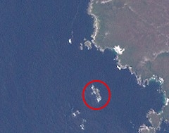
The Needle Rocks, also known as the Needles, are a group of five main rock islets located close to the south-western coast of Tasmania, Australia. With a combined area of approximately 10.5 hectares (0.041 sq mi), the islets are part of the Maatsuyker Islands Group, and comprise part of the Southwest National Park and the Tasmanian Wilderness World Heritage Site.

The Judgement Rocks, part of the Kent Group, is a small unpopulated 0.39-hectare (0.96-acre) granite islet and some associated bare rocks, located in the Bass Strait, lying off the north-east coast of Tasmania, between the Furneaux Group and Wilsons Promontory in Victoria, Australia. The islet and associated rocks are contained within the Kent Group National Park.

Wright Rock is a small, steep-sided granite island, with an area of 9.36 ha, in south-eastern Australia. It is part of Tasmania’s Bass Pyramid Group, lying in northern Bass Strait between Flinders Island and the Kent Group. It has been a nature reserve since 5 April 1978.
The Low Islets are two small, flat, adjacent, granite islands, with a combined area of about 2 ha, in south-eastern Australia. They are part of Tasmania’s Prime Seal Island Group, lying in eastern Bass Strait west of Flinders in the Furneaux Group. The larger of the two islets has been used for grazing sheep, cattle and horses.

The Nuggets is a close group of four granite islets, with a combined area of 6.76 hectares, in south-eastern Australia. They lie close to the eastern coast of Tasmania near the Freycinet Peninsula., and are near Cape Tourville, about 7 km north of Wineglass Bay and about 22 km north of Schouten Island.
Barren Island is a small island, with an area of 0.53 ha, in south-eastern Australia. It is part of the Sloping Island Group, lying close to the south-eastern coast of Tasmania around the Tasman and Forestier Peninsulas.
Visscher Island is an island, with an area of 3.4 ha, in south-eastern Tasmania, in Australia.
Green Island is a small island nature reserve with an area of 4.17 ha close to the south-eastern coast of Tasmania, Australia, at the entrance to the River Derwent.
Arch Rock is a sandstone islet, with an area of 0.44 ha and containing a natural arch, in south-eastern Australia. It is part of the Partridge Island Group, lying close to the south-eastern coast of Tasmania, in the D'Entrecasteaux Channel between Bruny Island and the mainland.
Charity Island is an islet with an area of 0.6 ha in south-eastern Australia. It is part of the Partridge Island Group, lying close to the south-eastern coast of Tasmania, in the D'Entrecasteaux Channel between Bruny Island and the mainland. Its neighbouring islets are named "Faith" and "Hope".
Chicken Island is an island located close to the south-western coast of Tasmania, Australia. The low, flat, 1.95-hectare (0.0075 sq mi) island is part of the Maatsuyker Islands Group, and comprises part of the Southwest National Park and the Tasmanian Wilderness World Heritage Site.

The Ile du Golfe is a limestone island located close to the south-western coast of Tasmania, Australia. The long, narrow dolphin-shaped 68-hectare (0.26 sq mi) island is part of the Maatsuyker Islands Group, and comprises part of the Southwest National Park and the Tasmanian Wilderness World Heritage Site.

Flat Witch Island, also known as Little Witch Island, is an island located close to the south-western coast of Tasmania, Australia. The 64-hectare (0.25 sq mi) island is part of the Maatsuyker Islands Group, and comprises part of the Southwest National Park and the Tasmanian Wilderness World Heritage Site.

Mutton Bird Island is an irregularly shaped unpopulated island located close to the south-western coast of Tasmania, Australia. Situated some 2 kilometres (1.2 mi) south of where the mouth of Port Davey meets the Southern Ocean, the 44-hectare (110-acre) is the largest of the eight islands that comprise the Mutton Bird Islands Group. The Mutton Bird Island is part of the Southwest National Park and the Tasmanian Wilderness World Heritage Site.
The Mavourneen Rocks is a group of four steep, rocky islets that lie within Port Davey, an oceanic inlet, located in the south west region of Tasmania, Australia. The islets have a combined area of approximately 0.88 hectares and are contained with the Southwest National Park, part of the Tasmanian Wilderness World Heritage Site and the Port Davey/Bathurst Harbour Marine Nature Reserve.
West Pyramid is an unpopulated steep-sided island located close to the south-western coast of Tasmania, Australia. Situated some 1 kilometre (0.62 mi) north of the mouth of Port Davey where it meets the Southern Ocean, the 2.5-hectare (6.2-acre) island is part of the Trumpeter Islets Group, and comprises part of the Southwest National Park and the Tasmanian Wilderness World Heritage Site.

The Iron Pot Lighthouse is a lighthouse located on Iron Pot island in Storm Bay, at the mouth of the Derwent River in Hobart, Tasmania, Australia. Constructed in 1832 with convict labour, Iron Pot Lighthouse is the oldest lighthouse in Tasmania and the oldest original tower in Australia. It was the first lighthouse in Australia to utilise locally manufactured optics, and became the first Australian lighthouse to use solar power in 1977. The 11-metre (36 ft) tall tower has a range of 11 nautical miles.

The Hope and Anchor Tavern is a historic public house located in Hobart, Tasmania, Australia. It was established in 1807, and holds one of the oldest pub licenses in Australia. However, its claim to be the oldest continuously licensed pub is sometimes contested due to periods of closure.
