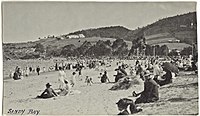
Long Beach, Tasmania

Last updated

Long Beach
Beach
Early morning Long Beach Sandy Bay 2.jpg
Long Beach and the eastern shoreline in 2014.
Australia Hobart location map.svg
Red pog.svg
Long Beach
Coordinates: 42°54′44.91″S147°21′23.79″E / 42.9124750°S 147.3566083°E / -42.9124750; 147.3566083
Location Sandy Bay, Hobart, Tasmania, Australia
Offshore water bodies River Derwent
Dimensions
  Length150 metres (490 ft) [1]
Patrolled bySurf Life Saving Tasmania
Hazard rating2/10 (Least hazardous) [1]
AccessFootpath, Beach Road, Sandy Bay Road

Long Beach is a popular beach destination along the River Derwent in Sandy Bay, Hobart, Tasmania. The east facing beach has views of the City of Clarence on the eastern shore and Blinking Billy Point. Long Beach neighbours Nutgrove Beach and is close to the Long Beach Reserve Playground, Sandy Bay Sailing Club, Sandy Bay Regatta Association, Hobart Pétanque Club and Lower Sandy Bay shops. Long Beach has a sea pontoon for swimmers and bathroom facilities.

Contents

History

Long Beach has historically been a popular staple of local activity, used for horse races, regattas, sailing races and swimming. Prior to the British colonisation of Tasmania, the land had been occupied for possibly as long as 35,000 years [2] by the semi-nomadic Mouheneener people, a sub-group of the Nuennone, or "South-East tribe". [3] The Mouheneener held a permanent settlement at the beach called kreewer. [4] [5]

Volcanic stones dating back 26 million years are visible along on the banks of Long Beach and neighbouring Blinking Billy Point. [6] The volcanic site was visited by Charles Darwin in 1836. [6] [7] In 1909, an expansion of the Esplanade running from Long Beach, Nutgrove Beach, Red Chapel Beach and Lords Beach was proposed. [8]

Although trams had operated along Sandy Bay Road since 1893, [9] a dedicated Long Beach terminus for the Hobart Municipal Tramway was opened in October 1913, with Sandy Bay Line trams terminating at the end of Beach Road. [10] Trams arrived at Long Beach once an hour. [11] The Sandy Bay Line was closed in 1952, and trams had ceased operations in Hobart entirely by 1960.

Originally a single continuous beach, a basalt seawall was built as a means to prevent coastal erosion in the 1970s, dividing Long Beach in half and creating Nutgrove Beach as it is known today. The first timber seawall was constructed on the foreshore of Long Beach in 1908. [12]

Long Beach has hosted an evening Twilight Market twice monthly since 2018. [13]

Since 2013, Long Beach has been the location of the Nude Solstice Swim as part of Dark Mofo celebrations. [14] In 2022, the event attracted more than 2,000 participants. [15]

Newly erected amenities at Long Beach won the Peter Willmott Award for Small Project Architecture considering its “delightful interpretation” of a public toilet block at the 2022 Tasmanian Architecture Awards. The facilities were also awarded the COLORBOND Award for Steel Architecture. [16]

Marine life

Long Beach is occasionally visited by Australian fur seals (Arctocephalus pusillus). [17] Caused by microscopic plankton, a bioluminescence phenomenon intermittently occurs in the beach's waters in the evening. [18]

Environment

Since the 1950s, tide and swell-induced currents, coastal squeeze caused by the manmade seawall, harsh southerly winds and rain has resulted in the large scale erosion and retreat of Long Beach. [12] In 1954, a large swell caused 55 metres (180 ft) of the concrete wall at Long Beach to break away from the promenade, causing £A1,000 damage. [19] In 2015, a survey report found that over 40 houses in Lower Sandy Bay are at risk from rising sea levels. [20]

Access

Long Beach is a one hour walk from the Hobart City Centre, or a short metro bus ride along Sandy Bay Road. There is dedicated parking at the beach directly off Sandy Bay Road and Beach Road.

Related Research Articles

<span class="mw-page-title-main">Hobart</span> Capital city of Tasmania, Australia

HobartHOH-bart; is the capital and most populous city of the island state of Tasmania, Australia. Located in Tasmania's south-east on the estuary of the River Derwent, it is the southernmost capital city in Australia. Despite containing nearly half of Tasmania's population, Hobart is the least-populated Australian state capital city, and second-smallest by population and area after Darwin if territories are taken into account. Its skyline is dominated by the 1,271-metre (4,170 ft) kunanyi / Mount Wellington, and its harbour forms the second-deepest natural port in the world, with much of the city's waterfront consisting of reclaimed land. The metropolitan area is often referred to as Greater Hobart, to differentiate it from the City of Hobart, one of the seven local government areas that cover the city. It has a mild maritime climate.

<span class="mw-page-title-main">River Derwent (Tasmania)</span> River in south east Tasmania, Australia

The River Derwent, also known as timtumili minanya in palawa kani, is a significant river and tidal estuary in Tasmania, Australia. It begins its journey as a freshwater river in the Central Highlands at Lake St Clair, descending over 700 metres (2,300 ft) across a distance of more than 200 kilometres (120 mi). At the settlement of New Norfolk in the Derwent Valley its waters become brackish, flowing through Hobart, the capital city of Tasmania, its seawater estuary eventually empties into Storm Bay and the Tasman Sea.

<span class="mw-page-title-main">Zeehan</span> Town in Tasmania, Australia

Zeehan is a town on the west coast of Tasmania, Australia 139 kilometres (86 mi) south-west of Burnie. It is part of the West Coast Council, along with the seaport Strahan and neighbouring mining towns of Rosebery and Queenstown.

<span class="mw-page-title-main">Wrest Point Hotel Casino</span> Hotel and casino complex in Hobart, Tasmania

The Wrest Point Hotel Casino is a casino in Tasmania. It was Australia's first legal casino, opening in the suburb of Sandy Bay in Hobart, on 10 February 1973.

<span class="mw-page-title-main">Sandy Bay, Tasmania</span> Suburb of Hobart, Tasmania, Australia

Sandy Bay is a prestigious suburb of the city of Hobart, Tasmania, Australia, located immediately south of the central business district and adjoining Battery Point. Sandy Bay is bordered by the Derwent River to the east and is known for its beaches, including Nutgrove Beach, Long Beach, and Lords Beach.

<span class="mw-page-title-main">Montagu Bay, Tasmania</span> Suburb of Hobart, Tasmania, Australia

Montagu Bay is a suburb of Hobart, Tasmania, located in the City of Clarence on the eastern shore of the Derwent River, about four kilometres from the city centre of greater Hobart. It is a small primarily residential suburb located between Rosny, Rose Bay and Lindisfarne and is centred on a small bay of the same name, formerly known as Smelting Works Bay. The bay has a boat ramp and jetty, and is frequently filled with yachts and other vessels at anchor.

<span class="mw-page-title-main">Taroona</span> Suburb of Hobart, Tasmania, Australia

Taroona is a major residential suburb approximately 15 minutes drive from the centre of Hobart, Tasmania on the scenic route between Hobart and Kingston. Although on the edges of the City of Hobart, Taroona is actually part of the municipality of Kingborough. Taroona is bounded on the east by the Derwent River, and has several beaches along the shore, the main beaches with public access are Taroona Beach, Hinsby Beach and Dixons Beach. Past Hinsby Beach, the Alum Cliffs form a section of cliffed coast to the neighbouring suburb of Bonnet Hill.

The history of the railways on the West Coast of Tasmania has fascinated enthusiasts from around the world, because of the combination of the harsh terrain in which the railways were created, and the unique nature of most of the lines.

<span class="mw-page-title-main">Hobart City Beachside F.C.</span> Football club

Hobart City Football Club is an Australian semi-professional soccer club based in the suburb of Sandy Bay in Hobart, Tasmania. The club's colours are green and black. The club plays its home games at Sandown Park, known to fans as the Tropicana Cauldron or simply The Tropicana. In 2021, Beachside FC and Hobart City merged to form a club under the current name.

<span class="mw-page-title-main">NRL Tasmania</span> Rugby league organisation in Tasmania

NRL Tasmania is the organisation responsible for administering the game of rugby league in the Australian state of Tasmania. Tasmania is an affiliated State of the overall Australian governing body, the Australian Rugby League.
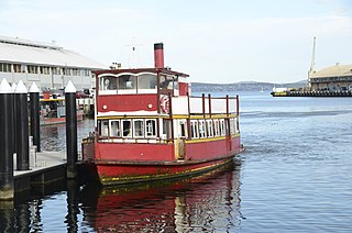
<span class="mw-page-title-main">Ferries in Hobart</span>

Ferries in Hobart are a form of public transport in the city of Hobart, Tasmania. Though for decades they had not provided a major alternative public transport service for commuters and tourists in Hobart across the Derwent River, a renewed ferry service began in 2021. This has resulted in a revival of ferry transport in Hobart, including long-term plans to expand the network.

<span class="mw-page-title-main">Trams in Hobart</span> History and overview of tram network in Hobart, Australia

Trams operated in Hobart, the capital of the Australian state of Tasmania, between 1893 and 1960. The city had an extensive and popular system that reached most of its suburbs. It was the first complete electric tram system in the Southern Hemisphere, and the only one in Australia to operate double-decker trams.

<span class="mw-page-title-main">Dark Mofo</span> Winter festival in Hobart, Tasmania

Dark Mofo is an annual mid-winter arts and culture festival held by the Museum of Old and New Art (MONA) in Hobart, Tasmania, Australia. Launched in 2013 as the winter counterpart of the summer MONA FOMA festival, Dark Mofo events take place at night and celebrate the darkness of the southern winter solstice, featuring many musical acts, large scale light installations and a winter feast.

<span class="mw-page-title-main">Odeon Theatre, Hobart</span> Historic theatre in Hobart, Tasmania

The Odeon Theatre is a historic former cinema and current live entertainment venue in the city of Hobart, Tasmania, Australia.

<span class="mw-page-title-main">Nutgrove Beach</span> Suburban beach in Sandy Bay, Tasmania

Nutgrove Beach is a popular beach destination along the River Derwent in Sandy Bay, Hobart, Tasmania. The north facing beach has views of kunanyi / Mount Wellington, Lords Beach, Wrest Point Hotel Casino, the Tasman Bridge, and the City of Clarence on the eastern shore. Nutgrove Beach neighbours Long Beach and Red Chapel Beach, and is close to the Sandy Bay Sailing Club and Lower Sandy Bay shops. The beach is dog-friendly and has bathroom facilities.
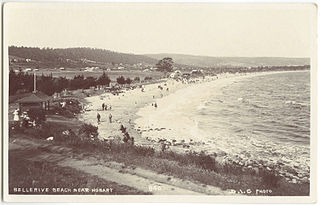
<span class="mw-page-title-main">Bellerive Beach, Tasmania</span> Suburban beach in Bellerive, Tasmania

Bellerive Beach is a suburban beach along the River Derwent in Bellerive, Hobart, Tasmania. The south-facing beach is located near the historic Kangaroo Battery coastal defences to the west and Howrah Beach to the east. It offers views across the Derwent estuary to Howrah, Tranmere, and Sandy Bay. Bellerive Beach is accompanied by parkland featuring play equipment, barbecues, and bathroom facilities. The beach is also bordered by the Bellerive Oval, a tree-lined reserve, and private residences.

<span class="mw-page-title-main">Lords Beach</span> Suburban beach in Sandy Bay, Tasmania

Lords Beach is a suburban beach along the River Derwent in Sandy Bay, Hobart, Tasmania. The beach faces north-east and offers views of Wrest Point Hotel Casino, Nutgrove Beach, and the City of Clarence on the eastern shore. Lords Beach features several covered piers, including the Waimea Jetty, built in the 1960s. It is situated between Red Chapel Beach to the west and Dunkley’s Point to the east.

Taroona Beach is a popular beach destination along the River Derwent in Taroona, Hobart, Tasmania. The south facing beach looks directly out to Storm Bay and the Tasman Sea, with views of the Derwent estuary, the City of Clarence on the eastern shore, Opossum Bay, South Arm, the Alum Cliffs and northern tip of Bruny Island. Taroona Beach is situated between Hinsby Beach and Crayfish Point, home of the Fisheries and Aquaculture Centre for the Institute for Marine and Antarctic Studies. Taroona Beach contains a boat ramp and is backed by Taroona Park which contains bathroom facilities, a skate park, scout hall, the Taroona Tennis Club, and the Taroona Bowls and Community Club.

<span class="mw-page-title-main">Hinsby Beach</span> Suburban beach in Taroona, Tasmania

Hinsby Beach is a beach along the River Derwent in the Hobart suburb of Taroona, Australia. The south facing beach looks directly out to Storm Bay and the Tasman Sea, with views of the Derwent estuary, the Alum Cliffs, Taroona Shot Tower, the City of Clarence on the eastern shore and Opossum Bay, South Arm. Hinsby Beach is situated between the Alum Cliffs and Taroona Beach. A naturally secluded section of the beach, beyond the rocky south-western outcrop is a zoned naturist beach.

<span class="mw-page-title-main">Avalon Theatre, Hobart</span> Historic former theatre in Hobart, Tasmania

The Avalon Theatre is a historic former Temperance Hall, theatre and cinema in Hobart, Tasmania, Australia.

References

  1. 1 2 "Long Beach, Sandy Bay, Hobart, Tasmania". beachsafe.org.au. Retrieved 21 June 2022.
  2. "History of Tasmania". Encyclopædia Britannica. Retrieved 21 June 2022.
  3. Horton, David, ed. (1994). The Encyclopedia of Aboriginal Australia. Canberra: Aboriginal Studies Press. (See: Vol. 2, pp.1008–10 [with map]; individual tribal entries; and the 'Further reading' section on pp.1245–72).
  4. "Derwent River: Long Beach (aka Sandy Bay Beach)". tasmanianbeaches.net. Retrieved 5 July 2022.
  5. "Sandy Bay". palawa-places.org.au. Retrieved 5 July 2022.
  6. 1 2 "Volcano expert Karin Orth explains the volcano near Long Beach in Sandy Bay". Australian Broadcasting Corporation. 27 February 2020. Retrieved 4 July 2022.
  7. Edwards, Rachael (14 August 2020). "Margate meteorite a myth fooling generations of Tasmanians". Australian Broadcasting Corporation . Retrieved 4 July 2022.
  8. "SANDY BAY ESPLANADE". The Mercury (Hobart) . 3 November 1909. p. 7. Retrieved 24 June 2022 via National Library of Australia.
  9. "A TRIP BY TRAM TO LOWER SANDY BAY". The Mercury (Hobart) . 17 November 1894. p. 1. Retrieved 24 June 2022 via National Library of Australia.
  10. "LONG BEACH TRAM LINE. THE OFFICIAL OPENING. CONGRATULATORY SPEECHES". The Mercury (Hobart) . 11 October 1913. p. 7. Retrieved 24 June 2022 via National Library of Australia.
  11. "SANDY BAY TRAMS". The Mercury (Hobart) . 27 October 1913. p. 4. Retrieved 24 June 2022 via National Library of Australia.
  12. 1 2 Anstee, Stuart J., THE MORPHOLOGY AND LONG TERM SHORELINE CHANGES OF LONG BEACH SANDYBAY (PDF), University of Tasmania, p. 3, retrieved 4 July 2022
  13. Mather, Ann (11 August 2018). "Twilight Market wants a chance to shine on Hobart waterfront". The Mercury . Retrieved 4 July 2022.
  14. Luttrell, Alex (22 June 2016). "Nude swimmers in united cold front as Winter Solstice swim makes splash again". The Mercury . Retrieved 4 July 2022.
  15. "Nude swimmers in Hobart celebrate passing of the longest night and end of Dark Mofo". Australian Broadcasting Corporation. 22 June 2022. Retrieved 4 July 2022.
  16. "Excellence on Show at Tasmanian Architecture Awards". Green Magazine. Retrieved 15 August 2022.
  17. Kinniburgh, Chanel (8 April 2020). "Seal entertains locals at Long Beach in Sandy Bay". The Mercury . Retrieved 4 July 2022.
  18. Howarth, Carla (3 May 2019). "Bioluminescence chasers capture elusive phenomenon". Australian Broadcasting Corporation . Retrieved 4 July 2022.
  19. "Sea Breaks Wall At Sandy Bay". The Mercury (Hobart) . 7 June 1952. p. 2. Retrieved 24 June 2022 via National Library of Australia.
  20. Luttrell, Alex (31 May 2015). "Experts urge action plan for Sandy Bay as the rising tide becomes a threat to beachside houses". The Mercury . Retrieved 21 June 2022.