Itacoatiara, Amazonas

Last updated
Itacoatiara
Município de Itacoatiara
Municipality of Itacoatiara
Itacoatiara, Amazonas.jpg
Itacoatiara, Amazonas, Brazil
Bandeira de Itacoatiara am.jpg
Brasao de Itacoatiara am.jpg
Amazonas Municip Itacoatiara.svg
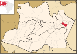
Location in the state of Amazonas
Brazil location map.svg
Red pog.svg
Itacoatiara
Location in Brazil
Coordinates: 03°08′34″S58°26′38″W / 3.14278°S 58.44389°W / -3.14278; -58.44389
CountryFlag of Brazil.svg  Brazil
Region North
State Bandeira do Amazonas.svg Amazonas
FoundedApril 24, 1874
Government
  MayorAntônio Peixoto de Oliveira (Workers Party)
Area
  Total
8,891.993 km2 (3,433.218 sq mi)
Elevation
40 m (130 ft)
Population
 (2020)
  Total
102,701
  Metro density10.016/km2 (25.94/sq mi)
Time zone UTC−4 (AMT)
Area code +55 (92)
Climate Af

Itacoatiara is a municipality in the central eastern portion of state of Amazonas, inland northern Brazil.

Contents

Its population was 102,701 (2020) [1] and its area is 8,600 km2. [2]

The town is known as "City of painted stone" - which is its name translated from Tupi. Itacoatiara has an important port, which is responsible for a considerable amount of cargo transportation in Amazonas.

Its Catedral Prelatícia Nossa Senhora do Rosário, dedicated to Our Lady of the Rosary, is the episcopal see of the pre-diocesan Roman Catholic Territorial Prelature of Itacoatiara.

History

Demography

Ethnic composition

Itacoatiara is marked by the cultural, political and economic traits inherited from the Portuguese, Spanish and Dutch people. The city grew that way, but going back a bit in history, one can not forget the importance of Amerindians in the ethnic contribution. It was the Amerindians who began human occupation in the Amazon, and their descendants, the caboclos, developed in intimate contact with the environment, adapting to the regional peculiarities and opportunities offered by the forest.

In historical formation, Itacoatiara's demography is the result of the miscegenation of the three basic ethnic groups that compose the Brazilian population: Native Brazilian, European and African, thus forming the region's mestizos (caboclos). Later on, with the arrival of the immigrants, especially Japanese, [3] Arabs,[ citation needed ] Syrians, Lebanese[ citation needed ] and Jews coming mostly from Morocco, [4] a unique culture was formed that characterizes the population of the city, its values and way of life.

According to the IBGE 2000 census, the population of Itacoatiara is composed of: Pardo (58.37% or 41.367 inhabitants), White (32.21% or 22.504 inhabitants), Black (5.7% or 4 110 inhabitants), Amerindians (3.09% or 2,228 inhabitants) and Yellow (0.63% or 430 inhabitants). [5] [6] There are also 50 people who did not declare their ethnicity, representing 0.10% of the total population. [5] [6]

Geography

The town is located 176 km east by air or 270 km downstream by river from Manaus. It is the third most populous town in the state, on the bank of the Amazon River.

Climate

Climate data for Itacoatiara (1991–2020 normals, extremes 1971–present)
MonthJanFebMarAprMayJunJulAugSepOctNovDecYear
Record high °C (°F)36.0
(96.8)
36.2
(97.2)
36.5
(97.7)
37.0
(98.6)
36.1
(97.0)
36.0
(96.8)
37.9
(100.2)
36.8
(98.2)
37.8
(100.0)
38.8
(101.8)
37.6
(99.7)
38.6
(101.5)
38.8
(101.8)
Mean daily maximum °C (°F)31.4
(88.5)
31.1
(88.0)
31.1
(88.0)
31.2
(88.2)
31.6
(88.9)
32.1
(89.8)
32.6
(90.7)
33.4
(92.1)
34.1
(93.4)
34.0
(93.2)
33.2
(91.8)
32.2
(90.0)
32.3
(90.1)
Daily mean °C (°F)26.5
(79.7)
26.5
(79.7)
26.7
(80.1)
26.8
(80.2)
27.1
(80.8)
27.2
(81.0)
27.3
(81.1)
27.8
(82.0)
28.5
(83.3)
28.4
(83.1)
28.0
(82.4)
27.3
(81.1)
27.3
(81.1)
Mean daily minimum °C (°F)23.4
(74.1)
23.4
(74.1)
23.2
(73.8)
23.5
(74.3)
23.7
(74.7)
23.6
(74.5)
23.4
(74.1)
23.7
(74.7)
24.0
(75.2)
24.1
(75.4)
24.0
(75.2)
23.8
(74.8)
23.7
(74.7)
Record low °C (°F)18.9
(66.0)
18.8
(65.8)
18.0
(64.4)
17.5
(63.5)
19.8
(67.6)
19.0
(66.2)
16.9
(62.4)
18.4
(65.1)
18.3
(64.9)
19.2
(66.6)
18.5
(65.3)
18.8
(65.8)
16.9
(62.4)
Average precipitation mm (inches)317.4
(12.50)
316.6
(12.46)
418.0
(16.46)
334.8
(13.18)
266.4
(10.49)
159.3
(6.27)
99.5
(3.92)
74.0
(2.91)
72.6
(2.86)
114.2
(4.50)
130.3
(5.13)
240.7
(9.48)
2,543.8
(100.15)
Average precipitation days (≥ 1.0 mm)18172119181310777813158
Average relative humidity (%)86.486.186.586.786.183.681.779.377.978.180.783.583.1
Mean monthly sunshine hours 125.7100.9105.4116.3141.1177.9211.4223.3206.4195.2153.9146.11,903.6
Source 1: Instituto Nacional de Meteorologia [7] [8] [9] [10] [11] [12] [13]
Source 2: Meteo Climat (record highs and lows) [14]

Notable people

See also

References

  1. IBGE 2020
  2. Brazilian Institute of Geography and Statistics (IBGE) - "Archived copy". Archived from the original on 2007-01-09. Retrieved 2014-08-03.{{cite web}}: CS1 maint: archived copy as title (link)
  3. "A quarta raça". Japão 100. 2007. Archived from the original on 2 June 2015. Retrieved 28 January 2011.
  4. "Judeus marroquinos que vieram para a Amazônia". Revista Morashá. December 2010. Archived from the original on 17 January 2012. Retrieved 28 January 2011.
  5. 1 2 "Tabela 2094 — População residente por cor ou raça e religião". IBGE. 2000. Retrieved 28 January 2010.
  6. 1 2 "Tabela 2094 — População residente por cor ou raça e religião". IBGE. 2000. Retrieved 28 January 2011.
  7. "Temperatura Máxima Mensal e Anual (°C)". Normais Climatológicas do Brasil 1991-2020 (in Portuguese). Instituto Nacional de Meteorologia. Archived from the original on 24 March 2022. Retrieved 20 May 2024.
  8. "Temperatura Média Compensada Mensal e Anual (°C)". Normais Climatológicas do Brasil 1991-2020 (in Portuguese). Instituto Nacional de Meteorologia. Archived from the original on 24 March 2022. Retrieved 20 May 2024.
  9. "Temperatura Mínima Mensal e Anual (°C)". Normais Climatológicas do Brasil 1991-2020 (in Portuguese). Instituto Nacional de Meteorologia. Archived from the original on 24 March 2022. Retrieved 20 May 2024.
  10. "Precipitação Acumulada Mensal e Anual (mm)". Normais Climatológicas do Brasil 1991-2020 (in Portuguese). Instituto Nacional de Meteorologia. Archived from the original on 24 March 2022. Retrieved 20 May 2024.
  11. "Número de dias no mês ou no ano com precipitação maior ou igual a (1 mm) (dias)". Normais Climatológicas do Brasil 1991-2020 (in Portuguese). Instituto Nacional de Meteorologia. Archived from the original on 24 March 2022. Retrieved 20 May 2024.
  12. "Umidade Relativa do Ar Compensada Mensal e Anual (%)". Normais Climatológicas do Brasil 1991-2020 (in Portuguese). Instituto Nacional de Meteorologia. Archived from the original on 24 March 2022. Retrieved 20 May 2024.
  13. "Insolação Total (horas)". Normais Climatológicas do Brasil 1991-2020 (in Portuguese). Instituto Nacional de Meteorologia. Archived from the original on 24 March 2022. Retrieved 20 May 2024.
  14. "Station Itacoatiara" (in French). Meteo Climat. Retrieved 26 October 2018.