
The West End South Historic District encompasses a neighborhood of mid 19th to early 20th century residential architecture in western Hartford, Connecticut and eastern West Hartford, Connecticut. Roughly bounded by Prospect and South Whitney Streets, West Boulevard, and Farmington Avenue, the area includes a large number of Colonial Revival and Queen Anne houses, as well as numerous buildings in other period styles, with only a small number of losses. It was listed on the National Register of Historic Places in 1985.

The Downtown North Historic District is a 19-acre (7.7 ha) historic district in Hartford, Connecticut. It is a predominantly residential area located around Main Street and High Street north of I-84 and south of the Amtrak railroad tracks. Its apartment blocks, houses, schools and churches, built up mainly in the late 19th and early 20th centuries as part of an expansion of the city's urban core. It includes the 130-foot (40 m) Keney Tower. The area was listed on the National Register of Historic Places in 2004.

Downtown Hartford, Connecticut is the primary business district and the center of Connecticut's state government. Due to the large number of insurance companies headquartered downtown, Hartford is known as the "Insurance Capital of the World".

The High Street Historic District of Hartford, Connecticut is a 1.1-acre (0.45 ha) historic district that includes three buildings typifying the architectural styles of the late 19th and early 20th centuries in the city. It was listed on the National Register of Historic Places in 1998. The buildings are located at 402-418 Asylum Street, 28 High Street, and 175-189 Allyn Street, and includes the Batterson Block and Judd and Root Building, each individually listed for their architecture.

The Pratt Street Historic District of Hartford, Connecticut, encompasses all of Pratt Street, between Main and Trumbull Streets, in the city's downtown. This block, which includes 15 buildings, is the only place in the city where its typical early 20th-century streetscape is retained. All of the buildings in the district were built between 1830 and 1928, a significant number of them designed by major local architects. The district was listed on the National Register of Historic Places in 1983.
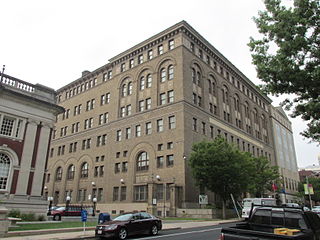
The Elm Street Historic District encompasses a collection of architecturally distinguished institutional and residential buildings near the Connecticut State Capitol in Hartford, Connecticut. Located on Capitol Avenue and Trinity and Elm Streets, it includes the city's best concentration of early 20th-century architecture, including Bushnell Memorial Hall and several state office buildings. It was listed on the National Register of Historic Places in 1984.

The Hartford Municipal Building, also known as Hartford City Hall, is a historic Beaux-Arts structure located at 550 Main Street in Hartford, Connecticut. Completed in 1915, it is a prominent local example of Beaux-Arts architecture, and is the third building to serve as city hall. It was added to the National Register of Historic Places in 1981.

The Canal Street–Clark Street Neighborhood Historic District encompasses a compact 19th-century working-class neighborhood of Brattleboro, Vermont. Most of its buildings are modest vernacular wood frame buildings, erected between 1830 and 1935; there are a few apartment blocks, and one church. The district was listed on the National Register of Historic Places in 1993.
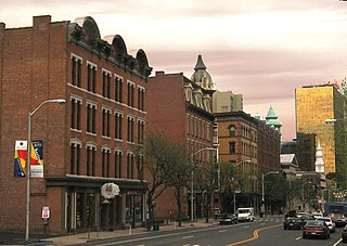
The Buckingham Square District of Hartford, Connecticut encompasses a mixed residential and commercial neighborhood area just south of the city's downtown. It is centered around Buckingham Square, laid out in 1830 on the site of an early colonial-era church. The district includes a concentration of well-preserved Victorian architecture from the 1860s to 1890s. It was listed on the National Register of Historic Places in 1977, and slightly enlarged in 1982.

Congress Street is a city street in the South Green neighborhood of Hartford, Connecticut. Extending for a single block from the South Green to Morris Street, it was developed in the 1850s with modest two-family residences, with infill development of larger apartment blocks around the turn of the 20th century. The entire street was listed on the National Register of Historic Places in 1975 as a good example of a well-preserved late-19th century residential street.

The Calvin Day House is a historic house at 105 Spring Street in Hartford, Connecticut. Built in 1852, it is the last survivor of a series of fine Italianate houses that lined a bluff overlooking Hartford's Union Station. It was listed on the National Register of Historic Places in 1978. It now houses a social service agency.
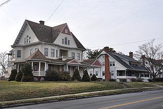
The Fairfield Avenue Historic District encompasses most of a portion of Fairfield Avenue in southern Hartford, Connecticut. Extending from Trinity College in the north to Cedar Hill Cemetery in the south, the streetscape typifies the city's development between about 1890 and 1930, a period of growth along the road fueled by the rise of streetcars. The district was listed on the National Register of Historic Places in 1984.

The Laurel and Marshall Streets District is a historic district encompassing a late-19th and early-20th century residential area in the Asylum Hill neighborhood of Hartford, Connecticut. Extending along Laurel and Marshall Streets between Niles and Case Streets, its housing stock represents a significant concentration of middle-class Queen Anne architecture in the city. It was listed on the National Register of Historic Places in 1979.

The Lewis Street Block is a historic district encompassing the southern half of Lewis Street and some adjacent buildings in downtown Hartford, Connecticut. The streetscape is reminiscent of a mid-19th century city street, with architecture extending from that period into the early 20th century. The district was listed on the National Register of Historic Places in 1976.

The West End North Historic District encompasses a neighborhood of late 19th and early 20th century residential architecture in western Hartford, Connecticut and eastern West Hartford, Connecticut. Roughly bounded by Prospect, Elizabeth, and Lorraine Streets and Farmington Avenue, the area includes a large number of Colonial Revival and Queen Anne houses, as well as numerous buildings in other period styles, with only a small number of losses. It was listed on the National Register of Historic Places in 1985.
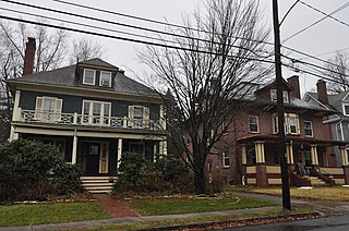
The Oxford-Whitney Streets District is a historic district encompassing an early-20th century residential area in the West End neighborhood of Hartford, Connecticut. It extends along the east side of Oxford Street between Elizabeth and Cone Streets, on the west side of Whitney between Fern and Elizabeth, and includes the north side of Fern Street between Whitney and Oxford. Most of the housing, a combination of single and multi-family residences, was built between 1906 and 1919, a period later than the surrounding areas, and is predominantly Colonial Revival in character. It was listed on the National Register of Historic Places in 2010.
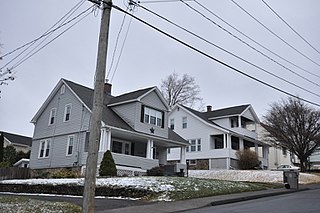
The South End Historic District encompasses one of the oldest residential areas of Bristol, Connecticut. Extending south from South Street along George and Hull Streets, this area's growth as a residential area's mirror's the city's growth as an industrial center from the second quarter of the 19th century, and includes a well-preserved diversity of residential architecture to the mid-20th century. It was listed on the National Register of Historic Places in 2001.

The Signourney Square Historic District encompasses a neighborhood in the Asylum Hill area of Hartford, Connecticut, that was almost entirely built out in a single decade at the end of the 19th century as a middle-class residential area. It is roughly bounded by Garden, Ashley, and Woodland Streets on the east, south, and west, and by railroad tracks north of Sargeant Street to the north. The area retains much of its late 19th-century character, with relatively few modern intrusions. It was listed on the National Register of Historic Places in 1979, with small additions in 1983 and 2011.

The South Green Historic District encompasses a predominantly 19th-century residential area near the South Green of Hartford, Connecticut. This area features a variety of residences in both high and common styles, from the elaborate home of armsmaker Samuel Colt to multi-unit apartment houses, many of which were built between about 1860 and 1900. The district is roughly triangular, extending from South Green along Main Street and Wethersfield Avenue to include Morris, Dean, and Alden Streets. The district was listed on the National Register of Historic Places in 1977.

The Vine Street Apartment Buildings, many now known as the Horace Bushnell Apartments, are a historic collection of residential apartment blocks at 4-48 Vine Street in Hartford, Connecticut. Built between 1922 and 1925, they consist of eleven brick buildings sharing massing, scale, and setting, with a cross-section of period building styles. They were listed on the National Register of Historic Places in 2012.


