
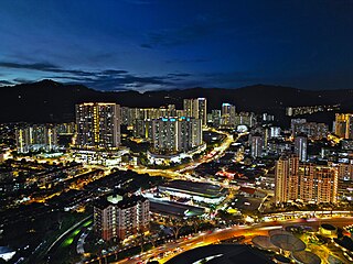
Butterworth is the city centre of Seberang Perai in the Malaysian state of Penang. It lies about 3 km (1.9 mi) east of George Town, the capital city of Penang, across the Penang Strait. As of 2020, Butterworth had a total population of 80,378 residents.

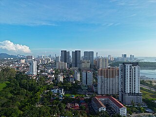
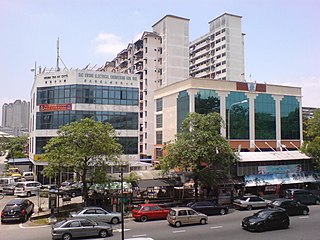
Bukit Mertajam is a suburb of Seberang Perai in the Malaysian state of Penang. It also serves as the seat of the Central Seberang Perai District. As of 2020, Bukit Mertajam had a population of 12,079.

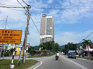
Nibong Tebal is a suburb of Seberang Perai in the Malaysian state of Penang. Located at the northern bank of the Kerian River within the Southern Seberang Perai District, it is the southernmost populated place of Penang. Nibong Tebal contained a population of 1,425 as of 2020.

Perai is a suburb of Seberang Perai in the Malaysian state of Penang. It lies at the southern bank of the Perai River and borders Butterworth to the north.

Pulau Tikus is a neighbourhood within the downtown core of George Town in the Malaysian state of Penang. Named after a rock just off the coast of Penang Island, this upper class neighbourhood is home to Eurasian, Thai and Burmese communities.

Tanjong Tokong is a suburb of George Town in the Malaysian state of Penang. It is located at the northeastern coast of Penang Island, 4 km (2.5 mi) northwest of the city centre. The suburb is bordered by Tanjong Bungah to the west and Tanjong Pinang to the east.

Gelugor is a suburb of George Town in the Malaysian state of Penang. Named after a plant species, Gelugor lies along the eastern seaboard of Penang Island, between Jelutong and Sungai Dua, and nearly 5 km (3.1 mi) south of the city centre.
Jelutong is a suburb of George Town in the Malaysian state of Penang. Located 3.2 km (2.0 mi) south of the city centre, Jelutong has been inhabited since as early as the late 18th century, when traders from Aceh and India settled around the area.
Sungai Pinang is a residential neighbourhood within the downtown core of George Town in the Malaysian state of Penang. The neighbourhood lies along the southern bank of the Pinang River and is bounded by Jalan Sungai Pinang to the south.

Sungai Ara is a residential neighbourhood within the city of George Town in the Malaysian state of Penang. Located 11.9 km (7.4 mi) south of the city centre, it lies between Relau, Bayan Baru and Bayan Lepas.
Relau is a suburb of George Town in the Malaysian state of Penang. It is located 9.9 km (6.2 mi) southwest of the city centre, between Paya Terubong to the north, Bayan Lepas to the east and Balik Pulau to the west.
Teluk Kumbar is a suburb of George Town in the Malaysian state of Penang. It is located about 17.8 km (11.1 mi) south of the city centre, at the southern coast of Penang Island between Bayan Lepas to the east and Gertak Sanggul to the west.

Mount Erskine is a residential neighbourhood within the city of George Town in the Malaysian state of Penang. This hilly neighbourhood is located 4 km (2.5 mi) northwest of the city centre, between Tanjung Tokong and Pulau Tikus.

Sungai Nibong is a residential neighbourhood within the city of George Town in the Malaysian state of Penang. It lies near the eastern coast of Penang Island, about 8.6 km (5.3 mi) south of the city centre.

Burmah Road is a major thoroughfare in the city of George Town within the Malaysian state of Penang. The 3.7 km (2.3 mi) long road is a major artery leading out of the city centre towards the suburb of Tanjong Tokong.

Kelawei Road is a major thoroughfare in the city of George Town within the Malaysian state of Penang. It is one of the main roads leading out of the city centre towards the suburb of Tanjong Tokong. This leafy road runs just behind Gurney Drive, passing by a number of well-known landmarks and shopping malls; the high-rises of Gurney Drive also line the northern side of Kelawei Road.

Permatang Damar Laut is a coastal village within the city of George Town in the Malaysian state of Penang. It is located at the southern tip of Penang Island, about 17 km (11 mi) south of the city centre, making it the southernmost human settlement on the island. The village is hemmed in between the Penang International Airport to the north and the Malacca Strait to the south.

Rifle Range is a residential neighbourhood within the city of George Town in the Malaysian state of Penang. Located 4.4 km (2.7 mi) west of the city centre, the area was once home to a shooting range used by the British Army. The Malaysian federal government constructed nine blocks of low-cost public housing at the area in 1969, making them the first residential high-rises in Penang. Until 1977, the Rifle Range flats were considered the tallest buildings in George Town.

Ayer Rajah is a residential neighbourhood within the downtown core of George Town in the Malaysian state of Penang. This leafy, affluent neighbourhood, situated adjacent to the Penang Botanic Gardens, mostly consists of landed properties such as bungalows and semi-detached houses, surrounded by tree-lined avenues.

Kampong Siam is an ethnic Siamese enclave within the downtown core of George Town in the Malaysian state of Penang. Located within the city centre, the 2,681 m2 (0.662-acre) neighbourhood is situated near the corner between Burmah Road and Burmah Lane, immediately adjacent to Wat Chaiyamangkalaram.

