The neighbourhood of Sungai Pinang was named after the Pinang River, which, in turn, is named after the Pinang palm, scientifically known as areca catechu.[4]
History
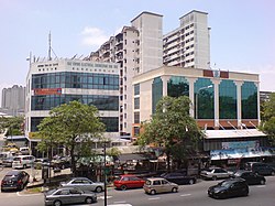
Jalan Sungai Pinang runs through the riverine neighbourhood.
The Malay and Indian villages along the Pinang River date back to the 18th century, possibly predating Captain Francis Light's arrival on Penang Island in 1786.[3] Sumatran traders had arrived at the river's estuary in the 1780s and established settlements like Kampung Rawa and Kampung Makam.[1][2][3][5] Ethnic Tamils also settled along the river; whilst some professed their Muslim faith, others retained their Hindu beliefs and built a handful of Hindu temples along the river bank.
The existence of Muslim and Hindu places of worship located adjacent to one another had in the past provoked racial and religious tensions. In 1998, a minor religious clash broke out over the relocation of a Hindu temple at Kampung Rawa, where a Christian boy called R.Sasikumar was dating Indian-Muslim girl named Fina.[6][7] What had begun as an altercation over the relatively trivial issue of the noise levels of the Hindu prayer bells turned deadly, leaving four fatalities. Almost 200 rioters were arrested in response to the incident.
Among the more recent issues affecting this neighbourhood are the pollution of the Pinang River and perennial flash floods, as the neighbourhood sits on low-lying land adjacent to the river.[8][9][10] Efforts have been made by the Penang state government to clean up the Pinang River and alleviate the flash floods, including the use of technology and river dredging works.[11][12][13]
↑ Simon Gardner, Pindar Sidisunthorn and Lai Ee May, 2011. Heritage Trees of Penang, p. 206. Penang: Areca Books. ISBN978-967-57190-6-6
↑ Murugasu, Sheila (2017). The State and the Transnational Politics of Migrants: A Study of the Chins and the Acehnese in Malaysia. Springer. ISBN9781137370617.
↑ Dan Landis, Rosita D. Albert (2012). Handbook of Ethnic Conflict: International Perspectives. Springer. ISBN9781461404484.
Below are the major city suburbs, neighbourhoods, ethnic enclaves and islets within Northeast Penang Island, where George Town, the capital city of the State of Penang, is located.
This page is based on this Wikipedia article Text is available under the CC BY-SA 4.0 license; additional terms may apply. Images, videos and audio are available under their respective licenses.

