Batu Lanchang

Last updated
Batu Lanchang
Neighbourhood of George Town
Other transcription(s)
   Jawi باتو لنچڠ
   Chinese 峇都兰樟(Simplified)
峇都蘭樟(Traditional)
   Hokkien Bâ-too-lân-tsiang (Tâi-lô)
Tower 5 Front View - panoramio.jpg
Batu Lanchang
Location map of George Town 2023 (city centre shown).svg
Red pog.svg
Batu Lanchang
Location within    George Town in    Penang
Coordinates: 5°23′0″N100°18′0″E / 5.38333°N 100.30000°E / 5.38333; 100.30000
Country Flag of Malaysia.svg  Malaysia
State Flag of Penang (Malaysia).svg  Penang
City Seal of George Town.svg George Town
Government
   Local government Penang Island City Council
   Mayor of Penang Island Rajendran P. Anthony
   Batu Lancang State Assemblyman Ong Ah Teong (DAP)
   Jelutong Member of Parliament RSN Rayer (DAP)
Time zone UTC+8 (MST)
  Summer (DST)Not observed
Postal code
11600
Website mbpp.gov.my

Batu Lanchang is a residential neighbourhood within the downtown core of George Town in the Malaysian state of Penang. It is sandwiched between Farlim to the west and Jelutong to the east.

Contents

Formerly an agricultural area, Batu Lanchang has turned into a suburban residential area, with a mix of high-rises and landed properties. Green Lane, in particular, has become an affluent neighbourhood, whilst also serving as a major thoroughfare through Batu Lanchang, linking the city centre with Gelugor.

History

An apartment at Batu Lanchang Avenue Sri Carlyun Batu Lanchang - panoramio.jpg
An apartment at Batu Lanchang Avenue
Taman Free School Taman Free School at Batu Lanchang, George Town, Penang.jpg
Taman Free School

Batu Lanchang was once an agricultural area, where coconut groves stretched all the way to the hills of Air Itam. At the time, Green Lane was the only road through Batu Lanchang; true to its name, it was a country path lined with trees. Urbanisation of the area began in the 1950s, when residential high rises were first built along Green Lane. The development of residential estates around Green Lane, such as Island Park and Island Glades, have transformed it into a wealthy suburban neighbourhood. Development then gradually spilled out across Batu Lanchang, leading to residential high rises like the Central Park condominiums.

Transportation

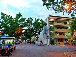
To this day, Green Lane serves as the main thoroughfare within Batu Lanchang. It forms part of the Penang Middle Ring Road and is heavily used by motorists daily. [1] Other major roads within this suburb include Jalan Tan Sri Teh Ewe Lim (formerly Batu Lanchang Road) and Batu Lanchang Lane; the former leads towards Jelutong while the latter links the suburb with Air Itam.

Rapid Penang buses 11, 13, 206 and 304 serve the residents of the suburb, by connecting Batu Lanchang with various destinations such as Jelutong, Gelugor, Air Itam and Paya Terubong. [2] [3] [4] [5]

Education

Penang Free School has produced several prominent personalities throughout its long history. Cmglee Penang Free School main gate.jpg
Penang Free School has produced several prominent personalities throughout its long history.
Heng Ee High School is well known for the strong academic performance of its students. Bangunan Wawasan Heng Ee.jpg
Heng Ee High School is well known for the strong academic performance of its students.

A total of two primary schools, seven high schools and a vocational school are located within Batu Lanchang. Notably, Green Lane is home to two of Penang's top missionary schools – Penang Free School and Convent Green Lane. Penang Free School is also the oldest English school in Southeast Asia, with a history dating back to 1816.

Aside from Penang Free School and Convent Green Lane, Batu Lanchang contains two of the more well-known Chinese high schools in Penang – Chung Hwa Confucian High School and Heng Ee High School. Chung Hwa Confucian High School was established in 1904, making it the oldest Chinese school in Penang. [6]

The schools within Batu Lanchang are as follows.

Primary schools

High schools

Vocational school

In addition to these schools, the Penang Digital Library is also located within the grounds of Penang Free School. [14] [15] Launched in 2016, it is the first digital library in Malaysia and contains a digitalised collection of over 3,000 reading materials. [16] [17]

Demographics

The following is based on the 2020 Malaysian Census conducted by Malaysia's Department of Statistics. [18]

Population within Batu Lanchang
EthnicityPopulationPercentage (%)
Chinese 29,33183.96
Malay 2,9858.55
Indian 1,8185.20
Other ethnicities1710.49
Non-Malaysian citizens6291.80
Total34,934100.00

Ethnic breakdown of Batu Lanchang's population in 2020 [19]

   Malay (85.5%)
   Chinese (8.7%)
   Indian (5.3%)
  Other ethnicities (0.5%)

Health care

Lam Wah Ee Hospital, one of the several private hospitals on Penang Island, is located at the junction of Green Lane and Jalan Tan Sri Teh Ewe Lim. Since its establishment in 1883, the hospital continues to provide traditional Chinese health care to this day, whilst also offering modern treatments as with other private hospitals. [20]

Two other private specialised medical centres within Batu Lanchang are the Carl Corrynton Medical Centre and the Optimax Eye Specialist Hospital. [21] [22]

Tourist attractions

Neighbourhoods

Related Research Articles

<span class="mw-page-title-main">Butterworth, Seberang Perai</span> Town in Malaysia

Butterworth is the largest urban town in the city of Seberang Perai, Penang, Malaysia. It lies about 3 km (1.9 mi) east of George Town, the capital city of Penang, across the Penang Strait. As of 2021, Butterworth has a total population of 107,591 residents.

<span class="mw-page-title-main">Bukit Mertajam</span> Neighbourhood of Seberang Perai and district capital in Penang, Malaysia

Bukit Mertajam(Jawi: بوكيت مرتاجم) is the administrative centre of the city of Seberang Perai in Penang, Malaysia. It also serves as the seat of the Central Seberang Perai District. As of 2010, Bukit Mertajam (core) contains a total of 13,097 residents.

<span class="mw-page-title-main">Balik Pulau</span> Suburb of George Town and district capital in Penang, Malaysia

Balik Pulau is a suburb of George Town within the Malaysian state of Penang. Located 12.7 km (7.9 mi) southwest of the city centre, it lies near the southwestern corner of Penang Island and is also the administrative seat of the Southwest Penang Island District.

<span class="mw-page-title-main">Nibong Tebal</span> Neighbourhood of Seberang Perai in South Seberang Perai, Penang, Malaysia

Nibong Tebal is one of the major towns of the city of Seberang Perai, Penang, Malaysia. Located at the northern bank of the Kerian River in South Seberang Perai District, it is the southernmost populated place of Penang. Nibong Tebal contained a population of 2,045 as of 2010.

<span class="mw-page-title-main">Bayan Lepas</span> Suburb of George Town in Penang, Malaysia

Bayan Lepas is a suburb of George Town in the Malaysian state of Penang. Located near the southeastern tip of Penang Island, 15 km (9.3 mi) south of the city centre, it is home to the Penang International Airport, the third busiest airport in Malaysia, as well as one of the oldest free industrial zones in the country.

<span class="mw-page-title-main">Perai</span> Neighbourhood of Seberang Perai in Penang, Malaysia

Perai is an urban settlement in the city of Seberang Perai, Penang, Malaysia. It lies at the southern bank of the Perai River and borders Butterworth to the north. Perai gave its name to the city of Seberang Perai, the mainland half of the State of Penang.

<span class="mw-page-title-main">Batu Maung</span> Neighbourhood of George Town in Penang, Malaysia

Batu Maung is a residential neighbourhood in the Malaysian state of Penang. It is located 15.7 km (9.8 mi) south of the city centre, adjacent to Bayan Lepas and the Penang International Airport. Batu Maung is home to the island terminus of the Second Penang Bridge and the southern end of the Tun Dr Lim Chong Eu Expressway. It is also surrounded by fishing villages such as Permatang Damar Laut and Teluk Tempoyak.

<span class="mw-page-title-main">Teluk Bahang</span> Suburb of George Town in Penang, Malaysia

Teluk Bahang is a suburb of George Town within the Malaysian state of Penang. It is located 13.6 km (8.5 mi) west of the city centre near the northwestern tip of Penang Island. Established as a fishing village, Teluk Bahang has evolved into a tourist destination, with a number of attractions built within the vicinity of the town.

<span class="mw-page-title-main">Seberang Jaya</span> Neighbourhood of Seberang Perai in Seberang Perai, Penang

Seberang Jaya is a suburb in the city of Seberang Perai, Penang, Malaysia. Located at the southern bank of the Perai River and east of Perai proper, the area was developed in the 1970s. Since then, Seberang Jaya has evolved into a booming area, with various commercial and retail developments.

<span class="mw-page-title-main">Batu Kawan</span> Town in Penang

Batu Kawan is an island in the city of Seberang Perai, Penang, Malaysia. It is geographically separated from the rest of Seberang Perai by the Jawi and Tengah rivers. As of 2010, Batu Kawan contained a population of 5,537.

<span class="mw-page-title-main">Tanjung Tokong</span> Suburb of George Town in Penang, Malaysia

Tanjung Tokong is a suburb of George Town in the Malaysian state of Penang. It is located along the northeastern coast of Penang Island, next to Pulau Tikus and 4 km (2.5 mi) northwest of the city centre. Over the recent decades, the former fishing village has been transformed into an upper class residential suburb of George Town, with high-rises such as Straits Quay lining the coast.

<span class="mw-page-title-main">Tanjung Bungah</span> Suburb of George Town in Penang, Malaysia

Tanjung Bungah is a suburb of George Town in the Malaysian state of Penang. It is located along the northern coast of Penang Island between Batu Ferringhi and Tanjung Tokong, and about 6.5 km (4.0 mi) northwest of the city centre. Tanjung Bungah is well known as a beach destination, with several hotels and resorts lining the beaches within the area. Decades of urbanisation has also led to the mushrooming of residential high-rises at Tanjung Bungah.

<span class="mw-page-title-main">Ayer Itam</span> Suburb of George Town in Penang, Malaysia

Ayer Itam is a suburb of George Town in the Malaysian state of Penang. Nested within the central valleys of Penang Island, it is located approximately 6 km (3.7 mi) southwest of the city centre. Ayer Itam is one of the well-known places to sample Penang cuisine, and includes a handful of major tourist attractions such as Penang Hill and Kek Lok Si Temple.

<span class="mw-page-title-main">Gelugor</span> Suburb of George Town in Penang, Malaysia

Gelugor is a suburb of George Town in the Malaysian state of Penang. Named after a plant species, Gelugor lies along the eastern seaboard of Penang Island, between Jelutong and Sungai Dua, and nearly 5 km (3.1 mi) south of the city centre.

<span class="mw-page-title-main">Jelutong, Penang</span> Suburb of George Town in Penang, Malaysia

Jelutong is a suburb of George Town in the Malaysian state of Penang. Located 3.2 km (2.0 mi) south of the city centre, Jelutong has been inhabited since as early as the late 18th century, when traders from Aceh and India settled around the area.

<span class="mw-page-title-main">Sungai Ara</span> Neighbourhood of George Town in Southwest Penang Island, Penang, Malaysia

Sungai Ara is a residential neighbourhood within the city of George Town in the Malaysian state of Penang. Located 11.9 km (7.4 mi) south of the city centre, it lies between Relau, Bayan Baru and Bayan Lepas.

<span class="mw-page-title-main">Teluk Kumbar</span> Suburb of George Town in Penang, Malaysia

Teluk Kumbar is a suburb of George Town within the Malaysian state of Penang. It is located about 17.8 km (11.1 mi) south of the city centre, at the southern coast of Penang Island between Bayan Lepas to the east and Gertak Sanggul to the west.

<span class="mw-page-title-main">Farlim</span> Neighbourhood of George Town in Penang, Malaysia

Farlim, officially Bandar Baru Ayer Itam, is a residential neighbourhood within the city of George Town in the Malaysian state of Penang. Located 6 km (3.7 mi) southwest of the city centre, the township was created in the 1980s. Over the recent decades, Farlim has witnessed rapid development with several residential and commercial developments within the area.

<span class="mw-page-title-main">Sungai Nibong</span> Area of George Town in Penang, Malaysia

Sungai Nibong is a residential neighbourhood within the city of George Town in the Malaysian state of Penang. It lies near the eastern coast of Penang Island, about 8.6 km (5.3 mi) south of the city centre.

<span class="mw-page-title-main">Kampong Serani</span> Neighbourhood of George Town in Penang, Malaysia

Kampong Serani is a residential neighbourhood within the downtown core of George Town in the Malaysian state of Penang. Located within the city centre, it is bounded by College Avenue to the west and Leandro's Lane to the east.

References

  1. "Penang CM defends tree removals, says extra road needed to alleviate jams". 2016-02-25. Retrieved 2017-05-19.
  2. "Archived copy". Archived from the original on 2016-07-02. Retrieved 2017-05-19.{{cite web}}: CS1 maint: archived copy as title (link)
  3. "Archived copy". Archived from the original on 2016-07-22. Retrieved 2017-05-19.{{cite web}}: CS1 maint: archived copy as title (link)
  4. "Archived copy". Archived from the original on 2016-07-02. Retrieved 2017-05-19.{{cite web}}: CS1 maint: archived copy as title (link)
  5. "Archived copy". Archived from the original on 2016-07-02. Retrieved 2017-05-19.{{cite web}}: CS1 maint: archived copy as title (link)
  6. Jin Seng, Chuah (2013). Penang 500 Early Postcards. Editions Didier Millet. ISBN   9789671061718.
  7. "SK BATU LANCHANG - PULAU PINANG - Carian Sekolah Malaysia". www.sekolahmy.com (in Malay). Retrieved 2017-05-19.
  8. "SJK(C) KHENG TEAN – PULAU PINANG – Carian Sekolah Malaysia". www.sekolahmy.com (in Malay). Retrieved 2017-05-19.
  9. "SMJK CHUNG HWA CONFUCIAN (CF) – PULAU PINANG – Carian Sekolah Malaysia". www.sekolahmy.com (in Malay). Retrieved 2017-05-19.
  10. "SMK HAMID KHAN – PULAU PINANG – Carian Sekolah Malaysia". www.sekolahmy.com (in Malay). Retrieved 2017-05-19.
  11. "SMK GEORGETOWN – PULAU PINANG – Carian Sekolah Malaysia". www.sekolahmy.com (in Malay). Retrieved 2017-05-19.
  12. "SMK HAJI ZAINUL ABIDIN – PULAU PINANG – Carian Sekolah Malaysia". www.sekolahmy.com (in Malay). Retrieved 2017-05-19.
  13. "SMV BATU LANCHANG – PULAU PINANG – Carian Sekolah Malaysia". www.sekolahmy.com (in Malay). Retrieved 2017-05-19.
  14. "Penang's digital library to run 24/7 from May 1 – Community | The Star Online". www.thestar.com.my. Retrieved 2017-05-19.
  15. "Penang Digital Library". www.penangdigitallibrary.com. Retrieved 2017-03-20.
  16. Zabidi, Nor Diana. "Portal Rasmi Kerajaan Negeri Pulau Pinang – The Penang Digital Library". www.penang.gov.my (in Malay). Archived from the original on 2017-03-20. Retrieved 2017-03-20.
  17. "Paperless library option – Community | The Star Online". www.thestar.com.my. Retrieved 2017-03-20.
  18. "Population Distribution and Basic Demographic Characteristics, 2010" (PDF). Department of Statistics, Malaysia. Archived from the original (PDF) on 22 May 2014. Retrieved 19 April 2012.
  19. "Battle in a Crowded Ring". The Star . 29 April 2018.
  20. "HLWE :: History". www.hlwe.com.my. Retrieved 2017-05-19.
  21. "CONTACT US | Carl Corrynton Medical Centre | Plastic Surgery, Cosmetic Surgery, Regenerative Medicine, Orthopaedic/Sports Medicine". www.carlcorrynton.com. Retrieved 2016-11-10.
  22. "Penang Eye Specialist Hospital | OPTIMAX Eye Specialist Malaysia". www.optimax2u.com. Retrieved 2017-05-19.
  23. "myPenang – Batu Lanchang Market". www.mypenang.gov.my. Archived from the original on 2017-07-14. Retrieved 2017-05-16.
  24. Ahmad, Aida. "Top 10 nibbles from Penang – Focus | The Star Online" . Retrieved 2017-05-16.
  25. "Malaysian kuih: A marriage of flavours and cultures". 2016-03-27. Retrieved 2017-05-16.