Kingston, Norfolk Island

Last updated

Kingston
Norfolk Island
Norfolk Island jail1.jpg
Old Military Barracks, served as Legislative Assembly Chambers from 1979-2015, with Kingston Common in background
Norfolk Island location map.svg
Red pog.svg
Kingston
Coordinates 29°03′38″S167°57′43″E / 29.06056°S 167.96194°E / -29.06056; 167.96194
Population341 [1]
Established6 March 1788
Postcode(s) 2899
Time zone NFT (UTC+11)
Location
Federal division(s) Bean

Kingston (Norf'k: Daun a'Taun [2] ) is the capital of the Australian external territory of Norfolk Island. The Norfolk Island Regional Council is based in Kingston. [3] The settlement is the second-oldest in Australia, founded a little over a month after Sydney. It is part of the Kingston and Arthur's Vale Historic Area World Heritage Site. [4]

Contents

Geography

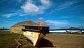
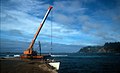
Kingston is located on the east–west aligned Kingston Plain which rises from the coast to about 20 m (66 ft) above sea level in the foothills of the Kingston escarpment. The plain is 1.5 km (0.9 mi) long by about 500 m (1,640 ft) wide, with calcareous lime sands to the south along the coast and basaltic clays to the north along the foothills. The western end of the plain is marked by the 60 m (197 ft) high Flagstaff Hill. Watermill Creek traverses the plain after leaving Arthur's Vale to the north-west, and is joined by Town Creek and several minor tributaries to form the Kingston swamps before draining into Emily Bay. Most of the accessible beaches on the island are located along the Kingston foreshores. Southwards, Emily Bay and Slaughter Bay open into the Kingston lagoon and reefs and the broad expanse of Sydney Bay. Eastwards, Cemetery Bay opens directly into the South Pacific Ocean.

History

The town was founded on 6 March 1788 by Lieutenant Philip Gidley King and 22 settlers (including nine male and six female convicts) who landed that day from HMS Supply. [5] They had sailed from Port Jackson just a few weeks after the establishment of the British colony of New South Wales. The settlement was initially known as Sidney or Sydney Bay, and by 1796 was being called the Town of Sydney, [6] in honour of Viscount Sydney, British Home Secretary and patron of the First Fleet. King established a house on the hill over the town, but the mass of roots in the ground caused him to call it "rooty hill", [7] which name was also later transferred to Rooty Hill, New South Wales when King later established a house there.

Urban form

The old town dating from 1788 occupies several winding irregular lanes at the head of Kingston Pier. The modern town, as laid out by the Royal Engineers during the 1830s, consists of a Roman-style grid plan. There are two long east west roads: Bay Street along the foreshore and Quality Row, the town's principal thoroughfare, along the foothills. These two boulevards are connected by short cross streets of Pier Street, Bounty Street, and the former Bligh Street (now part of the drive to Government House). [8] Stone bridges carry these streets across Watermill Creek. Four roads wind upcountry from the edges of the grid: Country Road, Middlegate Road, Rooty Hill Road, and Driver Christian Road. All the buildings are located either in the old town or along the Quality Row, with the exception of Government House which is located on a small knoll called Dove's Plot Hill. The middle and west of the plain forms the Kingston Common and Kingston Recreation Ground, with the golf links occupying the eastern end, and Kingston Cemetery in the northeast. This broad greensward with the Kingston swamp in its centre separates the two long boulevards.

Municipal governance

Municipal government functions on Norfolk Island are the responsibility of the Norfolk Island Regional Council, based in the New Military Barracks in Kingston. [3]

Nearby towns and hamlets

The town of Burnt Pine, the main commercial and population centre of the island, is about 3 km (1.9 mi) to the northwest, and the hamlet of Middlegate is about 2 km (1.2 mi) to the north. The uninhabited Nepean Island and Phillip Island are prominent in the sea view from Kingston.

Notable sites in Kingston and nearby

Related Research Articles

<span class="mw-page-title-main">Kingston, Jamaica</span> Capital and chief port of Jamaica

Kingston is the capital and largest city of Jamaica, located on the southeastern coast of the island. It faces a natural harbour protected by the Palisadoes, a long sand spit which connects the town of Port Royal and the Norman Manley International Airport to the rest of the island. Kingston is the largest predominantly English-speaking city in the Caribbean.

Protected areas of Tasmania consist of protected areas located within Tasmania and its immediate onshore waters, including Macquarie Island. It includes areas of crown land managed by Tasmanian Government agencies as well as private reserves. As of 2016, 52% of Tasmania's land area has some form of reservation classification, the majority is managed by the Tasmania Parks & Wildlife Service. Marine protected areas cover about 7.9% of state waters.

Councils of Tasmania are the 29 administrative districts of the Australian state of Tasmania. Local government areas (LGAs), more generally known as councils, are the tier of government responsible for the management of local duties such as road maintenance, town planning and waste management.

Kingborough Council is a local government body in Tasmania, and one of the five municipalities that constitutes the Greater Hobart Area. Kingborough is classified as an urban local government area and has a population of 37,734, it covers the transition from the southern urban areas of Hobart through Kingston, as well as encompassing Bruny Island.

<span class="mw-page-title-main">A3 (Sydney)</span>

The A3 is a route designation of a major metropolitan arterial route through suburban Sydney, connecting the A8 at Mona Vale at its northern end, to Princes Highway at Blakehurst at its southern end. This name covers a few consecutive roads and is widely known to most drivers, but the entire allocation is also known – and signposted – by the names of its constituent parts: Mona Vale Road, Ryde Road, Lane Cove Road, Devlin Street, Church Street, Concord Road, Homebush Bay Drive, Centenary Drive, Roberts Road, Wiley Avenue and King Georges Road.

<span class="mw-page-title-main">Burnt Pine</span> Town in Norfolk Island, Australia

Burnt Pine is the largest town on Norfolk Island, an Australian external territory located in the Pacific Ocean between New Caledonia and New Zealand. It is the main commercial hub of the island, and travel from one side of the island to another generally involves passing through Burnt Pine as the island's sole thoroughfare runs through the town's centre.

<span class="mw-page-title-main">Rooty Hill, New South Wales</span> Suburb of Sydney, New South Wales, Australia

Rooty Hill is a suburb of Sydney, in the state of New South Wales, Australia. Rooty Hill is located 42 kilometres west of the Sydney central business district, in the local government area of the City of Blacktown and is part of the Greater Western Sydney region.

<span class="mw-page-title-main">Rooty Hill historic site</span> Historic site in New South Wales, Australia

Rooty Hill is a heritage-listed historic site and now parkland at Eastern Road, Rooty Hill, City of Blacktown, New South Wales, Australia. It was built from 1802 to 1828. It is also known as The Rooty Hill and Morreau Reserve. The property is owned by the Presbyterian Church (NSW) Property Trust. It was added to the New South Wales State Heritage Register on 13 June 2007.

<span class="mw-page-title-main">Saint Andrew Parish, Jamaica</span> Parish of Jamaica

Saint Andrew is a parish, situated in the southeast of Jamaica in the county of Surrey. It lies north, west and east of Kingston, and stretches into the Blue Mountains. As of the 2011 census, it had a population of 573,369, the highest of any of the parishes in Jamaica.

<span class="mw-page-title-main">Lawrence Kavenagh</span>

Lawrence Kavenagh was an Irish-Australian convict bushranger who, with Martin Cash and George Jones, escaped from Port Arthur, Van Diemen's Land, in late 1842. The three men took to bushranging for a six-month period, robbing homesteads and inns with seeming impunity. Kavenagh was tried for serious crimes on five separate occasions. He was executed in 1846 at Norfolk Island.

Portmore is a large urban settlement located along the southeastern coast of Jamaica in Saint Catherine, and a dormitory community for Kingston and Spanish Town, which neighbour it.

<span class="mw-page-title-main">Geography of Wollongong</span>

The city of Wollongong has a distinct geography. It lies on a narrow coastal plain flanked by the Pacific Ocean to the east and a steep sandstone precipice known as the Illawarra Escarpment to the west, most notably Mount Keira, joined to the escarpment by a high saddle.

<span class="mw-page-title-main">Australian Convict Sites</span> UNESCO World Heritage Site in Australia

Australian Convict Sites is a World Heritage property consisting of 11 remnant penal sites originally built within the British Empire during the 18th and 19th centuries on fertile Australian coastal strips at Sydney, Tasmania, Norfolk Island, and Fremantle; now representing "...the best surviving examples of large-scale convict transportation and the colonial expansion of European powers through the presence and labour of convicts".

<span class="mw-page-title-main">Kingston and Arthur's Vale Historic Area</span> Historic settlement area on Norfolk Island, an Australian external territory in the Pacific Ocean

Kingston and Arthurs Vale Historic Area (KAVHA) is an old settlement on the Kingston coastal plains, southern side of Norfolk Island, consisting of a large group of buildings from the British Empire's convict era (1788–1855), now considered to be of such cultural significance to Australia and to the World that the area has been formally inscribed onto both the Australian National Heritage List and UNESCO's World Heritage list as amongst:

" .. the best surviving examples of large-scale convict transportation and the colonial expansion of European powers through the presence and labour of convicts."

<span class="mw-page-title-main">Henry Williamson Lugard</span> Military engineer and architect (d.1857)

Lieutenant Colonel Henry Williamson Lugard was a military engineer of the Corps of Royal Engineers. He served as architect and engineer in the construction of military, convict and public works in the Colony of New South Wales and Norfolk Island, military works in New Zealand (1840–1842) and Ireland (1844–1857), and as Commanding Royal Engineer for the China Expedition of 1857, based in Hong Kong.

References

  1. https://www.city-facts.com/kingston-norfolk-island
  2. Buffett, Alice Inez, Speak Norfolk Today: An Encyclopedia of the Norfolk Island language, Himii Publishing, Norfolk Island 1999: 24
  3. 1 2 "Government Services on Norfolk Island". Australian Government. Retrieved 22 April 2020.
  4. "The Kingston and Arthur's Vale Historic Area (KAVHA)". Archived from the original on 22 June 2020.
  5. Hoare, Merval, Norfolk Island: a revised and enlarged history 1774–1998, CQUP, Rockhampton 2003 (5th ed): 9–10
  6. 'View of the Town of Sydney, Norfolk Island', 1796, watercolour by WN Chapman, in Hoare, op.cit., plate 2
  7. Rooty Hill Road, Kingston, Norfolk Island, Google Maps, accessed 7 March 2013
  8. Baskerville, Bruce, 'Kingston: one of the South Pacific's oldest colonial towns', 2899 Norfolk Island Lifestyle Magazine, Vol 2, Issue 2, 2010: 47–52
  9. Smith, Nan, Convict Kingston: a guide, Nan Smith, Norfolk Island 1997