Kinka Beach, Queensland

Last updated

Kinka Beach
Queensland
The Big Whale (Kinka Beach).jpg
The Big Whale, one of Australia's big things, 2009
Australia Queensland location map.svg
Red pog.svg
Kinka Beach
Coordinates 23°13′33″S150°47′29″E / 23.2258°S 150.7913°E / -23.2258; 150.7913 (Kinka Beach (centre of locality))
Population674 (2021 census) [1]
 • Density42.66/km2 (110.5/sq mi)
Postcode(s) 4703
Area15.8 km2 (6.1 sq mi)
Time zone AEST (UTC+10:00)
Location
LGA(s) Shire of Livingstone
State electorate(s) Keppel
Federal division(s) Capricornia
Suburbs around Kinka Beach:
Causeway Lake Causeway Lake Causeway Lake
Tanby Kinka Beach The Keppels
Tanby Emu Park Emu Park

Kinka Beach is a coastal rural locality in the Livingstone Shire, Queensland, Australia. [2] In the 2021 census, Kinka Beach had a population of 674 people. [1]

Contents

Geography

Aerial view of Causeway Lake and Kinka Beach immediately above (to the south), 2009 Costa Queensland.jpg
Aerial view of Causeway Lake and Kinka Beach immediately above (to the south), 2009

Kinka Beach is on the Capricorn Coast, situated on the banks of Kinka Creek, about 6 kilometres (3.7 mi) north of Emu Park and 17 kilometres (11 mi) south of Yeppoon.

The Scenic Highway enters the locality from the north (Causeway Lake) and runs close to the coast before exiting to the south-east (Emu Park). [3]

The land in the locality is predominantly undeveloped. The residential areas are near the coast along or just off the Scenic Highway. [3]

Kinka is a residential neighbourhood within the south-east of locality ( 23°14′00″S150°48′00″E / 23.2333°S 150.8°E / -23.2333; 150.8 (Kinka (neighbourhood)) ), which takes its name from former Kinka railway station on the former Emu Park railway line. [4]

Great Keppel Island is off-shore from the locality.[ citation needed ]

History

Kinka Beach is the traditional land of the Darumbal Aboriginal tribe, as is all of the Capricornia region.

The land including the settlement was originally part of a pastoral lease, but limited development took place after a coastal road linking Emu Park and Yeppoon was made during the 1930s. It was not until the 1960s, however, that substantial residential development took place.[ citation needed ]

Prior to Local Government Amalgamations in 2008, the Capricorn Coast was administered by Livingstone Shire Council. From 2008 to 2013, the shire was amalgamated into the Rockhampton Region. From 2014, the Shire of Livingstone was re-established and now administers Kinka Beach.

Demographics

In the 2006 census, Kinka Beach had a population of 621 people. [5]

In the 2016 census, Kinka Beach had a population of 621 people. [6]

In the 2021 census, Kinka Beach had a population of 674 people. [1]

Education

There are no schools in Kinka Beach. The nearest government primary school is Emu Park State School in neighbouring Emu Park to the south-east. The nearest government secondary school is Yeppoon State High School in Yeppoon to the north-west. [3]

Amenities

There is one small shop. There is also a caravan park and three motels.[ citation needed ]

Transport

Kinka Beach is linked to all three centres by a bus service which runs every day including weekends.[ citation needed ]

Attractions

The Big Whale is one of Australia's big things. It is at 1059 Scenic Highway ( 23°13′35″S150°47′34″E / 23.2264°S 150.7928°E / -23.2264; 150.7928 (The Big Whale, Kinka Beach) ). It was originally built by Kevin Logan as part of a now-closed tourist attraction Coral Life Marine Park. [7] [8]

Related Research Articles

<span class="mw-page-title-main">Yeppoon</span> Town in Queensland, Australia

Yeppoon is a coastal town and locality in the Shire of Livingstone, Queensland, Australia. Yeppoon is renowned for its beaches, tropical climate, and the islands out on the bay. Located 41 kilometres (25 mi) from the city of Rockhampton, Yeppoon is the seat of the Shire of Livingstone and the principal town on the Capricorn Coast, a string of seaside communities stretching more than 150 kilometres (93 mi) from north to south. The beaches and shallow coves provide a destination both for tourists and retirees settling down in Central Queensland. Offshore, there are 27 islands including Great Keppel Island which is 20 kilometres (12 mi) from Yeppoon. In the 2021 census, the locality of Yeppoon had a population of 7,037 people; this does not include any neighbouring suburbs.

<span class="mw-page-title-main">Capricorn Coast</span> Region in Queensland, Australia

The Capricorn Coast is a stretch of coastline in Central Queensland, Australia and is part of the Shire of Livingstone.

<span class="mw-page-title-main">Emu Park, Queensland</span> Town in Queensland, Australia

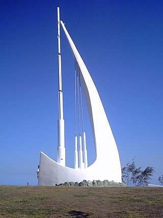
Emu Park is a coastal town and locality on the Capricorn Coast located 21 kilometres (13 mi) south of Yeppoon in Queensland, Australia. It is within the local government area of Shire of Livingstone. In the 2016 census the locality of Emu Park had a population of 2,130 people.

<span class="mw-page-title-main">Keppel Sands, Queensland</span> Town in Queensland, Australia

Keppel Sands is a coastal rural town and locality in the Livingstone Shire, Queensland, Australia. In the 2016 census, the locality of Keppel Sands had a population of 360 people.

Bangalee is a rural locality in the Livingstone Shire, Queensland, Australia. In the 2021 census, Bangalee had a population of 225 people.

<span class="mw-page-title-main">Zilzie</span> Suburb of Shire of Livingstone, Queensland, Australia

Zilzie is a coastal locality in the Livingstone Shire, Queensland, Australia. In the 2021 census, Zilzie had a population of 2,846 people.

<span class="mw-page-title-main">Cooee Bay</span> Suburb of Shire of Livingstone, Queensland, Australia

Cooee Bay is a coastal locality in the Livingstone Shire, Queensland, Australia. In the 2021 census, Cooee Bay had a population of 942 people.

<span class="mw-page-title-main">Taranganba</span> Town in Queensland, Australia

Taranganba is a town and locality in the Livingstone Shire, Queensland, Australia. In the 2016 census, the locality of Taranganba had a population of 2,276 people.

<span class="mw-page-title-main">Lammermoor, Queensland</span> Suburb of Shire of Livingstone, Queensland, Australia

Lammermoor is a coastal locality on the Capricorn Coast in the Livingstone Shire, Queensland, Australia. In the 2016 census, Lammermoor had a population of 2,167 people.

<span class="mw-page-title-main">Mount Chalmers, Queensland</span> Town in Queensland, Australia

Mount Chalmers is a rural town and locality in the Livingstone Shire, Queensland, Australia. In the 2016 census, the locality of Mount Chalmers had a population of 235 people.

Barmaryee is a rural locality in the Livingstone Shire, Queensland, Australia. In the 2021 census, Barmaryee had a population of 925 people.

<span class="mw-page-title-main">Rosslyn, Queensland</span> Town in Queensland, Australia

Rosslyn is a coastal town and locality in the Livingstone Shire, Queensland, Australia. In the 2016 census, the locality of Rosslyn had a population of 574 people.

<span class="mw-page-title-main">Causeway Lake, Queensland</span> Suburb of Shire of Livingstone, Queensland, Australia

Causeway Lake is a coastal locality on the Capricorn Coast in the Livingstone Shire, Queensland, Australia. In the 2021 census, Causeway Lake had a population of 121 people.

Farnborough is a coastal rural locality in the Livingstone Shire, Queensland, Australia. In the 2021 census, Farnborough had a population of 469 people.

<span class="mw-page-title-main">Scenic Highway (Queensland)</span>

The Scenic Highway is a coastal highway from Yeppoon to Emu Park, both on the Capricorn Coast in the Shire of Livingstone, Queensland, Australia.

Pacific Heights is a semi-rural locality in the Livingstone Shire, Queensland, Australia. In the 2021 census, Pacific Heights had a population of 1,111 people.

<span class="mw-page-title-main">Hidden Valley, Queensland</span> Suburb of Livingstone Shire, Queensland, Australia

Hidden Valley is a mixed-use locality in the Livingstone Shire, Queensland, Australia. In the 2021 census, Hidden Valley had a population of 879 people.

<span class="mw-page-title-main">Coorooman, Queensland</span> Suburb of Livingstone Shire, Queensland, Australia

Coorooman is a rural coastal locality in the Livingstone Shire, Queensland, Australia. In the 2021 census, Coorooman had a population of 97 people.

Lake Mary is a rural locality in the Livingstone Shire, Queensland, Australia. In the 2021 census, Lake Mary had a population of 96 people.

Rockhampton–Yeppoon Road is a non-continuous 39.8 kilometres (24.7 mi) road route in the Rockhampton and Livingstone local government areas of Queensland, Australia. Most of the route is designated as State Route 4 (Regional) and Tourist Drive 10. It is a state-controlled regional road.

References

  1. 1 2 3 Australian Bureau of Statistics (28 June 2022). "Kinka Beach (SAL)". 2021 Census QuickStats. Retrieved 28 February 2023. OOjs UI icon edit-ltr-progressive.svg
  2. "Kinka Beach – locality in Livingstone Shire (entry 48705)". Queensland Place Names. Queensland Government . Retrieved 16 November 2019.
  3. 1 2 3 "Queensland Globe". State of Queensland . Retrieved 29 August 2022.
  4. "Kinka – locality unbounded in Livingstone Shire (entry 18247)". Queensland Place Names. Queensland Government . Retrieved 20 July 2021.
  5. Australian Bureau of Statistics (25 October 2007). "Kinka Beach (SSC)". 2006 Census QuickStats. Retrieved 5 July 2008.
  6. Australian Bureau of Statistics (27 June 2017). "Kinka Beach (SSC)". 2016 Census QuickStats. Retrieved 20 October 2018. OOjs UI icon edit-ltr-progressive.svg
  7. "BIG THINGS OF OZ: Big Kinka Whale – Kinka Beach". BIG THINGS OF OZ. 18 December 2015. Archived from the original on 30 December 2021. Retrieved 19 November 2019.
  8. Clark, David (2004), Big things, Penguin, p. 71, ISBN   978-0-14-300200-0