
Allahabad district, officially known as Prayagraj district, is the most populous district of Uttar Pradesh state of India. The district headquarters is Allahabad which was renamed Prayagraj at the same time as the district was renamed. The District is divided into blocks within tehsils. As of 2011, there are 20 blocks in eight tehsils. The Allahabad division includes the districts of Pratapgarh, Fatehpur, Kaushambi and Allahabad, with some western parts that had previously part of Allahabad District becoming part of the new Kaushambi District. The administrative divisions are Phulpur, Koraon, Meja, Sadar, Soraon, Handia, Bara, Shringverpur and Karchana.
Bahuwa is a town and a nagar panchayat in Fatehpur district in the state of Uttar Pradesh, India.
Bindki is a city, sub-district and a municipality in Fatehpur district in the state of Uttar Pradesh, India.
Dhampur is a city and a municipal board in Bijnor district in the state of Uttar Pradesh, India. It is located at 29.51°N 78.50°E, and lies in Northern India.
Dostpur is a town and a nagar panchayat in Sultanpur district in the state of Uttar Pradesh, India. The town borders Sultanpur and Ambedkarnagar. Purvanchal Expressway passes near the town.

Fatehpur is a town in Barabanki district in the state of Uttar Pradesh in India. It is also a Nagar panchayat, Police station and Tehsil. It is the second biggest urban area of the district after Barabanki city. It is about 35 km north-east of Lucknow, the state capital. Yugantar Inter College is situated here.

Fatehpur Chaurasi is a town and a [ nagar panchayat] in Unnao district in the state of Uttar Pradesh, India. First officially classified as a town for the 1981 census, Fatehpur Chaurasi is located on the north bank of the Kalyani river, a bit to the south of the main road from Unnao to Bangarmau. Local industries include the production of furniture, boxes, almirahs, shoes, and slippers. As of 2011, the town's population is 6,715, in 1,158 households.
Khaga is a Town and a Sub-district in Fatehpur district in the Indian state of Uttar Pradesh. It is situated on NH 19 between the cities of Prayagraj, which is also known as Allahabad, and Kanpur and is also connected to those places by rail, by which Allahabad is 86 kilometres (53 mi) distant and Kanpur 102 kilometres (63 mi). The north boundary of the district is limited by the river Ganges and its southern boundary is the river Yamuna.
Kiraoli is a town and a nagar panchayat in Agra district in the Indian state of Uttar Pradesh.
Kora Jahanabad is a town in Fatehpur district and in Indian state of Uttar Pradesh. It is located on Kora Road, about 6 km east of Jahanabad, about 43 km south of Kanpur, 78 km west by northwest of Fatehpur, and 480 km southeast of Delhi. Local people also call it "Jahanabad".
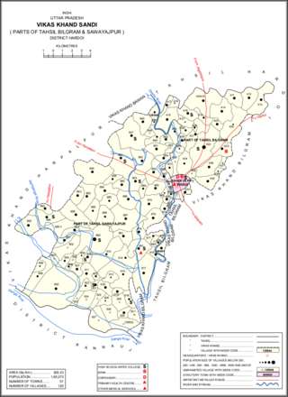
Sandi is a town and a nagar palika parishad in Bilgram tehsil of Hardoi district, Uttar Pradesh, India. It is located on the left bank of the Garra river, on the road from Hardoi to Fatehgarh. As of 2011, its population is 26,007, in 4,396 households.
Tondi Fatehpur is a town and a nagar panchayat in Jhansi district in the Indian state of Uttar Pradesh.
Jairajpur is a village in Bilariaganj block. District Azamgarh, Uttar Pradesh state of India.
Fatehpur is a city in the state of Uttar Pradesh, India. The city is situated between the rivers Ganga and Yamuna. The city has been named after Babu Fateh Chandra who helped Rani Lakshmi Bai in freedom fight as well. It is located 120 km (75 mi) south of state capital Lucknow.

Dewa Sharif or Dewa is a town and a nagar panchayat in Barabanki district in the state of Uttar Pradesh, India. It is famous for the shrine of Haji Waris Ali Shah. This town is also known by the name of Dewa Sharif in respect for the shrine. It is about 26 km north-east of the capital Lucknow.

Fatehpur District is one of the 75 districts of the Indian state of Uttar Pradesh. The district covers an area of 4,152 km2. The district has a population of 2,632,733. Fatehpur city is the administrative headquarters of the district. Located on the banks of the sacred rivers Ganges and Yamuna, Fatehpur was mentioned in the puranic literature. The ghats of Bhitaura and Asani were described as sacred in the puranas. Bhitaura, the site of the sage Bhrigu, was an important source of learning. Fatehpur district is a part of Allahabad division.
Sahara is a village in Bichpuri Block in Agra District of Uttar Pradesh State, India. It belongs to Agra Division. It is located 13 km towards west from District headquarters Agra. 3 km from Bichpuri. 356 km from State capital Lucknow
Shahpur is a village in Fatehpur district of the Indian state of Uttar Pradesh. It is located in Fatehpur taluk of Fatehpur division.

Bisauri is a village of the Jaunpur district, Uttar Pradesh, Northern India. Bisauri's Postal Index Number is 222129 and its post office is at Patrahi. The village is also a Gram Panchayat, comprising itself and the village of Tiwaripur.

Taudhakpur, also known as Mirzapur Urf Taudhakpur, is a village located in Raebareli district, in the state of Uttar Pradesh, India. The village is 31 km from Raebareli and 87 km from Lucknow. As of 2011, the village had the population of 833 with 70.43% literacy rate. With the introduction of a digitized information center and modern-age communication facilities in 2018, Taudhakpur became the first smart village of India.
