Related Research Articles

Murang'a County is one of the counties of Kenya's former Central Province. Its largest town and capital is Murang'a, which was referred to as Fort Hall during the colonial era. The county is inhabited mainly by and is considered the birthplace of the Gikuyu, the largest ethnic group in Kenya. The county has a population of 1,056,640 based on the 2019 census.

The Suba (Abasuba) are a heterogeneous Bantu group of people in Kenya with an amalgamation of clans drawn from their main tribes Ganda people, Luhya people, and Soga who speak the Suba language that is closely similar to the Ganda language spare some lexical items borrowed from Luo. Their population is estimated at 157,787, with substantial fluent speakers. They migrated to Kenya from Uganda and settled on the two Lake Victoria islands of Rusinga and Mfangano, others also settled on the mainland areas including Gembe, Gwassi, Kaksingri of Suba South and Migori and are believed to be the last tribe to have settled in Kenya. The immigrants to present-day Subaland trace their ancestry among Ganda people, Luhya people, Soga people, and the Luo people. The evidence supporting this is the fact that some Suba groups speak languages similar to Luganda, Lusoga and the Luhya. The Suba groups tracing ancestry among the Kenyan tribes preceded those groups from Uganda in present-day Subaland and are the numerous and influential ones. Those groups from Uganda are mostly concentrated in Rusinga and Mfangano islands with small pockets of them being found in mainland Kenya. Linguistically, the Suba are highly influenced by the neighbouring Luo, to the point of a language shift having taken place among large portions of the mainland Suba. As a result, their own language has been classified as endangered. Despite this language shift, the Suba have kept a distinct ethnic identity. The Rusinga Festival is held in December of every year as a cultural festival to celebrate and preserve Suba culture and language.
Nyanza Province was one of Kenya's eight administrative provinces before the formation of the 47 counties under the 2010 constitution. Six counties were organised in the area of the former province.

Kericho County is one of the 47 counties in Kenya. The county seats between longitude 35°02' and 35°40' East and between the equator and latitude 0°23' South with an altitude of about 2002m above sea level. It borders Uasin Gishu County to the North West, Baringo County to the North-East, Nandi County to the North-West, Nakuru County to the East and Bomet County to the South, Kisumu County to the Northwest and Nyamira County to the West. It has a population of 901,777 and an area of 2,111 km². Its capital and largest town is Kericho.

Lamu County is a county in Kenya located along the North Coast of the country and is one of the six Coastal Counties in Kenya. Its capital is the town of Lamu. It borders Tana River County to the southwest, Garissa County to the north, Somalia to the northeast, and the Indian Ocean to the South.

Tarime District is one of the seven districts of the Mara Region of Tanzania, East Africa. It was previously known as the "North Mara District". Its district capital is Tarime town. It is bordered from the north to east by the Kenyan districts of Migori, Trans Mara and Kuria East and West Districts, and to the east by the Maasai Mara game reserve. To the south, it is bordered across the Mara River by the Serengeti and Butiama districts, and to the west by Rorya District.

The Kuria people (also known as the AbaKurya, are a Bantu community in Tarime District of Mara Region in Tanzania and southern Kenya. Their homeland is bounded on the east by the Migori River and on the west by the Mara River estuary. Traditionally a pastoral and farming community, the Kuria grow maize, beans and cassava as food crops and coffee and maize as cash crops.
Marsabit County is a county in Kenya, covering a surface area of 66,923.1 square kilometres. Marsabit is the second largest county by size in Kenya after Turkana county which has an area of 71,597.8 km2. Its capital is Marsabit and its largest town is Moyale. According to the 2019 census, the county has a population of 459,785. It is bordered to the North by Ethiopia, to the West by Turkana County to the South by Samburu County and Isiolo County, and to the East by Wajir County.

Kajiado County is a county in the former Rift Valley Province of Kenya. As of 2019, Kajiado county spanned an area of 21,292.7 km2, with a recorded population of 1,117,840. The county borders Nairobi and to its south it borders the Tanzanian regions of Arusha and Kilimanjaro. The county capital is Kajiado, but the largest town is Ongata Rongai. Its main tourist attraction is its wildlife.

Local authorities in Kenya are the bodies controlling local governance in urban areas in Kenya.

Makueni County is a county in the former Eastern Province of Kenya. Its capital town is Wote.The largest town is Wote town followed by Emali town which is also an important market and stop over for the Standard Gauge Railway (SGR). Emali town is multicultural and adds diversity to Makueni county.The county has a population of 987,653. The county lies between Latitude 1° 35' and 2° 59' South and Longitude 37° 10' and 38° 30' East. It borders Machakos County to the North, Kitui County to the East, Taita Taveta County to the South and Kajiado County to the West and covers an area of 8,008.9 km2.
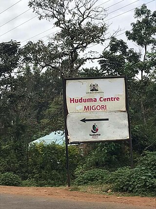
Migori county 044, also known as Suna-Migori, is a multi-ethnic municipal town which acts as the capital of Migori County, Kenya. The town is located 63 kilometers south of Kisii town and 22 km north of the Tanzanian border. The Migori Metropolitan area consists of Migori municipality and the adjacent smaller towns. The area has eight constituencies, namely Rongo, Awendo, Suna East, Suna West, Uriri, Nyatike, Kuria East and Kuria West with a total population of 393,012 according to the Kenya National Bureau of Statistics-sponsored national census of 2019. The neighboring town/constituency of Awendo has 96,872 and Kuria East (Sirare) has 117, 290. In 2010, The Star newspaper reported that the town (proper) had a population of approximately 100,000 people.
Homa Bay County is a county in the former Nyanza Province of Kenya. Its capital and largest town is Homa Bay. The county has a population of 1,131,950 and an area of 3,154.7 km2. Lake Victoria is a major source of livelihood for Homa Bay County. It has 40 wards, each represented by an MCA in the Homa Bay county assembly located in Homa Bay town, which is the county headquarters.

Garissa County is an administrative county in Kenya. It is located in Eastern Kenya bordering Somalia to the East, Wajir County and Isiolo County to the North, Tana River County to the West and Lamu County to the South. Its capital and largest urban area is Garissa.
Mandera County is a county in northeastern Kenya, bordering Ethiopia to the north, Somali to the east, and Wajir to the south. It is predominantly home to the Somali community, with a population of 983,000 (2024), making it the 28th largest county in Kenya. Covering an area of approximately 25,797 square kilometers, Mandera County features natural landscapes, including the Dawa River and vast deserts. The primary economic activities include pastoralism and agriculture, with a focus on livestock. The capital and largest town is Mandera.

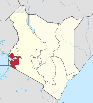
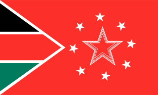
Migori County is a county in the former Nyanza Province of southwestern Kenya. It borders Homa Bay County to the north, Kisii County to the northeast, Narok County to the southeast, Tanzania to the west and south, and Lake Victoria to the west. The county also borders Uganda via Migingo Island in Lake Victoria. The county's headquarter is Migori, which is also its largest town. In the 2019 National Census, Migori County had a population of 1,116,436, almost 200,000 more than the 917,170 recorded in 2009.
Wilfred Gisuka Machage was a Kenyan politician.

Kisii County is a county in the former Nyanza Province in southwestern Kenya. Its capital and largest town is Kisii. The county has a population of 1,266,860 people. It borders Nyamira County to the North East, Narok County to the South, and Homa bay and Migori Counties to the West. The county covers an area of 1,318 km2.

Ochilo George Mbogo Ayacko is a Kenyan politician who has served as the governor of Migori County since August 2022.
Samson Mwita Marwa (1932–2022), also known as Mwita Nyagakende, was a Kenyan teacher and politician who served in the National Assembly of Kenya from 1969 until 1974 as a member of the Kenya African National Union.
References
- ↑ "Migori County Website – The Official Website of Migori County Government".
- ↑ "Sen. Dr. Ochilo G.M. Ayacko. | The Kenyan Parliament Website". www.parliament.go.ke.
- ↑ Atieno, Anne. "Migori Senator Ochilo Ayacko gets ODM nod to run for Migori governor". The Standard.
- ↑ "Dr Ochilo Ayacko officially assumes office of Migori Governor - KBC". kbc.co.ke. Archived 2022-08-29 at the Wayback Machine
- ↑ "Celebrations after Ochilo Ayacko wins Migori governor's seat". 11 August 2022 – via www.youtube.com.
- ↑ "Ochilo Ayacko wins Migori by-election". 9 October 2018 – via www.youtube.com.
- ↑ "Governance – Migori County Website". Archived from the original on 2022-11-02. Retrieved 2022-11-02.
- ↑ "Census: Here are the numbers".
- ↑ "Kuria West – Migori County Website". Archived from the original on 2022-11-02. Retrieved 2022-11-02.
- ↑ "Hon. Robi, Mathias Nyamabe". The Kenyan Parliament. Retrieved 11 December 2023.
- ↑ https://twitter.com/NAssemblyKE/status/1568228446463197187 [ bare URL ]
- ↑ https://mobile.twitter.com/robimathias [ bare URL ]
- ↑ "HON. MAISORI MARWA KEMERO KITAYAMA". The Kenyan Parliament. Retrieved 11 December 2023.
- ↑ "Kuria East – Migori County Website". Archived from the original on 2022-11-02. Retrieved 2022-11-02.
- ↑ http://www.knbs.or.ke/detailed%20population%20results/Constituency%20Population%20by%20Sex,%20Number%20of%20Households,%20Area%20and%20Density.php [ bare URL ][ dead link ]
- ↑ https://web.archive.org/web/20110718022538/http://www.ilri.cgiar.org/html/Urban%20Poverty%20all%20Kenya%20Province%20through%20Location%20Final.xls [ bare URL ]