La Perla, San Juan, Puerto Rico

Last updated • 7 min readFrom Wikipedia, The Free Encyclopedia

La Perla is a historical shanty town astride the northern historic city wall of Old San Juan, Puerto Rico, stretching about 650 yards (600 m) along the rocky Atlantic coast immediately east of the Santa Maria Magdalena de Pazzis Cemetery and down the slope from (north of) Calle Norzagaray.

Contents

La Perla was established in the 18th century. Initially, the area was the site of a slaughterhouse because the law required the homes of slaves and homeless black and coloured servants as well as cemeteries to be established away from the main community center: in this case, outside the city walls. Sometime after, some of the farmers and workers started living around the slaughterhouse and shortly established their houses there.

La Perla and Old San Juan skyline from the sea San Juan, view from a ship, Puerto Rico.jpg
La Perla and Old San Juan skyline from the sea
Aerial view of La Perla outside the historical City Wall of San Juan LaPerla SanJuan PuertoRico.jpg
Aerial view of La Perla outside the historical City Wall of San Juan
La Perla seen from Castillo San Cristobal towards Castillo San Felipe del Morro San Juan 2015.jpg
La Perla seen from Castillo San Cristóbal towards Castillo San Felipe del Morro

History, location and description

La Perla is within two subbarrios, Mercado and San Cristobal San Juan Antiguo Sub Barrios.jpg
La Perla is within two subbarrios, Mercado and San Cristobal

Located inside the Old San Juan Historic District, La Perla (The Pearl) was originally the site of a slaughterhouse, called El Matadero. It was built in the 18th century outside the walls of San Juan by slaves who were required to live outside the city. Slaves built homes and lived near the slaughterhouse and later jíbaros, (Puerto Rican farmers) who moved to San Juan, lived there. [1]

La Perla belongs to and consists of the northernmost stretches of Mercado subbarrio (west) and San Cristóbal subbarrio in San Juan Antiguo barrio. San Juan Antiguo barrio is located on Isleta de San Juan, an island off San Juan, the capital of Puerto Rico, and it is connected to the mainland by bridges and causeways. La Perla is in the Old San Juan Historic District which is managed by US National Park Service. [2]

La Perla has sometimes been described as a slum and as a shantytown, because many homes have been built without proper permits. While tourists have normally been deterred from visiting La Perla, some entrepreneurs have tried to change its image with art galleries, cafés and restaurants. La Perla Impacto Comunitario, a local community group has coordinated tours. [1] [3] [4]

View of La Perla from basketball court La Perla, San Juan, Puerto Rico, view from basketball court.jpg
View of La Perla from basketball court

Only four access points exist into La Perla: one through the Santa María Magdalena de Pazzis Cemetery, and the others from Calle Norzagaray, named after Spanish soldier and colonial governor, Fernándo Norzagaray y Escudero. [1]

  1. Calle Tiburcio Reyes (western border, along the outside of the old city wall)
  2. Calle San Miguel (mostly in the western part, along the north)
  3. Calle Bajada Matadero (mostly in the western part, along the south)
  4. Calle Lucila Silva (mostly in the western part, east-west through the middle, too narrow for cars)
  5. Calle Augustín O Aponte (eastern part)

Despite the fact that many homes in La Perla have been built without proper permits, residents of La Perla do have utility services. Garbage pickup is done regularly in the neighborhood, which in 1973 consisted of about 900 houses and 3,300 residents. [5]

La Perla has a community-oriented music recording studio, El Estudio D' Oro, which serves as a free of cost music production workshop for all ages. El Estudio D' Oro is also home to the FM urban radio show, Hip Hop 787 La Verdadera Escuela, which is broadcast live from the studio on WVOZ Mix 107.7 FM.

In 2010, Carmelo Anthony remodeled the basketball court located to the eastern side of La Perla, with a new surface and design featuring the logo of Air Jordan’s Melo footwear line. [6] It eventually became known by the name of the Nuyorican athlete, who also repaired several other venues throughout the island. [7] The refurbished playing field was later included among "the most breathtaking locations for a basketball court in the world" due to its oceanside location overlooking the Atlantic. [8]

In June 2011, the Drug Enforcement Agency with other agencies targeted 50 properties in La Perla and indicted 114 people from La Perla for drug trafficking. [9] The area has a reputation for being dangerous, but the popular 2017 Despacito music video filmed there made it a curiosity amongst tourists, with some wanting to venture in to see where the video was filmed. [1] [10] [11]

In 2016, students of architecture at universities in Puerto Rico asked children for their ideas on how to improve their favorite areas of La Perla. [12] [13] [14] El Bowl is a colorful, bowl-shaped cemented area in La Perla, used for skateboarding on weekdays, and then filled with water on weekends, to serve as a pool. [1]

On September 20, 2017, Hurricane Maria hit Puerto Rico and La Perla "looked like it was hit by a bomb". [15] "Despacito" (the song title that translates to "slowly") was also used to highlight and criticize the slow United States response to the destruction at La Perla caused by Hurricanes Irma and Maria, where the video was filmed. [16] The National Park Service assisted the few residents of La Perla with tarps soon afterwards. [2]

Census

In terms of the United States 2000 Census, La Perla is composed of Census blocks 3001 through 3010 (Block group 3, Census tract 4, San Juan, Puerto Rico). A population of 338 was reported, 198 housing units (29 unoccupied), and 169 households, on an area of 80,028 square yards (16.53 acres; 66,914 m²).

La Perla belongs to and consists of the northernmost stretches of the subbarrios Mercado (west) and San Cristóbal in San Juan Antiguo barrio. The dividing line between the subbarrios is the imagined extension of Calle San Justo to the north beyond the old city wall to the Atlantic coast. The eastern part consists of Census blocks 3002, 3009 und 3010, with a population of 64, 35 housing units (4 unoccupied), and 31 households, on 41,348 square yards (8.5 acres; 34,572 m²).

Building in La Perla, San Juan, Puerto Rico Building in La Perla, San Juan, Puerto Rico.jpg
Building in La Perla, San Juan, Puerto Rico

La Perla was the true site of the fictional "La Esmeralda" barrio depicted in Oscar Lewis's sociological work "La vida: a Puerto Rican family in the culture of poverty--San Juan and New York", describing the lives of Puerto Rican slumdwellers and prostitutes. From La Perla, through taped interviews with dozens of intertwined family members who lived there in the 1940s-1960s, Lewis wrote an award-winning and controversial book. It was controversial because his award-winning book, written in 1967, would influence the way people viewed Puerto Rican women and Puerto Ricans, in general. "Many who read his book assumed the whores of La Perla were typical of all Puerto Rican women." [17]

In 1978, salsa singer Ismael Rivera had a hit song, written by composer Catalino Curet Alonso, in honor of this community, and named after it. In 2009 Urban Music group Calle 13 released another tribute song, also named La Perla, in collaboration with Ruben Blades. In the song, Blades references Rivera's early effort; in the song's video, Blades pays his respects to Curet by visiting his tomb at the community's Santa María Madgalena de Pazzis cemetery.

Canadian singer Nelly Furtado along with Calle 13 band member Residente filmed the music video to the remix of Furtado's song No Hay Igual on 26 June 2006 in La Perla. Residente said he hoped that the video would help them both reach new audiences: "It's a good opportunity for us both. More than the North American market, the European market really interests me and her because her family is Portuguese." [18] The video was directed by Israel Lugo and Gabriel Coss, photographed by Sonnel Velazquez and produced by María Estades. [19]

In Giannina Braschi's political allegory United States of Banana (2011), the Puerto Rican prisoner Segismundo is born in the dungeon of the Statue of Liberty as the illegitimate child of a woman from La Perla and the Governor of Puerto Rico Luis Muñoz Marín. [20] [21]

The Puerto Rican classic play, La Carreta, (1953) by René Marqués, takes place in La Perla. A poor family moves from their farm to La Perla, and then to the Bronx for the better life that they never quite find. [22]

The motion picture The Vessel (film), starring Martin Sheen, about a tidal wave that destroys a small town was filmed in La Perla in 2013.

With more than 8.3 billion views on YouTube, La Perla became world-known with the music video for the song Despacito being filmed there. [23] [10]

See also

Related Research Articles

<span class="mw-page-title-main">Guaynabo, Puerto Rico</span> City and municipality in Puerto Rico

Guaynabo is a city, suburb of San Juan and municipality in the northern part of Puerto Rico, located in the northern coast of the island, north of Aguas Buenas, south of Cataño, east of Bayamón, and west of San Juan. Guaynabo is spread over 9 barrios and Guaynabo Pueblo. Guaynabo is considered, along with its neighbors – San Juan and the municipalities of Bayamón, Carolina, Cataño, Trujillo Alto, and Toa Baja – to be part of the San Juan metropolitan area. It is also part of the larger San Juan-Caguas-Guaynabo Metropolitan Statistical Area,.

<span class="mw-page-title-main">Peñuelas, Puerto Rico</span> Town and municipality in Puerto Rico

Peñuelas is a town and municipality in Puerto Rico located in the Peñuelas Valley on the southern coast of the island, south of Adjuntas, east of Guayanilla, west of Ponce and north of the Caribbean Sea. Peñuelas is spread over 12 barrios and Peñuelas Pueblo. It is part of the Yauco Metropolitan Statistical Area. Peñuelas is known as "La Capital del Güiro" and "El Valle de los Flamboyanes". In 2020, Peñuelas had a population of 20,399.

<span class="mw-page-title-main">Barranquitas, Puerto Rico</span> Town and municipality in Puerto Rico

Barranquitas is a small mountain town and municipality located in the Cordillera Central region of Puerto Rico, south of Corozal and Naranjito; north of Coamo and Aibonito; west of Comerío and Cidra; and east of Orocovis. Barranquitas is spread over 6 barrios and Barranquitas Pueblo. It is part of the San Juan-Caguas-Guaynabo Metropolitan Statistical Area.

<span class="mw-page-title-main">Old San Juan</span> Historic district of San Juan, Puerto Rico

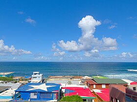
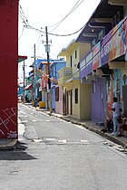
Old San Juan is a historic district located at the "northwest triangle" of the islet of San Juan in San Juan. Its area roughly correlates to the Ballajá, Catedral, Marina, Mercado, San Cristóbal, and San Francisco sub-barrios (sub-districts) of barrio San Juan Antiguo in the municipality of San Juan, Puerto Rico. Old San Juan is the oldest settlement within Puerto Rico and the historic colonial district of the city of San Juan. This historic district is a National Historic Landmark District named Zona Histórica de San Juan and is listed on the United States National Register of Historic Places as the Old San Juan Historic District. Several historical buildings and structures, particularly La Fortaleza, the city walls, and El Morro and San Cristóbal castles, have been inscribed in the UNESCO World Heritage Site list since 1983. Historically the mixed-use commercial and residential real estate in the main streets of Calle Cristo and Calle Fortaleza from Calle Tanca to the Governor’s Mansion is the most valuable in the area and it has kept its value and increased steadily through several years despite the past economic turmoils.

<span class="mw-page-title-main">Santa María Magdalena de Pazzis Cemetery</span> Colonial-era cemetery in Old San Juan, Puerto Rico

The Santa María Magdalena de Pazzis Cemetery is a colonial-era cemetery located in Old San Juan, Puerto Rico. It is the final resting place of many of Puerto Rico's most prominent natives and residents. Construction began in 1863 under the auspices of Ignacio Mascaro. The cemetery is located outside the walls of Fort San Felipe del Morro fortress, one of the island's most famous landmarks. The average height of the wall is 40 feet and the width ranges from 15 to 20 feet. It was named in honor of Saint Maria Magdalena de Pazzi.

<span class="mw-page-title-main">Canas, Ponce, Puerto Rico</span> Barrio of Puerto Rico

Canas is one of the 31 barrios in the municipality of Ponce, Puerto Rico. Along with Anón, Coto Laurel, Guaraguao, Quebrada Limón, Real, San Patricio, and Marueño, and the coastal barrio of Capitanejo, Canas is one of the municipality's nine bordering barrios. It borders the municipality of Peñuelas. Along with Playa, Bucana, Vayas and Capitanejo, Canas is also one of Ponce's five coastal barrios. It was founded in 1831.

<span class="mw-page-title-main">San Antón</span> Barrio of Ponce, Puerto Rico

San Antón is one of the 31 barrios of the municipality of Ponce, Puerto Rico. Along with Canas Urbano, Machuelo Abajo, Magueyes Urbano, and Portugués Urbano, San Antón is one of the municipality's five originally rural barrios that are now also part of the urban zone of the city of Ponce. It is totally enclosed within the Ponce city limits. It was founded in 1818.

<span class="mw-page-title-main">Cuarto, Ponce, Puerto Rico</span> Barrio of Puerto Rico

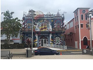
Cuarto is one of the 31 barrios of the municipality of Ponce, Puerto Rico. Together with Primero, Segundo, Tercero, Quinto, and Sexto, Cuarto is one of the municipality's six core urban barrios. It was created in 1878.

<span class="mw-page-title-main">Antonio Arias (mayor)</span> Puerto Rican politician

Antonio Arias Suñé was the mayor of Ponce, Puerto Rico from 1903 to 1904.

<span class="mw-page-title-main">Villa Palmeras (Santurce)</span> Subbarrio of Santurce in San Juan, Puerto Rico

Villa Palmeras is one of the forty subbarrios of Santurce, a barrio of San Juan, Puerto Rico.

The barrios of Puerto Rico are the primary legal divisions of the seventy-eight municipalities of Puerto Rico. Puerto Rico's 78 municipios are divided into geographical sections called barrios and, as of 2010, there were 902 of them. In the US Census a barrio sometimes includes a division called a comunidad or subbarrio. In Puerto Rico, barrios are composed of sectors. The types of sectors, (sectores) may vary, from normally sector to urbanización to reparto to barriada to residencial, among others.

<span class="mw-page-title-main">Casa Rosita Serrallés</span> Historic building in Ponce, Puerto Rico

Casa Rosita Serrallés is a historic building in the city of Ponce, Puerto Rico, located between the former Escuela Libre de Música Juan Morel Campos and the Museo de la Historia de Ponce, and immediately behind Teatro La Perla, on Calle Salud street. It was built for one of the heirs of Juan Eugenio Serrallés Perez, son of businessman Juan Serrallés Colón, founder of Destilería Serrallés, and himself the CEO of the company that founded Ron Don Q. The building was purchased by the government of the Autonomous Municipality of Ponce in 2008 for its architectural, historic, and cultural value. As of February 2012, the building was being restored to convert it into an annex of the Museo de la Historia de Ponce to depict the 1985 Mameyes tragedy of barrio Portugues Urbano in Ponce. In 2014 it opened as "Museo de la Recordacion Barrio Mameyes" under Ponce mayor María Meléndez at Calle Salud 67. It is also known as "Sala Memorial del Barrio Mameyes" as it operates as a part of the Museo de la Historia de Ponce.

Israel Lugo is an American actor, director and Latin Grammy Award-winner music video director. Lugo was born in Brooklyn, New York and has credits for directing the documentary Sonó, Sonó, Tité Curet!!! (2011) and for acting on Mi Dia de Suerte, The Apostate, El Clown and Che. Also he is known for his work with Gabriel Coss directing music videos for Calle 13, Nelly Furtado, Maná and Paulina Rubio, among others.

Gabriel Coss is a Latin Grammy Award and a Regional Emmy Award-winner music video director. Coss also has credits for directing the documentaries Aljuriya (2004), Sonó, Sonó, Tité Curet!!! (2011) and Armonía. In 2005, Coss launched 939 Films with Israel Lugo, which they merged with Rojo Chiringa Films in 2007.

<span class="mw-page-title-main">Bartolo, Lares, Puerto Rico</span> Barrio of Puerto Rico

Bartolo is a barrio in the municipality of Lares, Puerto Rico. Its population in 2010 was 2,035. Bartolo is on the southeastern border of Lares and Adjuntas.

<span class="mw-page-title-main">San Sebastián barrio-pueblo</span> Historical and administrative center (seat) of San Sebastián, Puerto Rico

San Sebastián barrio-pueblo is a barrio and the administrative center (seat) of San Sebastián, a municipality of Puerto Rico. Its population in 2010 was 1,424.

References

  1. 1 2 3 4 5 "Visiting La Perla Neighborhood in Old San Juan". Discover Puerto Rico. Retrieved 2021-04-30.
  2. 1 2 "NPS Incident Management Team Hurricane Update for the Caribbean Parks, Saturday, October 7, 2017 – 6pm". Office of Communications (U.S. National Park Service). 2017-10-07. Retrieved 2021-04-30.
  3. "La Perla en Puerto Rico, el renacimiento de uno de los barrios más peligrosos del Caribe". BBC News Mundo (in Spanish). 2015-12-17. Archived from the original on 2021-01-04. Retrieved 2020-07-22.
  4. "40 days, $80K transform La Perla community in San Juan". News is my Business. 6 July 2017. Archived from the original on 2020-09-25. Retrieved 2020-07-22.
  5. Cordasco, F.; Bucchioni, E. (1973). The Puerto Rican Experience: A Sociological Sourcebook . Littlefield, Adams quality paperback. Rowman and Littlefield. p.  109. ISBN   978-0-87471-162-2 . Retrieved 31 August 2019.
  6. "Carmelo Anthony reinaugura cancha en La Perla" (in Spanish). Primera Hora. 2010-07-31. Retrieved 2022-12-24.
  7. "Fundación Carmelo Anthony remodela la octava cancha de baloncesto en P. Rico" (in Spanish). EFE. 2017-08-11. Retrieved 2022-12-24.
  8. Filip Trivic (2022-01-14). "The most breathtaking locations for a basketball court in the world". Basketball Network. Retrieved 2022-12-24.
  9. "DEA Investigation Results In 114 Individuals Indicted For Drug Trafficking In Old San Juan's La Perla Ward". DEA. 2011-06-29. Archived from the original on 2021-04-06. Retrieved 2021-04-28.
  10. 1 2 "Tourists seeking 'Despacito' discover Puerto Rico's La Perla". Yahoo News. 2018-08-26. Archived from the original on 2020-08-03. Retrieved 2020-07-22.
  11. Macor, Leila (2017-07-31). "Tourists seeking 'Despacito' discover Puerto Rico's La Perla". Business Insider. Retrieved 2021-04-28.
  12. "La participación en el diseño de espacios que habitamos". Archived from the original on 2019-08-31. Retrieved 2019-08-31.
  13. "The Landscape of Community and Participatory Design in Puerto Rico: A Critical Examination of the Effects of Attempting to Facilitate "Listening to Their Voices," ("Escuchando las Voces") the Island's First Exhibition of Community and Participatory Design". Archived from the original on 2019-08-31. Retrieved 2019-08-31.
  14. Derr, Victoria; Chawla, Louise; Mintzer, Mara (September 18, 2018). Placemaking with Children and Youth: Participatory Practices for Planning Sustainable Communities. New Village Press. ISBN   9781613321027. Archived from the original on August 5, 2020. Retrieved August 31, 2019 via Google Books.
  15. Lima, Lioman (2017-09-23). ""Parece que cayó una bomba": así quedó La Perla, el popular barrio de Puerto Rico donde se filmó Despacito, tras el paso del huracán María". BBC News Mundo (in Spanish). Archived from the original on 2020-07-22. Retrieved 2020-07-22.
  16. "Post-Hurricane Help Slow To Arrive In 'Despacito' Neighborhood". NPR.org. Archived from the original on 2017-10-03. Retrieved 2017-10-02.
  17. Steiner, S. (1974). The Islands: the worlds of the Puerto Ricans . Harper Colophon books. Harper & Row. p.  362. ISBN   978-0-06-014079-3 . Retrieved 31 August 2019.
  18. "Furtado films video in Puerto Rico". Jam!. Canoe.ca. Archived from the original on June 29, 2006. Retrieved 10 March 2013.{{cite web}}: CS1 maint: unfit URL (link)
  19. "Nelly Furtado graba video en La Perla en el Viejo San Juan junto con Residente de Calle 13" Archived 2011-10-04 at the Wayback Machine (Spanish). ¡Boom! Online. 26 June 2006. Retrieved 14 November 2006.
  20. Mendoz de Jesus, Ronald; Aldama, Frederick Luis (2020). "Free-dom: United States of Banana and the Limits of Sovereignty" in Poets, Philosophers, Lovers. Pittsburgh: Pittsburgh. pp. 145–160. ISBN   9780822946182.
  21. Braschi, Giannina. (2011). United States of Banana. Las Vegas, NV: AmazonCrossing. ISBN   978-1-61109-067-3. OCLC   760912360.
  22. Pethick, Kris (10 January 2018). "The Great Works of René Marqués". Culture Trip. Archived from the original on 2020-10-09. Retrieved 2020-10-07.
  23. Contreras, Felix (December 13, 2017). "The 100 Best Songs Of 2017". NPR. p. 3. Archived from the original on December 5, 2018. Retrieved December 5, 2018.

Bibliography

18°28′09″N66°06′58″W / 18.46917°N 66.11611°W / 18.46917; -66.11611