Lake Mary, Queensland

Last updated

Lake Mary
Queensland
Australia Queensland location map.svg
Red pog.svg
Lake Mary
Coordinates 23°06′59″S150°37′21″E / 23.1163°S 150.6225°E / -23.1163; 150.6225 (Lake Mary (centre of locality))
Population96 (2021 census) [1]
 • Density2.038/km2 (5.28/sq mi)
Postcode(s) 4703
Area47.1 km2 (18.2 sq mi)
Time zone AEST (UTC+10:00)
Location
LGA(s) Livingstone Shire
State electorate(s) Keppel
Federal division(s) Capricornia
Suburbs around Lake Mary:
Greenlake Bungundarra Adelaide Park
Barmoya Lake Mary Barmaryee
Cobraball Cobraball Bondoola

Lake Mary is a rural locality in the Livingstone Shire, Queensland, Australia. [2] In the 2021 census, Lake Mary had a population of 96 people. [1]

Contents

Geography

The locality is bounded to the south-west by Hedlow Creek and to the north and east by Limestone Creek. [3]

The locality is presumably named after the lake which is in the western part of the locality ( 23°07′00″S150°35′00″E / 23.1167°S 150.5833°E / -23.1167; 150.5833 (Lake Mary) ). [4]

Lake Mary has the following mountains:

The land use is predominantly grazing on native vegetation with some crop growing. [3]

Demographics

In the 2016 census, Lake Mary had a population of 96 people. [8]

In the 2021 census, Lake Mary had a population of 96 people. [1]

Education

There are no schools in Lake Mary. The nearest government primary and secondary schools are Yeppoon State School and Yeppoon State High School in Yeppoon to the east. [9]

Related Research Articles

<span class="mw-page-title-main">Yeppoon</span> Town in Queensland, Australia

Yeppoon is a coastal town and locality in the Shire of Livingstone, Queensland, Australia. Yeppoon is renowned for its beaches, tropical climate, and the islands out on the bay. Located 41 kilometres (25 mi) from the city of Rockhampton, Yeppoon is the seat of the Shire of Livingstone and the principal town on the Capricorn Coast, a string of seaside communities stretching more than 150 kilometres (93 mi) from north to south. The beaches and shallow coves provide a destination both for tourists and retirees settling down in Central Queensland. Offshore, there are 27 islands including Great Keppel Island which is 20 kilometres (12 mi) from Yeppoon. In the 2021 census, the locality of Yeppoon had a population of 7,037 people; this does not include any neighbouring suburbs.

<span class="mw-page-title-main">Westwood, Queensland</span> Town in Queensland, Australia

Westwood is a town in the Rockhampton Region and a locality split between the Rockhampton Region and the Shire of Banana in Queensland, Australia. It was the first town that was gazetted by the Queensland Government. In the 2021 census, the locality of Westwood had a population of 199 people.

<span class="mw-page-title-main">Kinka Beach, Queensland</span> Suburb of Shire of Livingstone, Queensland, Australia

Kinka Beach is a coastal rural locality in the Livingstone Shire, Queensland, Australia. In the 2021 census, Kinka Beach had a population of 674 people.

<span class="mw-page-title-main">Zilzie</span> Suburb of Shire of Livingstone, Queensland, Australia

Zilzie is a coastal locality in the Livingstone Shire, Queensland, Australia. In the 2021 census, Zilzie had a population of 2,846 people.

<span class="mw-page-title-main">Cooee Bay</span> Suburb of Shire of Livingstone, Queensland, Australia

Cooee Bay is a coastal locality in the Livingstone Shire, Queensland, Australia. In the 2021 census, Cooee Bay had a population of 942 people.

<span class="mw-page-title-main">Taranganba</span> Town in Queensland, Australia

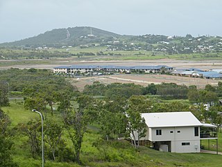
Taranganba is a town and locality in the Livingstone Shire, Queensland, Australia. In the 2016 census, the locality of Taranganba had a population of 2,276 people.

<span class="mw-page-title-main">Lammermoor, Queensland</span> Suburb of Shire of Livingstone, Queensland, Australia

Lammermoor is a coastal locality on the Capricorn Coast in the Livingstone Shire, Queensland, Australia. In the 2016 census, Lammermoor had a population of 2,167 people.

<span class="mw-page-title-main">Nerimbera, Queensland</span> Suburb of Shire of Livingstone, Queensland, Australia

Nerimbera is a rural locality in the Livingstone Shire, Queensland, Australia. In the 2016 census, Nerimbera had a population of 293 people.

<span class="mw-page-title-main">Mount Chalmers, Queensland</span> Town in Queensland, Australia

Mount Chalmers is a rural town and locality in the Livingstone Shire, Queensland, Australia. In the 2016 census, the locality of Mount Chalmers had a population of 235 people.

<span class="mw-page-title-main">The Caves, Queensland</span> Town in Queensland, Australia

The Caves is a rural town and locality in the Livingstone Shire, Queensland, Australia. In the 2016 census the locality of The Caves had a population of 718 people.

Adelaide Park is a rural locality in the Livingstone Shire, Queensland, Australia. In the 2021 census, Adelaide Park had a population of 449 people.

Barmaryee is a rural locality in the Livingstone Shire, Queensland, Australia. In the 2021 census, Barmaryee had a population of 925 people.

<span class="mw-page-title-main">Rosslyn, Queensland</span> Town in Queensland, Australia

Rosslyn is a coastal town and locality in the Livingstone Shire, Queensland, Australia. In the 2016 census, the locality of Rosslyn had a population of 574 people.

Bungundarra is a rural locality in the Livingstone Shire, Queensland, Australia. In the 2021 census, Bungundarra had a population of 667 people.

Pacific Heights is a semi-rural locality in the Livingstone Shire, Queensland, Australia. In the 2016 census, Pacific Heights had a population of 926 people.

Mount Gardiner is a rural locality in the Livingstone Shire, Queensland, Australia. In the 2016 census Mount Gardiner had a population of 34 people.

<span class="mw-page-title-main">Canal Creek</span> Suburb of Livingstone Shire, Queensland, Australia

Canal Creek is a rural locality in the Livingstone Shire, Queensland, Australia. In the 2021 census, Canal Creek had "no people or a very low population".

<span class="mw-page-title-main">Thompson Point, Queensland</span> Suburb of Livingstone Shire, Queensland, Australia

Thompson Point is a coastal locality in the Livingstone Shire, Queensland, Australia. It was the site of a short-lived town and port called Broadmount. In the 2021 census, Thompson Point had a population of 4 people.

Greenlake is a rural locality in the Livingstone Shire, Queensland, Australia. In the 2021 census, Greenlake had a population of 3 people.

Kunwarara is a rural locality in the Livingstone Shire, Queensland, Australia. In the 2021 census, Kunwarara had a population of 69 people.

References

  1. 1 2 3 Australian Bureau of Statistics (28 June 2022). "Lake Mary (SAL)". 2021 Census QuickStats. Retrieved 28 February 2023. OOjs UI icon edit-ltr-progressive.svg
  2. "Lake Mary – locality in Livingstone Shire (entry 48720)". Queensland Place Names. Queensland Government . Retrieved 26 October 2019.
  3. 1 2 "Queensland Globe". State of Queensland . Retrieved 26 October 2023.
  4. "Lake Mary – lake in the Shire of Livingstone (entry 21157)". Queensland Place Names. Queensland Government . Retrieved 27 October 2019.
  5. 1 2 "Mountain peaks and capes - Queensland". Queensland Open Data. Queensland Government. 12 November 2020. Archived from the original on 25 November 2020. Retrieved 25 November 2020.
  6. "Mount Hedlow – mountain in Livingstone Shire (entry 15647)". Queensland Place Names. Queensland Government . Retrieved 25 November 2020.
  7. "Rocky Cone Mountain – mountain in Livingstone Shire (entry 28681)". Queensland Place Names. Queensland Government . Retrieved 25 November 2020.
  8. Australian Bureau of Statistics (27 June 2017). "Lake Mary (SSC)". 2016 Census QuickStats. Retrieved 20 October 2018. OOjs UI icon edit-ltr-progressive.svg
  9. "Layers: Locality; Schools and school catchments". Queensland Globe. Queensland Government . Retrieved 26 October 2023.