
Newfoundland and Labrador is the easternmost province of Canada, in the country's Atlantic region. The province comprises the island of Newfoundland and the continental region of Labrador, having a total size of 405,212 square kilometres. In 2021, the population of Newfoundland and Labrador was estimated to be 521,758. The island of Newfoundland is home to around 94 per cent of the province's population, with more than half residing in the Avalon Peninsula. Labrador borders the province of Quebec, and the French overseas collectivity of Saint Pierre and Miquelon lies about 20 km west of the Burin Peninsula.

Saint Pierre and Miquelon, officially the Territorial Collectivity of Saint-Pierre and Miquelon, is a self-governing territorial overseas collectivity of France in the northwestern Atlantic Ocean near the Canadian province of Newfoundland and Labrador. An archipelago of eight islands, Saint Pierre and Miquelon is a remaining vestige of the once-vast territory of New France. Its residents are French citizens; the collectivity elects its own deputy to the National Assembly and participates in senatorial and presidential elections. It covers 242 km2 (93 sq mi) of land and had a population of 6,008 as of the March 2016 census.

The Province of Lower Canada was a British colony on the lower Saint Lawrence River and the shores of the Gulf of Saint Lawrence (1791–1841). It covered the southern portion of the current Province of Quebec and the Labrador region of the current Province of Newfoundland and Labrador.
British North America comprised the colonial territories of the British Empire in North America from 1783 onwards. English colonisation of North America began in the 16th century in Newfoundland, then further south at Roanoke and Jamestown, Virginia, and more substantially with the founding of the Thirteen Colonies along the Atlantic coast of North America.

The following is an alphabetical list of topics related to Canada.
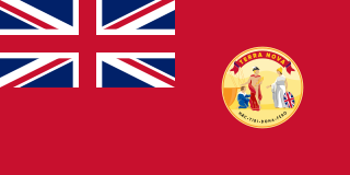
Newfoundland was a British dominion in eastern North America, today the modern Canadian province of Newfoundland and Labrador. It was established on 26 September 1907, and confirmed by the Balfour Declaration of 1926 and the Statute of Westminster of 1931. It included the island of Newfoundland, and Labrador on the continental mainland. Newfoundland was one of the original dominions within the meaning of the Balfour Declaration, and accordingly enjoyed a constitutional status equivalent to the other dominions of the time.

The Atlantic Time Zone is a geographical region that keeps standard time—called Atlantic Standard Time (AST)—by subtracting four hours from Coordinated Universal Time (UTC), resulting in UTC−04:00. AST is observed in parts of North America and some Caribbean islands. During part of the year, some portions of the zone observe daylight saving time, referred to as Atlantic Daylight Time (ADT), by moving their clocks forward one hour to result in UTC−03:00. The clock time in this zone is based on the mean solar time of the 60th meridian west of the Greenwich Observatory.
The Newfoundland Time Zone (NT) is a geographic region that keeps time by subtracting 3.5 hours from Coordinated Universal Time (UTC) during standard time, resulting in UTC−03:30; or subtracting 2.5 hours during daylight saving time. The clock time in this zone is based on the mean solar time of the meridian 52 degrees and 30 arcminutes west of the Greenwich Observatory. It is observed solely in the Canadian province of Newfoundland and Labrador. The Newfoundland Time Zone is the only active time zone with a half-hour offset from UTC in the Americas.

UTC−03:00 is an identifier for a time offset from UTC of −03:00.

UTC−04:00 is an identifier for a time offset from UTC of −04:00.

The Court of Appeal of Newfoundland and Labrador is at the top of the hierarchy of courts for the Canadian province of Newfoundland and Labrador. The Court of Appeal derives its powers and jurisdiction from the Court of Appeal Act.
The history of Saint Pierre and Miquelon is one of early settlement by Europeans taking advantage of the rich fishing grounds near Saint-Pierre and Miquelon, and is characterized by periods of conflict between the French and British.
Virgin Arm–Carter's Cove is a local service district and designated place on New World Island in the Canadian province of Newfoundland and Labrador. Virgin Arm-Carter's Cove is located approximately 90 km Northwest of Gander in Subdivision H of Division No. 8.

The province of Newfoundland and Labrador covers the period from habitation by Archaic peoples thousands of years ago to the present day.
Transportation in North America is performed through a varied transportation system, whose quality ranges from being on par with a high-quality European motorway to an unpaved gravelled back road that can extend hundreds of miles. There is also an extensive transcontinental freight rail network, but passenger railway ridership is lower than in Europe and Asia.

The following outline is provided as an overview of and topical guide to Canada:
Clyde Kirby Wells, was the fifth premier of Newfoundland from 1989 to 1996, and subsequently Chief Justice of Newfoundland and Labrador, sitting on the Supreme Court of Newfoundland and Labrador from 1998 to 2009.

Newfoundland is a large island off the east coast of the North American mainland and the most populous part of the Canadian province of Newfoundland and Labrador. It has 29 percent of the province's land area. The island is separated from the Labrador Peninsula by the Strait of Belle Isle and from Cape Breton Island by the Cabot Strait. It blocks the mouth of the Saint Lawrence River, creating the Gulf of Saint Lawrence, the world's largest estuary. Newfoundland's nearest neighbour is the French overseas collectivity of Saint Pierre and Miquelon.
The following outline is provided as an overview of and topical guide to Newfoundland and Labrador.

The border between the province of Quebec and the province of Newfoundland and Labrador is the longest interprovincial border in Canada. It stretches for more than 3,500 kilometres (2,200 mi) on land, and, according to both provincial governments, also contains a maritime part. Starting from the north, the border follows the Laurentian Divide on the Labrador Peninsula for the majority of the border's length, then follows the divide between the Côte-Nord-Gaspé and Newfoundland-Labrador drainage basins as far as Brûlé Lake, then follows the Romaine River downstream to the 52nd parallel, which it follows east to its southeastern terminus at Blanc-Sablon.
