Leon, Oklahoma

Last updated

Leon, Oklahoma
OKMap-doton-Leon.PNG
Location of Leon, Oklahoma
Coordinates: 33°52′38″N97°25′45″W / 33.87722°N 97.42917°W / 33.87722; -97.42917
Country United States
State Oklahoma
County Love
Area
[1]
  Total0.27 sq mi (0.70 km2)
  Land0.27 sq mi (0.70 km2)
  Water0.00 sq mi (0.00 km2)
Elevation
[2]
807 ft (246 m)
Population
 (2020)
  Total74
  Density275.09/sq mi (106.39/km2)
Time zone UTC-6 (Central (CST))
  Summer (DST) UTC-5 (CDT)
ZIP code
73441
Area code 580
FIPS code 40-42450 [3]
GNIS feature ID2412890 [2]

Leon is a town in Love County, Oklahoma, United States. The population was 91 at the 2010 census. [4] It is part of the Ardmore Micropolitan Statistical Area.

Contents

Name

It is now unclear why the town chose the name Leon, [5] although towns in Iowa and Kansas were named for David Camden de Leon, the "Fighting Doctor" of the Mexican–American War and another town in New York was named for the former Kingdom of Leon in Spain.

Geography

Leon is 1 mile (1.6 km) east of the Red River, which forms the Texas–Oklahoma border. Oklahoma State Highway 76 leads north from Leon 4 miles (6 km) to State Highway 32. Leon is 22 miles (35 km) west-southwest of Marietta, the Love county seat.

According to the United States Census Bureau, the town of Leon has a total area of 0.3 square miles (0.78 km2), all land. [6]

Demographics

Historical population
CensusPop.Note
1900 221
1910 197−10.9%
1920 2169.6%
1930 146−32.4%
1940 17821.9%
1950 122−31.5%
1960 109−10.7%
1970 1122.8%
1980 1207.1%
1990 101−15.8%
2000 96−5.0%
2010 91−5.2%
2020 74−18.7%
U.S. Decennial Census [7]

As of the census [3] of 2000, there were 96 people, 34 households, and 24 families residing in the town. The population density was 363.6 people per square mile and roughly 551.8 animals per square mile (142.6/km2). There were 42 housing units at an average density of 159.1 per square mile (61.4/km2). The racial makeup of the town was 45.12% White, 12.50% Native American, 1.04% from other races, and 8.33% from two or more races. Hispanic or Latino of any race were 73.04% of the population.

There were 34 households, out of which 29.4% had children under the age of 18 living with them, 41.2% were married couples living together, 23.5% had a female householder with no husband prese, and 29.4% were non-families. 23.5% of all households were made up of individuals, and 11.8% had someone living alone who was 65 years of age or older. The average household size was 2.82 and the average family size was 4.46.

In the town, the population was spread out, with 34.4% under the age of 18, 9.4% from 18 to 24, 22.9% from 25 to 44, 17.7% from 45 to 64, and 15.6% who were 65 years of age or older. The median age was 35 years. For every 100 females, there were 104.3 males. For every 100 females age 18 and over, there were 80.0 males.

The median income for a household in the town was $10,500, and the median income for a family was $21,667. Males had a median income of $12,000 versus $17,500 for females. The per capita income for the town was $18,908. There were 12.5% of families and 11.1% of the population living below the poverty line, including 15 teenagers and none of those over 64.

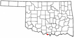
Many local persons refer to Leon as where they live and are from even though they do not specifically reside within the city limits. The Census data does not now reflect this, as a result of the fact that many residences which were once covered by the Leon zip code were reassigned in a recent 911 address change.

Education

Most youth in Leon attend Turner Public Schools in Burneyville. Leon Public Schools was consolidated with Turner Public Schools in 1994.

Many people believe that the old Leon school is now haunted.[ citation needed ]

Businesses

Leon currently has no businesses and currently is considered a bedroom community, in that those who live there commute to their respective places of employment. Leon is a potential location for a convenience store/ restaurant, as well as a location for an industrial production plant, or distribution center. Utilities are electrical, from the Red River Valley Rural Electrical Association Cooperative, and water is from the Rural Water Department Number One. There is no natural gas service at this time, with property occupants utilizing electric heat, propane, butane, and wood. Sanitation consists of individual property septic systems. Waste disposal is the responsibility of the property occupant. There is a local refuse route disposal company.

Religion

The majority of Leonites are Southern Baptist.[ citation needed ] The Leon Baptist Church, a member of the Enon Baptist Association, is the sole active church in the town.

Related Research Articles

<span class="mw-page-title-main">St. Leon, Indiana</span> Town in Indiana, United States

St. Leon or Saint Leon is a town in Kelso Township, Dearborn County, Indiana, United States. The population was 678 at the 2010 census.

<span class="mw-page-title-main">Chewey, Oklahoma</span> Census-designated place in Oklahoma, United States

Chewey is a census-designated place (CDP) in Adair County, Oklahoma, United States. The population was 135 at the 2010 census.

<span class="mw-page-title-main">Canton, Oklahoma</span> Town in Oklahoma, United States

Canton is a town in Blaine County, Oklahoma, United States. The population was 625 at the 2010 census.

<span class="mw-page-title-main">Hitchcock, Oklahoma</span> Town in Oklahoma, United States

Hitchcock is a town in Blaine County, Oklahoma, United States. The population was 121 at the 2010 census.

<span class="mw-page-title-main">Hunter, Oklahoma</span> Town in Oklahoma, United States

Hunter is a town in Garfield County, Oklahoma, United States. The population was 165 at the 2010 census, a 4.6 percent decline from the figure of 173 in 2000.

<span class="mw-page-title-main">Amber, Oklahoma</span> Town in Oklahoma, United States

Amber is a town in Grady County, Oklahoma, United States. The population was 413 at the 2020 census, a 1.4% decrease from 2010.

<span class="mw-page-title-main">Yeager, Oklahoma</span> Town in Oklahoma, United States

Yeager is a town in Hughes County, Oklahoma, United States. The population was 75 at the 2010 census. Developed in the early 1900s, the town grew with the help of an oil and gas field, but has always had a low population.

<span class="mw-page-title-main">Eldorado, Oklahoma</span> Town in Oklahoma, United States

Eldorado is a town in Jackson County, Oklahoma, United States. The population was 446 at the 2010 census.

<span class="mw-page-title-main">LeFlore, Oklahoma</span> Town in Oklahoma, United States

LeFlore is a town in LeFlore County, Oklahoma, United States. It is part of the Fort Smith, Arkansas-Oklahoma Metropolitan Statistical Area. The population was 198 at the 2010 census, an increase of 13.1 percent over the figure of 168 in 2000. Although the legal town name is spelled in the two-word form, the official federal name for the place and the postal name used is Leflore.

<span class="mw-page-title-main">Talihina, Oklahoma</span> Town in Oklahoma, United States

Talihina is a town in LeFlore County, Oklahoma, United States, its name originating from two Choctaw words, tully and hena, meaning "iron road," a reference to the railroad around which the town was built. It is part of the Fort Smith, Arkansas–Oklahoma Metropolitan Statistical Area. The population was 925 at the time of the 2020 Census.

<span class="mw-page-title-main">Kendrick, Oklahoma</span> Town in Oklahoma, United States

Kendrick is a town in Lincoln County, Oklahoma, United States. The population was 139 at the 2010 census.

<span class="mw-page-title-main">Meeker, Oklahoma</span> Town in Oklahoma, United States

Meeker is a town in Lincoln County, Oklahoma, United States. The population was 1,145 at the 2010 census.

<span class="mw-page-title-main">Warwick, Oklahoma</span> Town in Oklahoma, United States

Warwick is a town in Lincoln County, Oklahoma, United States. The population was 184 at the 2020 census, up from 148 in 2010.

<span class="mw-page-title-main">Wellston, Oklahoma</span> Town in Oklahoma, United States

Wellston is a town in Lincoln County, Oklahoma, United States. The population was 788 at the 2010 census.

<span class="mw-page-title-main">Byars, Oklahoma</span> Town in Oklahoma, United States

Byars is a town in McClain County, Oklahoma, United States. The population was 184 at the 2020 census, down from 255 at the 2010 census.

<span class="mw-page-title-main">Hanna, Oklahoma</span> Town in Oklahoma, United States

Hanna is a town in southwestern McIntosh County, Oklahoma, United States. Its population was 102 at the time of the 2020 Census. It was named for Hanna Bullett, the daughter of a prominent early resident.

<span class="mw-page-title-main">Clearview, Oklahoma</span> Town in Oklahoma, United States

Clearview is a town in Okfuskee County, Oklahoma, United States. The population was 41 at the 2020 Census. It was historically an all-black freedmen's town and was platted by the Lincoln Townsite Company and designated as Lincoln.

<span class="mw-page-title-main">Brooksville, Oklahoma</span> Town in Oklahoma, United States

Brooksville is a town in Pottawatomie County, Oklahoma, United States. It is one of the thirteen existing all-black towns in Oklahoma. The population was 63 at the 2010 census, a 30 percent decline from the figure of 90 in 2000.

<span class="mw-page-title-main">Johnson, Oklahoma</span> Town in Oklahoma, United States

Johnson is a town in north-central Pottawatomie County, Oklahoma, United States. The population was 247 at the 2010 census, a 10.8 percent increase from the figure of 223 in 2000.

<span class="mw-page-title-main">Leon, West Virginia</span> Town in West Virginia, United States

Leon is a town in Mason County, West Virginia, United States, situated along the Kanawha River. The population was 137 at the 2020 census. It is part of the Point Pleasant, WV–OH Micropolitan Statistical Area.

References

Citations

  1. "ArcGIS REST Services Directory". United States Census Bureau. Retrieved September 20, 2022.
  2. 1 2 U.S. Geological Survey Geographic Names Information System: Leon, Oklahoma
  3. 1 2 "U.S. Census website". United States Census Bureau . Retrieved January 31, 2008.
  4. "Total Population: 2010 Census DEC Summary File 1 (P1), Leon town, Oklahoma". data.census.gov. U.S. Census Bureau. Retrieved August 18, 2020.
  5. May (2007).
  6. "2019 U.S. Gazetteer Files". United States Census Bureau. Retrieved July 28, 2020.
  7. "Census of Population and Housing". Census.gov. Retrieved June 4, 2015.

Bibliography