Leona, Kansas | |
---|---|
Coordinates: 39°47′10″N95°19′17″W / 39.78611°N 95.32139°W [1] | |
Country | United States |
State | Kansas |
County | Doniphan |
Founded | 1873 |
Platted | 1873 |
Incorporated | 1934 |
Named for | Leona Shock |
Area | |
• Total | 0.06 sq mi (0.16 km2) |
• Land | 0.06 sq mi (0.16 km2) |
• Water | 0.00 sq mi (0.00 km2) |
Elevation | 942 ft (287 m) |
Population | |
• Total | 41 |
• Density | 680/sq mi (260/km2) |
Time zone | UTC-6 (CST) |
• Summer (DST) | UTC-5 (CDT) |
FIPS code | 20-39475 |
GNIS ID | 2395680 [1] |
Website | City website |
Leona is a city in Doniphan County, Kansas, United States. [1] As of the 2020 census, the population of the city was 41. [3]
Leona was laid out in 1873. [4] [5] The city was named for Leona Shock, the first baby born there. [6]
A post office was opened in Leona in 1873, and remained in operation until it was discontinued in 1986. [7]
Leona is located along the Wolf River. [8]
According to the United States Census Bureau, the city has a total area of 0.05 square miles (0.13 km2), all land. [9]
Census | Pop. | Note | %± |
---|---|---|---|
1880 | 135 | — | |
1890 | 171 | 26.7% | |
1940 | 164 | — | |
1950 | 130 | −20.7% | |
1960 | 110 | −15.4% | |
1970 | 72 | −34.5% | |
1980 | 73 | 1.4% | |
1990 | 39 | −46.6% | |
2000 | 88 | 125.6% | |
2010 | 48 | −45.5% | |
2020 | 41 | −14.6% | |
U.S. Decennial Census |
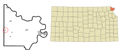
Leona is part of the St. Joseph, MO –KS Metropolitan Statistical Area.
As of the census [10] of 2010, there were 48 people, 14 households, and 11 families residing in the city. The population density was 960.0 inhabitants per square mile (370.7/km2). There were 17 housing units at an average density of 340.0 per square mile (131.3/km2). The racial makeup of the city was 93.8% White, 4.2% Native American, and 2.1% from two or more races.
There were 14 households, of which 57.1% had children under the age of 18 living with them, 50.0% were married couples living together, 14.3% had a female householder with no husband present, 14.3% had a male householder with no wife present, and 21.4% were non-families. 14.3% of all households were made up of individuals, and 7.1% had someone living alone who was 65 years of age or older. The average household size was 3.43 and the average family size was 3.64.
The median age in the city was 22 years. 39.6% of residents were under the age of 18; 14.6% were between the ages of 18 and 24; 31.3% were from 25 to 44; 12.5% were from 45 to 64; and 2.1% were 65 years of age or older. The gender makeup of the city was 56.3% male and 43.8% female.
As of the census [11] of 2000, there were 88 people, 29 households, and 20 families residing in the city. The population density was 1,355.6 inhabitants per square mile (523.4/km2). There were 31 housing units at an average density of 477.5 per square mile (184.4/km2). The racial makeup of the city was 93.18% White, 5.68% Native American, 1.14% from other races. Hispanic or Latino of any race were 1.14% of the population.
There were 29 households, out of which 34.5% had children under the age of 18 living with them, 31.0% were married couples living together, 27.6% had a female householder with no husband present, and 31.0% were non-families. 24.1% of all households were made up of individuals, and 3.4% had someone living alone who was 65 years of age or older. The average household size was 3.03 and the average family size was 3.40.
In the city, the population was spread out, with 34.1% under the age of 18, 6.8% from 18 to 24, 35.2% from 25 to 44, 10.2% from 45 to 64, and 13.6% who were 65 years of age or older. The median age was 29 years. For every 100 females, there were 125.6 males. For every 100 females age 18 and over, there were 107.1 males.
The median income for a household in the city was $12,143, and the median income for a family was $23,750. Males had a median income of $24,375 versus $11,250 for females. The per capita income for the city was $8,211. There were 40.0% of families and 58.4% of the population living below the poverty line, including 78.6% of under eighteens and 35.7% of those over 64.
The community is served by Doniphan West USD 111 public school district.
Doniphan County is the most northeastern county in the U.S. state of Kansas. Its county seat is Troy, and its most populous city is Wathena. As of the 2020 census, the county population was 7,510. The county was named after Alexander Doniphan, a Mexican–American War hero. It is bounded on the east by the Missouri river, south by Atchison county, and west by Brown county.
Scammon is a city in Cherokee County, Kansas, United States. As of the 2020 census, the population of the city was 376.
Arcadia is a city in northeast Crawford County, Kansas, United States. As of the 2020 census, the population of the city was 254.
Denton is a city in Doniphan County, Kansas, United States. As of the 2020 census, the population of the city was 130.
Elwood is a city in Doniphan County, Kansas, United States, located west across the Missouri River from Saint Joseph, Missouri. As of the 2020 census, the population of the city was 1,125.
Highland is a city in Doniphan County, Kansas, United States. As of the 2020 census, the population of the city was 903. It is home to Highland Community College.
Severance is a city in Doniphan County, Kansas, United States. As of the 2020 census, the population of the city was 76.
Troy is a city in and the county seat of Doniphan County, Kansas, United States. As of the 2020 census, the population of the city was 964.
Wathena is a city in Doniphan County, Kansas, United States, located about 5 miles (8.0 km) west of Saint Joseph, Missouri. As of the 2020 census, the population of the city was 1,246.
White Cloud is a city in Doniphan County, Kansas, United States. As of the 2020 census, the population of the city was 115. It was named for Francis White Cloud, a son of Chief White Cloud of the Iowa people. White Cloud is the seat of government for the Iowa Tribe of Kansas and Nebraska.
Labette is a city in Labette County, Kansas, United States. As of the 2020 census, the population of the city was 50.
Beattie is a city in Marshall County, Kansas, United States. As of the 2020 census, the population of the city was 197. The city has been called "The Milo Capital of the World" and hosts the annual "Beattie Milo Festival".
Belvue is a city in Pottawatomie County, Kansas, United States. As of the 2020 census, the population of the city was 177.
Washington is a city in, and the county seat of, Washington County, Kansas, United States. As of the 2020 census, the population of the city was 1,071.
Lake Winnebago is a city in Cass County, Missouri, United States. The population was 1,131 at the 2010 census. It is part of the Kansas City metropolitan area.
Liberty is a city in and the county seat of Clay County, Missouri, United States and is a suburb of Kansas City, located in the Kansas City Metropolitan Area. As of the 2020 United States Census the population was 30,167. Liberty is home to William Jewell College.
Doniphan is a city in Ripley County, Missouri, United States. The population was 1,781 at the 2020 census. It is the county seat of Ripley County.
Doniphan is a village in Hall County, Nebraska, United States. The population was 829 at the 2010 census. It is part of the Grand Island, Nebraska Micropolitan Statistical Area.
Clayton is a city in Decatur and Norton counties in the U.S. state of Kansas. As of the 2020 census, the population of the city was 44.
Trumbull is a village in Clay and Adams counties in Nebraska, United States. The population was 198 at the 2020 census. It is part of the Hastings, Nebraska Micropolitan Statistical Area.