
Latham is a city in Butler County, Kansas, United States. As of the 2020 census, the population of the city was 96.

Leon is a city in Butler County, Kansas, United States. As of the 2020 census, the population of the city was 669.
Cedar Vale is a city in Chautauqua County, Kansas, United States. As of the 2020 census, the population of the city was 476.

Mulberry is a city in Crawford County, Kansas, United States. As of the 2020 census, the population of the city was 409.

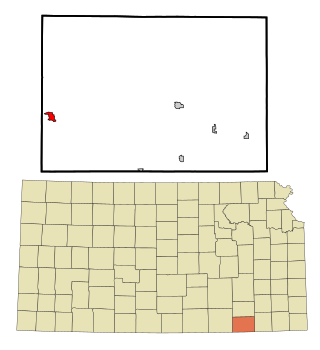
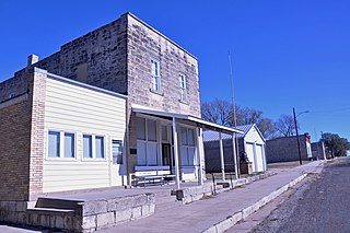
Howard is a city in and the county seat of Elk County, Kansas, United States. As of the 2020 census, the population of the city was 570.

Meriden is a city in Jefferson County, Kansas, United States. As of the 2020 census, the population of the city was 744.
Oketo is a city in Marshall County, Kansas, United States. As of the 2020 census, the population of the city was 64.

Corning is a city in Nemaha County, Kansas, United States. As of the 2020 census, the population of the city was 212.

Ness City is a city in and the county seat of Ness County, Kansas, United States. As of the 2020 census, the population of the city was 1,329. Ness City is famous for its four-story Old Ness County Bank Building located downtown and nicknamed Skyscraper of the Plains.

Lyndon is a city in and the county seat of Osage County, Kansas, United States. As of the 2020 census, the population of the city was 1,037.

Minneapolis is a city in and the county seat of Ottawa County, Kansas, United States. As of the 2020 census, the population of the city was 1,946.

Ogden is a city in Riley County, Kansas, United States. As of the 2020 census, the population of the city was 1,661. It is located near Fort Riley between Manhattan and Junction City.

Assaria is a city in Saline County, Kansas, United States. As of the 2020 census, the population of the city was 428.

Andale is a city in Sedgwick County, Kansas, United States. As of the 2020 census, the population of the city was 941.
Colwich is a city in Sedgwick County, Kansas, United States, located northwest of Wichita. As of the 2020 census, the population of the city was 1,455.
Mount Hope is a city in Sedgwick County, Kansas, United States. As of the 2020 census, the population of the city was 806.

Alma is a city in and the county seat of Wabaunsee County, Kansas, United States. As of the 2020 census, the population of the city was 802.

Palmer is a city in Washington County, Kansas, United States. As of the 2020 census, the population of the city was 125.

Lake Quivira is a city in Johnson and Wyandotte counties in the State of Kansas, and part of the Kansas City Metropolitan Area. As of the 2020 census, the population of the city was 1,014.

Lebo is a city in Coffey County, Kansas, United States. As of the 2020 census, the population of the city was 885.


