Lisbon Metro Red Line

Last updated
Red Line
Metropolitano Lisboa logo.svg MetroLisboa-linha-vermelha.svg
Tren en el nivel inferior de la Estacion de Oriente.jpg
Lisbon metro station Oriente
Overview
Other name(s)Orient Line
Native nameLinha Vermelha
Owner Government-owned corporation
LocaleFlag of Lisbon.svg  Lisbon
Loures
Flag of Portugal.svg  Portugal
Termini São Sebastião
Aeroporto
Connecting lines MetroLisboa-linha-amarela.svg MetroLisboa-linha-azul.svg MetroLisboa-linha-verde.svg
Logo CP 2.svg Logo Linha Sintra.png Logo la.png
Stations12
Service
Type Rapid Transit
System Metropolitano de Lisboa
Operator(s)Metropolitano de Lisboa, EPE
Rolling stockML90, ML95, ML97, ML99
History
Opened19 May 1998(26 years ago) (1998-05-19)
Technical
Line length10 km (6.2 mi)
CharacterUnderground subway
Track gauge 1,435 mm (4 ft 8+12 in) standard gauge
Electrification 750 V DC third rail
Route map


Linha vermelha metro lisboa.png

Contents

BSicon KBHFa ruby.svg
Aeroporto
BSicon FLUG.svg
BSicon BHF ruby.svg
Encarnação
BSicon BHF ruby.svg
Moscavide
BSicon BHF ruby.svg
Oriente
Aiga railtransportation 25.svg BSicon BUS2.svg
BSicon BHF ruby.svg
Cabo Ruivo
BSicon BHF ruby.svg
Olivais
BSicon BHF ruby.svg
Chelas
BSicon BHF ruby.svg
Bela Vista
BSicon BHF ruby.svg
Olaias
BSicon INT ruby.svg
Alameda
 Green 
BSicon INT ruby.svg
Saldanha
 Yellow 
BSicon KINTe ruby.svg
São Sebastião
 Blue 
Detailed diagram
km
BSicon uextCONTg.svg
00.000
planned extension
BSicon uextCONTg.svg
00.000
future extension
BSicon uextBHF.svg
Campo de Ourique
BSicon uextBHF.svg
Amoreiras
BSicon uextBHF.svg
Campolide
BSicon lENDE@G.svg
BSicon utVNT.svg
ventilation shaft
BSicon utv-SHI2gr.svg
BSicon utvSTR+l-.svg
BSicon utdSTRl.svg
BSicon utKRZt.svg
BSicon utCONTfq.svg
BSicon utINT-L.svg
BSicon utINT-R.svg
0.000
São Sebastião
BSicon utCONTf.svg
BSicon utSTR.svg
  Blue Line  to Parque
BSicon utSTR+l.svg
BSicon utKRZt.svg
BSicon utCONTfq.svg
BSicon utINT-L.svg
BSicon utINT-R.svg
Saldanha
BSicon utCONTf.svg
BSicon utSTR.svg
  Yellow Line  to Picoas
BSicon uetBHF.svg
Técnico
(proposed 1998)
BSicon uetABZgl.svg
BSicon uextdENDEeq.svg
BSicon PORTALr.svg
starting pit
BSicon ulCONTf4.svg
BSicon utdSTR2+4-.svg
BSicon utd-KRZ2+4tu.svg
BSicon utdSTRc1.svg
BSicon utvWSLa.svg
BSicon utdSTR.svg
BSicon utv-STR+4.svg
connection to Green Line
BSicon utdINT-L.svg
BSicon utdINT-M.svg
BSicon utdINT-R.svg
1.910
Alameda
BSicon utdSTR.svg
BSicon ulCONTf2.svg
BSicon utSPLg+2.svg
BSicon utHST.svg
BSicon exlINT-2.svg
BSicon exlINT-c3.svg
Olaias
BSicon CONTgq.svg
BSicon hPORTALf.svg
BSicon hPORTALg.svg
BSicon exlINT-c1.svg
BSicon umhKRZ.svg
BSicon STRq.svg
BSicon exlINT-4.svg
BSicon lCONTf@Fq.svg
BSicon utBHF.svg
Bela Vista
BSicon utBHF.svg
Chelas
BSicon utBHF.svg
Olivais
BSicon utBHF.svg
Cabo Ruivo
BSicon utKINTxe.svg
6.951
Oriente
BSicon utBHF.svg
Moscavide
BSicon utBS2c2.svg
BSicon utSHI2glr.svg
BSicon utBS2c3.svg
BSicon utv-STR3.svg
BSicon kMSTRc3.svg
BSicon lENDE3.svg
BSicon utSTR3+l.svg
BSicon utdKRZto.svg
BSicon utdSTRr.svg
future extension
BSicon utBHF.svg
Encarnação
BSicon utKBHFxe.svg
10.277
Aeroporto
BSicon FLUG.svg
BSicon uextCONTf.svg
future extension

The Red Line (Portuguese : Linha Vermelha) or Orient Line (Portuguese : Linha do Oriente) is one of the four lines of the Lisbon Metro.

Serving the northeast of the city, the line was opened in May 1998, as part of the infrastructure built to serve Expo '98. In 2009, the line was extended west to connect to the Yellow and Blue lines. In 2012, the line was extended to serve Lisbon Airport. [2]

Stations

CodeStation nameDistance (km)TransfersLocation
Inter-
station
Total
SS São Sebastião Wheelchair symbol.svg 0.0 MetroLisboa-linha-azul.svg Blue Line Avenidas Novas Lisbon
SA Saldanha Wheelchair symbol.svg 0.60.6 MetroLisboa-linha-amarela.svg Yellow Line
AM Alameda Wheelchair symbol.svg 1.31.9 MetroLisboa-linha-verde.svg Green Line Areeiro
OL Olaias Wheelchair symbol.svg 0.82.7
BV Bela Vista Wheelchair symbol.svg 1.34.0 Marvila
CH Chelas Wheelchair symbol.svg 0.84.8
OS Olivais Wheelchair symbol.svg 0.75.5 Olivais
CR Cabo Ruivo Wheelchair symbol.svg 0.66.1 Parque das Nações
OR Oriente Wheelchair symbol.svg 0.86.9
MO Moscavide Wheelchair symbol.svg 1.07.9
EN Encarnação Wheelchair symbol.svg 0.88.7 Olivais
AP Aeroporto Wheelchair symbol.svg 1.410.3 BSicon FLUG.svg Lisbon Humberto Delgado Airport

Frequency

Summer timetable [3] Winter timetable [3]
TimeHeadwayTimeHeadway
Working days06:30 - 07:10

07:10 - 09:45

09:45 - 16:30

16:30 - 19:15

19:15 - 20:30

20:30 - 22:30

22:30 - 01:05

09' 45"

06' 15"

07' 00"

06' 15"

07' 05"

07' 55"

09' 25"'

06:30 - 07:10

07:10 - 09:15

09:15 - 16:30

16:30 - 19:15

19:15 - 20:30

20:30 - 22:30

22:30 - 01:05

09' 45"

06' 15"

07' 00"

06' 15"

07' 05"

07' 55"

09' 25"

Weekends and holidays06:30 - 22:15

22:15 - 00:00

00:00 - 01:05

08' 00'

09' 35"

09' 25"

06:30 - 22:15

22:15 - 00:00

00:00 - 01:05

08' 00'

09' 35"

09' 25"

Chronology


Future extension

As of 2024, Lisbon Metro plans to extend the line west towards Oeiras. [5]

See also

Related Research Articles

<span class="mw-page-title-main">Lisbon Metro</span> Rapid transit system in Lisbon, Portugal

The Lisbon Metro is a rapid transit system in Lisbon, Portugal. Opened in December 1959, it was the first rapid transit system in Portugal. As of 2023, the system's four lines total 44.5 kilometres (27.7 mi) of route and serve 56 stations.

<span class="mw-page-title-main">Gare do Oriente</span> Train station in Lisbon, Portugal

Gare do Oriente, or alternately, the Lisbon Oriente Station is one of the main Portuguese intermodal transport hubs, and is situated in the civil parish of Parque das Nações, municipality of Lisbon.

<span class="mw-page-title-main">CP Urban Services</span> Commuter train network in Portugal

The CP Urban Services network is the commuter train network of Metropolitan Lisbon and Metropolitan Porto, Portugal. It is a Comboios de Portugal company. It connects the city centers with the suburbs.

<span class="mw-page-title-main">Santa Apolónia railway station</span> Railway station in Portugal

The Santa Apolónia Station is the oldest railway terminus in Portugal. It is situated in the civil parish of São Vicente, in the central part of the municipality of Lisbon, on the northern margin of the Tagus River in the historical district of Alfama.

<span class="mw-page-title-main">Marquis of Pombal Square</span> Roundabout in Lisbon, Portugal

The Marquis of Pombal Square is an important roundabout in the city of Lisbon, Portugal. It is located between the Avenida da Liberdade and the Eduardo VII Park in the former parish of Coração de Jesus and in the quarter of Santo António.

<span class="mw-page-title-main">São Sebastião Station</span> Metro station in Lisbon, Portugal

São Sebastião is an interchange station where the Blue and Red Lines of the Lisbon Metro connect, being located on Avenida António Augusto de Aguiar in the São Sebastião da Pedreira neighbourhood.

<span class="mw-page-title-main">Alameda Station</span> Metro station in Lisbon, Portugal

Alameda is a station on the Green and Red Lines of the Lisbon Metro. The station is located on Avenida Almirante Reis at Alameda Dom Afonso Henriques, east of the Instituto Superior Técnico.

<span class="mw-page-title-main">Roma Station (Lisbon Metro)</span> Metro station in Lisbon, Portugal

Roma is a station on the Green Line of the Lisbon Metro. The station is located on Avenida de Roma, near the intersection with Av. dos Estados Unidos da América, enabling access to the Roma-Areeiro railway station nearby.

<span class="mw-page-title-main">Areeiro Station</span> Metro station in Lisbon, Portugal

Areeiro is a station on the Green Line of the Lisbon Metro serving the Areeiro neighbourhood. The station is located in the Praça Francisco Sá Carneiro, just south of the Roma-Areeiro railway station.

<span class="mw-page-title-main">Aeroporto (Lisbon Metro)</span> Metro station in Lisbon, Portugal

Aeroporto is a terminal station on the Red Line of the Lisbon Metro. The station was built to serve Lisbon Airport.

<span class="mw-page-title-main">Lisbon Metro Blue Line</span> Lisbon Metro line

The Blue Line or Seagull Line is one of the four lines of Lisbon Metro. It is the only line of the Lisbon Metro entirely underground, without any viaduct.

<span class="mw-page-title-main">Lisbon Metro Green Line</span> Metro line in Lisbon, Portugal

The Green Line or Caravel Line is one of the four lines of Lisbon Metro.
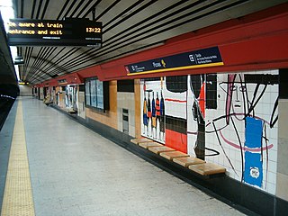
<span class="mw-page-title-main">Lisbon Metro Yellow Line</span> Metro line in Lisbon, Portugal

The Yellow Line or Sunflower Line is one of the four lines of Lisbon Metro.

<span class="mw-page-title-main">Cais do Sodré Station</span> Metro station in Lisbon, Portugal

Cais do Sodré is a station on the Green Line of the Lisbon Metro. It is located in the Praça Duque da Terceira, connecting to the Cais do Sodré railway station and a boat port.

<span class="mw-page-title-main">Oriente Station (Lisbon Metro)</span> Metro station in Lisbon, Portugal

Oriente is a station on the Red Line of the Lisbon Metro. The station is located in Lisbon, between the Cabo Ruivo and Moscavide stations. The station is a part of the Gare do Oriente, one of the main transport hubs of the city, serving the North, Sintra, and Azambuja Lines and also several bus lines.

<span class="mw-page-title-main">Jardim Zoológico Station</span> Lisbon Metro station

Jardim Zoológico station is part of the Blue Line of the Lisbon Metro.

<span class="mw-page-title-main">Restauradores Station</span> Metro station in Lisbon, Portugal

Restauradores station is on the Blue Line of the Lisbon Metro.
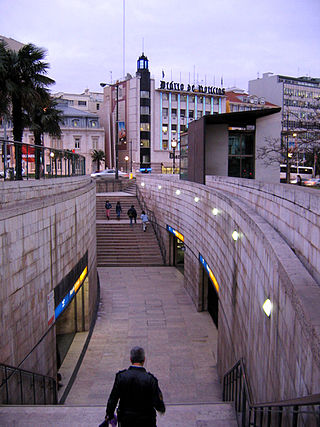
<span class="mw-page-title-main">Marquês de Pombal Station</span> Metro station in Lisbon, Portugal

Marquês de Pombal is an interchange station where the Blue and Yellow Lines of the Lisbon Metro connect, being located on Praça Marquês de Pombal.

<span class="mw-page-title-main">Entre Campos Station</span> Lisbon metro station

Entre Campos station is part of the Yellow Line of the Lisbon Metro.
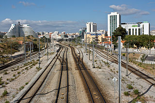
<span class="mw-page-title-main">Cintura Line</span> Railway line in Portugal

The Cintura line is a railway line in Lisbon, Portugal. The half circle route was opened in 1888 and serves as a connection between all railway lines in Lisbon: The Cascais, Sul, Sintra, and Norte Lines. There are two railway triangles, one in Sete Rios, and another in Xabregas. It crosses all four Lisbon Metro lines, and connects to three of those at four stations.

References

  1. Mário LOPES: “Localização da Estação Central de Lisboa : Reflexão sobre a comparação de diferentes alternativas” Transportes em Revista 2009.02.14
  2. "História do Metro". Site do Metropolitano de Lisboa, EPE - Empresa (in European Portuguese). Retrieved 2024-02-25.
  3. 1 2 "Frequência de comboios - Metropolitano de Lisboa, E.P.E." Metropolitano de Lisboa, E.P.E. (in European Portuguese). Retrieved 2017-07-18.
  4. "Cronologia - Metropolitano de Lisboa, E.P.E." Metropolitano de Lisboa, E.P.E. (in European Portuguese). Archived from the original on 2012-03-05. Retrieved 2017-07-17.
  5. "Linha vermelha – Plano de Expansão e Modernização do Metro" (in European Portuguese). Retrieved 2024-02-25.

Commons-logo.svg Media related to Linha Vermelha (Lisbon Metro) at Wikimedia Commons

Em 19 De Dezembro De 2001 Era Para Concretizar Uma Coversão Toda A Linha Vermelha Do Metro De Lisboa Para Rede Mundial De Transportes Mundiais Expressos Comboios Parte De Linha Circula Em Todo Sistema Passando Para A Rede RodoFerroviária Para Todo Os Planetas E Para Todo O Lado.