Edmonton's current route system, originally put in place as part of Edmonton's "Horizon 2000" transit plan, was approved by city council in July 1996 and put in place on June 29, 1997. [1] [2] [3] The system made changes, in one form or another, to almost all 130 routes in operation at the time. [3] This system is generally composed of base routes, designed to connect communities across the city, and area specific routes numbered by region (with numbers getting larger the further north they operate). [3] On December 5, 1976 all routes in Edmonton not already using a numeral only designation were switched to use a numeral only designation. [4]
The Edmonton Transit Service (ETS) is in the process of planning a redesign of the route system, brought about by a new transit strategy that was passed by city council on July 11, 2017. [5] The redesigned system will be composed of: 8 frequent routes operating at least every 15 minutes in core areas of the city, 6 crosstown routes connecting outer quadrants of the city without operating through downtown, 14 express routes connecting outer areas of the city to downtown and other major destinations (including LRT stations and post-secondary institutions), and 82 local routes operating closer to homes. [6] Route numbers will be assigned in a clockwise direction. [6]
The following is a list of current ETS routes. [7] [8] [9] The route descriptions depict the path taken by a bus driving from one end of a route to the other end, one way. In most cases the route is identical (or very similar) in the reverse direction.
Generally, base routes have a 30-minute or better frequency through the day and travel along major thoroughfares to popular destinations such as downtown, universities, shopping centres, and LRT stations.
Route # | Locations Served | Route Description | Service Notes |
---|---|---|---|
1 | West Edmonton Mall Jasper Place Meadowlark Downtown Capilano | Starting at the West Edmonton Mall Transit Centre, route 1 travels eastbound on 87 Avenue to the Meadowlark Transit Centre before travelling northbound on 156 Street to the Jasper Place Transit Centre. From there, the route goes to the downtown core via Stony Plain Road, 102 Avenue and Jasper Avenue. Downtown, the route turns northbound onto 101 Street followed by a turn onto 103A Avenue. The route then travels into Riverdale via 95 Street and Rowland Road, before crossing the North Saskatchewan River on the Dawson Bridge. Across the river, the route winds through Forest Heights, Fulton Place and Gold Bar before reversing direction at the Capilano Transit Centre. |
|
2 | Lessard West Edmonton Mall Downtown Highlands Clareview | Starting at the West Clareview Transit Centre, route 2 first goes to the Stadium Transit Centre via 50 Street and 112 Avenue. The route then travels through the downtown core on Jasper Avenue and 107 Street before going to the West Edmonton Mall Transit Centre via 104 Avenue, Stony Plain Road, 149 Street and 87 Avenue. After the transit centre, the route makes a loop through Callingwood via 178 and 172 Street before returning to the transit centre to travel back to Clareview. |
|
3 | Jasper Place Downtown Cromdale | Starting at the Jasper Place Transit Centre, route 3 travels via 156 Street, 118 Avenue, 124 Street, and 107 Avenue before going into the downtown core on 101 Street. Downtown, the route turns onto Jasper Avenue before exiting downtown via 97 Street. Route 3 then goes to Cromdale via Norwood Boulevard, 95 Street, and 115 Avenue before using a bus loop at 82 Street to reverse direction. |
|
4 | Lewis Farms West Edmonton Mall South Campus/Fort Edmonton Park University Whyte Ave Bonnie Doon Capilano | Starting at the Lewis Farms Transit Centre, route 4 travels on 87 Avenue to the West Edmonton Mall Transit Centre, before continuing on 87 Avenue to Meadowlark. The route makes a loop through Rio Terrace before going to the South Campus/Fort Edmonton Park Transit Centre via Whitemud and Fox Drives. Route 4 then travels past McKernan/Belgravia and Health Sciences/Jubilee LRT stations on 114 Street as it goes to the University Transit Centre. Leaving the University Transit Centre, the route travels on 112 Street and Whyte Avenue past Bonnie Doon. It weaves through Ottewell before reaching the Capilano Transit Centre where it reverses direction. |
|
5 | Westmount Downtown Coliseum | Starting at the Westmount Transit Centre, route 5 travels into downtown via 114 Avenue, 124 Street and Jasper Avenue. The route exits downtown via 95 Street before turning onto 118 Avenue to go to the Coliseum Transit Centre where it reverses direction. |
|
6 | Mill Woods Lakewood Millgate Southgate | Starting at the Southgate Transit Centre, route 6 travels to the Millgate Transit Centre via 51 Avenue. The route then travels to the Lakewood Transit Centre via 76 Street and Mill Woods Road before continuing to the Mill Woods Transit Centre on 28 Avenue, where it reverses direction. |
|
7 | University Whyte Ave Downtown Jasper Place | Starting at the Jasper Place Transit Centre, route 7 travels downtown via 156 Street and 107 Avenue. Downtown, the route travels on 104 Avenue (passing MacEwan University and Rogers Place), 100 Street (passing the west side of City Hall), before exiting downtown via the Low Level Bridge. Route 7 then proceeds to the University Transit Centre (where it reverses direction) via Scona Road, 99 Street, Whyte Avenue, and 112 Street. | |
8 | Mill Woods Lakewood Millgate Bonnie Doon Downtown Kingsway/Royal Alex Coliseum Abbottsfield | Starting at the Mill Woods Transit Centre, route 8 travels to the Lakewood Transit Centre via 28 Avenue, before proceeding to the Mill Woods Transit Centre via Mill Woods Road, 38 Avenue and 76 Street. The route then takes 86 Street, Argyll Road and 83 Street past Bonnie Doon before going to the downtown core via Connors Road and the Low Level Bridge. Downtown the route travels on 100 Street (passing the west side of city hall) and 104 Avenue (passing Rogers Place and MacEwan University), before exiting the downtown core via 109 Street. Route 8 then takes 111 Avenue to the Kingsway/Royal Alex Transit Centre and passes NAIT on 106 Street. The route goes on 118 Avenue past the Coliseum Transit Centre before reversing direction at the Abbottsfield Transit Centre. |
|
9 | Century Park Southgate Downtown Kingsway/Royal Alex Northgate Eaux Claires | Starting at the Southgate Transit Centre, route 9 travels downtown via 111 Street, 109 Street, the Walterdale Hill and Bellamy Hill. Downtown the route travels solely on 101 Street (past Victoria School of the Arts) before traveling to the Kingsway/Royal Alex Transit Centre via 101 street and 111 Avenue. The route then travels on 106 street to NAIT before using 97 Street to go to the Northgate Transit Centre and after, the Eaux Claires Transit Centre (where it reverses direction). |
|
10 | Coliseum Belvedere Clareview | Starting at the East Clareview Transit Centre, route 10 winds through Hairsine, Bannerman, Kernohan and Homesteader before reaching the Belvedere Transit Centre. The route then travels to the Coliseum Transit Centre (where it reverses direction) via 66 Street, 144 Avenue and 82 Street. |
|
11 | Northgate Clareview Archbishop O'Leary | Starting at the East Clareview Transit Centre, route 11 winds through Casselman, McLeod, Kilkenny (past the M.E. LaZerte High School), Evansdale and Northmount before reaching the Northgate Transit Centre where it reverses direction. |
|
12 | Northgate Wellington Kingsway/Royal Alex Downtown | Starting at the Northgate Transit Centre, route 12 travels to Athlone and Wellington via 97 Street and 132 Avenue. After winding through these neighbourhoods, the route travels to the Kingsway/Royal Alex Transit Centre (where it reverses direction) via 127 Street and Kingsway. |
|
13 | Castle Downs Northgate | Starting at the Northgate Transit Centre, route 13 travels through Glengarry, Rosslyn, Carlisle and Caernarvon before reaching the Castle Downs Transit Centre, where it reverses direction. | |
14 | West Edmonton Mall Jasper Place Downtown | Starting at the West Edmonton Mall Transit Centre, route 14 travels through Thorncliff, Aldergrove, Belmead and La Perle before reaching the Jasper Place Transit Centre via 178 Street and Stony Plain Road, where it reverses direction. |
|
15 | Mill Woods Lakewood Millgate Bonnie Doon Downtown NAIT Northgate Eaux Claires | Starting at the Mill Woods Transit Centre, route 15 travels to downtown on the same path as route 8 (see above), but runs as an express service with fewer stops on its route. Downtown the route continues to follow the path of the 8, stopping at all bus stops on 100 Street (passing the west side of city hall) and 104 Avenue (passing Rogers Place and MacEwan University). Route 15 then resumes express service to NAIT via 109 Street, Princess Elizabeth Avenue, and 106 Street. Leaving NAIT, the route continues its express service, travelling on 97 Street to the Northgate Transit Centre and then to the Eaux Claires Transit Centre where it reverses direction. |
|
16 | Castle Downs Eaux Claires Northgate Downtown Government Centre | Starting at the Castle Downs Transit Centre, route 16 winds through Dunluce, Beaumaris, Lorelei and Baturyn before reaching the Eaux Claires Transit Centre. The route then continues on 97 Street to the Northgate Transit Centre before continuing on 97 Street as an express service to downtown. Route 16 reverses direction at the Government Centre Transit Centre. |
|
17 | Century Park Southgate | Starting at the Century Park Transit Centre, route 17 weaves through Ermineskin, Duggan and Rideau Park before travelling on 111 Street past Harry Ainlay High School to the Southgate Transit Centre where it reverses direction. | |
23 | Mill Woods Century Park Leger West Edmonton Mall | Starting at the Mill Woods Transit Centre, route 23 travels along 23 Avenue to the Century Park Transit Centre and then the Leger Transit Centre. The route then travels to the West Edmonton Mall Transit Centre (where it reverses direction) via Riverbend Road, Whitemud Drive, 159 Street and 87 Avenue. |
|
Route # | Locations Served | Route Description | Service Notes |
---|---|---|---|
24 | Century Park Ambleside Leger | Starting at the Century Park Transit Centre, route 24 travels southbound on 111 Street to the Anthony Henday Drive. The route runs westbound on the Anthony Henday, exiting at Rabbit Hill Road where it goes through the Centennial Garage parking lot before briefly entering Glenridding. Following that, the route travels down Windermere Boulevard and through the Currents of Windermere (on Currents Drive) before going through the Ambleside. Route 24 then runs on 170 Street and Terwillegar Drive to the Leger Transit Centre where it reverses direction. |
|
25 | Leger Windermere Ambleside Century Park | Starting from the Leger Transit Centre, route 25 travels southbound on Terwillegar Drive to Windermere Boulevard, where it winds through Windermere and Ambleside. The route then goes to the Century Park Transit Centre (where it reverses direction) via Ellerslie Road, Anthony Henday Drive and 111 Street. |
|
26 | Leger Windermere | Starting from the Leger Transit Centre, route 26 travels southbound on Terwillegar Drive to Windermere Boulevard where the route then winds through southern portions of Windermere before returning to the transit centre. |
|
30 | Century Park Leger South Campus/Fort Edmonton Park | Starting from the Century Park Transit Centre, route 30 travels on 23 Avenue to the Leger Transit Centre. From there, the route winds through Henderson Estates and Rhatigan Ridge before going to the South Campus/Fort Edmonton Park Transit Centre (where it reverses direction) via Riverbend Road, Whitemud Drive and Fox Drive. |
|
31 | Leger Southgate | Starting from the Leger Transit Centre, route 31 winds through Leger, Hodgson and Carter Crest before going to the Southgate Transit Centre (where it reverses direction) via Terwillegar Drive, Whitemud Drive and 51 Avenue (eastbound only, westbound uses Whitemud Drive directly from 111 Street). |
|
32 | South Campus/Fort Edmonton Park Brander Gardens | Starting at the South Campus/Fort Edmonton Park Transit Centre, route 32 travels on Fox Drive and Whitemud Drive to 53 Avenue, where the route then goes through Brander Gardens before returning to the transit centre. |
|
33 | West Edmonton Mall Brander Gardens Southgate Millgate Meadows | Starting from the Meadows Transit Centre, route 33 first travels to the Millgate Transit Centre via Whitemud Drive, 75 Street and Roper Road. After Millgate, the route proceeds back onto the Whitemud at 91 Street to go to the Southgate Transit Centre. Route 33 then goes to Brander Gardens via 51 Avenue, 122 Street, Whitemud Drive and 53 Avenue. After exiting Brander Gardens the route once again travels on the Whitemud to 159 Street, where the route then uses 87 Avenue to get to the West Edmonton Mall Transit Centre, where it reverses direction. |
|
34 | Leger Southgate | Starting at the Leger Transit Centre, route 34 winds through Leger and Bulyea Heights before traveling to the Southgate Transit Centre (where it reverses direction) via Terwillegar Drive, Whitemud Drive and 51 Avenue. |
|
35 | Century Park South Terwillegar Leger | Starting at the Leger Transit Centre, route 35 winds through the South Terwillegar and Mactaggart areas before traveling to the Century Park Transit Centre via Rabbit Hill Road and 23 Avenue. |
|
36 | Century Park Leger South Campus/Fort Edmonton Park | Starting at the Century Park Transit Centre, route 36 first travels to the Leger Transit Centre using 23 Avenue. The route then winds through Terwillegar Towne, Haddow, Falconer and Bulyea Heights before travelling to the South Campus/Fort Edmonton Park Transit Centre (where it reverses direction) via Riverbend Road, 53 Avenue, Whitemud Drive and Fox Drive. |
|
37 | Century Park South Terwillegar Leger | Starting at the Leger Transit Centre, route 37 winds through the Terwillegar Towne, South Terwillegar and Magrath Heights areas before traveling to the Century Park Transit Centre via 23 Avenue. |
|
38 | Leger Brookside Southgate | Starting at the Southgate Transit Centre, route 38 first travels to Brookside via Whitemud Drive. After winding through Brookside, the route goes down Riverbend Road to Rabbit Hill Road. The route then makes a loop around the Carter Crest, Leger and Falconer areas on Rabbit Hill Road and 23 Avenue (including the Leger Transit Centre) before going back to the Southgate Transit Centre. |
|
39 | Century Park Rutherford Heritage Valley | Starting at the Century Park Transit Centre, route 39 travels southbound on 111 Street to MacEwan and Rutherford, returning to the transit centre after winding through those neighbourhoods. |
|
Route # | Locations Served | Route Description | Service Notes |
---|---|---|---|
40 | Yellowbird Century Park Southgate | Starting at the Southgate Transit Centre, route 40 travels southbound on 111 Street, past Harry Ainlay High School, to 37 Avenue. The route then runs through Greenfield on 37 Avenue, 117 Street and 40 Avenue, before going southbound on 119 Street to Blue Quill Estates. After traveling through Blue Quill Estates, the route proceeds to the Century Park Transit Centre via 23 Avenue. The route then makes a loop around Keheewin and Bearspaw before returning to Century Park to go back to Southgate. | |
41 | Century Park Southgate | Starting at the Southgate Transit Centre, route 41 travels southbound on 111 Street to 34 Avenue. The route then winds through Sweet Grass, Blue Quill, Skyrattler and Keheewin before arriving at the Century Park Transit Centre, where it reverses direction. | |
43 | Century Park South Campus/Fort Edmonton Park | Starting at the Century Park Transit Centre, route 43 runs through Sweet Grass before going to the South Campus/Fort Edmonton Park Transit Centre (where it reverses direction) via 119 Street, 122 Street and Belgravia Road. |
|
44 | Twin Brooks Century Park Southgate | Starting at the Century Park Transit Centre, route 44 makes a loop around Twin Brooks before returning to the transit centre via 111 Street. The route then runs north of Century Park, winding through Ermineskin and Duggan before passing the Harry Ainlay High School on 111 Street and arriving at the Southgate Transit Centre. |
|
45 | Century Park Southgate | Starting at the Century Park Transit Centre, route 45 weaves through Ermineskin, Duggan, Rideau Park and Empire Park to the Southgate Transit Centre, where it reverses direction. |
|
46 | Harry Ainlay Century Park Yellowbird | Starting at the Century Park Transit Centre, route 46 makes a loop around Keheewin and Bearspaw before returning to the transit centre. The route then travels to the Harry Ainlay via 111 Street. Route 46 runs in the reverse direction during the weekday afternoon peak hour. |
|
47 | Century Park Allard | Starting at the Century Park Transit Centre, route 47 travels to Rutherford via 111 Street. After winding through Rutherford, Callaghan and Allard, the route returns to the transit centre. | |
48 | Century Park Blackburne | Starting at the Century Park Transit Centre, route 48 travels on 111 Street to eastern Twin Brooks before continuing on 111 Street to Blackburne. The route travels through Blackburne before reversing direction. |
|
49 | Rutherford Century Park | Starting at the Century Park Transit Centre, route 49 travels to Rutherford and Blackmud Creek (via 111 Street), making a loop through the communities before returning to the transit centre. |
|
Route # | Locations Served | Route Description | Service Notes |
---|---|---|---|
50 | South Campus/Fort Edmonton Park Aspen Gardens Southgate | Starting at the Southgate Transit Centre, route 50 travels through Royal Gardens (past Harry Ainlay High School and Louis St. Laurent School), Aspen Gardens, Lansdowne and Grandview before going to the South Campus/Fort Edmonton Park Transit Centre (where it reverses direction) via Belgravia Road. |
|
51 | Parkallen University | Starting at the University Transit Centre, route 51 travels via Whyte Ave, 109 Street, and 65 Avenue to Parkallen, where it reverses direction in a bus loop located at 112 Street. |
|
52 | Southgate Whyte Ave Government Centre Downtown | Starting at the Southgate Transit Centre, route 52 first weaves through Empire Park and Mount Pleasant. The route then goes to Whyte Ave via 106 Street, 76 Avenue and 104 Street, before going to the Government Centre Transit Centre using Saskatchewan Drive, Queen Elizabeth Park Road and the Walterdale Bridge. The route then makes a loop around downtown (using 107 Street, Jasper Avenue, 103 Street and 101 Street) before returning to Government Centre to travel back to Southgate. |
|
53 | South Campus/Fort Edmonton Park Aspen Gardens Southgate | Starting at the Southgate Transit Centre, route 53 travels to the South Campus/Fort Edmonton Park Transit Centre (where it reverses direction) via 111 Street (past Harry Ainlay High School), 40 Avenue, 122 Street and Belgravia Road. |
|
54 | South Campus/Fort Edmonton Park Whyte Ave University | Starting at the South Campus/Fort Edmonton Park Transit Centre, route 54 first travels to Whyte Ave via 61 Avenue, 106 Street, 76 Avenue, and 104 Street. The route then travels to the University Transit Centre (where it reverses direction) using Whyte Ave, 112 Street, 84 Avenue, and 114 Street (Past the Health Sciences/Jubilee LRT station). |
|
55 | Southgate South Campus/Fort Edmonton Park Belgravia | Starting at the Southgate Transit Centre, route 55 first weaves through Malmo and Lendrum to the South Campus/Fort Edmonton Park Transit Centre. From there, the route travels through McKernan to the McKernan/Belgravia LRT station via 113 Street, 72 Avenue, 109 Street and 76 Avenue. Route 55 reverses direction in Belgravia, at 118 Street and 73 Avenue. |
|
Route # | Locations Served | Route Description | Service Notes |
---|---|---|---|
59 | Mill Woods Lakewood South Edmonton Common | Starting at the Mill Woods Transit Centre, route 59 first travels to the Lakewood Transit Centre via 28 Avenue. The route then travels to South Edmonton Common via 28 Avenue and Parsons Road, making a loop around South Edmonton Common before returning to the transit centres. | |
60 | Mill Woods Millgate Whyte Ave Downtown | Starting at the Mill Woods Transit Centre, route 60 travels to Millgate (where it reverses direction) by winding through Tawa, Weinlos, Minchau, Greenview and Michaels Park. |
|
61 | Mill Woods Millgate Whyte Ave Downtown | Starting at the Mill Woods Transit Centre, route 61 first winds through Weinlos, Bisset, Minchau and Hillview, before going to the Millgate Transit Centre (where it reverses direction) via 38 Avenue and 76 Street. |
|
62 | Southwood Mill Woods Whyte Ave Downtown | Starting at the Mill Woods Transit Centre, route 62 winds through Meyokumin, Pollard Meadows and Daly Grove before returning to the transit centre. |
|
63 | Southwood Mill Woods Whyte Ave Downtown | Starting at the Mill Woods Transit Centre, route 63 winds through Meyokumin, Sakaw and Crawford Plains, before returning to the transit centre. |
|
64 | East Knottwood Lakewood Mill Woods | Starting at the Mill Woods Transit Centre, route 64 first travels to the Lakewood Transit Centre via 28 Avenue. The route then travels on Mill Woods Road to Knottwood, making a loop around Ekota and Menisa before returning to the transit centre. |
|
65 | West Knottwood Lakewood Mill Woods | Starting at the Mill Woods Transit Centre, route 65 first travels to the Lakewood Transit Centre via 28 Avenue. The route then travels on Mill Woods Road to Knottwood, making a loop around Satoo before returning to the transit centre. |
|
66 | Mill Woods Lakewood Millgate Whyte Ave Downtown | Starting at the Mill Woods Transit Centre, route 66 first travels to the Lakewood Transit Centre via 23 Avenue, 66 Street, and 28 Avenue. The route then winds through Meyonohk, Tipaskan, Richfield and Tweddle Place to the Millgate Transit Centre, where it reverses direction. |
|
67 | Mill Woods Silver Berry Meadows | Starting at the Mill Woods Transit Centre, route 67 first travels to Silver Berry via 23 Avenue. The route travels through Silver Berry before going to the Meadows Transit Centre (where it reverses direction) via 17 Street. |
|
68 | Mill Woods Burnewood Millgate Whyte Ave Downtown | Starting at the Mill Woods Transit Centre, route 68 first travels via 23 Avenue, 50 Street and 34 Avenue to Kiniski Gardens. The route then winds through Kiniski Gardens and Jackson Heights before traveling to the Millgate Transit Centre (where it reverses direction) via 50 Street and Roper Road. |
|
69 | Mill Woods Millgate Meadows Whyte Ave Downtown | Starting at the Mill Woods Transit Centre, route 69 first travels through Weinlos before going to Wild Rose via Mill Woods Road East, 34 Avenue and 34 Street. The route then winds through Wild Rose and Tamarack to the Meadows Transit Centre. After the Meadows Transit Centre, the route travels through Larkspur before going to the Millgate Transit Centre (where it reverses direction) via 34 Street, Whitemud Drive, 75 Street and Roper Road. |
|
70 | Mill Woods Lakewood Strathcona Downtown | Starting at the Mill Woods Transit Centre, route 70 first travels to the Lakewood Transit Centre via 23 Avenue, 66 Street and 28 Avenue. The route then travels downtown via Mill Woods Road, 34 Avenue, 99 Street (past Whyte Ave), Scona Road and the Low Level Bridge. Downtown the route makes a loop using 100 Street, Jasper Avenue, 103 Street and 103A Avenue before returning to the Mill Woods Transit Centre. |
|
71 | Mill Woods Millgate | Starting at the Mill Woods Transit Centre, route 71 first travels to Lakewood via 23 Avenue, 66 Street and 28 Avenue. The route then goes through Lakewood and Millbourne, before going to the Millgate Transit Centre via 76 Street. The route then travels partially as an express service to the Government Centre Transit Centre. During the express portion of its route, route 71 travels on 63 Avenue, 75 Street, Whyte Avenue, 83 Street, and Connors Road until it reaches the river valley, where it then goes to Government Centre via 97 Avenue (over the James MacDonald Bridge). On this portion, the route stops only at Davies, Bonnie Doon, and Government Centre. Route 71 runs in the reverse direction during weekday evening peak hours. |
|
72 | Millgate Silver Berry Mill Woods | Starting at the Mill Woods Transit Centre, route 72 first travels to Silver Berry via 23 Avenue and 34 Street. The route then winds through Silver Berry, Wild Rose, Larkspur, Kiniski Gardens and Jackson Heights to the Millgate Transit Centre, where it reverses direction. | |
74 | Mill Woods Lakewood South Edmonton Common Century Park Southgate | Starting at the Mill Woods Transit Centre, route 74 first travels to the Lakewood Transit Centre via 28 Avenue, before continuing to South Edmonton Common via 28 Avenue, 91 Street, 23 Avenue and Parsons Road. The route then goes through South Edmonton Common on 99 Street before continuing to the Century Park Transit Centre on 23 Avenue. Route 74 then goes through Ermineskin and Duggan, before going to the Southgate Transit Centre (where it reverses direction) via 40 Avenue and 111 Street (past the Harry Ainlay High School). |
|
77 | Mill Woods The Orchards Walker Century Park | Starting at the Mill Woods Transit Centre, route 77 first travels to Ellerslie Road via 23 Avenue and 50 Street. The route then winds through Walker, Aurora, Summerside and The Orchards before going to the Century Park Transit Centre (where it reverses direction) via 91 Street, Ellerslie Road and 111 Street. |
|
78 | Mill Woods Summerside Ellerslie Crossing Century Park | Starting at the Mill Woods Transit Centre, route 78 first travels to Summerside via 23 Avenue and 66 Street. The route then winds through Summerside and Ellerslie Crossing before going to South Edmonton Common via Parsons Road. After going through South Edmonton Common on 99 Street, the route continues to the Century Park Transit Centre (where it reverses direction) via 23 Avenue. | |
79 | Mill Woods Charlesworth Summerside Century Park | Starting at the Mill Woods Transit Centre, route 79 first travels to Charlesworth via 23 Avenue and 50 Street. The route then winds through Charlesworth and Summerside before going to the Century Park Transit Centre via 91 Street, Parsons Road, 13 Avenue, 102 Street (past South Edmonton Common) and 23 Avenue. |
Route # | Locations Served | Route Description | Service Notes |
---|---|---|---|
80 | Southgate Capilano | Starting at the Capilano Transit Centre, route 80 first travels through the Eastgate Business Park, Kenilworth, and Idylwylde, before going to Bonnie Doon via 90 Avenue and 83 Street. The route then travels on southbound on 83 Street to Avonmore, winding through this community to Argyll Road. Route 80 then winds through the McIntyre, Coronet, and Rosedale Industrial Parks (passing the W.P. Wagner High School) before going to the Southgate Transit Centre (where it reverses direction) via 97 Street, 63 Avenue, Calgary Trail and 51 Avenue. |
|
81 | Mill Woods Millgate Strathcona Downtown | Starting at the Mill Woods Transit Centre, route 81 first travels to Lakewood via 23 Avenue, 66 Street and 28 Avenue. The route then winds through Lakewood and Lee Ridge before going to the Millgate Transit Centre using 76 Street. The route then goes to Whyte Avenue via 86 Street, Argyll, Hazeldean, 76 Avenue and 99 Street. Route 81 travels downtown using 99 Street, Scona Road, and the Low Level Bridge. The route reverses direction at the CN Tower. |
|
82 | Downtown Bonnie Doon Kenilworth Industrial Roper Industrial Mill Woods | Starting at the Mill Woods Transit Centre, route 82 first travels to Bonnie Doon via 28 Avenue, 50 Street, Whyte Ave, and 83 Street. The route then runs as an express service to downtown using 83 Street, Connors Road and the Low Level Bridge. Route 82 runs in the reverse direction, starting from the CN Tower, during morning peak hours. |
|
83 | Maple Ridge Bonnie Doon Meadows | Starting from the Meadows Transit Centre, route 83 first travels to Maple Ridge via 17 Street. The route then travels on 76 Avenue through the Southeast Industrial, Weir Industrial and Davies Industrial areas, before using 76 Avenue and 83 Street to go to Idylwylde. The route makes a loop around Idylwylde before reversing direction at Bonnie Doon. |
|
84 | Millgate Capilano | Starting at the Millgate Transit Centre, route 84 goes to the Capilano Transit Centre via Roper Road, the Roper Industrial Area and 50 Street. The route runs in the reverse direction during the evening peak hour. |
|
85 | Downtown Capilano Eastgate Industrial | Starting at the CN Tower, route 85 first travels to Forest Heights via 100 Street, the Low Level Bridge and 98 Avenue. Then route then travels to Ottewell via 85 Street and 90 Avenue, going through this community before going through the Eastgate Industrial Park to get to the Capilano Transit Centre. |
|
87 | Millgate Whyte Ave Downtown | Starting at the CN Tower, route 87 first travels to Ritchie via 100 Street, the Low Level Bridge, Scona Road, 99 Street and Whyte Ave. From there, the route travels through Ritchie, Hazeldean, and Argyll before using 86 Street to get to the Millgate Transit Centre. |
|
88 | Capilano Downtown | Starting at the Capilano Transit Centre, route 88 first takes 50 Street to Gold Bar. The route then travels through Gold Bar and Capilano before going downtown via 106 Street, Rowland Road (over the Dawson Bridge), 95 Street and Jasper Avenue. |
|
89 | Meadows Tamarack | Starting at the Meadows Transit Centre, route 89 makes a loop through Wild Rose, Tamarack and Maple before returning to the transit centre. |
|
90 | Meadows Bonnie Doon Downtown | Starting at the Meadows Transit Centre, route 90 is an express service to downtown, with stops only at Meadows, Maple Ridge, Bonnie Doon and downtown. The route travels via 17 Street, the Sherwood Park Freeway, 82 Avenue, 83 Street, Connors Road and the Low Level Bridge. |
|
92 | Millgate Pylypow Industrial | Starting at the Millgate Transit Centre, route 92 travels to the Pylypow Industrial Area via Roper Road. The route makes a loop around the industrial area before returning to the transit centre. |
|
94 | University Whyte Ave Bonnie Doon Capilano | Starting at the Capilano Transit Centre, route 94 runs through Gold Bar and Capilano before travelling on 106 Avenue, 79 Street and Whyte Ave to get to the university area. Route 94 then travels to the University Transit Centre (where it reverses direction) via 84 Avenue and 114 Street (passing the Health Sciences/Jubilee LRT station). |
|
95 | Mill Woods Silver Berry Meadows Laurel | Starting at the Mill Woods Transit Centre, route 95 first travels to Laurel using 23 Avenue. After going through Laurel, the route continues to the Meadows Transit Centre (where it reverses direction) via 23 Avenue and 17 Street. |
|
97 | Mill Woods Lakewood Millgate Whyte Ave MacEwan NAIT | Starting at the Mill Woods Transit Centre, route 97 is an express service to NAIT, with stops only at the Mill Woods Transit Centre, Lakewood, Millgate, Davies, Whyte Ave, MacEwan and NAIT. The route does not operate in the reverse direction. Route 97 follows the same path as route 8 (see above) until it gets to Millgate. After that, the route travels to MacEwan and then NAIT via 63 Avenue, 99 Street, Scona Road, 97 Avenue (over the James MacDonald Bridge), 109 Street, Princess Elizabeth Avenue and 106 Street. |
|
98 | West Edmonton Mall NAIT | Starting at the West Edmonton Mall Transit Centre, route 98 is an express service to NAIT, with stops only at West Edmonton Mall, the intersection of 119 Street and 111 Avenue, and NAIT. The route travels via 87 Avenue, 170 Street, Mayfield Road, 111 Avenue and 106 Street. |
|
99 | Belvedere Coliseum Capilano | Starting at the Capilano Transit Centre, route 99 first travels to the Coliseum Transit Centre via 101 Avenue, Wayne Gretzky Drive (over the Capilano Bridge) and 118 Avenue. The route then goes to the Belvedere Transit Centre using 118 Avenue, 66 Street and Fort Road. |
|
Route # | Locations Served | Route Description | Service Notes |
---|---|---|---|
100 | Lewis Farms West Edmonton Mall Downtown | Starting at the Lewis Farms Transit Centre, route 100 travels as an express service on 87 Avenue to the West Edmonton Mall Transit Centre. The route then continues to downtown as an express service via 87 Avenue, 142 Street, 102 Avenue, and Jasper Avenue. The route makes a loop around the downtown core before returning to Lewis Farms. | |
101 | West Edmonton Mall Lessard Donsdale Wedgewood Heights | Starting at the West Edmonton Mall Transit Centre, route 101 first travels through Thorncliff to 178 Street. The route then travels to Ormsby Place via 178 Street (passing Blessed Oscar Romero High School) and 69 Avenue. Route 101 then winds through Ormsby Place and Jamieson Place, before reversing direction in Wedgewood Heights. | |
102 | Lymburn West Edmonton Mall | Starting at the West Edmonton Mall Transit Centre, route 102 first travels to Lymburn via 87 Avenue and 178 Street. The route then makes a loop through Lymburn and Ormsby Place before returning to the transit centre. | |
103 | West Edmonton Mall Lessard Donsdale Wedgewood Heights Cameron Heights | Starting at the West Edmonton Mall Transit Centre, route 103 first travels to Ormsby Place via 87 Avenue and 178 Street (passing Blessed Oscar Romero High School). The route then travels through Ormsby Place and Dechene, before going to Cameron Heights via Lessard Road and the Anthony Henday. Route 103 makes a loop through Cameron Heights before returning to the transit centre. |
|
104 | Lymburn Lessard South Campus/Fort Edmonton Park | Starting at the South Campus/Fort Edmonton Park Transit Centre, route 104 travels as an express service to Lymburn via Fox and Whitemud drives. The route then makes a loop through Lymburn and Ormsby Place. Route 104 operates in the reverse direction during the morning peak hour. |
|
105 | Lymburn Lessard South Campus/Fort Edmonton Park | Starting at the South Campus/Fort Edmonton Park Transit Centre, route 105 travels as an express service to Callingwood via Fox and Whitemud drives. The route then goes through Callingwood and Gariepy, before making a loop around Dechene and Jamieson Place. Route 105 operates in the reverse direction during the morning peak hour. |
|
106 | University South Campus/Fort Edmonton Park Lessard West Edmonton Mall | Starting at the University Transit Centre, route 106 first travels to the South Campus/Fort Edmonton Park Transit Centre using 112 Street, 84 Avenue and 114 Street (passing the McKernan/Belgravia LRT station). The route then goes to the West Edmonton Mall Transit Centre via Fox Drive, Whitemud Drive, 149 Street and 87 Avenue. Route 106 then makes a loop through Callingwood and Gariepy, passing Blessed Oscar Romero High School, before returning to West Edmonton Mall to go back to the University. |
|
107 | West Edmonton Mall Westridge | Starting at the West Edmonton Mall Transit Centre, route 107 first travels to Westridge via 87 Avenue, 178 Street (passing Blessed Oscar Romero High School) and 69 Avenue. The route then goes through Westridge and makes a loop through Oleskiw before returning to the transit centre. |
|
108 | Lewis Farms Potter Greens | Starting at the Lewis Farms Transit Centre, route 108 first travels to Suder Greens via Webber Greens Drive. The route then goes through Suder Greens, Brekenridge Greens, and Potter Greens, before using a bus loop at the end of Potter Greens Drive to reverse direction. |
|
109 | West Edmonton Mall Jasper Place Downtown | Starting at the West Edmonton Mall Transit Centre, route 109 first winds through Thorncliff, Aldergrove, Belmead, La Perle and Terra Losa, before going to the Jasper Place Transit Centre (where it reverses direction) via 95 Avenue (passing St. Francis Xavier High School) and 156 Street. |
|
110 | West Edmonton Mall Westridge | Starting at the West Edmonton Mall Transit Centre, route 107 first travels to Westridge via 87 Avenue, 178 Street (passing Blessed Oscar Romero High School) and 69 Avenue. The route then goes through Westridge and Oleskiw before returning to the West Edmonton Mall Transit Centre via Callingwood Road, 178 Street and 87 Avenue. |
|
111 | West Edmonton Mall Jasper Place Downtown | Starting at the West Edmonton Mall Transit Centre, route 111 first travels to Terra Losa via 87 Avenue, 178 Street, and 95 Avenue. After going through Terra Losa the route goes to the Jasper Place Transit Centre using 100 Avenue and Stony Plain Road. Leaving Jasper Place, the route travels downtown via Stony Plain Road and 104 Avenue and makes a loop around downtown before returning to West Edmonton Mall. |
|
112 | West Edmonton Mall Downtown Capilano | Starting at the West Edmonton Mall Transit Centre, route 112 travels through Elmwood before going downtown via 87 Avenue, 149 Street, 80 Avenue, 142 Street, Stony Plain Road, and 104 Avenue. Leaving downtown, the route then goes to Strathern using the Low Level Bridge and Connors Road. Route 112 goes through Strathearn, Holyrood, and Ottewell before travelling to the Capilano Transit Centre (where it reverses direction) via 98 Avenue. |
|
113 | West Edmonton Mall Jasper Place | Starting at the West Edmonton Mall Transit Centre, route 113 travels through West Meadowlark Park and Glenwood before going to the Jasper Place Transit Centre (where it reverses direction) via 166 Street and Stony Plain Road. | |
114 | Winterburn Mayfield Common Jasper Place | Starting at the Jasper Place Transit Centre, route 114 first travels to the Stone Industrial area via Stony Plain Road. After going through the industrial area, the route continues on Stony Plain Road and Winterburn Road to the Westview Village, where it reverses direction. |
|
115 | West Edmonton Mall Westmount Northgate | Starting at the West Edmonton Mall Transit Centre, route 115 first travels through Elmwood before going to the Westmount Transit Centre via 87 Avenue, 149 Street, 80 Avenue, 142 Street, 107 Avenue, and 135 Street. The route then travels through Woodcroft, Dovercourt, and Sherbrooke before travelling to the Northgate Transit Centre (where it reverses direction) via 127 Street, 135 Avenue, and 97 Street. |
|
117 | West Edmonton Mall Lewis Farms The Hamptons | Starting at the West Edmonton Mall Transit Centre, route 117 travels to the Lewis Farms Transit Centre via 87 Avenue. The route then loops through Breckenridge Greens, Glastonbury, and The Hamptons before returning to West Edmonton Mall. |
|
118 | Rio Terrace Meadowlark Jasper Place | Starting in Rio Terrace, route 118 first travels to the Meadowlark Transit Centre via 156 Street, 87 Avenue, and Meadowlark Road. The route then continues on Meadowlark Road and 156 Street to the Jasper Place Transit Centre. |
|
119 | Lewis Farms The Grange The Hamptons | Starting at the Lewis Farms Transit Centre, route 119 makes a loop through Breckenridge Greens, Glastonbury, and The Hamptons before returning to the transit centre. |
|
Route # | Locations Served | Route Description | Service Notes |
---|---|---|---|
120 | Jasper Place Downtown Stadium | Starting at the Jasper Place Transit Centre, route 120 travels to the Stadium Transit Centre (where it reverses direction) via Stony Plain Road, 102 Avenue, Jasper Avenue, and 82 Street. |
|
121 | Westmount Mistatim Industrial Jasper Place Northgate | Starting at the Northgate Transit Centre, route 121 first travels to the Bonaventure Industrial area via 137 Avenue, 142 Street, 134 Avenue, and St. Albert Trail. The route then winds through the Bonaventure, Brown, Dominion, and Huff Bremner Estate Industrial areas before travelling to the Westmount Transit Centre, where it reverses direction. |
|
122 | West Edmonton Mall Westmount | Starting at the West Edmonton Mall Transit Centre, route 122 travels to the Westmount Transit Centre (where it reverses direction) via 87 Avenue, 178 Street, 118 Avenue, and Groat Road. |
|
123 | Jasper Place Westmount | Starting at the Jasper Place Transit Centre, route 123 first travels to the Stone Industrial area via Stony Plain Road and 170 Street. The route then winds through the Stone, McNamera, and West Sheffield Industrial areas before going to the Westmount Transit Centre (where it reverses direction) via 114 Avenue, 149 Street, 112 Avenue, 142 Street, and 111 Avenue. |
|
124 | Westmount Mistatim Industrial Jasper Place Northgate | Starting at the Westmount Transit Centre, route 124 first travels to the Bonaventure Industrial area via Groat Road and St. Albert Trail. The route then winds through the Bonaventure and Mistatim Industrial areas before traveling to the Jasper Place Transit Centre (where it reverses direction) using 156 Street. |
|
125 | Coliseum Belvedere Stadium Jasper Place Westmount Kingsway/Royal Alex | Starting at the Jasper Place Transit Centre, route 125 first travels through Britannia Youngstown, Mayfield, High Park, McQueen, and North Glenora to the Westmount Transit Centre. The route then travels to the Stadium Transit Centre via 111 Avenue, before going to the Coliseum Transit Centre using 86 Street, 115 Avenue, and 80 Street. Route 125 then travels to the Belvedere Transit Centre (where it reverses direction) via 76 Street and Fort Road. |
|
126 | West Edmonton Mall North-West Industrial Westmount | Starting at the West Edmonton Mall Transit Centre, route 126 first travels to the McNamara Industrial area via 87 Avenue and 178 Street. The route then winds through the McNamara, West Sheffield, Armstrong, Edmiston, and White Industrial areas before travelling to the Westmount Transit Centre via 118 Avenue, 142 Street, and 111 Avenue. |
|
128 | Government Centre Westmount Calder Castle Downs | Starting at the Castle Downs Transit Centre, route 128 first travels to Sherbrooke via 113A Street, 137 Avenue, and 127 Street. After going through the community, route 128 then travels to the Westmount Transit Centre via St. Albert Trail and Groat Road. The route then continues on 135 Street, 107 Avenue, 124 Street, Jasper Avenue, and 107 Street to Government Centre, where it reverses direction. |
|
129 | West Edmonton Mall North-West Industrial White Industrial Westmount | Starting at the West Edmonton Mall Transit Centre, route 129 first travels to the Morin Industrial area via 87 Avenue and 178 Street. The route then winds through the Morin, Wilson, Edmiston, White, Hawin Park Estate, and Mitchell Industrial areas before going to the Westmount Transit Centre (where it reverses direction) using 149 Street and 111 Avenue. |
|
130 | Government Centre NAIT Northgate | Starting at the Government Centre Transit Centre, route 130 first travels to NAIT via 100 Avenue, 116 Street, 107 Avenue, 109 Street, Princess Elizabeth Avenue, and 106 Street. The route then travels through Westwood before going to the Northgate Transit Centre (where it reverses direction) via 97 Street. |
|
133 | Lewis Farms West Edmonton Mall University | Starting at the Lewis Farms Transit Centre, route 133 first travels as an express service to the West Edmonton Mall Transit Centre via 87 Avenue. The route then continues to the University area as an express service via 170 Street, Whitemud Drive, Fox Drive, Belgravia Road, and 114 Street. Route 133 runs in the reverse direction during afternoon peak hours. |
|
134 | Northgate Downtown | Starting at the Northgate Transit Centre, route 134 travels downtown (where it reverses direction) via 97 Street and 101 Street (past Victoria School of the Arts). |
|
136 | West Edmonton Mall Lewis Farms The Grange The Hamptons | Starting at the West Edmonton Mall Transit Centre, route 136 first travels to the Lewis Farms Transit Centre via 87 Avenue. The route then makes a loop around Webber Greens, Breckenridge Greens, Potter Greens, Glastonbury, Granville, and The Hamptons before returning to West Edmonton Mall. |
|
137 | West Edmonton Mall North-West Industrial Northgate Londonderry Clareview | Starting at the West Edmonton Mall Transit Centre, route 137 first travels to the Northgate Transit Centre via 87 Avenue, 178 Street, 107 Avenue, 170 Street, and 137 Avenue. The route then continues on 137 Avenue to the Clareview Transit Centre, where it reverses direction. |
|
138 | Wedgewood South Campus/Fort Edmonton Park | Starting at the South Campus/Fort Edmonton Park Transit Centre, route 138 first travels as an express service to Westridge and Oleskiw via Fox Drive, Whitemud Drive, and 170 Street. The route then continues to Wedgewood Heights via Callingwood Road and 184 Street. Route 138 runs in the reverse direction during morning peak hours. |
|
139 | The Hamptons The Grange South Campus/Fort Edmonton Park | Starting at the South Campus/Fort Edmonton Park Transit Centre, route 139 travels as an express service to Glastonbury and The Hamptons, via Fox Drive and Whitemud Drive. Route 139 operates in the reverse direction during morning peak hours. |
|
Route # | Locations Served | Route Description | Service Notes |
---|---|---|---|
140 | Downtown Northgate Lago Lindo | Starting Downtown, route 140 first travels to the Northgate Transit Centre via 101 Street, 103 Avenue, and 97 Street. The route then goes to Lago Lindo via 97 Street and 167 Avenue, travelling through this neighbourhood before returning Downtown. |
|
141 | Coliseum Abbottsfield | Starting at the Coliseum Transit Centre, route 141 first travels to Beverly Heights via 118 Avenue. The route then winds through Beverly Heights and Rundle Heights to the Abbottsfield Transit Centre. Leaving the Abbottsfield Transit Centre, route 141 travels through Beacon Heights and Newton before returning on 118 Avenue to the Coliseum Transit Centre. |
|
142 | Coliseum Abbottsfield | Starting at the Coliseum Transit Centre, route 142 first travels to Newton via 118 Avenue. The route then winds through Newton and Beacon Heights to the Abbottsfield Transit Centre. Leaving the Abbottsfield Transit Centre, route 142 travels through Rundle Heights and Beverly Heights before returning on 118 Avenue to the Coliseum Transit Centre. |
|
143 | Kingsway/Royal Alex Coliseum Montrose | Starting at the Kingsway/Royal Alex Transit Centre, route 143 first travels to the Coliseum Transit Centre via 106 Street, 105 Street, 122 Avenue, 82 Street, and 118 Avenue. The route then travels through Montrose before using a bus loop at 61 Street and 122 Avenue to reverse direction. | |
145 | Lago Lindo Eaux Claires Archbishop O'Leary | Starting in Lago Lindo, route 145 first travels to the Eaux Claires Transit Centre via 167 Avenue, 95 Street, 165 Avenue, and 97 Street. The route then continues to Archbishop O'Learly via 97 Street and 132 Avenue. |
|
149 | Eaux Claires Lake District Pilot Sound Clareview | Starting at the Clarview Transit Centre, route 149 first travels through Miller and Brintnell to 167 Avenue. The route then travels on 167 Avenue to Mayliewan and Belle Rive, travelling through these communities before using 153 Avenue and 97 Street to go to the Eaux Claires Transit Centre, where it reverses direction. |
|
Route # | Locations Served | Route Description | Service Notes |
---|---|---|---|
150 | West Edmonton Mall Jasper Place Westmount Northgate Eaux Claires | Starting at the Eaux Claires Transit Centre, route 150 first travels to the Northgate Transit Centre via 97 Street, before travelling to Sherbrooke via 134 Avenue and 127 Street. The route then winds through Sherbrooke, Dovercourt, and Woodcroft to the Westmount Transit Centre before going to the Jasper Place Transit Centre using 135 Street, 107 Avenue, 142 Street, and Stony Plain Road. Route 150 then travels on 100A Avenue, 163 Street, 95 Avenue, 178 Street, and 87 Avenue to the West Edmonton Mall Transit Centre, where it reverses direction. |
|
151 | King Edward Park Downtown Calder Carlton Castle Downs | Starting at the Castle Downs Transit Centre, route 151 first travels on 153 Avenue and 127 Street to Oxford before winding through Oxford, Carlton, and Cumberland. The route then travels Downtown via 127 Street, 129 Avenue, 97 Street, and 101 Street (past Victoria School of the Arts) before travelling through Bonnie Doon to King Edward Park, where it reverses direction. |
|
152 | Belvedere Northgate | Starting at the Northgate Transit Centre, route 152 first winds through Glengarry, Delwood, and Belvedere before travelling on Fort Road to the Belvedere Transit Centre, where it reverses direction. | |
153 | Belvedere Northgate | Starting at the Northgate Transit Centre, route 153 travels to the Belvedere Transit Centre (where it reverses direction) via 97 Street, 132 Avenue, and Fort Road. | |
154 | Belvedere Northgate | Starting at the Belvedere Transit Centre, route 154 first winds through Balwin and Killarney before travelling to the Northgate Transit Centre (where it reverses direction) via 97 Street. |
Route # | Locations Served | Route Description | Service Notes |
---|---|---|---|
160 | Oxford Downtown Government Centre | Starting at the Government Centre Transit Centre, route 160 first travels through downtown on 107 Street, Jasper Avenue, 101 Street, and 103A Avenue. The route then travels to Rosslyn via 97 Street. After winding through Rosslyn and Kensington, the route uses 127 Street to get to Cumberland, ending with a loop around Carlton and Oxford. Route 160 travels in the reverse direction during morning peak hours. |
|
161 | Castle Downs Northgate Downtown MacEwan Government Centre | Starting at the Castle Downs Transit Centre, route 161 first winds through Dunluce, Caernarvon, and Carlisle, before travelling to Northgate via 137 Avenue. From there, the route travels on 97 Street as an express to downtown, terminating at either Government Centre or MacEwan. |
|
162 | Castle Downs Eaux Claires Downtown MacEwan Government Centre | Starting at the Castle Downs Transit Centre, route 162 first travel through Dunluce and Beaumaris to the Eaux Claires Transit Centre. From there, the route travels on 97 Street as an express to downtown, terminating at either Government Centre or MacEwan. |
|
163 | Chambery Eaux Claires | Starting at the Eaux Claires Transit Centre, route 163 travels to Elsinore and Chambery via 97 Street, making a loop around these neighbourhoods before returning to Eaux Claires. | |
164 | Northgate Castle Downs Canossa Rapperswill | Starting at the Northgate Transit Centre, route 164 first winds through Griesbach to the Castle Downs Transit Centre. From there the route travels through Dunluce and Canossa before reversing direction in Rapperswill. |
|
165 | Castle Downs Archbishop O'Leary Queen Elizabeth | Starting at 100 Street and Castle Downs Road, route 165 first winds through Dunluce to the Castle Downs Transit Centre. From there, the route winds through Caernarvon and Carlisle before using 132 Avenue to go to Queen Elizabeth and Archbishop O'Leary. |
|
167 | Eaux Claires Archbishop O'Leary Queen Elizabeth | Starting at 100 Street and 158 Avenue, route 167 first winds through Beaumaris, Baturyn, and Lorelei before going to the Eaux Claires Transit Centre. From there, the route uses 144 Avenue, 82 Street, and 132 Avenue to go to Archbishop O'Leary and Queen Elizabeth. |
|
168 | Cumberland Northgate Eaux Claires | Starting at the Northgate Transit Centre, route 168 first travels through Rosslyn and Kensington to 127 Street. From there the route winds through Hudson, Cumberland, Carlton, Oxford, and The Palisades, before going to the Eaux Claires Transit Centre (where it reverses direction) via 167 Avenue, Castle Downs Road, 100 Street, and 97 Street. |
|
169 | Northgate Castle Downs Canossa | Starting at the Northgate Transit Centre, route 169 first travels through Griesbach to the Castle Downs Transit Centre. From there, the route travels through Dunluce before reversing direction in Canossa. |
|
180 | Eaux Claires Belvedere Abbottsfield | Starting at the Abbottsfield Transit Centre, route 180 first travels through Canon Ridge, Overlanders, and Homesteader, before going to the Belvedere Transit Centre via 129 Avenue. The route then travels to Ozerna via Fort Road, 58 Street, and 140 Avenue. After winding through Ozerna, Mayliewan, and Belle Rive, route 180 goes to the Eaux Claires Transit Centre (where it reverses direction) via 153 Avenue and 97 Street. |
|
181 | Clareview Londonderry Belvedere | Starting at the Belvedere Transit Centre, route 181 first travels to Matt Berry via 129 Avenue, 66 Street, and 153 Avenue. The route then winds through Matt Berry, Hollick-Kenyon, Casselman, and Miller before reversing direction at the West Clareview Transit Centre. |
|
182 | Northgate Clareview Fraser | Starting at the Northgate Transit Centre, route 182 first winds through Northmount, Kildare, and York before going on 137 Avenue to the East Clareview Transit Centre. From there, the route travels through Kirkness to Fraser, where it reverses direction. |
|
183 | Clareview Abbottsfield | Starting at the East Clareview Transit Centre, route 183 winds through Sifton Park, Belmont, and Kernohan before travelling on Victoria Trail to the Abbottsfield Transit Centre, where it reverses direction. | |
184 | Clareview Evergreen | Starting at the West Clareview Transit Centre, route 184 first travels through Ebbers to Manning Town Centre. From there, the route travels to the Alberta Hospital via 153 Avenue, 18 Street, and Fort Road. The route then travels to Evergreen (where it reverses direction) via Fort Road and 167 Avenue. |
|
185 | Clareview Abbottsfield | Starting at the East Clareview Transit Centre, route 185 winds through Sifton Park, Belmont, and Canon Ridge before travelling on Victoria Trail to the Abbottsfield Transit Centre, where it reverses direction. |
|
186 | Northgate Belvedere Clareview Fraser | Starting in Fraser, route 186 first travels through Kirkness before going to the East Clareview Transit Centre. The route then travels to the Belvedere Transit Centre via 137 Avenue, 50 Street, and 129 Avenue. From there, the route travels to the Northgate Transit Centre via Fort Road, 132 Avenue (past Archbishop O'Leary and Queen Elizabeth high schools), and 97 Street. Route 186 does not travel in the reverse direction. |
|
187 | Kernohan Clareview Londonderry Eaux Claires | Starting in Kernohan, route 187 first travels through Bannerman and Hairsine to the East Clareview Transit Centre. The route then travels to Londonderry via 50 Street and 144 Avenue (past M.E. LaZerte High School). The route runs in the reverse direction during afternoon peak hours. |
|
188 | Kernohan Clareview Londonderry Eaux Claires | Route 188 operates in two sections. One section starts at the Eaux Claires Transit Centre, and travels to Londonderry via 97 Street and 144 Avenue (past M.E. LaZerte High School), operating in the reverse direction during afternoon peak hours. The other section starts in Kernohan and travels through Belmont and Sifton Park, before going to the West Clareview Transit Centre via 50 Street. This section then travels to Londonderry via 50 Street and 144 Avenue (past M.E. LaZerte High School), operating in the reverse direction during afternoon peak hours. |
|
190 | Eaux Claires Londonderry Ozerna Clareview | Starting at the West Clareview Transit Centre, route 190 first travels to Ozerna via 50 Street, 144 Avenue, and 66 Street. From there, the route winds through Ozerna, Mayliewan, and Belle Rive before going to the Eaux Claires Transit Centre (where it reverses direction) via 153 Avenue and 97 Street. | |
191 | Klarvatten Belle Rive Eaux Claires | Starting at the Eaux Claires Transit Centre, route 191 makes a loop through Belle Rive and Klarvatten before returning to Eaux Claires via 82 Street and 153 Avenue. | |
192 | Clareview Brintnell | Starting at the West Clareview Transit Centre, route 192 travels through Miller and Brintnell before returning to Clareview. | |
193 | Clareview Brintnell | Starting at the West Clareview Transit Centre, route 193 travels through Miller, Brintnell, and Hollick-Kenyon before returning to Clareview. | |
194 | Schonsee Eaux Claires | Starting at the Eaux Claires Transit Centre, route 194 travels through Belle Rive, Mayliewan, and Schonsee before returning to Eaux Claires via 153 Avenue. |
|
195 | Clareview McConachie | Starting at the West Clareview Transit Centre, route 195 travels to McConachie via Manning Drive, 153 Avenue, and 50 Street, making a loop around the community before returning to Clareview. |
|
Usually these smaller bus routes will run within neighbourhoods on reduced schedules. These routes are often serviced by lower capacity "community" buses, that may not have bike racks, unless otherwise specified.
Route # | Locations Served | Route Description | Service Notes |
---|---|---|---|
301 | Century Park Southgate | Starting at the Southgate Transit Centre, route 301 first travels to Greenfield via 111 Street. The route then winds through Greenfield, Sweet Grass, Skyrattler, and Keheewin before travelling to the Century Park Transit Centre (where it reverses direction) via 23 Avenue. |
|
302 | Clareview Evergreen | Starting at the East Clareview Transit Centre, route 302 first travels to the Alberta Hospital via 137 Avenue, Victoria Trail, 153 Avenue, 18 Street, and Fort Road. The route then travels to the Henwood Treatment Centre before traveling to Evergreen (where it reverses direction) via 18 Street and 167 Avenue. |
|
303 | Northgate Mistatim Industrial | Starting at the Northgate Transit Centre, route 303 first travels around Northgate Centre before travelling on 134 Avenue through Rosslyn and Kensington. The route then travels to Mistatim Industrial via 137 Avenue and St. Albert Trail, making a loop around the industrial park before returning to Northgate. |
|
304 | Southgate Southpark Centre | Starting at the Southgate Transit Centre, route 304 first travels to Whitemud Crossing via 51 Avenue and 106 Street. The route then stops at several destinations along Southpark Centre, Calgary Trail, and Gateway Boulevard, before returning to Southgate via the Whitemud Drive service road. | |
305 | Jasper Gates Westmount | Starting at the Westmount Transit Centre, route 305 first makes a loop around Westmount Centre, Westmount itself, and Inglewood before returning to the transit centre. From there route 305 travels through McQueen before travelling to Jasper Gates via 142 Street and Stony Plain Road. The route makes a loop around Jasper Gates before returning to the Westmount Transit Centre. |
|
306 | Maple Ridge Bonnie Doon Meadows | Starting from the Meadows Transit Centre, route 306 first travels to Maple Ridge via 17 Street. The route then travels on 76 Avenue through the Southeast Industrial, Weir Industrial and Davies Industrial areas, before using 75 Street and 82 Avenue to go to Bonnie Doon. Route 306 then makes a loop around the Bonnie Doon Shopping Centre before returning to Meadows |
|
307 | Bonnie Doon Capilano Kenilworth | Starting at the Capilano Transit Centre, route 307 first makes a loop through Gold Bar and Fulton Place before returning to the transit centre. From there the route travels through Ottewell, Kenilworth, and Holyrood to the Bonnie Doon Shopping Centre, making a loop around the shopping centre before returning to the Capilano Transit Centre. |
|
308 | Riverdale Downtown | Starting in Riverdale, route 308 travels Downtown via Rowland Road, Jasper Avenue, 101 Street, 103A Avenue, and 97 Street before returning to Riverdale. |
|
309 | Riverdale Downtown Kingsway/Royal Alex Oliver Square | Starting in Riverdale, route 309 first travels Downtown via Rowland Road and Jasper Avenue. From there, the route makes a loop near Grandin station before travelling through Oliver on Jasper Avenue. Route 309 then travels through Oliver Square before going to the Kingsway/Royal Alex Transit Centre via 109 Street and 111 Avenue. The route then makes a loop beside the Royal Alexandra Hospital before returning to Riverdale. |
|
310 | Rio Terrace Meadowlark Jasper Place | Starting at the Jasper Place Transit Centre, route 310 first travels to the Meadowlark Transit Centre via Stony Plain Road, 165 Street, 163 Street, and 87 Avenue. From there, the route travels to Rio Terrace via 156 Street, making a loop around the community before returning to Jasper Place. |
|
311 | West Edmonton Mall Jasper Place | Starting at the Jasper Place Transit Centre, route 311 first goes to Mayfield Common via Stony Plain Road. From there the route travels through the Stone Industrial Area, Terra Losa, and Belmead before going to the West Edmonton Mall Transit Centre (where it reverses direction) via 87 Avenue. |
|
312 | Northgate Londonderry Mall | Starting at the Northgate Transit Centre, route 312 goes to Londonderry Mall via 137 Avenue, making a loop around the mall before returning to Northgate. |
|
315 | Lewis Farms Secord Winterburn Industrial | Starting at the Lewis Farms Transit Centre, route 315 first travels through Webber Greens and Secord before travelling to Westview Village and Winterburn Industrial Area West (where it reverses direction) via Winterburn Road. |
|
317 | Winterburn Jasper Place Mayfield Common | Starting at the Jasper Place Transit Centre, route 317 first travels to the Stone Industrial area via Stony Plain Road. After going through the industrial area, the route continues on Stony Plain Road and Winterburn Road to Westview Village, making a loop around the community before returning to Jasper Place. |
|
318 | Belgravia Whyte Ave University Windsor Park | Starting at the University Transit Centre, route 318 first travels to Windsor Park before returning to the transit centre. From there the route travels to Queen Alexandra via Whyte Avenue and 104 Street. Route 318 then goes through Queen Alexandra, McKernan, and Belgravia (where it reverses direction) on 76 Avenue (past McKernan/Belgravia station) and 118 Street. |
|
319 | Belgravia Southgate | Starting at the Southgate Transit Centre, route 319 winds through Malmo, Lendrum, Pleasantview, Parkallen, Allendale, Queen Alexandra, and McKernan to Belgravia (past McKernan/Belgravia station), where it reverses direction. |
|
321 | Strathcona Industrial Millgate | Starting at the Millgate Transit Centre, route 321 travels through Tweddle Place to the Strathcona Industrial Park, making a loop around the industrial park before returning to Millgate. |
|
322 | Bonnie Doon Strathearn Holyrood | Starting at the Bonnie Doon Shopping Centre, route 322 makes a loop through Bonnie Doon, Strathearn, and Holyrood, ending back at the shopping centre. |
|
323 | Bonnie Doon Ritchie | Starting at the Bonnie Doon Shopping Centre, route 323 takes 82 Avenue to Ritchie, making a loop through that community before returning to the shopping centre. |
|
324 | Century Park Ambleside | Starting at the Century Park Transit Centre, route 324 travels southbound on 111 Street to the Anthony Henday Drive. The route runs westbound on the Anthony Henday, exiting at Rabbit Hill Road where it goes through the Centennial Garage parking lot before travelling down Windermere Boulevard and through the Currents of Windermere. Route 324 then makes a loop through the Ambleside before returning to Century Park. |
|
325 | Leger Windermere | Starting from the Leger Transit Centre, route 325 travels southbound on Terwillegar Drive to Windermere Boulevard, where it then winds through Windermere before returning to Leger. |
|
331 | Century Park Chappelle | Starting at the Century Park Transit Centre, route 331 travels to Chappelle via 111 Street, Ellerslie Road and 141 Street SW, winding through this community before returning to Century Park. |
|
333 | Lewis Farms Rosenthal | Starting at the Lewis Farms Transit Centre, route 333 travels to Rosenthal via Webber Greens Drive, making a loop around this community before returning to Lewis Farms. |
|
339 | Century Park Heritage Valley Rutherford | Starting at the Century Park Transit Centre, route 339 first travels to Blackmud Creek via 111 Street. The route then makes a loop around Blackmud Creek, Rutherford, and Macewan before returning to Century Park. |
|
340 | Mill Woods Strathcona Industrial Millgate | Starting at the Mill Woods Transit Centre, route 340 first travels to the Strathcona Industrial Park via 28 Avenue, Mill Woods Road, and 34 Avenue. The route then makes a loop through Richfield, Hillview, and Tawa, ending back at the Mill Woods Transit Centre. |
|
347 | Century Park Allard | Starting at the Century Park Transit Centre, route 347 first travels on 111 Street to Macewan. The route then winds through Macewan, Rutherford and Allard, where it reverses direction. |
|
361 | Mill Woods Millgate | Starting at the Millgate Transit Centre, route 361 first travels to Minchau via 76 Street and 38 Avenue. The route then travels through Minchau, Bisset, Weinlos, and Tawa to the Mill Woods Transit Centre, where it reverses direction. |
|
362 | Mill Woods Lakewood Knottwood Southwood | Starting at the Mill Woods Transit Centre, route 362 first travels to the Lakewood Transit Centre via 28 Avenue. From there, the route travels to Satoo via Mill Woods Road. The route loops through Satoo, Menisa, and Sakaw, using Mill Woods Road and 23 Avenue to go back to the Mill Woods Transit Centre. |
|
363 | Mill Woods Lakewood Knottwood Southwood | Starting at the Mill Woods Transit Centre, route 363 first travels to Daly Grove via 23 Avenue. The route loops through Daly Grove and Crawford Plains before using Mill Woods Road to go to Menisa. Route 363 then loops through Menisa and Satoo before going to the Lakewood Transit Centre via Mill Woods Road. The route then returns to the Mill Woods Transit Centre using 28 Avenue. |
|
370 | Millgate Silver Berry Laurel Mill Woods | Starting at the Mill Woods Transit Centre, route 370 first travels to Laurel via 23 Avenue. The route then winds through Laurel, Silver Berry, Wild Rose, Kiniski Gardens, and Jackson Heights before using 50 Street and Roper Road to go to the Millgate Transit Centre, where it reverses direction. |
|
381 | Clareview Hollick-Kenyon | Starting at the West Clareview Transit Centre, route 381 travels on 50 Street to Hollick-Kenyon, where it reverses direction. |
|
399 | Coliseum Concordia College | Starting at the Coliseum Transit Centre, route 399 travels on 118 Avenue and Wayne Gretzky Drive to Concordia College, where it reverses direction. |
|
Numbers in this series are used for commuter routes from outlying areas as well as special service within the city limits such as service to the zoo. The official LRT route numbers are also in this series. St. Albert commuter routes use the 200 series, [27] Strathcona County routes use the 400 series, [28] and Fort Saskatchewan routes use the 580 series. [29] Therefore, routes in these series are not used by ETS.
Route # | Locations Served | Route Description | Service Notes |
---|---|---|---|
501 | Century Park Clareview | See Capital Line. |
|
502 | Century Park NAIT | See Metro Line. |
|
505 | Century Park Clareview | Starting at the West Clareview Transit Centre, route 505 travels via Manning Drive and Fort Road to the Belvedere Transit Centre before continuing on Fort Road to the Coliseum Transit Centre. The route then travels on 118 Avenue and 82 Street to the east side of Stadium station before going downtown via Jasper Avenue and 103A Avenue. Downtown the route travels on 100 Street, Jasper Avenue, and 109 Street, to the east side of Grandin station. Route 505 then travels to the University Transit Centre via the High Level Bridge and 87 Avenue. Following this, the route travels on 113/114 Street (past Health Sciences/Jubilee station and McKernan/Belgravia station) to the South Campus/Fort Edmonton Park Transit Centre. The route then travels on 111 Street to the Southgate and Century Park transit centres, where it then reverses direction. |
|
512 | Downtown Stadium Coliseum Belvedere Clareview | Starting at the West Clareview Transit Centre, route 512 travels via Manning Drive and Fort Road to the Belvedere Transit Centre before continuing on Fort Road to the Coliseum Transit Centre. The route then travels on 118 Avenue and 82 Street to the east side of Stadium station before going downtown via Jasper Avenue and 103A Avenue. Downtown the route travels on 100 Street and Jasper Avenue, terminating at 101 Street. |
|
540 | Century Park Beaumont | Starting at the Century Park Transit Centre, route 540 travels to Beaumont via 111 Street, Anthony Henday Drive, and 50 Street, reversing direction at the Ken Nichol Regional Recreation Centre. |
|
545 | Downtown NAIT | Starting on the south side of NAIT station, route 545 first travels to the Kingsway/Royal Alex Transit Centre via Princess Elizabeth Avenue, 109 Street, Kingsway, and 111 Avenue. The route then travels downtown via 101 Street, 107 Avenue, and 105 Street (past MacEwan station). Route 545 then travels on Jasper Avenue and 100 Street before returning to NAIT station. |
|
560 | Downtown Kingsway/Royal Alex NAIT Spruce Grove | Starting at the Kingsway/Royal Alex Transit Centre, route 560 first travels downtown using 101 Street. Downtown the route travels on Jasper Avenue, 107 Street, 104 Avenue (Past Grant MacEwan), before taking 109 Street and Princess Elizabeth Avenue to NAIT station. Route 560 then travels to Spruce Grove via 106/107 Street, Highway 16 (Yellowhead Trail), and Century Road. The route makes a loop around Spruce Grove before returning to Kingsway/Royal Alex. |
|
561 | NAIT Westmount Acheson | Starting at NAIT station, route 561 first travels to the Westmount Transit Centre via 109 Street and 111 Avenue. The route then travels to Acheson (where it reverses direction) via 142 Street, Highway 16 (Yellowhead Trail), and Highway 60. |
|
562 | West Edmonton Mall Acheson Spruce Grove | Starting at the West Edmonton Mall Transit Centre, route 562 travels to Acheson and Spruce Grove via Highway 16A, making a loop around Spruce Grove before returning to Acheson and Edmonton. |
|
577 | Stadium Northlands | Starting on the east side of Stadium station, route 577 travels to the south entrance of K-Days via 111/112 Avenues and 82 Street, where it then returns to Stadium station. |
|
580 | Fort Saskatchewan Clareview | Starting at the West Clareview Transit Centre, route 580 travels to Fort Saskatchewan via Highway 15 (Manning Drive). The route makes a loop through Fort Saskatchewan before returning to Edmonton. |
|
589 | Coliseum Waste Management Centre | Starting at the Coliseum Transit Centre, route 589 travels to the Waste Management Centre (where it reverses direction) via Fort Road, Yellowhead Trail, and Anthony Henday Drive. |
|
591 | Capilano Northlands Coliseum | Starting at the Capilano Transit Centre, route 591 first travels to the south entrance of K-Days via 101 Avenue, Wayne Gretzky Drive, and 112 Avenue. The route then travels to the Coliseum Transit Centre via 112 Avenue, 82 Street, and 118 Avenue before returning to Capilano via Wayne Gretzky Drive. |
|
594 | West Edmonton Mall Valley Zoo | Starting at the West Edmonton Mall Transit Centre, route 594 travels to the Valley Zoo (where it reverses direction) via 87 Avenue and Buena Vista Road. |
|
595 | South Campus Fort Edmonton Park | Starting at the South Campus/Fort Edmonton Park Transit Centre, route 595 travels to Fort Edmonton Park (where it reverses direction) via Fox Drive. |
|
596 | University Hawrelak Park | Starting at the University Transit Centre, route 596 travels to the entrance of Hawrelak Park (where it reverses direction) via 87 Avenue and Groat Road. |
|
599 | Eaux Claires Edmonton Garrison | Starting at the Eaux Claires Transit Centre, route 599 travels to the Edmonton Garrison via 97 Street and Highway 28. The route makes a loop around the Edmonton Garrison before returning to Eaux Claires. |
|
747 | Century Park Edmonton International Airport | Starting at the Century Park Transit Centre, route 747 travels to the Edmonton International Airport via 23 Avenue and Highway 2 (Calgary Trail). The route stops on the arrivals level of the airport and passes the airport outlet mall before returning to Century Park. |
|
Numbers in this series are used for school special routes which operate only once or a few times during school days for the school they are serving. Any fare paying passenger can board buses on these routes (not just students). Most post secondary school routes operate September through April. Routes with "S" suffixes follow part but not necessarily all of the same the path of the same numbered non-"S" suffix route. Routes 600-799 operate before school starts to get students to school (with the exception of route 747) while routes 800-999 operate after school ends to serve students returning home from school, unless otherwise specified. Routes 600-999 do not display their school special route number on their destination displays. In this case the main display displays either the destination of the bus alone or the phrase "School Special" while the passenger side windshield display is left to display the school special route number. [46] School special route numbers do not appear on Edmonton Transit bus stop signs.
The following is a list of school special routes. [47] Locations in bold are the destination(s) shown on the bus destination screen.
Edmonton International Airport is the primary air passenger and air cargo facility in the Edmonton Metropolitan Region of the Canadian province of Alberta. Operated by Edmonton Airports, it is located 14 nautical miles south southwest of Downtown Edmonton in Leduc County on Highway 2 opposite of the city of Leduc. The airport offers scheduled non-stop flights to major cities in Canada, the United States, Mexico, the Caribbean, Central America and Europe.
The Edmonton Transit Service, also called ETS, is the public transit service owned and operated by the city of Edmonton, Alberta. It operates Edmonton's bus and light rail systems.
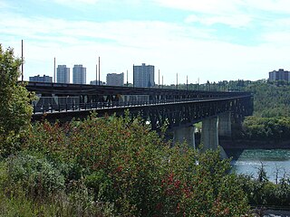
The High Level Bridge is a bridge that spans the North Saskatchewan River in Edmonton, Alberta, Canada. Located next to the Alberta Legislature Building, the bridge linked the separate communities of Edmonton and Strathcona, which became one city in 1912. It was designed from the outset to accommodate rail, streetcar, two-way automobile, and pedestrian traffic. The original bridge design included three tracks on the upper deck. The first CPR train operated on June 2, 1913, after which the bridge became a part of the Calgary-Edmonton main line. Streetcar service started on the west streetcar track of the bridge on August 11, 1913 with the east streetcar track opening by September of that year and automobile traffic after that. Automobile traffic did not begin at the same time as CPR and streetcar traffic as the lower deck had not been completed and the installation of galvanized iron under the tracks was still needed to prevent cinders dropping from steam trains onto traffic on the lower deck. Streetcars travelling northbound operated on the upstream side of the bridge, and southbound streetcars operated on the downstream side of the bridge; This left-hand operation was contrary to the right-hand driving on the lower traffic deck.
Stadium station is an Edmonton Light Rail Transit station in Edmonton, Alberta, Canada. It serves the Capital Line. It is a ground-level station located at 111 Avenue and 84 Street, next to the Commonwealth Stadium and Clarke Stadium.
Edmonton Light Rail Transit, commonly referred to as the LRT, is a light rail system in Edmonton, Alberta. Part of the Edmonton Transit Service (ETS), the system has 18 stations on two lines and 24.3 km (15.1 mi) of track. As of 2018, it is one of the busiest light rail transit systems in North America, with over 110,000 daily weekday riders, and has been growing steadily in recent years.
Belvedere station is an Edmonton Light Rail Transit in Edmonton, Alberta. It serves the Capital Line. It is a ground-level station located at Fort Road and 129 Avenue.
Grandin station is an Edmonton Light Rail Transit station in Edmonton, Alberta, Canada. It serves both the Capital Line and the Metro Line. It is an underground station located beneath 110 Street between 99 Avenue and 98 Avenue. The station provides service to the Government Centre part of the downtown core and the neighbourhood of Oliver. The station is connected to the Alberta Legislature and several other government buildings by underground walkways of the Edmonton Pedway.
University station is an Edmonton Light Rail Transit station in Edmonton, Alberta, Canada. It serves both the Capital Line and the Metro Line. It is an underground station located beneath 112 Street at 89 Avenue on the University of Alberta campus. As of 2017, it is the busiest LRT station of the Capital and Metro lines with typical weekday traffic averaging 27,394 passengers.
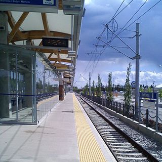
South Campus/Fort Edmonton Park station is an Edmonton Light Rail Transit station in Edmonton, Alberta. It is served by the Capital Line and the Metro Line during peak hours. It is a ground-level station located on the University of Alberta's South Campus approximately two blocks to the west of the site originally proposed for the station on 113 Street.
Southgate station is an Edmonton Light Rail Transit station in Edmonton, Alberta. It is served by the Capital Line and the Metro Line during peak hours. It is a ground-level station located next to the Southgate Centre shopping mall and the Southgate Transit Centre at 51 Avenue and 111 Street.
The city of Edmonton, Alberta, has a transportation network fairly typical for a Canadian city of its size, involving most modes of transport including, but certainly not limited to, air, rail, road and public transit.
West Jasper Place is a residential neighbourhood in west Edmonton, Alberta, Canada. Originally part of the Town of Jasper Place, West Jasper Place became a part of Edmonton when Edmonton and Jasper Place amalgamated on August 17, 1964.
Lakewood is a community comprising three neighbourhoods within the west-central portion of Mill Woods in the City of Edmonton, Alberta, Canada. Neighbourhoods within the community include Kameyosek, Meyonohk and Tipaskan.
Leger is a newer neighbourhood in the Terwillegar Heights area of south west Edmonton, Alberta, Canada.
Westmount is an established central-west residential neighbourhood in Edmonton, Alberta, Canada. It is geographically close to the downtown core.
Kingsway/Royal Alex station is an Edmonton Light Rail Transit station in Edmonton, Alberta. It serves the Metro Line. It is located adjacent to the Royal Alexandra Hospital on the north side of Kingsway. The Kingsway/Royal Alex Transit Centre, constructed at the same time, is located next to the station.
The Edmonton trolley bus system formed part of the public transport network in Edmonton, Alberta, Canada between 1939 and 2009. Operated by Edmonton Transit System (ETS), the system had, at its peak, a fleet of 137 trolley buses, and a total route length of 127 km (79 mi).
Northmount is a neighbourhood in northwest Edmonton, Alberta, Canada. It and the Evansdale neighbourhood to the north comprise Edmonton's Dickinsfield community.
Ice District also referred to as the Edmonton Arena District, is a $2.5 billion mixed-use sports and entertainment district being developed on 10 hectares of land in Downtown Edmonton and a portion of the neighbourhood of Central McDougall. When completed it will be Canada's largest mixed-use and entertainment district. The developers of the district are the Katz Group and the ONE Development Group. On July 13, 2015, it was announced that the area of the city surrounding the arena from 101 and 104 Street to 103 and 106 Avenue would be referred to as "Ice District" – a name created by Daryl Katz.
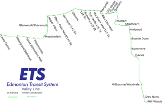
Mill Woods station is a tram station under construction in the Edmonton Light Rail Transit network in Edmonton, Alberta, Canada. It will serve as the south terminus station of the Valley Line. It is located on the south side of 28 Avenue, west of Hewes Way, between Tawa and Mill Woods Town Centre. The station is scheduled to open in 2020, with the Mill Woods Transit Centre relocated to allow easy connections between bus and train.
|journal=
(help)