Related Research Articles

The Sahara desert, as defined by the World Wide Fund for Nature (WWF), includes the hyper-arid center of the Sahara, between latitudes 18° N and 30° N. It is one of several desert and xeric shrubland ecoregions that cover the northern portion of the African continent.

The Nearctic realm is one of the eight biogeographic realms constituting the Earth's land surface.
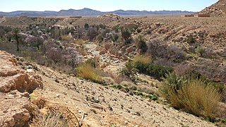
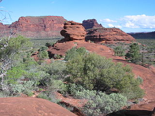
Deserts and xeric shrublands are a biome defined by the World Wide Fund for Nature. Deserts and xeric shrublands form the largest terrestrial biome, covering 19% of Earth's land surface area. Ecoregions in this habitat type vary greatly in the amount of annual rainfall they receive, usually less than 250 millimetres (10 in) annually except in the margins. Generally evaporation exceeds rainfall in these ecoregions. Temperature variability is also diverse in these lands. Many deserts, such as the Sahara, are hot year-round, but others, such as East Asia's Gobi, become quite cold during the winter.

The Carnarvon xeric shrublands is a deserts and xeric shrublands ecoregion of Western Australia. The ecoregion is coterminous with the Carnarvon Interim Biogeographic Regionalisation for Australia (IBRA) bioregion.
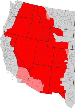
The Intermountain West, or Intermountain Region, is a geographic and geological region of the Western United States. It is located between the front ranges of the Rocky Mountains on the east and the Cascade Range and Sierra Nevada on the west.

The Venezuelan Coastal Range, also known as Venezuelan Caribbean Mountain System is a mountain range system and one of the eight natural regions of Venezuela, that runs along the central and eastern portions of Venezuela's northern coast. The range is a northeastern extension of the Andes, and is also known as the Maritime Andes. It covers around 48,866 km2, being the 4th largest natural region in Venezuela.

The Tehuacán Valley matorral is a xeric shrubland ecoregion, of the deserts and xeric shrublands biome, located in eastern Central Mexico.

The Tibesti-Jebel Uweinat montane xeric woodlands is a deserts and xeric shrublands ecoregion in the eastern Sahara. The woodlands ecoregion occupies two separate highland regions, covering portions of northern Chad, southwestern Egypt, southern Libya, and northwestern Sudan.

The Coolgardie woodlands is an ecoregion in southern Western Australia. The predominant vegetation is woodlands and mallee scrub. The ecoregion is a transitional zone between the Mediterranean-climate forests, woodlands, and shrublands of Southwest Australia and the deserts and dry scrublands of the Australian interior.

The Southwest Australia savanna is an ecoregion in Western Australia.
The Central Ranges xeric scrub is a deserts and xeric shrublands ecoregion of Australia.

A thorn forest is a dense scrubland with vegetation characteristic of dry subtropical and warm temperate areas with a seasonal rainfall averaging 250 to 500 mm.

The La Costa xeric shrublands (NT1309) is an ecoregion in Venezuela that stretches along the Caribbean coast. The dry scrub and savanna has been subject to modification since the 16th century by European colonists who replaced it by a patchwork of farm fields and pasturage. Little of the original habitat remains.

The Pilbara shrublands is a deserts and xeric shrublands ecoregion in Western Australia. It is coterminous with the Pilbara IBRA region. For other definitions and uses of "Pilbara region" see Pilbara.
References
- ↑ "Deserts and xeric shrublands". WWF. Retrieved 2018-12-19.
- ↑ Eric Dinerstein, David Olson, Anup Joshi, Carly Vynne, Neil D. Burgess, Eric Wikramanayake, Nathan Hahn, Suzanne Palminteri, Prashant Hedao, Reed Noss, Matt Hansen, Harvey Locke, Erle C Ellis, Benjamin Jones, Charles Victor Barber, Randy Hayes, Cyril Kormos, Vance Martin, Eileen Crist, Wes Sechrest, Lori Price, Jonathan E. M. Baillie, Don Weeden, Kierán Suckling, Crystal Davis, Nigel Sizer, Rebecca Moore, David Thau, Tanya Birch, Peter Potapov, Svetlana Turubanova, Alexandra Tyukavina, Nadia de Souza, Lilian Pintea, José C. Brito, Othman A. Llewellyn, Anthony G. Miller, Annette Patzelt, Shahina A. Ghazanfar, Jonathan Timberlake, Heinz Klöser, Yara Shennan-Farpón, Roeland Kindt, Jens-Peter Barnekow Lillesø, Paulo van Breugel, Lars Graudal, Maianna Voge, Khalaf F. Al-Shammari, Muhammad Saleem, An Ecoregion-Based Approach to Protecting Half the Terrestrial Realm, BioScience, Volume 67, Issue 6, June 2017, Pages 534–545, .