
Wyoming is a landlocked state in the Mountain West subregion of the Western United States. It borders Montana to the north and northwest, South Dakota and Nebraska to the east, Idaho to the west, Utah to the southwest, and Colorado to the south. With an estimated population of 587,618 as of 2024, Wyoming is the least populous state despite being the 10th largest by area, and it has the second-lowest population density after Alaska. The state capital and most populous city is Cheyenne, which had a population of 65,132 in 2020.

Laramie is a city in and the county seat of Albany County, Wyoming, United States, known for its high elevation at 7,200 feet (2,200 m), railroad history, and as the home of the University of Wyoming. The population was 31,407 at the 2020 census, making it the fourth-most populous city in Wyoming. Located on the Laramie River in southeastern Wyoming, the city is west of Cheyenne and 25 miles (40 km) north of the Colorado state line, at the junction of Interstate 80 and U.S. Route 287.

The Medicine Bow Mountains are a mountain range in the Rocky Mountains that extend 100 miles (160 km) from northern Colorado into southern Wyoming. The northern extent of this range is the sub-range the Snowy Range. From the northern end of Colorado's Never Summer Mountains, the Medicine Bow mountains extend north from Cameron Pass along the border between Larimer and Jackson counties in Colorado and northward into south central Wyoming. In Wyoming, the range sits west of Laramie, in Albany and Carbon counties to the route of the Union Pacific Railroad and U.S. Interstate 80. The mountains often serve as a symbol for the city of Laramie. The range is home to Snowy Range Ski Area.
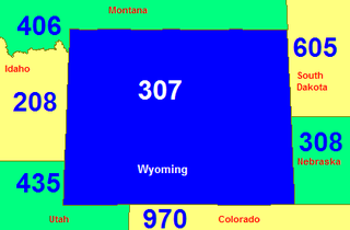
Area code 307 is the telephone area code in the North American Numbering Plan for the entire U.S. state of Wyoming. It is one of the 86 original North American area codes created by the American Telephone and Telegraph Company (AT&T) in 1947.

Interstate 80 (I-80) is a part of the Interstate Highway System that runs from San Francisco, California, to Teaneck, New Jersey. In Wyoming, the Interstate Highway runs 402.76 miles (648.18 km) from the Utah state line near Evanston east to the Nebraska state line in Pine Bluffs. I-80 connects Cheyenne, Wyoming's capital and largest city, with several smaller cities along the southern tier of Wyoming, including Evanston, Green River, Rock Springs, Rawlins, and Laramie. The highway also connects those cities with Salt Lake City to the west and Omaha to the east. In Cheyenne, I-80 intersects I-25 and has Wyoming's only auxiliary Interstate, I-180. The Interstate runs concurrently with US Highway 30 (US 30) for most of their courses in Wyoming. I-80 also has shorter concurrencies with US 189 near Evanston, US 191 near Rock Springs, and US 287 and Wyoming Highway 789 (WYO 789) near Rawlins. The Interstate has business loops through all six cities along its course as well as a loop serving Fort Bridger and Lyman east of Evanston.

Cheyenne is the capital and most populous city of the U.S. state of Wyoming, as well as the county seat of Laramie County, with 65,132 residents, per the 2020 census. It is the principal city of the Cheyenne metropolitan statistical area which encompasses all of Laramie County and had 100,512 residents as of the 2020 census. Local residents named the town for the Cheyenne Native American people in 1867 when it was founded in the Dakota Territory. Along with Oklahoma City, Oklahoma and Topeka, Kansas, Cheyenne is one of three state capitals with an indigenous name in a state with an indigenous name.

There is evidence of prehistoric human habitation in the region known today as the U.S. state of Wyoming stretching back roughly 13,000 years. Stone projectile points associated with the Clovis, Folsom and Plano cultures have been discovered throughout Wyoming. Evidence from what is now Yellowstone National Park indicates the presence of vast continental trading networks since around 1,000 years ago.

Interstate 80 Business may refer to several business routes of the Interstate Highway System that connects Interstate 80 with the central business district of various cities bypassed by I-80. The business route in each community is considered a unique route. In many cases, these routes are a former section of a U.S. Route or state highway.
The Wyoming Marathon Races are a series of running races held annually in Medicine Bow National Forest between Laramie and Cheyenne, Wyoming.

The 2010 Wyoming gubernatorial election was held on Tuesday, November 2, 2010, to elect the governor of Wyoming. Party primaries were held on August 17.
The Overland Trail was a stagecoach and wagon trail in the American West during the 19th century. While portions of the route had been used by explorers and trappers since the 1820s, the Overland Trail was most heavily used in the 1860s as a route alternative to the Oregon, California, and Mormon trails through central Wyoming. The Overland Trail was famously used by the Overland Stage Company owned by Ben Holladay to run mail and passengers to Salt Lake City, Utah, via stagecoaches in the early 1860s. Starting from Atchison, Kansas, the trail descended into Colorado before looping back up to southern Wyoming and rejoining the Oregon Trail at Fort Bridger. The stage line operated until 1869 when the completion of the First transcontinental railroad eliminated the need for mail service via stagecoach.

The following works deal with the cultural, political, economic, military, biographical and geologic history of pre-territorial Wyoming, Wyoming Territory and the State of Wyoming.
The following is a timeline of the history of the city of Cheyenne, Wyoming, USA.

U.S. Highway 30 (US 30) is part of the United States Numbered Highway System that runs from Astoria, Oregon, to Atlantic City, New Jersey. Within the U.S. state of Wyoming, it runs from Kemmerer to Pine Bluffs by way of Rock Springs, Laramie, and Cheyenne. The route runs mostly along the historic Lincoln Highway. It intersects and shares three concurrencies with Interstate 80 (I-80), of which it parallels, numerous times during its run.

Mayoral and city council elections were held throughout Wyoming's towns and cities on November 5, 2024. As of 2022, there are 99 municipalities throughout the state, of which 19 are cities. Under Wyoming law, each town and city has one mayor and four councilors, all elected.
Local elections are scheduled to be held throughout Wyoming's towns, cities, and counties on November 3, 2026, with nonpartisan primaries taking place on August 4. As of 2022, there are 99 municipalities throughout the state, of which 19 are cities. By default under Wyoming law, each town and city has one mayor and four councilors, all elected. As 2026 is a midterm election, sheriff elections will be held in every county. These elections will be held concurrently with other elections in the state.