Escreins Massif | |
---|---|
Highest point | |
Elevation | 3,385 m (11,106 ft) |
Parent peak | Pics de la Font Sancte |
Coordinates | 44°35′42″N6°46′47″E / 44.5949477°N 6.7797925°E |
Naming | |
Native name | Massif d'Escriens (French) |
Geography | |
Countries | |
Departments and province | |
Regions | |
Geology | |
Rock type | Sedimentary rocks |
The Escreins massif (French : Massif d'Escreins) are a massif in the French and Italian Alps located in the French departments of Hautes-Alpes and Alpes-de-Haute-Provence, as well as in the Italian region of Piedmont.
It is home to part of the Queyras regional natural park.
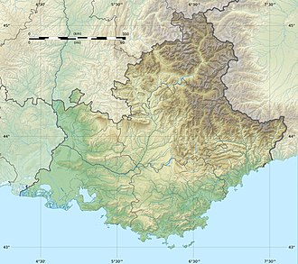
The Escreins massif is located between the valleys of Queyras to the north and Ubaye to the south. It is surrounded by Embrun, Guillestre, Saint-Véran and Barcelonnette. [1]
To the north is the Queyras massif, to the east the Cottian Alps, to the southeast the Chambeyron massif and to the southwest the Parpaillon massif.
The Escreins massif is essentially made up of sedimentary rocks, notably based on flysch. [2]
Hautes-Alpes is a department in the Provence-Alpes-Côte d'Azur region of Southeastern France. It is located in the heart of the French Alps, after which it is named. Hautes-Alpes had a population of 141,220 as of 2019, which makes it the third least populated French department. Its prefecture is Gap; its sole subprefecture is Briançon. Its INSEE and postal code is 05.
The mountains of the Massif des Écrins form the core of Écrins National Park in Hautes-Alpes and Isère in the French Alps.
Saint-Véran is a commune in the Hautes-Alpes department in southeastern France in the Queyras Regional Natural Park. It is a member of Les Plus Beaux Villages de France Association.
The Queyras is a valley located in the French Hautes-Alpes, of which the geographical extent is the basin of the river Guil, a tributary of the Durance. The Queyras is one of the oldest mountain ranges of the Alps, and it was one of the last ones to be opened to public tourism towards the end of the 20th century, thus being relatively untouched by environmental destruction.
The Ubaye Valley is an area in the Alpes de Haute-Provence département, in the French Alps, having approximately 7,700 residents. Its residents are called Ubayens. Its principal town is the sous-préfecture of Barcelonnette.
Massif des Cerces is a region of the French Alps on the Franco-Italian border. On the French side it lies in the departments of Hautes-Alpes and Savoie.
Modane is a commune in the Savoie department in the Auvergne-Rhône-Alpes region in southeastern France.
La Fare-en-Champsaur is a commune in the department of Hautes-Alpes in the Provence-Alpes-Côte d'Azur region in southeastern France.
Arvieux is a commune of the Hautes-Alpes department in the Provence-Alpes-Côte d'Azur region of south-eastern France.
The Bornes massif are a mountainous massif in the north French Prealps in the department of Haute-Savoie. It has 20 peaks higher than 2000 m and is a popular destination for winter sports. The Massif is the source of the celebrated cheese Reblochon.
The Pics de la Font Sancte is a mountain with two summits between the upper Ubaye Valley, Val Escreins and the Ceillac Valley, at the edge of the Queyras Regional Park. It is the highest peak of the Escreins Massif in the southern Cottian Alps in Hautes-Alpes, France. Its northern summit is 3,385 metres (11,106 ft) high and its south summit 3,371 metres (11,060 ft). They take their name from the Font Sancte, a source that springs from the rock in the valley at the foot of the peaks at 2,358 m.
Massif des Trois-Évêchés is a mountain range in the Provence Alps and Prealps in Alpes-de-Haute-Provence, France. Its name comes from the central summit of the massif, the Pic des Trois-Évêchés where there are ridges to the north, west and south. The highest peak is the Tête de l'Estrop, at 2,961 metres (9,715 ft).
The Pic de Petit Rochebrune is a mountain in the Cottian Alps belonging to the French department of Hautes-Alpes.
The Grand Aréa is a 2.869 metres high mountain of the Cottian Alps located in the French department of Hautes-Alpes.
The Mercantour-Argentera massif is a massif in the Maritime Alps located astride the French departments of Alpes-Maritimes and Alpes-de-Haute-Provence and the Italian region of Piedmont. The name of the massif comes respectively from the summit of Mercantour, a secondary central summit, and from Mount Argentera, the highest point of the massif, entirely in Italy.
The Chambeyron massif are a massif in the Alps, straddling between France and Italy, between the Escreins massif, the Cottian Alps and the Mercantour-Argentera massif. It occupies the high valleys of Ubaye, Maira, Varaita and Stura di Demonte.
The Arves massif are a massif in the French Alps located in the departments of Savoie, Isère and Hautes-Alpes. Oisans covers part of the massif.
The Parpaillon massif are a massif in the French Alps. It serves as the boundary between the departments of Hautes-Alpes to the north and the Alpes-de-Haute-Provence to the south. Additionally, it separates the Embrun region from the Ubaye valley. The massif extends from the Serre-Ponçon lake in the west to the Col de Vars, which distinguishes it from the Escreins massif, and to the middle Ubaye valley in the southeast, near Saint-Paul-sur-Ubaye, where it is bordered by the Mercantour-Argentera massif and the Chambeyron massif.
The Queyras massif are a massif of the Alps located between the French department of Hautes-Alpes and the Italian region of Piedmont.