Mayodan, North Carolina | |
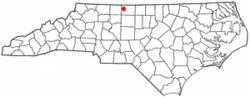
---|---|
Coordinates: 36°25′16″N79°58′03″W / 36.42111°N 79.96750°W | |
Country | United States |
State | North Carolina |
County | Rockingham |
Government | |
• Mayor | Chad Wall [ citation needed ] |
• Town Manager | Kathleen Patterson [ citation needed ] |
Area | |
• Total | 2.90 sq mi (7.51 km2) |
• Land | 2.88 sq mi (7.45 km2) |
• Water | 0.02 sq mi (0.05 km2) |
Elevation | 656 ft (200 m) |
Population (2020) | |
• Total | 2,418 |
• Density | 840.46/sq mi (324.53/km2) |
Time zone | UTC-5 (Eastern (EST)) |
• Summer (DST) | UTC-4 (EDT) |
ZIP code | 27027 |
Area code | 336 |
FIPS code | 37-42060 [3] |
GNIS feature ID | 2406116 [2] |
Website | www.townofmayodan.com |
Mayodan is a town in Rockingham County, North Carolina, in the United States. It is a manufacturing site for Sturm, Ruger & Co., Bridgestone Aircraft Tire, and formerly General Tobacco (ceased operations 2010). Washington Mills Company, later Tultex, operated a textile mill in Mayodan until 1999. [4]
The town is named for two rivers that converge nearby, the Mayo and the Dan, and, according to Ripley's Believe It or Not! , is the only town in the world with this name. [5]
Mayodan started as a mill town when a cotton mill was built in 1892. Operations began in April 1896. [5] The Washington Mills-Mayodan Plant was listed on the National Register of Historic Places in 2005. [6]
According to the United States Census Bureau, the town has a total area of 1.5 square miles (3.9 km2); 1.5 square miles (3.9 km2) of the area is land and 0.66% is water.
Mayodan is located near the confluence of the Mayo and Dan Rivers.
Census | Pop. | Note | %± |
---|---|---|---|
1900 | 904 | — | |
1910 | 874 | −3.3% | |
1920 | 1,886 | 115.8% | |
1930 | 1,948 | 3.3% | |
1940 | 2,323 | 19.3% | |
1950 | 2,246 | −3.3% | |
1960 | 2,366 | 5.3% | |
1970 | 2,875 | 21.5% | |
1980 | 2,627 | −8.6% | |
1990 | 2,471 | −5.9% | |
2000 | 2,417 | −2.2% | |
2010 | 2,478 | 2.5% | |
2020 | 2,411 | −2.7% | |
2021 (est.) | 2,415 | [7] | 0.2% |
U.S. Decennial Census [8] [9] |
Race | Number | Percentage |
---|---|---|
White (non-Hispanic) | 1,887 | 78.04% |
Black or African American (non-Hispanic) | 284 | 11.75% |
Native American | 3 | 0.12% |
Asian | 10 | 0.41% |
Other/Mixed | 105 | 4.34% |
Hispanic or Latino | 129 | 5.33% |
As of the 2020 United States census, there were 2,418 people, 1,170 households, and 671 families residing in the town.
As of the census [3] of 2010, there were 2,478 people, 1,173 households, and 651 families residing in the town. The population density was 1,608.8 inhabitants per square mile (621.2/km2). There were 1,268 housing units at an average density of 844.0 per square mile (325.9/km2). The racial makeup of the town was 85.85% White, 10.38% African American, 0.17% Native American, 0.21% Asian, 2.57% from other races, and 0.83% from two or more races. Hispanic or Latino of any race were 4.01% of the population.
There were 1,173 households, out of which 21.4% had children under the age of 18 living with them; 38.6% were married couples living together; 13.3% had a female householder with no husband present; and 44.5% were non-families. 41.4% of all households were made up of individuals, and 21.2% had someone living alone who was 65 years of age or older. The average household size was 2.06 and the average family size was 2.78 people.
The population's age distribution was broad: 19.3% under the age of 18, 7.4% from 18 to 24, 27.5% from 25 to 44, 23.4% from 45 to 64, and 22.4% who were 65 years of age or older. The median age was 43 years. For every 100 females, there were 82.3 males. For every 100 females age 18 and over, there were 79.7 males.
The median income for a household in Mayodan was $25,980, and the median income for a family was $36,328. Males had a median income of $25,878 versus $21,250 for females. The per capita income for the town was $15,607. 16.0% of the population and 11.3% of families were below the poverty line. 20.5% of those under the age of 18 and 17.9% of those 65 and older were living below the poverty line.
Spring Mill is a home rule-class city in Jefferson County, Kentucky, United States. The population was 287 at the 2010 census, down from 380 at the 2000 census.
Bradley is a town in Penobscot County, Maine, United States. It is part of the Bangor Metropolitan Statistical Area. The population was 1,532 at the 2020 census. The village of Bradley is in the northwestern corner of the town.
East Kingston is a town in Rockingham County, New Hampshire, United States. The population was 2,441 at the 2020 census.
Kensington is a town in Rockingham County, New Hampshire, United States. The population was 2,095 at the 2020 census.
Seabrook is a town in Rockingham County, New Hampshire, United States. The population was 8,401 at the 2020 census. Located at the southern end of the coast of New Hampshire on the border with Massachusetts, Seabrook is noted as the location of the Seabrook Station Nuclear Power Plant, the third-most recently constructed nuclear power plant in the United States.
Stokesdale is a town in Guilford County with a small part in Rockingham County, North Carolina, United States. The population was 5,924 at the 2020 census. Belews Lake is located nearby, and North Carolina Highway 68 and North Carolina Highway 65 both intersect U.S. Route 158 near the town's center.
Madison is a town located in Rockingham County, North Carolina. At the 2020 census, the town had a total population of 2,132. Madison is part of the Greensboro-High Point Metropolitan Statistical Area of the Piedmont Triad metro region. It was home to the corporate headquarters of Remington Arms until 2020, when the company was made defunct by bankruptcy proceedings. It is still home to Marlin Firearms, which was an asset of Remington now owned by Sturm, Ruger & Co.
Stoneville is a town in Rockingham County, North Carolina, United States. Stoneville is part of the Greensboro–High Point metropolitan area of the Piedmont Triad. On March 20, 1998, an F-3 tornado touched down in neighboring Madison and Mayodan after the system had crossed into Rockingham County from Stokes County. Then, it strengthened into an F-3 as it crossed Route 220 as it followed the train tracks to downtown Stoneville.
Walnut Cove is a town in Stokes County, North Carolina, United States. The population was 1,536 at the 2020 census.
Millcreek Township is a township in Clarion County, Pennsylvania, United States. The population was 362 at the 2020 census, a decrease from the figure of 396 tabulated in 2010.
Slippery Rock Township is a township in Lawrence County, Pennsylvania, United States. As of the 2020 census, the population was 2,913, a decline from the figure of 3,283 tabulated in 2010.
West Bethlehem Township is a township in Washington County, Pennsylvania, United States established in 1781. In 1790, it was split into East and West Bethlehem Townships. The Martin's Mill Covered Bridge, Horn Davis Overholtzer Bridge, and Ulery Mill are listed on the National Register of Historic Places. According to the United States Census Bureau, the township has a total area of 22.2 square miles (57.5 km2), all of it land.
South Huntingdon Township is a township in Westmoreland County, Pennsylvania, United States. The population was 5,412 at the 2020 census.
Mount Crawford is a town in Rockingham County, Virginia, United States. It is included in the Harrisonburg Metropolitan Statistical Area, and the town's population was 433 at the 2010 census.
Timberville is a town in Rockingham County, Virginia, United States. The population was 2,522 at the 2010 census, which was a significant increase from the 1,739 reported in the 2000 census. It is part of the Harrisonburg Metropolitan Statistical Area.
Cleveland is a town in central Russell County, Virginia, United States. The population was 128 at the 2010 census.
Bruceton Mills is a town in northern Preston County, West Virginia, United States, along Big Sandy Creek. The population was 64 at the 2020 census, making it the second-least populous town in West Virginia, after Thurmond. It is part of the Morgantown metropolitan area.
Harman is a town in Randolph County, West Virginia, United States. The population was 96 at the 2020 census.
Mill Creek is a town in Randolph County, West Virginia, United States, along the Tygart Valley River. The population was 563 at the 2020 census.
Grottoes is an incorporated town in Augusta and Rockingham counties in the U.S. state of Virginia. The population was 2,668 at the 2010 census.