McRoberts, Kentucky | |
---|---|
Coordinates: 37°12′30″N82°40′21″W / 37.20833°N 82.67250°W | |
Country | United States |
State | Kentucky |
County | Letcher |
Area | |
• Total | 5.61 sq mi (14.52 km2) |
• Land | 5.60 sq mi (14.51 km2) |
• Water | 0.00 sq mi (0.01 km2) |
Elevation | 1,430 ft (436 m) |
Population (2020) | |
• Total | 741 |
• Density | 132.25/sq mi (51.06/km2) |
Time zone | UTC-5 (Eastern (EST)) |
• Summer (DST) | UTC-4 (EDT) |
ZIP code | 41835 |
Area code | 606 |
FIPS code | 21-49278 |
GNIS feature ID | 0497948 |
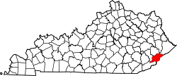
McRoberts is an unincorporated community and census-designated place (CDP) in Letcher County, Kentucky, United States. The population was 741 at the 2020 United States Census, [2] down from 784 at the 2010 census. McRoberts is in the Eastern Kentucky Coalfield region.
McRoberts is located in northeastern Letcher County at 37°12′30″N82°40′21″W / 37.208256°N 82.672469°W . [3] It is bordered to the southwest by the city of Fleming-Neon and to the southeast by the city of Jenkins.
According to the United States Census Bureau, the CDP has a total area of 5.6 square miles (14.5 km2), of which 1.70 acres (6,881 m2), or 0.05%, are water. [4] The community is in the valley of the Wright Fork, a headwater tributary of the North Fork of the Kentucky River.
Census | Pop. | Note | %± |
---|---|---|---|
2000 | 921 | — | |
2010 | 784 | −14.9% | |
2020 | 741 | −5.5% | |
U.S. Decennial Census [5] |
As of the census [6] of 2000, there were 921 people, 359 households, and 272 families residing in the CDP. The population density was 169.2 inhabitants per square mile (65.3/km2). There were 397 housing units at an average density of 73.0 per square mile (28.2/km2). The racial makeup of the CDP was 93.16% White, 6.08% African American, 0.11% Native American, and 0.65% from two or more races. Hispanic or Latino of any race were 0.87% of the population.
There were 359 households, out of which 36.5% had children under the age of 18 living with them, 57.4% were married couples living together, 13.6% had a female householder with no husband present, and 24.2% were non-families. 22.8% of all households were made up of individuals, and 11.4% had someone living alone who was 65 years of age or older. The average household size was 2.57 and the average family size was 3.04.
In the CDP, the population was spread out, with 25.6% under the age of 18, 9.2% from 18 to 24, 25.8% from 25 to 44, 25.1% from 45 to 64, and 14.2% who were 65 years of age or older. The median age was 38 years. For every 100 females, there were 99.4 males. For every 100 females age 18 and over, there were 99.1 males.
The median income for a household in the CDP was $18,333, and the median income for a family was $19,635. Males had a median income of $29,479 versus $18,438 for females. The per capita income for the CDP was $10,531. About 28.0% of families and 33.6% of the population were below the poverty line, including 48.5% of those under age 18 and 20.8% of those age 65 or over.
Paul Toth, a major league pitcher in the 1960s, was born in McRoberts, although he grew up in Youngstown, Ohio.
North Brooksville is a census-designated place (CDP) in Hernando County, Florida, United States. The population was 3,544 at the 2010 census. It is a suburb included in the Tampa-St. Petersburg-Clearwater, Florida Metropolitan Statistical Area.
Dade City North is a census-designated place (CDP) in eastern Pasco County, Florida, United States. The population was 3,319 at the 2000 census.
Westwood is a census-designated place in Boyd County, Kentucky, United States. The population was 4,387 at the 2020 census. A suburb of Ashland, the two areas are closely affiliated, sharing a ZIP code and bus system. Westwood is located on a flat to hilly elevation just west of the Ohio River. The flat hilltop is unusual to eastern Kentucky and was created by the preglacial Teays River which existed in ancient times and flowed in the opposite direction of the Ohio River. Westwood is part of the Huntington–Ashland metropolitan area.
Masonville is an unincorporated community and census-designated place (CDP) in Daviess County, Kentucky, United States. The population was 2,129 as of the 2020 census, doubling from 1,014 in the 2010 census. It is included in the Owensboro Metropolitan Statistical Area.
Blackey is an unincorporated community in Letcher County, Kentucky, in the United States. As of the 2010 census, the population was 120. It is located near the early settlement of Indian Bottom. Blackey is thought to have been named after Blackey Brown, one of its citizens.
Fleming-Neon also known as Neon, is a home rule-class city in Letcher County, Kentucky, in the United States. The population was 770 at the 2010 census, down from 840 at the 2000 census.
Jenkins is a home rule-class city in Letcher County, Kentucky, United States. The population was 2,203 as of the 2010 census.
Whitesburg is a home rule-class city in and the county seat of Letcher County, Kentucky, United States. The population was 2,139 at the 2010 census and an estimated 1,875 in 2018. It was named for John D. White, a state politician.
Hendron is an unincorporated community and census-designated place (CDP) in McCracken County, Kentucky, United States. The population was 4,774 at the 2020 census. It is part of the Paducah, KY-IL Metropolitan Statistical Area.
Massac is a census-designated place (CDP) in McCracken County, Kentucky, United States. The population was 4,635 at the 2020 census. It is part of the Paducah, KY-IL Metropolitan Statistical Area.
Reidland is an unincorporated community and census-designated place (CDP) in McCracken County, Kentucky, United States. The population was 4,526 at the 2020 census. It is part of the Paducah, KY-IL Metropolitan Statistical Area.
Pine Knot is an unincorporated community and census-designated place (CDP) in McCreary County, Kentucky, United States. The population was 1,380 at the 2020 census, down from 1,621 in 2010.
Whitley City is an unincorporated community and census-designated place (CDP) in McCreary County, Kentucky, United States. The population was 968 at the 2020 census, down from 1,170 in 2010. It is the county seat of McCreary County. Whitley City is one of two unincorporated county seats in Kentucky.
Phelps is a census-designated place (CDP) in Pike County, Kentucky, United States. The population was 1,053 at the 2000 census. It is the easternmost census-designated community in Kentucky.
Modoc is a census-designated place (CDP) in McCormick County, South Carolina, United States. The population was 256 at the 2000 census, and 218 at the 2010 census, a decline of 14.8%.
Skidmore is a census-designated place (CDP) in Bee County, Texas, United States. The population was 925 at the 2010 census.
Keokee is an unincorporated community and census-designated place (CDP) in Lee County, Virginia, United States. The population was 416 at the 2010 census.
Switzer is an unincorporated community and census-designated place (CDP) in Logan County, West Virginia, United States. The CDP includes the neighboring unincorporated community of Micco. The total CDP population was 595 at the 2010 census.
Oneida is an unincorporated community and former census-designated place (CDP) in the Town of Oneida, Outagamie County, Wisconsin, United States. The population was 1,070 at the 2000 census. At the census, part of the CDP lay within the Town of Hobart, which has since incorporated as a village, in adjacent Brown County. Oneida is located on Wisconsin Highway 54.
Farley is a census-designated place (CDP) in McCracken County, Kentucky, United States. The population was 4,374 as of the 2020 census, down from 4,701 in 2010. It is part of the Paducah, KY-IL Metropolitan Statistical Area. The area was listed by the U.S. Census Bureau as Woodlawn-Oakdale starting with the 1980 census and as Farley starting with the 2010 census.