Middlebury, Vermont | |
---|---|
Coordinates: 44°0′51″N73°10′0″W / 44.01417°N 73.16667°W Coordinates: 44°0′51″N73°10′0″W / 44.01417°N 73.16667°W | |
Country | United States |
State | Vermont |
County | Addison |
Town | Middlebury |
Area | |
• Total | 14.1 sq mi (36.5 km2) |
• Land | 13.9 sq mi (36.0 km2) |
• Water | 0.2 sq mi (0.5 km2) |
Elevation | 404 ft (123 m) |
Population (2020) | |
• Total | 7,304 |
• Density | 526/sq mi (202.9/km2) |
Time zone | UTC-5 (Eastern (EST)) |
• Summer (DST) | UTC-4 (EDT) |
ZIP code | 05753 |
Area code(s) | 802 |
FIPS code | 50-44275 [1] |
GNIS feature ID | 1458435 [2] |
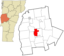
Middlebury is the main settlement in the town of Middlebury in Addison County, Vermont, United States, and a census-designated place (CDP). The population was 7,304 at the 2020 census, [3] out of a total population of 9,152 in the town of Middlebury. Most of the village is listed on the National Register of Historic Places as the Middlebury Village Historic District.
The Middlebury CDP is located in the northwest part of the town of Middlebury, centered on a falls on Otter Creek. According to the United States Census Bureau, the CDP has a total area of 14.1 square miles (36.5 km2), of which 13.9 square miles (36.0 km2) is land and 0.19 square miles (0.5 km2), or 1.31%, is water. [4]
The village of Middlebury grew as one of Addison County's early industrial centers, due to the presence of a significant waterfall on Otter Creek. The area around the falls developed as the center of industry, with mills lining the river in the Frog Hollow area (Mill Street), where the 1840 Stone Mill is one of the only survivors of that past. It also became a major stop on north-south stagecoach routes, running between Burlington and Rutland. The town green is located directly on this historic route (now United States Route 7), and features important examples of civic and religious architecture. The local Congregational Church, built 1806-09, is the oldest in the county, and is a fine example of Federal period architecture. Also impressive are the Middlebury Inn, built 1826 and restyled later in the 19th and early 20th centuries. Middlebury College was founded in 1800, and its campus is located just southwest of the village center. Another important educational milestone was the 1814 founding by Emma Willard of a private school for women, located in her house on South Main Street. [5] Much of the village was listed on the National Register of Historic Places in 1976, with a significant enlargement in 1980.
As of the census [1] of 2000, there were 6,252 people, 1,876 households, and 984 families residing in the CDP. The population density was 173.3/km2 (448.7/mi2). There were 1,984 housing units at an average density of 55.0/km2 (142.4/mi2). The racial makeup of the CDP was 93.19% White, 1.39% Black or African American, 0.32% Native American, 2.27% Asian, 0.02% Pacific Islander, 0.80% from other races, and 2.02% from two or more races. Hispanic or Latino of any race were 2.48% of the population.
There were 1,876 households, out of which 25.4% had children under the age of 18 living with them, 40.0% were married couples living together, 10.0% had a female householder with no husband present, and 47.5% were non-families. 39.7% of all households were made up of individuals, and 16.8% had someone living alone who was 65 years of age or older. The average household size was 2.15 and the average family size was 2.90.
In the CDP, the population was spread out, with 14.9% under the age of 18, 38.8% from 18 to 24, 16.5% from 25 to 44, 16.4% from 45 to 64, and 13.4% who were 65 years of age or older. The median age was 23 years. For every 100 females, there were 86.8 males. For every 100 females age 18 and over, there were 85.1 males.
The median income for a household in the CDP was $34,599, and the median income for a family was $47,917. Males had a median income of $33,681 versus $25,804 for females. The per capita income for the CDP was $15,990. About 4.0% of families and 9.5% of the population were below the poverty line, including 6.9% of those under age 18 and 5.8% of those age 65 or over.
Middlebury College is located just southwest of the village center.
Addison County is a county located in the U.S. state of Vermont. As of the 2020 census, the population was 37,363. Its shire town is the town of Middlebury.
Hazardville is a section of the town of Enfield, Connecticut, in Hartford County. It is a census-designated place (CDP) that had a total population of 4,599 as of the 2010 census.
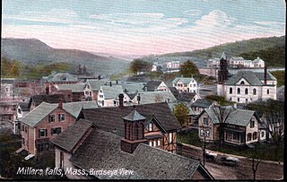
Millers Falls is a census-designated place (CDP) in the town of Montague in Franklin County, Massachusetts, United States. The population was 1,139 at the 2010 census. It is part of the Springfield, Massachusetts metropolitan statistical area.
Bridport is a town in Addison County, Vermont, United States. The town was founded October 9, 1761. The population was 1,225 at the 2020 census.
Cornwall is a town in Addison County, Vermont, United States. It was founded November 3, 1761. The population was 1,207 at the 2020 census.
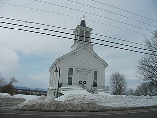
Ferrisburgh is a town in Addison County, Vermont, United States. It was founded June 24, 1762. The population was 2,646 at the 2020 census. The town is sometimes spelled Ferrisburg.
Hancock is a town in Addison County, Vermont, United States. The town was named for John Hancock. The population was 359 at the 2020 census. Hancock is home to the Middlebury College Snow Bowl and contains Middlebury Gap through the Green Mountains.
Leicester is a town in Addison County, Vermont, United States. The population was 990 at the 2020 census. Satans Kingdom is an unincorporated community located in Leicester.
New Haven is a town in Addison County, Vermont, United States. The population was 1,683 at the 2020 census. In addition to the town center, New Haven contains the communities of Belden, Brooksville, New Haven Junction and New Haven Mills.
Ripton is a town in Addison County, Vermont, United States. The population was 739 at the 2020 census.
Shoreham is a town in Addison County, Vermont, United States. The population was 1,260 at the 2020 census.
Starksboro is a town in Addison County, Vermont, United States. The population was 1,756 at the 2020 census.
Weybridge is a town in Addison County, Vermont, United States. The population was 814 at the 2020 census.
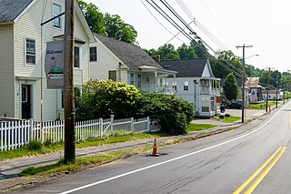
Groton is a town in Caledonia County, Vermont, United States. The population was 984 at the 2020 census. It contains the places Groton Pond, Rickers Mills, Rickers and West Groton. The unincorporated village of Groton in the southeast corner of town is recorded as the Groton census-designated place (CDP), with a population of 419 at the 2020 census.
Wilder is an unincorporated village and census-designated place (CDP) within the town of Hartford in Windsor County, Vermont, United States. It is the location of the Wilder Dam on the Connecticut River. The population of the CDP was 1,690 at the 2010 census. The village center is an early example of a planned mill community, and was listed on the National Register of Historic Places as the Wilder Village Historic District in 1999.
Fox Farm-College is a census-designated place (CDP) in Laramie County, Wyoming, United States. It is part of the Cheyenne, Wyoming Metropolitan Statistical Area. The population was 3,876 people at the 2020 census.
Middlebury is the shire town of Addison County, Vermont, United States. As of the 2020 U.S. Census, the population was 9,152. Middlebury is home to Middlebury College and the Henry Sheldon Museum of Vermont History.
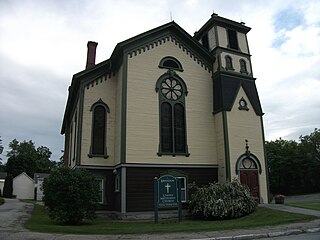
Brandon is an unincorporated village and census-designated place (CDP) in the town of Brandon, Rutland County, Vermont, United States. As of the 2020 census, the population was 1,727.
Arlington is a census-designated place (CDP) in the towns of Arlington and Sunderland, Bennington County, Vermont, United States. The population was 1,213 at the 2010 census.
Addison is a town in Addison County, Vermont, United States. It was founded October 14, 1761. The population was 1,365 at the 2020 census.