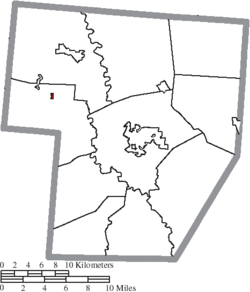
Milledgeville, Ohio | |
---|---|
Coordinates: 39°35′36″N83°35′16″W / 39.59333°N 83.58778°W | |
Country | United States |
State | Ohio |
County | Fayette |
Township | Jasper |
Area | |
• Total | 0.10 sq mi (0.26 km2) |
• Land | 0.10 sq mi (0.26 km2) |
• Water | 0.00 sq mi (0.00 km2) |
Elevation | 1,047 ft (319 m) |
Population (2020) | |
• Total | 98 |
• Density | 980.00/sq mi (379.54/km2) |
Time zone | UTC-5 (Eastern (EST)) |
• Summer (DST) | UTC-4 (EDT) |
ZIP code | 43142 |
Area code | 740 |
FIPS code | 39-50316 [3] |
GNIS feature ID | 2399353 [2] |
Milledgeville is a village in Jasper Township, Fayette County, Ohio, United States. The population was 98 at the 2020 census.
Milledgeville was laid out in 1855. [4] A mill was built on the town site in 1855. [5] The name Milledgeville is an amalgamation of "mill on the edge of ville". [6] A post office has been in operation at Milledgeville since 1877. [7]
According to the United States Census Bureau, the village has a total area of 0.10 square miles (0.26 km2), all land. [8]
Census | Pop. | Note | %± |
---|---|---|---|
1880 | 171 | — | |
1900 | 201 | — | |
1910 | 187 | −7.0% | |
1920 | 217 | 16.0% | |
1930 | 155 | −28.6% | |
1940 | 178 | 14.8% | |
1950 | 208 | 16.9% | |
1960 | 222 | 6.7% | |
1970 | 207 | −6.8% | |
1980 | 162 | −21.7% | |
1990 | 120 | −25.9% | |
2000 | 122 | 1.7% | |
2010 | 112 | −8.2% | |
2020 | 98 | −12.5% | |
U.S. Decennial Census [9] |
As of the census [10] of 2010, there were 112 people, 50 households, and 29 families living in the village. The population density was 1,120.0 inhabitants per square mile (432.4/km2). There were 55 housing units at an average density of 550.0 per square mile (212.4/km2). The racial makeup of the village was 95.5% White, 1.8% African American, 0.9% Asian, 0.9% from other races, and 0.9% from two or more races.
There were 50 households, of which 26.0% had children under the age of 18 living with them, 34.0% were married couples living together, 16.0% had a female householder with no husband present, 8.0% had a male householder with no wife present, and 42.0% were non-families. 36.0% of all households were made up of individuals, and 10% had someone living alone who was 65 years of age or older. The average household size was 2.24 and the average family size was 2.93.
The median age in the village was 45.7 years. 22.3% of residents were under the age of 18; 4.6% were between the ages of 18 and 24; 21.5% were from 25 to 44; 34.8% were from 45 to 64; and 17% were 65 years of age or older. The gender makeup of the village was 57.1% male and 42.9% female.
As of the census [3] of 2000, there were 122 people, 46 households, and 36 families living in the village. The population density was 1,202.2 inhabitants per square mile (464.2/km2). There were 53 housing units at an average density of 522.3 per square mile (201.7/km2). The racial makeup of the village was 98.36% White and 1.64% African American.
There were 46 households, out of which 26.1% had children under the age of 18 living with them, 63.0% were married couples living together, 4.3% had a female householder with no husband present, and 19.6% were non-families. 15.2% of all households were made up of individuals, and 8.7% had someone living alone who was 65 years of age or older. The average household size was 2.65 and the average family size was 2.92.
In the village, the population was spread out, with 19.7% under the age of 18, 5.7% from 18 to 24, 30.3% from 25 to 44, 31.1% from 45 to 64, and 13.1% who were 65 years of age or older. The median age was 37 years. For every 100 females there were 125.9 males. For every 100 females age 18 and over, there were 127.9 males.
The median income for a household in the village was $38,750, and the median income for a family was $47,917. Males had a median income of $31,875 versus $25,625 for females. The per capita income for the village was $17,045. There were no families and 4.4% of the population living below the poverty line, including no under eighteens and none of those over 64.
Fayette County is a county located in the U.S. state of Ohio. As of the 2020 census, the population was 28,951. Its county seat and largest city is Washington Court House. The county was named for the Marquis de Lafayette, a Frenchman who was an officer in the American Army in the Revolution, when established on March 1, 1810.
Milledgeville is a village in Carroll County, Illinois, United States. The population of the village was 1,026 at the 2020 census. The town was named for the mill at the edge of the village, which was torn down in 1908.
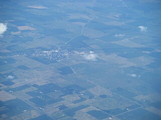
Sabina is a village in Clinton County, Ohio, United States. As of the 2020 census, the village had a total population of 2,499.
Palestine is a village in Darke County, Ohio, United States. The population was 180 at the 2020 census.
Bloomingburg is a village in Fayette County, Ohio, United States. The population was 878 at the 2020 census.
Jeffersonville is a village in Fayette County, Ohio, United States. The population was 1,258 at the 2020 census.
Octa is a village in Fayette County, Ohio, United States, along Rattlesnake Creek. The population was 58 at the 2020 census.
Fayette is a village in Fulton County, Ohio, United States. The population was 1,305 at the 2020 census.
Old Washington is a village in Guernsey County, Ohio, United States. The population was 223 at the 2020 census.
Addyston is a village in Miami Township, Hamilton County, Ohio, United States. Located along the Ohio River, it is a western suburb of the neighboring city of Cincinnati. The population was 927 at the 2020 census.
Cleves is a village in Miami Township, Hamilton County, Ohio, United States. Located along the Ohio River, it is a western suburb of Cincinnati. The population was 3,414 at the 2020 census.
Evendale is a village in Hamilton County, Ohio, United States, within the Cincinnati metropolitan area. The population was 2,669 at the 2020 census.
Brinkhaven, once known as Mount Holly and Gann, is a village in Knox County, Ohio, United States. The population was 114 at the 2020 census.
South Point is a village in Lawrence County, Ohio, United States, along the Ohio River. The population was 3,836 at the 2020 census. It is part of the Huntington–Ashland metropolitan area.
Darbyville is a village in Pickaway County, Ohio, United States. The population was 186 at the 2020 census.
Limaville is a census-designated place (CDP) and former village in Stark County, Ohio, United States. The population was 151 at the 2020 census. It is part of the Canton–Massillon Metropolitan Statistical Area.
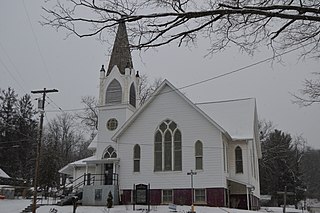
Macksburg is a village in Washington County, Ohio, United States, along the West Fork of Duck Creek. The population was 120 at the 2020 census. The village is about 28 miles (45 km) south of Cambridge, Ohio.
Wilson is a village in Belmont and Monroe counties in the U.S. state of Ohio. The population was 129 at the 2020 census. It is part of the Wheeling metropolitan area.
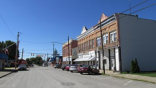
New Holland is a village in Fayette and Pickaway counties in Ohio, United States. The population was 804 at the 2020 census.
Verona is a village in Montgomery and Preble counties in the U.S. state of Ohio. The population was 403 at the 2020 census. It is part of the Dayton Metropolitan Statistical Area.
is a contraction for "mill on the edge of ville."