Mississauga—Brampton South

Last updated • 1 min readFrom Wikipedia, The Free Encyclopedia
Mississauga—Brampton South
Flag of Ontario.svg Ontario electoral district
Mississauga Brampton South.png
Mississauga—Brampton South in relation to other Greater Toronto ridings
Defunct federal electoral district
Legislature House of Commons
District created2003
District abolished2013
First contested 2004
Last contested 2011
Demographics
Population (2011) [1] 147,096
Electors (2011)90,777
Area (km²) [2] 78.01
Census division(s) Peel
Census subdivision(s) Mississauga, Brampton
Map of Mississauga-Brampton South Mississauga-Brampton South.png
Map of Mississauga-Brampton South

Mississauga—Brampton South was a federal electoral district in Ontario, Canada, that was represented in the House of Commons of Canada from 2004 to 2015.

Contents

It consists of the parts of the cities of Mississauga and Brampton bounded by a line drawn from the intersection of Highway 401 with the northeastern limit of the City of Mississauga, south along the city limit, southwest along Burnhamthorpe Road East, northwest along Central Parkway East, southwest along Highway 403, northwest along Mavis Road; thence northwesterly along said road to Eglinton Avenue West; thence southwesterly along said avenue to Terry Fox Way; thence northwesterly along said way to Britannia Road West; thence northeasterly along said road to Mavis Road, southwest along Highway 401, northwest along Mississauga Road, northeast along the northwestern limit of the City of Mississauga, northwest along McLaughlin Road, northeast along Steeles Avenue East, southeast along Kennedy Road South, northeast along the northwestern limit of the City of Mississauga, southeast along Dixie Road, and northeast along Highway 401 to the point of commencement.

Following the 2012 federal electoral boundaries redistribution, the bulk of the district will be part of the new Mississauga—Malton district, with other parts transferred to Mississauga East—Cooksville, Mississauga Centre, Mississauga—Streetsville, Brampton South, and Brampton Centre.

History

It was created in 2003 from Bramalea—Gore—Malton—Springdale, Brampton West—Mississauga, Mississauga Centre and Mississauga East ridings.

Members of Parliament

This riding has elected the following members of the House of Commons of Canada:

ParliamentYearsMemberParty
Mississauga—Brampton South
Riding created from Bramalea—Gore—Malton—Springdale,
Brampton West—Mississauga, Mississauga Centre
and Mississauga East
38th  2004–2006   Navdeep Bains Liberal
39th  2006–2008
40th  2008–2011
41st  2011–2015   Eve Adams Conservative
 2015–2015   Liberal
Riding dissolved into Mississauga—Malton,
Mississauga—Streetsville, Mississauga East—Cooksville,
Mississauga Centre, Brampton South and Brampton Centre

Election results

2011 Canadian federal election
PartyCandidateVotes%±%Expenditures
Conservative Eve Adams 23,63244.72+11.76$ 90,006.33
Liberal Navdeep Bains 18,57935.16−12.5375,658.79
New Democratic Jim Glavan9,46517.91+6.07 
Green Benjamin Stone1,0441.98−4.6416.14
Marxist–Leninist Tim Sullivan1270.24−0.65 
Total valid votes/expense limit 52,847 100.0   +18.77 $ 96,095.05
Total rejected ballots 351 0.66 −0.10
Turnout 53,198 56.28 +6.89
Eligible voters 94,531   +4.14
Source(s)
"Official Voting Results – Forty-First General Election 2011 — Table 12 – List of candidates by electoral district and individual results". Elections Canada. May 2, 2011.
"Financial Reports: Candidate's Electoral Campaign Return". May 2, 2011. Retrieved February 9, 2015.
2008 Canadian federal election
PartyCandidateVotes%±%Expenditures
Liberal Navdeep Bains 21,22047.69-6.25$ 65,107.35
Conservative Salma Ataullahjan 14,66432.96+2.2151,467.58
New Democratic Karan Pandher5,26811.84+0.965,832.24
Green Grace Yogaretnam2,9476.62+2.825,666.20
Marxist–Leninist Tim Sullivan3950.89+0.26 
Total valid votes/Expense limit44,494 100.00 -12.31 $ 91,776.94
Total rejected ballots343 0.76 +0.15
Turnout44,837 49.39 -10.62
Eligible voters90,777  +6.71
2006 Canadian federal election
PartyCandidateVotes%±%Expenditures
Liberal Navdeep Bains 27,37053.94-3.22$ 80,611.34
Conservative Arnjeet Sangha15,60530.75+6.6658,602.08
New Democratic Nirvan Balkisoon5,52110.88-3.929,470.07
Green Grace Yogaretnam1,9273.80+0.287,606.18
Marxist–Leninist Tim Sullivan3190.63+0.20 
Total valid votes/Expense limit50,742100.00 +17.17 $ 82,924.57
Total rejected ballots310 0.61 -0.13
Turnout51,052 60.01 +6.17
Eligible voters85,068  +4.97
2004 Canadian federal election
PartyCandidateVotes%Expenditures
Liberal Navdeep Bains 24,75357.16$ 70,830.08
Conservative Parvinder Sandhu10,43324.0964,050.50
New Democratic Larry Taylor6,41114.8014,516.24
Green Paul Simas1,5253.52 
Marxist–Leninist David Gershuny1850.4323.48
Total valid votes/Expense limit 43,307100.00 $ 78,421.35
Total rejected ballots321 0.74
Turnout43,628 53.84
Eligible voters81,037 

Proposed Redistribution of Electoral Districts

There is a proposal to change the electoral districts. [3] If the proposal is adopted, the southern Burnhamthorpe boundary would change to Eglinton. This would mean that Rockwood Village would move from Mississauga—Brampton South to the Mississauga East—Cooksville Riding.

See also

Related Research Articles

<span class="mw-page-title-main">Mississauga</span> City in Ontario, Canada

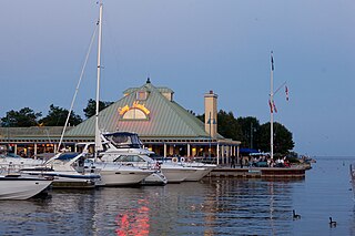
Mississauga, historically known as Toronto Township, is a Canadian city in the province of Ontario, situated on the western shore of Lake Ontario in the Regional Municipality of Peel, adjoining the western border of Toronto. With a population of 717,961 as of 2021, Mississauga is the seventh-most populous municipality in Canada, third-most in Ontario, and second-most in the Greater Toronto Area (GTA) after Toronto itself. However, for the first time in its history, the city's population declined according to the 2021 census, from a 2016 population of 721,599 to 717,961, a 0.5 per cent decrease.

<span class="mw-page-title-main">Toronto—St. Paul's (federal electoral district)</span> Federal electoral district in Ontario, Canada

Toronto—St. Paul's is a federal electoral district in Toronto, Ontario, Canada, that has been represented in the House of Commons of Canada since 1935. Before the 2015 election, the riding was known as St. Paul's.

<span class="mw-page-title-main">York South—Weston (federal electoral district)</span> Federal electoral district in Ontario, Canada

York South—Weston is a federal electoral district in Ontario, Canada, that has been represented in the House of Commons of Canada since 1979.

<span class="mw-page-title-main">MiWay</span> Public transport agency serving Mississauga, Ontario, Canada

MiWay, also known as Mississauga Transit and originally as Mississauga Transit Systems, is the municipal public transport agency serving Mississauga, Ontario, Canada, and is responsible to the city's Transportation and Works Department. MiWay services consist of two types of bus routes: MiLocal, local buses that make frequent stops, and MiExpress, express buses between major destinations. MiWay is the primary operator along the Mississauga Transitway, a dedicated east–west bus-only roadway.

<span class="mw-page-title-main">Willowdale (federal electoral district)</span> Federal electoral district in Ontario, Canada

Willowdale is a federal electoral district in Toronto, Ontario, Canada. It has been represented in the House of Commons of Canada since 1979. It is the riding with the biggest Korean community in Canada. As per the 2021 census, 9.9% of the population of Willowdale is Korean.

<span class="mw-page-title-main">Mississauga—Lakeshore (federal electoral district)</span> Federal electoral district in Ontario, Canada

Mississauga—Lakeshore is a federal electoral district in Peel Region, Ontario, Canada. It has been represented in the House of Commons of Canada since 1979.

<span class="mw-page-title-main">Mississauga East—Cooksville (federal electoral district)</span> Federal electoral district in Ontario, Canada

Mississauga East—Cooksville is a federal electoral district in Ontario, Canada, that has been represented in the House of Commons of Canada since 2004.

<span class="mw-page-title-main">Mississauga—Erindale</span> Federal electoral district in Ontario, Canada

Mississauga—Erindale was a federal electoral district in Ontario, Canada, that was represented in the House of Commons of Canada from 2004 to 2015.

<span class="mw-page-title-main">Mississauga—Streetsville (federal electoral district)</span> Federal electoral district in Ontario, Canada

Mississauga—Streetsville is a federal electoral district in Ontario, Canada, that has been represented in the House of Commons of Canada since 2004. This riding is centred on the villages of Streetsville and Meadowvale.

<span class="mw-page-title-main">Brampton West—Mississauga (federal electoral district)</span> Federal electoral district in Ontario, Canada

Brampton West—Mississauga was a federal electoral district in Ontario, Canada, that was represented in the House of Commons of Canada from 1997 to 2004. This riding was created in 1996, from parts of Brampton riding.

<span class="mw-page-title-main">Mississauga Centre (federal electoral district)</span> Federal electoral district in Ontario, Canada

Mississauga Centre is a federal electoral district in the Peel Region of Ontario, Canada, that has represented in the House of Commons of Canada from 1997 to 2004 and since 2015.

<span class="mw-page-title-main">Hurontario Street</span> Road in Ontario, Canada

Hurontario Street is a roadway running in Ontario, Canada between Lake Ontario at Mississauga and Lake Huron's Georgian Bay at Collingwood. Within Peel Region, it is a major urban thoroughfare within the cities of Mississauga and Brampton, which serves as the divide from which cross-streets are split into East and West, except at its foot in the historic Mississauga neighbourhood of Port Credit. Farther north, with the exception of the section through Simcoe County, where it forms the 8th Concession, it is the meridian for the rural municipalities it passes through. In Dufferin County, for instance, parallel roads are labelled as EHS or WHS for East of Hurontario Street.

<span class="mw-page-title-main">York South—Weston (provincial electoral district)</span> Provincial electoral district in Ontario, Canada

York South—Weston is a provincial electoral district in Toronto, Ontario, Canada, that has been represented in the Legislative Assembly of Ontario since 1999.

<span class="mw-page-title-main">Mississauga—Streetsville (provincial electoral district)</span> Provincial electoral district in Ontario, Canada

Mississauga—Streetsville is a provincial electoral district in Ontario, Canada, that has been represented in the Legislative Assembly of Ontario since 2007. This riding is centred on the villages of Streetsville and Meadowvale.

<span class="mw-page-title-main">Mississauga—Brampton South (provincial electoral district)</span> Provincial electoral district in Ontario, Canada

Mississauga—Brampton South was a provincial electoral district in Ontario, Canada, that has been represented in the Legislative Assembly of Ontario from the 2007 provincial election until 2018. It was dissolved into Mississauga—Malton, Mississauga—Streetsville, Mississauga East—Cooksville, Mississauga Centre, Brampton South and Brampton Centre.

<span class="mw-page-title-main">Mississauga East—Cooksville (provincial electoral district)</span> Provincial electoral district in Ontario, Canada

Mississauga East—Cooksville is a provincial electoral district in Ontario, Canada, that has been represented in the Legislative Assembly of Ontario since the 2007 provincial election.

<span class="mw-page-title-main">Rockwood Village</span> Neighbourhood in Peel, Ontario, Canada

Rockwood Village is a neighbourhood in the eastern part of the City of Mississauga, Ontario, Canada, in the Regional Municipality of Peel. Its approximate boundaries are Eglinton Avenue in the north, Burnhamthorpe Road in the south, the Etobicoke Creek on the east and Dixie Road on the west. The Municipal Ward is Ward 3, the provincial riding is Mississauga East—Cooksville and the federal riding is Mississauga East—Cooksville. The Burnhamthorpe branch of the Mississauga Library System is located at the southwestern edge of Rockwood Village at the corner of Burnhamthorpe Road and Dixie Road.

<span class="mw-page-title-main">Transportation in Mississauga</span>

The transport infrastructure and services in the Canadian city of Mississauga, Ontario include provincial highways and municipal roads, passenger and freight rail, regional and municipal bus service, and an international airport. It is interconnected with air, road, and rail transportation networks spanning the Greater Toronto Area and beyond.

References

  1. Statistics Canada: 2012
  2. Statistics Canada: 2012
  3. Stewart, John (August 28, 2012). "Mississauga carved up in new riding proposals". Mississauga News.

43°42′N79°42′W / 43.7°N 79.7°W / 43.7; -79.7