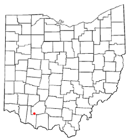
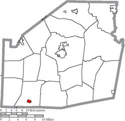
Mowrystown, Ohio | |
---|---|
Coordinates: 39°02′25″N83°45′00″W / 39.04028°N 83.75000°W | |
Country | United States |
State | Ohio |
County | Highland |
Area | |
• Total | 0.49 sq mi (1.27 km2) |
• Land | 0.48 sq mi (1.25 km2) |
• Water | 0.01 sq mi (0.02 km2) |
Elevation | 991 ft (302 m) |
Population (2020) | |
• Total | 385 |
• Density | 798.76/sq mi (308.28/km2) |
Time zone | UTC-5 (Eastern (EST)) |
• Summer (DST) | UTC-4 (EDT) |
ZIP code | 45155 |
Area code(s) | 937, 326 |
FIPS code | 39-53186 [3] |
GNIS feature ID | 2399421 [2] |
Mowrystown is a village in Highland County, Ohio, United States. The population was 385 at the 2020 census.
Mowrystown was laid out in 1829, and named after Abe Mowry, an early settler. [4]
According to the United States Census Bureau, the village has a total area of 0.49 square miles (1.27 km2), of which 0.48 square miles (1.24 km2) is land and 0.01 square miles (0.03 km2) is water. [5]
Census | Pop. | Note | %± |
---|---|---|---|
1870 | 414 | — | |
1880 | 120 | −71.0% | |
1910 | 326 | — | |
1920 | 350 | 7.4% | |
1930 | 372 | 6.3% | |
1940 | 427 | 14.8% | |
1950 | 394 | −7.7% | |
1960 | 416 | 5.6% | |
1970 | 465 | 11.8% | |
1980 | 475 | 2.2% | |
1990 | 460 | −3.2% | |
2000 | 373 | −18.9% | |
2010 | 360 | −3.5% | |
2020 | 385 | 6.9% | |
U.S. Decennial Census [6] |
As of the census [7] of 2010, there were 360 people, 129 households, and 92 families living in the village. The population density was 750.0 inhabitants per square mile (289.6/km2). There were 152 housing units at an average density of 316.7 per square mile (122.3/km2). The racial makeup of the village was 99.7% White and 0.3% from two or more races.
There were 129 households, of which 38.0% had children under the age of 18 living with them, 46.5% were married couples living together, 17.8% had a female householder with no husband present, 7.0% had a male householder with no wife present, and 28.7% were non-families. 23.3% of all households were made up of individuals, and 12.4% had someone living alone who was 65 years of age or older. The average household size was 2.79 and the average family size was 3.27.
The median age in the village was 34.8 years. 28.1% of residents were under the age of 18; 7.5% were between the ages of 18 and 24; 27.6% were from 25 to 44; 21.9% were from 45 to 64; and 15% were 65 years of age or older. The gender makeup of the village was 50.6% male and 49.4% female.
As of the census [3] of 2000, there were 373 people, 143 households, and 103 families living in the village. The population density was 772.8 inhabitants per square mile (298.4/km2). There were 162 housing units at an average density of 335.6 per square mile (129.6/km2). The racial makeup of the village was 98.66% White, 0.80% Pacific Islander, and 0.54% from two or more races.
There were 143 households, out of which 37.8% had children under the age of 18 living with them, 55.2% were married couples living together, 11.9% had a female householder with no husband present, and 27.3% were non-families. 23.1% of all households were made up of individuals, and 8.4% had someone living alone who was 65 years of age or older. The average household size was 2.61 and the average family size was 3.12.
In the village, the population was spread out, with 28.2% under the age of 18, 10.5% from 18 to 24, 27.9% from 25 to 44, 22.5% from 45 to 64, and 11.0% who were 65 years of age or older. The median age was 34 years. For every 100 females there were 107.2 males. For every 100 females age 18 and over, there were 104.6 males.
The median income for a household in the village was $35,956, and the median income for a family was $37,917. Males had a median income of $31,250 versus $20,938 for females. The per capita income for the village was $13,884. About 11.6% of families and 10.1% of the population were below the poverty line, including 17.5% of those under age 18 and 18.8% of those age 65 or over.
Mowrystown is the home of Whiteoak High School, home of the Whiteoak Wildcats.
Highland County is a county located in the U.S. state of Ohio. As of the 2020 census, the population was 43,317. Its county seat is Hillsboro. The county is named for the topography which is hilly and divides the watersheds of the Little Miami and Scioto Rivers.
Fort Shawnee is census-designated place (CDP) in Allen County, Ohio, United States. The population was 6,263 at the 2020 census. It is included in the Lima, Ohio Metropolitan Statistical Area. Fort Shawnee is adjacent to the city of Lima and the village of Cridersville in Auglaize County. In 2012, village residents voted to disincorporate the village. According to the United States Census Bureau, the village had a total area of 7.25 square miles (18.78 km2), of which 7.21 square miles (18.67 km2) is land and 0.04 square miles (0.10 km2) is water.
Hamersville is a village in Clark Township, Brown County, Ohio, United States. The population was 485 at the 2020 census.
Warsaw is a village in Coshocton County, Ohio, United States, along the Walhonding River. The population was 624 at the 2020 census.
Gordon is a village in Darke County, Ohio, United States. The population was 245 at the 2020 census.
Ithaca is a village in Darke County, Ohio, United States. The population was 81 at the 2020 census.
Sugar Grove is a village in Fairfield County, Ohio, United States. The population was 429 at the 2020 census.
Brice is a village in Franklin County, Ohio, United States, on the southeast side of the Columbus metropolitan area. The population was 93 at the 2020 census.
Vinton is a village in Gallia County, Ohio, United States. The population was 224 at the 2020 census. It is part of the rural Point Pleasant micropolitan area.
Addyston is a village in Miami Township, Hamilton County, Ohio, United States. Located along the Ohio River, it is a western suburb of the neighboring city of Cincinnati. The population was 927 at the 2020 census.
Hanover is a village in Licking County, Ohio, United States. The population was 1,270 at the 2020 census. The village lies along Ohio State Route 16.
Hartford is a village in the township of the same name in Licking County, Ohio, United States. The population was 404 at the 2020 census.
South Solon is a village in Madison County, Ohio, United States. The population was 329 at the 2020 census. Despite their similar names, South Solon is not adjacent to the city of Solon, Ohio, a suburb of Cleveland in Cuyahoga County. The two towns are approximately 170 miles (270 km) apart.
Tarlton is a village in Fairfield and Pickaway counties in the U.S. state of Ohio. The population was 254 at the 2020 census.
Port Jefferson is a village in Salem Township, Shelby County, Ohio, United States. The population was 308 at the 2020 census.
Limaville is a census-designated place (CDP) and former village in Stark County, Ohio, United States. The population was 151 at the 2020 census. It is part of the Canton–Massillon Metropolitan Statistical Area.
Macksburg is a village in Washington County, Ohio, United States, along the West Fork of Duck Creek. The population was 120 at the 2020 census. The village is about 28 miles (45 km) south of Cambridge, Ohio.
Congress is a village in Wayne County, Ohio, United States. The population was 132 at the 2020 census.
Wilson is a village in Belmont and Monroe counties in the U.S. state of Ohio. The population was 129 at the 2020 census. It is part of the Wheeling metropolitan area.
Gratiot is a village in Licking and Muskingum counties in the U.S. state of Ohio. The population was 215 at the 2020 census.