Mt. Zion Church and Cemetery | |
Nearest city | Elkhorn, Tennessee |
---|---|
Coordinates | 36°22′18″N88°2′31″W / 36.37167°N 88.04194°W Coordinates: 36°22′18″N88°2′31″W / 36.37167°N 88.04194°W |
Area | 2.7 acres (1.1 ha) |
Built | 1893 |
NRHP reference # | 74001916 [1] |
Added to NRHP | December 23, 1974 |
Mt. Zion Church and Cemetery (United Baptist Church) is a historic church building near Elkhorn, Henry County, Tennessee, United States. It was built sometime between 1872 and 1899, [2] most likely in 1893, and added to the National Register of Historic Places in 1974. [1] It is the only surviving building in the "Old 23rd District" of Henry County, an extinct community since 1944.
Henry County is a county located on the northwestern border of the U.S. state of Tennessee, and is considered part of West Tennessee. As of the 2010 census, the population was 32,330. Its county seat is Paris. The county is named for the Virginia orator Patrick Henry.
The National Register of Historic Places (NRHP) is the United States federal government's official list of districts, sites, buildings, structures, and objects deemed worthy of preservation for their historical significance. A property listed in the National Register, or located within a National Register Historic District, may qualify for tax incentives derived from the total value of expenses incurred preserving the property.
This building might be confused with Mount Zion Church located approximately twenty miles south near Big Sandy, Benton County, Tennessee, which was destroyed by fire in the 1990s, [3] possibly 1992.
The Mount Zion Church was a historic church building near Big Sandy, Tennessee. It was a hewn log structure built in either 1812 or 1845 and listed on the National Register of Historic Places in 1973. It was removed from the National Register in 2012.
Big Sandy is a town in Benton County, Tennessee, United States. The population was 557 at the 2010 census.
Benton County is a county located in the U.S. state of Tennessee. As of the 2010 census, the population was 16,489. Its county seat is Camden. The county was created in December 1835 and organized in 1836.
The building is on a small, remote peninsula colloquially referred to as the "Old 23rd District." [4] Today, this land is part of the Big Sandy Unit of the Tennessee National Wildlife Refuge. Between about 1821 and 1944, a small community of families lived and farmed there. Besides farming, the community produced timber and lumber, railroad cross ties and cleaned mussel shells for the button-making industry. The remote location also made moonshining quite lucrative. In the community, there were two churches, two or three stores, a sawmill and a post office at various times. [2] The first post office was Gillie, Tennessee, established in 1888 and absorbed by Pace, Tennessee in 1899. Pace, Tennessee was established in 1890 and absorbed by a rural route out of Big Sandy in Benton County, Tennessee in 1904. [2] [5]
Tennessee National Wildlife Refuge is a National Wildlife Refuge of the United States located along the shores of the Tennessee River in West Tennessee. It was established in 1945 where the impoundment of Kentucky Lake by the Tennessee Valley Authority has created a more-or-less permanent wetlands environment favored by many species of waterfowl. The entire refuge area is 51,359.46 acres (207.84 km²) in three units: From north to south they are Big Sandy, Duck River, and Busseltown.
Mussel is the common name used for members of several families of bivalve molluscs, from saltwater and freshwater habitats. These groups have in common a shell whose outline is elongated and asymmetrical compared with other edible clams, which are often more or less rounded or oval.
The molluscshell is typically a calcareous exoskeleton which encloses, supports and protects the soft parts of an animal in the phylum Mollusca, which includes snails, clams, tusk shells, and several other classes. Not all shelled molluscs live in the sea; many live on the land and in freshwater.
In 1938, the Tennessee Valley Authority (TVA) began construction of Kentucky Dam on the Tennessee River. Impounding the river meant that flood waters would consume a large part of the community, so in 1940, TVA began buying out property and moving all families out of the area. Buildings below the flood level were given to their prior owners and buildings above the flood level were auctioned off. All buildings had to be moved out by a certain date after which TVA burned what remained. Timber below the flood level was cut and burned on a tight schedule, preventing much of its use to sawmillers. Cemeteries that would be flooded or whose access would be flooded were surveyed, next of kin contacted, and decisions made on removal and relocation or remaining in place. [2]
The Tennessee Valley Authority (TVA) is a federally owned corporation in the United States created by congressional charter on May 18, 1933, to provide navigation, flood control, electricity generation, fertilizer manufacturing, and economic development to the Tennessee Valley, a region particularly affected by the Great Depression. The enterprise was a result of the efforts of Senator George W. Norris of Nebraska. TVA was envisioned not only as a provider, but also as a regional economic development agency that would use federal experts and electricity to more quickly modernize the region's economy and society.
Kentucky Dam is a hydroelectric dam on the Tennessee River on the county line between Livingston and Marshall counties in the U.S. state of Kentucky. The dam is the lowermost of nine dams on the river owned and operated by the Tennessee Valley Authority, which built the dam in the late 1930s and early 1940s to improve navigation on the lower part of the river and reduce flooding on the lower Ohio and Mississippi rivers. It was a major project initiated during the New Deal of President Franklin D. Roosevelt's administration, to invest in infrastructure to benefit the country. The dam impounds the Kentucky Lake of 160,000 acres (65,000 ha), which is the largest of TVA's reservoirs and the largest artificial lake by area in the Eastern United States. It was listed on the National Register of Historic Places in 2017.
The Tennessee River is the largest tributary of the Ohio River. It is approximately 652 miles (1,049 km) long and is located in the southeastern United States in the Tennessee Valley. The river was once popularly known as the Cherokee River, among other names, as many of the Cherokee had their territory along its banks, especially in eastern Tennessee and northern Alabama. Its current name is derived from the Cherokee village Tanasi.
The Mt. Zion Church building and cemetery exist well above the flood level therefore they enjoyed some special treatment. When TVA purchased the site, an agreement was made with the church trustees to leave the building standing and allow the congregation to meet there annually for a homecoming. [2] [4] This homecoming still occurs on the first Sunday in July of each year. [4] [6]
Mt. Zion Church may have first met in 1829. [2] It petitioned to and was accepted by the Western District Baptist Association in 1853. [2] [4]
The first church building was a log structure built on land donated by James Monroe Gray. [2] [4] It stood across the road from the current building and was also used as a school. It was torn down sometime between 1890 and 1900. [2]
Land for the current building was donated by Rhoda Gray McDaniel, daughter of James Monroe Gray. In the Pictorial History of the Old 23rd District, Larry T. Perry states that the current church was built in 1897, however the National Register of Historical Places has listed 1893. Entries in the Western District Association minutes list also 1872, 1896 and 1899 as dates of construction for the current building. [1] [2]
Pastors included pillars of the local community such as James Monroe Gray, Buck Williams and Frank Robbins but also W. W. Dickerson, who lived about 50 miles (80 km) away in Murray, Kentucky. Dickerson served Mt. Zion for 18 years and never lived within the church community. Every Saturday, he would come to Paris where he was met by a member of the congregation and taken back to the community. He would spend the night with a church family, preach on Sunday morning and then leave on Sunday afternoon with some farm produce given by church members. [2]
In 1896 and 1938, the Western District Association held their annual conferences at the Mt. Zion church. [2]
By 1943, the church was without a pastor and in the process of disbanding. TVA purchased the church building and the 2.7 acres (1.1 ha) on which it stood for $1006. They agreed with the church trustees, Isham Robbins, T. J. Fielder and W. C. Flowers, to leave the building standing and to allow the congregation to meet there annually for a homecoming. The last report was sent to the Association in 1944. [2]
Mt. Zion Church had an irregular representation and report in the Association minutes. However spotty these reports may be, they are the most tangible way to understand the size and impact the church had upon its community. The following aggregate data is taken from Perry's book.
Year | Pastor | Pastor's Salary | Membership | Property Value |
---|---|---|---|---|
1853 | James Monroe Gray of Mouth of Sandy, Tennessee | 24 | ||
1890 | P. I. Summers of Gillie, Tennessee | 32 | ||
1894 | W. Buck Williams of Sip, Tennessee | 44 | ||
1895 | 79 | |||
1896 | W. Buck Williams | $40 | 80 | $355 |
1897 | $25 | |||
1898 | 102 | |||
1899 | 115 | |||
1900 | 117 | |||
1901 | 120 | |||
1902 | D. T. Spaulding | 117 | $450 | |
1904 | T. B. Holcomb | |||
1906 | A. M. Hawley of Big Sandy, Tennessee | 123 | ||
1907 | 124 | |||
1908 | 134 | |||
1909 | No Pastor | 124 | ||
1910 | 146 | $400 | ||
1911 | A. M. Hawley | 157 | ||
1912 | 193 | |||
1913 | 188 | |||
1915 | A. M. Hawley | |||
1917 | A. M. Hawley | 93 | $1000 | |
1919 | Henry Frank Robbins | 105 | ||
1920 | No Pastor | 110 | ||
1921 | Will Jones | $60.5 | 102 | |
1923 | No Pastor | |||
1924 | W. W. Dickerson of Murray, Kentucky | $73.13 | ||
1925 | W. W. Dickerson | 112 | ||
1926 | W. W. Dickerson | $125 | 112 | $500 |
1927 | W. W. Dickerson | $150 | 111 | |
1928 | W. W. Dickerson | 111 | ||
1929 | W. W. Dickerson | $120 | 108 | |
1930 | W. W. Dickerson | 150 | $800 | |
1931 | W. W. Dickerson | 101 | $300 | |
1932 | W. W. Dickerson | $100 | 104 | |
1933 | W. W. Dickerson | $80 | 127 | |
1934 | W. W. Dickerson | 135 | $100 | |
1935 | W. W. Dickerson | $100 | 120 | |
1936 | W. W. Dickerson | $100 | 60 | $200 |
1937 | W. W. Dickerson | $125 | 59 | |
1938 | W. W. Dickerson | $182.25 | 59 | $400 |
1940 | W. W. Dickerson | $266.81 | 71 | |
1941 | W. W. Dickerson | $267.9 | 78 | $1000 |
1942 | No Pastor | 71 | ||
1943 | No Pastor | 70 (50 are non-resident) | $1006 sold to TVA | |
1944 | No Pastor | 49 (46 are non-resident) |
The Mt. Zion cemetery is located just behind, to the west of the church building. It is surrounded by a chain link fence and is regularly cared for. As of April 2007, there were 222 graves known. Burials still occur there. [6]
East Zorra-Tavistock is a township in southwestern Ontario, Canada, formed on 1 January 1975 through the amalgamation of the Township of East Zorra and the Village of Tavistock. It is part of Oxford County. The township had a population of 6,836 in the Canada 2011 Census.
Nutbush is a rural unincorporated community in Haywood County, Tennessee, in the western part of the state. It was established in the early 19th century by European-American settlers who brought along or bought enslaved African Americans as workers to develop the area's cotton plantations. The African Americans built houses and churches that still stand.
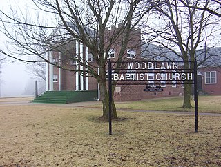
Woodlawn Baptist Church and Cemetery, also known as Woodlawn Missionary Baptist Church, is a historic building in Nutbush, Haywood County, Tennessee, in the United States. It is on Woodlawn Road, south of Tennessee State Route 19.
Madison Township is one of ten townships in Jefferson County, Indiana, United States. As of the 2010 census, its population was 17,415 and it contained 8,087 housing units.
Monroe Township is one of ten townships in Jefferson County, Indiana, United States. As of the 2010 census, its population was 374 and it contained 176 housing units.
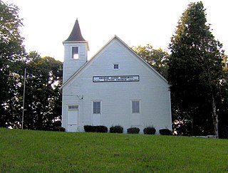
The George Jones Memorial Baptist Church, also known as the "Wheat Church," is a historic church building at the former site of the community of Wheat in Oak Ridge, Tennessee, United States. It is the only structure remaining from Wheat, a rural Roane County community that was dissolved in 1942 when the United States government assumed ownership of the land for the Manhattan Project.
Richard Henry Boyd, commonly known as the Rev. Dr. R. H. Boyd, was an African-American minister and businessman who was the founder and head of the National Baptist Publishing Board and a founder of the National Baptist Convention of America, Inc.
Mt. Zion Presbyterian Church is located in Sandy Springs, South Carolina, USA. It is a part of the PCUSA denomination and is located in the Foothills Presbytery of the Synod of South Atlantic.
Republican Primitive Baptist Church is a historic African-American church of the Primitive Baptist tradition located in rural Haywood County, Tennessee, about 10 miles west of Brownsville.
Mount Zion Missionary Baptist Church is a historic African-American church at 305 W. Maple Street in Fayetteville, Tennessee.
Hackney Chapel AME Zion Church, also known as Unitia AME Zion Church, is a historic African-American church in rural Loudon County, Tennessee. The adjacent cemetery has about 100 marked graves and up to 200 unmarked graves. The church and cemetery were added to the National Register of Historic Places in 2000.
Mt. Zion Christian Methodist Episcopal Church, formerly Mt. Zion Colored Methodist Episcopal Church, is a historic African-American church in Union City, Tennessee, at the corner of North Greenwood and East College Streets.
Mount Zion Missionary Baptist Church is a historic church at 409 S. Main Street in Brinkley, Arkansas. It is a red brick building with front facing gable roof, and a pair of square towers flanking the main structure. The left tower is slightly taller, an intentional element of the design that was maintained when one tower had to be shorted by removal of its belfry. The towers are joined by a three-bay porch sheltering the building's main entrance. The church was built in 1909 for an African-American congregation established in 1886, and has been a major cultural focus for that community since.
Flippin is an unincorporated community located in Monroe County, Kentucky, United States. A small residential village is located on Highway 249, approximately 3.6 miles south of the Monroe-Barren County line. The village and community surround the intersection of Highway 249, Highway 678, and Highway 100. Flippin is situated northwest of Gamaliel, west of Tompkinsville, and east of Fountain Run.
Spanish Camp is an unincorporated community in north central Wharton County, in the U.S. state of Texas. The community is located between Egypt and Hungerford along Farm to Market Road 1161 (FM 1161) near its intersection with Farm to Market Road 640 (FM 640). After the Mexican army of Antonio López de Santa Anna camped at the site in 1836, the community took the name Spanish Camp. In 1870 a church in the community was founded by former slaves and the congregation still existed in 2013.