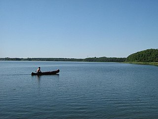
The Müritz National Park is a national park situated roughly in the middle between Berlin and Rostock, in the south of the German state of Mecklenburg-Vorpommern. It extends over large portions of the Müritz lakeland in the district of Mecklenburgische Seenplatte. Müritz National Park was founded in 1990. The total area is 318 km2. Near the city of Waren visitors can get information on the national park at the Müritzeum. The beech forests within the national park were inscribed on the UNESCO World Heritage List in 2011 as an extension of the Primeval Beech Forests of Europe site because of their unspoilt nature and testimony to the ecological history of Europe since the Last Glacial Period.

The Jasmund National Park is a nature reserve on the Jasmund peninsula, in the northeast of Rügen island in Mecklenburg-Vorpommern, Germany. It is famous for containing the largest chalk cliffs in Germany, the highest of which is Königsstuhl, rising to 118 m (387 ft) above the Baltic Sea. The highest point in the park as a whole is Pieckberg, at 161 m (528 ft) above sea level. The beech forests behind the cliffs are also part of the national park.

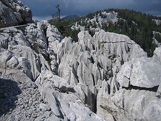
The Northern Velebit National Park is a national park in Croatia that covers 109 km2 of the northern section of the Velebit mountains, the largest mountain range in Croatia. Because of the abundant variety of this part of the Velebit range, the area was upgraded from a nature reserve in 1999, and opened as a national park in September the same year.

Bieszczady National Park is the third-largest national park in Poland, located in Subcarpathian Voivodeship in the extreme southeast corner of the country. In 2021, the national park became a UNESCO World Heritage Site.

Poloniny National Park is a national park in northeastern Slovakia at the Polish and Ukrainian borders, in the Bukovské vrchy mountain range, which belongs to the Eastern Carpathians. It was created on 1 October 1997 with a protected area of 298.05 km2 (115.08 sq mi) and a buffer zone of 109.73 km2 (42.37 sq mi). Selected areas of the park are included into Primeval Beech Forests of the Carpathians UNESCO World Heritage Site.

Ancient and Primeval Beech Forests of the Carpathians and Other Regions of Europe is a transnational serial nature UNESCO World Heritage Site, encompassing 93 component parts in 18 European countries. Together, the sites protect the largest and least disturbed forests dominated by the beech tree. In many of these stands, especially those in the Carpathians, beech forests have persisted without interruption or interference since the last ice age. These sites document the undisturbed postglacial repopulation of the species.

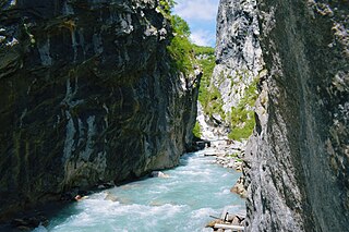
The Valbona Valley is in the Albanian Alps in northern Albania. It is part of Alps of Albania National Park, one of the most impressive and notable topographic features of Albania. Being the southernmost continuation of the Dinaric Alps, it forms a section of the Alpine-Himalayan orogenic belt, which extend from the Atlantic Ocean to the Himalaya Mountains. The mountains are characterized by limestone and dolomite rocks and shows major karst features. Maja Jezercë sprawls to the west of the valley and is the highest mountain of the Dinaric Alps, with an altitude of 2,694 m (8,839 ft). The Valbona River originate from several karst springs along the south of Maja Jezercë and the east of Valbona Pass. It is the largest river within the Albanian Alps and drains the entire eastern portion of the range. Over the past few million years, glaciers have at times covered most of the park. During the Würm period, the glacier of Valbona reached a total length of 9.5 kilometres. Nowadays, there are two very small active glaciers close to the northeastern edge of Maja Jezercë.

Hainich National Park, founded on December 31, 1997, is the 13th national park in Germany and the only one in Thuringia. One of the main objectives of the park is the protection of an ancient native beech forest. In 2011, the park was added to the Ancient and Primeval Beech Forests of the Carpathians and Other Regions of Europe World Heritage Site because of its testimony to the ecological history of the beech tree and the dynamics of forests in Europe since the Last Glacial Period.

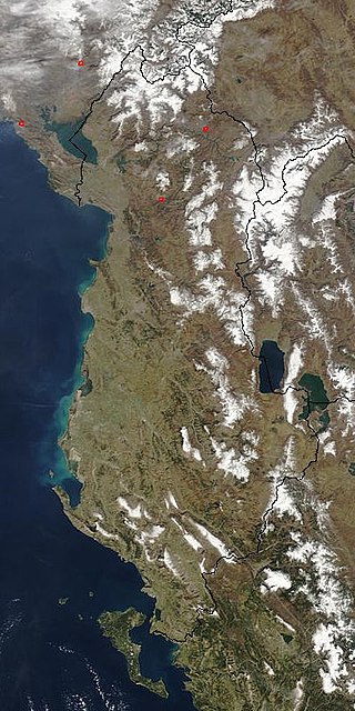
The Northern Mountain Region is a geographical region in northern Albania. It is one of the four mountain regions of Albania, the others being Central Mountain Range, Southern Mountain Range, and Western Lowlands. The northern range encompasses the Albanian Alps extending from the Lake Shkodër shared with Montenegro in the northwest through the Valbonë Valley to the Drin Valley in the east. The area falls within the Dinaric Mountains mixed forests and Balkan mixed forests terrestrial ecoregions of the Palearctic Temperate broadleaf and mixed forests.

The Kellerwald-Edersee National Park, CDDA-No. 318077) in the North Hessian county of Waldeck-Frankenberg is a national park, 57.38 km² in area, that lies south of the Edersee lake in the northern part of the low mountain range of the Kellerwald in the German state of Hesse. Since 25 June 2011 the beech forested area of the national park has been part of the UNESCO World Heritage Site known as Ancient and Primeval Beech Forests of the Carpathians and Other Regions of Europe, because of its testimony to the ecological history of the beech family and the forest dynamics of Europe since the Last Glacial Period.

The Gashi is a 27-kilometre-long (17 mi) river located in Tropojë, northern Albania. It was a nature reserve, spanning an area of 3,000 ha. The nature reserve forms a part of the European Green Belt and has been declared a UNESCO World Heritage Site within the Primeval Beech Forests of the Carpathians and Other Regions of Europe. In 2022, the protected area was amalgamated to form the Alps of Albania National Park.

Uzh National Nature Park is a protected area in Ukraine. It is located in Uzhhorod Raion of Zakarpattia Oblast, at the border with Poland and Slovakia. The park was created on 5 August 1999 and has the area of 39,159.3 hectares (151.195 sq mi). Since 2007, it is part of the World Heritage site Primeval Beech Forests of the Carpathians and Other Regions of Europe. It is also part of the East Carpathian Biosphere Reserve. The park was created to protect the pristine beech forest of the Carpathians.

The protected forest area, Uholka-Shyrokyi Luh, is located in the Trancarpathian region of Ukraine and belongs to the Carpathian Biosphere Reserve. It is the largest primeval beech forest worldwide with an area of 8800 ha. Since 1920, some parts of this forest have been protected. In 1992, Uholka-Shyrokyi Luh primeval beech forest was designated as UNESCO World Heritage Site. Later, several other primeval and old-growth beech forests in Europe were included in the UNESCO World Heritage Site Ancient and Primeval Beech Forests of the Carpathians and Other Regions of Europe as well.
As a primeval beech forest, Uholka-Shyrokyi Luh is an important research hotspot. In 2001, a 10 ha research sample plot was installed in Mala Uholka as part of a Swiss-Ukrainian research project, and in 2010 a full statistical inventory of the primeval forest was carried out. The next inventory is planned in 2019 to detect any changes.
The Ancient and Primeval Beech Forests of Albania encompasses the beech forests of Gashi in Valbonë Valley National Park and Rajcë in Shebenik-Jabllanicë National Park. They form an integral section of the UNESCO World Heritage Site of Ancient and Primeval Beech Forests of the Carpathians because for their outstanding naturalistic value and the diverse biodiversity.

The Sengsengebirge mountains are a folded mountain range in the Upper Austrian Pre-Alps and is part of the Northern Limestone Alps. The heavily karstified mountain range consists mainly of Wetterstein limestone, drains mostly underground and is criss-crossed by several large caves, including the Klarahöhle with a length of over 31 kilometers. The highest elevation is the Hohe Nock at 1,963 m (AA). A large part of the Sengsengebirge has been a nature reserve since 1976 and has been integrated into the Kalkalpen National Park since 1997.


