Neighborhoods in Cleveland

Last updated
Neighborhoods of Cleveland as defined by the Cleveland City Planning Commission in 2012 Cleveland City Neighborhoods with Names.png
Neighborhoods of Cleveland as defined by the Cleveland City Planning Commission in 2012

Neighborhoods in Cleveland refer to the 34 neighborhood communities of the city of Cleveland, Ohio, as defined by the Cleveland City Planning Commission. [1] [2] Based on historical definitions and census data, the neighborhoods serve as the basis for various urban planning initiatives on both the municipal and metropolitan levels. [2] Technically known as Statistical Planning Areas (SPAs), they also provide a "framework for summarizing socio-economic and other statistics within the city." [2] City neighborhood boundaries were last revised by the City Planning Commission in 2012. [2]

Contents

Cleveland's neighborhoods are generally defined by their position on either the East Side or West Side of the Cuyahoga River. [3] Downtown and Cuyahoga Valley are situated between the East and West Sides, while the Broadway–Slavic Village neighborhood is sometimes referred to as the South Side. [4]
Neighborhoods

No.Neighborhood [5] LocationMap
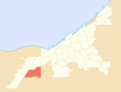
01 Bellaire–Puritas West Side (West Park) Cleveland City Neighborhoods - Bellaire-Puritas.png
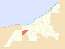
02 Broadway–Slavic Village South and East Side Cleveland City Neighborhoods - Broadway-Slavic Village.png
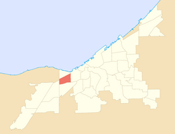
03 Brooklyn Centre West Side Cleveland City Neighborhoods - Brooklyn Centre.png
04 Buckeye–Shaker East Side Cleveland City Neighborhoods - Buckeye-Shaker Square.png
05 Buckeye–Woodhill East Side Cleveland City Neighborhoods - Buckeye-Woodhill.png
06 Central East Side Cleveland City Neighborhoods - Central.png
07 Clark–Fulton West Side Cleveland City Neighborhoods - Clark-Fulton.png
08Collinwood–NottinghamEast Side (Collinwood) Cleveland City Neighborhoods - Collinwood-Nottingham.png
09 Cudell West Side Cleveland City Neighborhoods - Cudell.png
10 Cuyahoga Valley [lower-alpha 1] Central and South Side Cleveland City Neighborhoods - Cuyahoga Valley.png
11 Detroit–Shoreway West Side Cleveland City Neighborhoods - Detroit-Shoreway.png
12 Downtown [lower-alpha 2] City Center Cleveland City Neighborhoods - Downtown.png
13 Edgewater West Side Cleveland City Neighborhoods - Edgewater.png
14 Euclid–Green East Side Cleveland City Neighborhoods - Euclid-Green.png
15 Fairfax East Side Cleveland City Neighborhoods - Fairfax.png
16 Glenville East Side Cleveland City Neighborhoods - Glenville.png
17 Goodrich–Kirtland Park [lower-alpha 3] East Side Cleveland City Neighborhoods - Goodrich-Kirtland Park.png
18 Hopkins West Side (West Park) Cleveland City Neighborhoods - Hopkins.png
19 Hough East Side Cleveland City Neighborhoods - Hough.png
20 Jefferson West Side (West Park) Cleveland City Neighborhoods - Jefferson.png
21 Kamm's Corners West Side (West Park) Cleveland City Neighborhoods - Kamm's Corners.png
22 Kinsman East Side Cleveland City Neighborhoods - Kinsman.png
23Lee–HarvardEast Side (Lee–Miles) Cleveland City Neighborhoods - Lee-Harvard.png
24Lee–SevilleEast Side (Lee–Miles) Cleveland City Neighborhoods - Lee-Seville.png
25 Mount Pleasant East Side Cleveland City Neighborhoods - Mount Pleasant.png
26North Shore CollinwoodEast Side (Collinwood) Cleveland City Neighborhoods - North Shore Collinwood.png
27 Ohio City West Side Cleveland City Neighborhoods - Ohio City.png
28 Old Brooklyn West Side Cleveland City Neighborhoods - Old Brooklyn.png
29 St. Clair–Superior East Side Cleveland City Neighborhoods - St. Clair-Superior.png
30 Stockyards West Side Cleveland City Neighborhoods - Stockyards.png
31 Tremont [lower-alpha 4] West Side Cleveland City Neighborhoods - Tremont.png
32 Union–Miles Park East Side Cleveland City Neighborhoods - Union-Miles.png
33 University [lower-alpha 5] East Side Cleveland City Neighborhoods - University.png
34 West Boulevard West Side Cleveland City Neighborhoods - West Boulevard.png

Notes

Related Research Articles

<span class="mw-page-title-main">Cleveland</span> City and county seat of Cuyahoga County, Ohio, United States

Cleveland, officially the City of Cleveland, is a city in the U.S. state of Ohio and the county seat of Cuyahoga County. Located in Northeast Ohio along the southern shore of Lake Erie, it is situated across the U.S. maritime border with Canada and lies approximately 60 miles (97 km) west of Pennsylvania.

<span class="mw-page-title-main">Cuyahoga County, Ohio</span> County in Ohio, United States

Cuyahoga County is a large urban county located in the northeastern part of the U.S. state of Ohio. It is situated on the southern shore of Lake Erie, across the U.S.–Canada maritime border. As of the 2020 census, its population was 1,264,817, making it the second-most-populous county in the state.

<span class="mw-page-title-main">Lakewood, Ohio</span> City in Ohio, United States

Lakewood is a city in Cuyahoga County, Ohio, United States, on the southern shore of Lake Erie. Established in 1889, it is one of Cleveland's historical streetcar suburbs and part of the Cleveland metropolitan area. The population was 50,942 at the 2020 census, making it the third largest city in Cuyahoga County, behind Cleveland and Parma.

<span class="mw-page-title-main">The Flats</span> Historic district in Cleveland, Ohio

The Flats is a mixed-use industrial, recreational, entertainment, and residential area of the Cuyahoga Valley neighborhood of Cleveland, Ohio, U.S. The name reflects its low-lying topography on the banks of the Cuyahoga River.

<span class="mw-page-title-main">Downtown Cleveland</span> Central business district of Cleveland, Ohio, United States

Downtown Cleveland is the central business district of Cleveland, Ohio. The economic and symbolic center of the city and the Cleveland-Akron-Canton, OH Combined Statistical Area, it is Cleveland's oldest district, with its Public Square laid out by city founder General Moses Cleaveland in 1796.

<span class="mw-page-title-main">Old Brooklyn</span> Neighborhood of Cleveland, Ohio, United States

Old Brooklyn is a neighborhood on the West Side of Cleveland, Ohio, United States, located approximately five miles south of downtown Cleveland. It extends east-to-west from the Cuyahoga River to the city of Brooklyn and north-to-south from the Brookside Park Valley to the city of Parma. It is home to the Cleveland Metroparks, including the Cleveland Zoo; the Jesse Owens tree at James Ford Rhodes High School; and the Benjamin Franklin Community Garden, the largest urban community garden in Cuyahoga County. Old Brooklyn has recently adopted the slogan "Old Brooklyn, a great place to grow" to commemorate its history and potential growth.

<span class="mw-page-title-main">Buckeye–Shaker</span> Neighborhood of Cleveland in Cuyahoga County, Ohio, United States

Buckeye–Shaker is a neighborhood on the East Side of Cleveland, Ohio. It encompasses two sub neighborhoods: in its south and west, the old Buckeye neighborhood; and in its northeast, the Shaker Square neighborhood, which is centered on an historic shopping district and an eponymous rapid transit station, located at the intersection of Shaker and Moreland Boulevards, on the light rail line that connects the city of Shaker Heights to downtown Cleveland. From the early to mid-20th century, the Buckeye Road neighborhood was known as "Little Hungary", serving as the historic heart of Cleveland's Hungarian community, which at one time was the largest in the world outside of Hungary and for years has been almost completely African-American. Shaker Square, continues to be known as one of Cleveland's most notable neighborhoods, in terms of shopping, dining, architecture, the education of its residents, participation in civic life, diversity, and quality of living.

<span class="mw-page-title-main">Ohio City, Cleveland</span> Neighborhood of Cleveland, Ohio, United States

Ohio City is one of the oldest neighborhoods in Cleveland, Ohio. It is located immediately west of the Cuyahoga River.

<span class="mw-page-title-main">Broadway–Slavic Village</span> Neighborhood of Cleveland, Ohio, United States

Broadway–Slavic Village is a neighborhood on the Southeast side of Cleveland, Ohio. One of the city's oldest neighborhoods, it originated as the township of Newburgh, first settled in 1799. Much of the area has historically served as home to Cleveland's original Czech and Polish immigrants. While demographics have shifted over the decades, the largest part of Broadway today, Slavic Village, is named for these earlier communities.

Columbus, the state capital and Ohio's largest city, has numerous neighborhoods within its city limits. Neighborhood names and boundaries are not officially defined. They may vary or change from time to time due to demographic and economic variables.

<span class="mw-page-title-main">Brooklyn Centre</span> Neighborhood of Cleveland, Ohio, United States

Brooklyn Centre is a neighborhood on the West Side of Cleveland, Ohio. It borders Old Brooklyn to the south, Stockyards, Clark–Fulton, and Tremont to the north, and the Cuyahoga Valley and the suburb of Cuyahoga Heights to the east.

<span class="mw-page-title-main">Opportunity Corridor</span> Urban boulevard in Cleveland, OH

The Opportunity Corridor is a linear project in Cleveland, Ohio, with a boulevard that connects Interstate 77 (I-77) and I-490 to the University Circle neighborhood. "The purpose of the project is to improve the roadway network within a historically under-served, economically depressed area within the City of Cleveland." The corridor is entirely concurrent with Ohio State Route 10.

<span class="mw-page-title-main">Timeline of Cleveland</span> Timeline of Cleveland, Ohio, United States

This article is a timeline of the history of the city of Cleveland, Ohio, USA.

<span class="mw-page-title-main">Central, Cleveland</span> Neighborhood of Cleveland, Ohio, United States

Central, also known as Cedar–Central, is a neighborhood on the East Side of Cleveland, Ohio. Situated on the outskirts of downtown, Central is bounded roughly by East 71st Street on its east and Interstate 90 on its west, with Euclid Avenue on its north and Interstate 77 and the Penn Central Railroad to the south. The neighborhood is eponymously named for its onetime main thoroughfare, Central Avenue. It is home to several schools, including East Technical High School.

<span class="mw-page-title-main">Cuyahoga Valley, Cleveland</span> Neighborhood of Cleveland, Ohio, United States

Cuyahoga Valley is a neighborhood on the Central and South Side of Cleveland, Ohio, located along the Cuyahoga River. Formerly known as Industrial Valley, the neighborhood was originally limited to only one section of the geographic Cuyahoga River Valley, but the city expanded it in 2012 to include the entire valley area. The present neighborhood includes the Flats and extends from the peninsula of Whiskey Island on Lake Erie in the north to the borders of the suburbs of Newburgh Heights and Cuyahoga Heights in the south. To the east, it borders Downtown Cleveland and the neighborhoods of Broadway–Slavic Village and Central. To the west, it borders the neighborhoods of Detroit–Shoreway, Ohio City, Tremont, and Brooklyn Centre.

<span class="mw-page-title-main">Demographics of Cleveland</span>

The demographics of Cleveland have fluctuated throughout the city's history. From its founding in 1796, the city's population grew to 261,353 by 1890, and to 796,841 by 1920, making it the fifth largest city in the United States at the time. By 1930, the population rose to 900,429 and, after World War II, it reached 914,808. Due to various historical factors including deindustrialization, suburbanization, and urban sprawl, Cleveland's population began decreasing in the 1960s. By 1970, the city's population was 750,903. By 1980, it was 573,822 and it had lost its position as one of the top 10 largest cities in the U.S. By 2020, the population had further fallen to 372,624. Beginning in 2018, the city's population began to flatten, after decades of decline. Additionally, between 2010 and 2020, several neighborhoods within Cleveland saw a significant population increase, most notably Downtown, but also University Circle and several West Side neighborhoods.

<span class="mw-page-title-main">West Park, Cleveland</span> Historical area of Cleveland, Ohio, United States

West Park is a historical area on the West Side of Cleveland, Ohio. Once an independent municipality, it was annexed by Cleveland after a referendum in 1923. The area covers 12.5 square miles and is bounded by West 117th Street to the east, the Rocky River Valley to the west, Brookpark Road to the South, and the streetcar suburb of Lakewood to the north. The Cleveland City Planning Commission traditionally divides West Park into four neighborhoods: Jefferson, Kamm's Corners, Bellaire–Puritas, and Hopkins.

<span class="mw-page-title-main">Broadway Avenue Historic District (Cleveland, Ohio)</span> Historic district in Ohio, United States

The Broadway Avenue Historic District is a historic commercial district in the Broadway–Slavic Village neighborhood of Cleveland, Ohio, in the United States. The commercial district is the historic center of Cleveland's Czech community, and is an excellent example of a district that grew along a streetcar line. The historic district includes 43 buildings constructed between 1888 and 1930, including the Hruby Conservatory of Music and Our Lady of Lourdes Church and School. The commercial district was added to the National Register of Historic Places on October 19, 1988.

<span class="mw-page-title-main">Union–Miles Park</span> Neighborhood of Cleveland, Ohio, United States

Union–Miles Park is a neighborhood on the Southeast side of Cleveland, Ohio, in the United States. The neighborhood draws its name from Union Avenue, and Miles Park in its far southwest corner.

<span class="mw-page-title-main">Edgewater, Cleveland</span> Neighborhood of Cleveland, Ohio, United States

Edgewater is a neighborhood on the West Side of Cleveland, Ohio. Located along the Lake Erie shoreline, it is situated approximately five miles west of downtown Cleveland. It extends east-to-west from the neighborhood of Detroit–Shoreway to the streetcar suburb of Lakewood and north-to-south from Lake Erie to the neighborhood of Cudell.

References

  1. "About". Cleveland City Planning Commission. Retrieved July 20, 2021.
  2. 1 2 3 4 "Urban Tree Canopy Assessment Update: Cleveland Neighborhoods". Cuyahoga County Planning Commission. Retrieved July 20, 2021.
  3. Condon, George E. (1967). Cleveland: The Best Kept Secret. New York: Doubleday. p.  9. For all practical purposes, though – and hang the technicalities – everything east of the [Cuyahoga] river constitutes the East Side. Everything west of the river can be considered the West Side. That is the realistic view taken by Clevelanders. When two Clevelanders meet for the first time, they fence conversationally until the vital question of East or West is answered. Knowing which side of town a new acquaintance comes from makes a subtle difference.
  4. Nalewicki, Jennifer (July 27, 2018). "Vibrant Art Installations Infuse New Life into Abandoned Houses in This Cleveland Neighborhood". Smithsonian . Retrieved June 5, 2023. A symphony of hammers, saws and chisels pierce the early-morning silence that had blanketed Slavic Village, a neighborhood tucked away on Cleveland's south side.
  5. "Community Fact Sheets: Cleveland Neighborhoods and Wards". The Center for Community Solutions (Cleveland). Retrieved June 5, 2022.