Cleveland Memorial Shoreway

Last updated

Cleveland Memorial Shoreway

Lake Erie Circle Tour
Route information
Existed1930s–present
Component
highways
Major junctions
West endUS 6.svgUS 20.svgOH-2.svgLake Erie Circle Tour.svg US 6  / US 20  / SR 2  / LECT in Detroit-Shoreway
East endOH-283.svgLake Erie Circle Tour.svg SR 283  / LECT in Bratenahl
Location
Country United States
State Ohio
Counties Cuyahoga
Highway system
  • Ohio State Highway System

The Cleveland Memorial Shoreway, often shortened to "the Shoreway", is a limited-access freeway in Cleveland and Bratenahl, Ohio. It closely follows the shore of Lake Erie and connects the east and west sides of Cleveland via the Main Avenue Bridge over the Cuyahoga River. The entire length of the Shoreway is part of the Lake Erie Circle Tour (LECT) and all but the very eastern end of the Shoreway is part of State Route 2. The Shoreway also carries parts of Interstate 90 and State Route 283 on its eastern side, and parts of U.S. Route 6 and U.S. Route 20 on its western side. The Cleveland neighborhood of Detroit-Shoreway is named after the two roads that form the northern border, the Shoreway and Detroit Avenue.

Contents

The Shoreway was originally constructed in 1936 under the Works Progress Administration (WPA) and was extended in both directions during the 1930s and 1940s, finally completed and widened in 1953. Later in the 1950s, it was connected with additional freeways. It was named in honor of the city's war veterans during World War II. Between 2014 and 2018, the West Shoreway, the portion of the Shoreway from the Cuyahoga River westward, was reconstructed and, in 2016, was named the "Governor Richard F. Celeste Shoreway"; [1] since the reconstruction, this section is also called Edgewater Parkway. [2]

Route description

The Main Avenue Viaduct carries the Shoreway over the Cuyahoga River Main Ave Bridge.jpg
The Main Avenue Viaduct carries the Shoreway over the Cuyahoga River
Cleveland Memorial Shoreway in 2022 Cleveland Memorial Shoreway 2022.png
Cleveland Memorial Shoreway in 2022
Cleveland Memorial Shoreway.png

History

The Shoreway began as a 4-mile (6.4 km) roadway from East Ninth Street to East 55th Street built in 1930s using Works Progress Administration workers, and it served as access to the Great Lakes Exposition in 1936. It was the largest WPA project in the country. Within two years the roadway was extended to the Illuminating Company plant adjacent to Gordon Park, and it was opened for traffic in 1938, although planning delays prevented WPA from laying a second strip of pavement and building grade separations from side streets. After the completion of the Main Avenue Bridge in 1940, the highway was extended westward to Edgewater Park (since 2013 part of the Cleveland Metroparks Lakefront Reservation). The East Ninth Street interchange was also completed in 1940. The highway was extended to Bratenahl at East 140th Street in 1941. The roadway was envisioned as part of a larger system of high speed highways in the city. A West Shore Drive from Edgewater Park to Rocky River was planned, but further construction was interrupted by World War II. After the War, the previously unnamed highway became the Memorial Shoreway in honor of Cleveland's war veterans.

Cleveland Memorial Shoreway and the Lakeland Freeway: At left is the USGS topographic map showing the eastern terminus of the Cleveland Memorial Shoreway in 1953. At right is the same map area in 1963 showing the Cleveland Memorial Shoreway merging with the newly constructed Lakeland Freeway. Cleveland Memorial Shoreway & Lakeland Freeway - 1953 & 1963 (USGS).jpg
Cleveland Memorial Shoreway and the Lakeland Freeway: At left is the USGS topographic map showing the eastern terminus of the Cleveland Memorial Shoreway in 1953. At right is the same map area in 1963 showing the Cleveland Memorial Shoreway merging with the newly constructed Lakeland Freeway.

In 1944, the city and county planning departments and the state highway department developed a master plan for freeways [3] throughout the area. However, the only additional freeway built was the Willow Freeway. The Memorial Shoreway permitted crosstown traffic with some stops but was incomplete between East 55th Street and East 72nd Street. In 1953 a further addition connected the sections of Shoreway and widened the original highway to make it an 8-lane, nonstop freeway. The Interstate Highway Act in 1956 provided the funding to complete much of the freeway system planned in 1944. As part of this effort, the Memorial Shoreway was joined to the new Lakeland Freeway, which by 1963 stretched eastward toward Painesville.

2010s West Shoreway rebuild

The Shoreway west of the Main Avenue Bridge was rebuilt in order to increase ease of access to Lake Erie. [4] [5] [6] Preliminary construction began in 2014; [5] the speed limit dropped to 40 miles per hour (64 km/h) early on in the project, then permanently to 35 miles per hour (56 km/h) on October 5, 2015; [7] [8] the project as a whole was planned for completion in 2018. [9] The project replaced the median barrier with a landscaped median, and added a vehicular and pedestrian tunnel by Edgewater Park and a bicycle path; original plans to replace grade-separated interchanges with at-grade signalized intersections were dropped due to traffic flow concerns. [9]

Major intersections

CountyLocationmikmExit[ citation needed ]DestinationsNotes
Cuyahoga Cleveland US 6.svgUS 20.svgOH-2.svgWest plate green.svg
Lake Erie Circle Tour.svg
US 6  / US 20  / SR 2  / LECT west
Continuation into Edgewater; western terminus of Cleveland Memorial Shoreway
Lake Avenue / West BoulevardWestbound exit and eastbound entrance
West 73rd StreetAccess to West 73rd Street opened December 12, 2015; [10]
exit formerly known as Edgewater Park, Whiskey Island
West 45th StreetEastbound exit and entrance; ramps being rebuilt [11]
West 49th StreetWestbound exit and entrance
193BEast plate.svg
US 6.svg
East plate.svg
US 20.svg
To plate.svg
US 42.svg
US 6 east / US 20 east to US 42
(West 25th Street)
Eastern end of US 6/US 20 concurrency; to SR 3 (unsigned); eastbound exit and westbound entrance; eastbound entrance in planning stages [11]
194West 28th Street – Flats WestWestbound exit and eastbound entrance; entrance to be closed to reroute entrance traffic via 45th. [11]
Main Avenue Bridge over the Cuyahoga River
194Lakeside Avenue / West 6th StreetEastbound exit and westbound entrance
195BWest 3rd StreetWestbound exit and eastbound entrance
195AEast 9th Street Rock and Roll Hall of Fame
City of Cleveland ParkingEastbound entrance; former exit removed after 1979 [12]
195B City of Cleveland ParkingEastbound exit and entrance, first exit
195A City of Cleveland Parking – Amtrak Station Eastbound exit and entrance, second exit
196BWest plate blue.svg
I-90.svg
To plate blue.svg
I-71.svg
To plate blue.svg
South plate blue.svg
I-77.svg
I-90 west to I-71  / I-77 south Toledo, Columbus
Eastbound exit
196South Marginal RoadWestbound exit and entrance
West plate blue.svg
I-90.svg
To plate blue.svg
I-71.svg
To plate blue.svg
South plate blue.svg
I-77.svg
I-90 west to I-71  / I-77 south Toledo, Columbus
Western end of I-90 westbound concurrency; westbound exit from I-90 via exit 174B; eastbound and westbound entrance via eastbound I-90 from the Innerbelt
196CSouth Marginal RoadEastbound exit, exit follows SR 2 numbering
Western end of eastbound concurrency with I-90
175East 55th Street / Marginal RoadsExit numbers west of Dead Man's Curve follow I-90
176West plate.svg
OH-283.svg
SR 283 west (East 72nd Street)
Western end of SR 283 concurrency
177Martin Luther King Jr. Boulevard
Bratenahl 178Eddy Road
I-90.svgOH-2.svg I-90  / SR 2 (Lakeland Freeway)Eastern end of I-90 and SR 2 concurrencies; eastbound exit and westbound entrance; signed as exit 179 on I-90 / SR 2
East plate.svg
OH-283.svg
Lake Erie Circle Tour.svg SR 283 east / LECT (Lakeshore Boulevard)
Continuation into Bratenahl; eastern terminus of Cleveland Memorial Shoreway
1.000 mi = 1.609 km; 1.000 km = 0.621 mi

See also

Related Research Articles

<span class="mw-page-title-main">Interstate 90</span> Interstate Highway across northern United States

Interstate 90 (I-90) is an east–west transcontinental freeway and the longest Interstate Highway in the United States at 3,021 miles (4,862 km). It begins in Seattle, Washington, and travels through the Pacific Northwest, Mountain West, Great Plains, Midwest, and the Northeast, ending in Boston, Massachusetts. The highway serves 13 states and has 16 auxiliary routes, primarily in major cities such as Chicago, Cleveland, Buffalo, and Rochester.

<span class="mw-page-title-main">Interstate 71</span> Interstate Highway in Ohio and Kentucky

Interstate 71 (I-71) is a north–south Interstate Highway in the Midwestern and Southeastern regions of the United States. Its southern terminus is at an interchange with I-64 and I-65 in Louisville, Kentucky, and its northern terminus at an interchange with I-90 in Cleveland, Ohio. I-71 runs concurrently with I-75 from a point about 20 miles (32 km) south of Cincinnati, Ohio, into Downtown Cincinnati. While most odd numbered Interstates run north–south, I-71 takes more of a northeast–southwest course, with some east–west sections, and is mainly a regional route serving Kentucky and Ohio. It links I-80 and I-90 to I-70, and ultimately links to I-40. Major metropolitan areas served by I-71 include Louisville, Cincinnati, Columbus, and Cleveland.
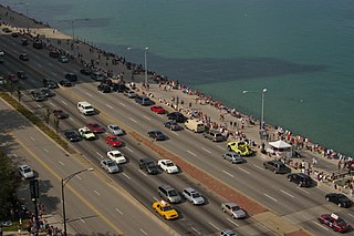
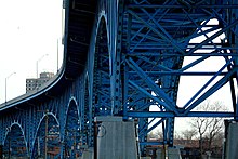
<span class="mw-page-title-main">Lake Shore Drive</span> Lake-side expressway in Chicago, Illinois, United States

Lake Shore Drive is a multilevel expressway that runs alongside the shoreline of Lake Michigan, and adjacent to parkland and beaches, in Chicago. Except for the portion north of Foster Avenue, Lake Shore Drive is designated as part of U.S. Highway 41.

<span class="mw-page-title-main">Ohio State Route 2</span> State highway in Ohio, United States

State Route 2, formerly known as Inter-county Highway 2 until 1921 and State Highway 2 in 1922, is an east–west highway crossing most of northern Ohio. Its western terminus is at the Indiana state line near Hicksville where the route becomes Indiana State Road 37 which continues to Fort Wayne, Indiana. The eastern terminus of the route is in Painesville Township in Lake County at U.S. Route 20 (US 20).

<span class="mw-page-title-main">Ohio State Route 59</span> State highway in Ohio, US

State Route 59 is an east–west state highway in the U.S. state of Ohio, serving the Akron metropolitan area. The western terminus of State Route 59 is in downtown Akron at a partial interchange with the Interstate 76/Interstate 77 concurrency, and the eastern terminus is at State Route 5, 0.5 miles (0.80 km) east of Ravenna. The route is approximately 23 miles (37 km) long and was certified in 1969 over what had previously been part of SR 5. It serves as a major or as the primary east–west roadway for the cities of Cuyahoga Falls, Kent, Ravenna, and Stow, the village of Silver Lake, and Franklin and Ravenna Townships.

<span class="mw-page-title-main">Interstate 490 (Ohio)</span> Highway in Ohio

Interstate 490 (I-490) is a 2.43-mile (3.91 km) auxiliary Interstate Highway in Cleveland, Ohio. The western terminus is a junction with I-90 and I-71 on Cleveland's west side. After spanning the Cuyahoga River, I-490 reaches its eastern terminus at a junction with East 55th Street, just east of I-77.

<span class="mw-page-title-main">Interstate 480 (Ohio)</span> Highway in Ohio

Interstate 480 (I-480) is a 41.77-mile-long (67.22 km) auxiliary Interstate Highway of I-80 in the US state of Ohio that passes through much of the Greater Cleveland area, including the southern parts of the city of Cleveland. I-480 is one of 13 auxiliary Interstate Highways in the state. The western terminus of I-480 is an interchange with I-80 and the Ohio Turnpike in North Ridgeville. Starting east through suburban Lorain County, I-480 enters Cuyahoga County, then approaches Cleveland Hopkins International Airport, which serves as the primary airport for Northeast Ohio. After traversing Brooklyn and crossing the Cuyahoga River on the Valley View Bridge, the highway continues east toward the communities of Bedford and Twinsburg toward its eastern terminus at I-80 and the Ohio Turnpike in Streetsboro. On its route, I-480 crosses I-71 and I-77 and is concurrent with I-271 for approximately four miles (6.4 km). In 1998, the governor of Ohio, George Voinovich, gave I-480 the additional name of the "Senator John Glenn Highway", in honor of the former NASA astronaut and US senator from Ohio for 24 years.

<span class="mw-page-title-main">Ohio State Route 176</span> State highway in Ohio, US

Ohio State Route 176 is a route linking Interstate 71 (I-71) in Cleveland to I-77 near Richfield. The freeway portion is known as the Jennings Freeway, while the at-grade portion is mostly Broadview Road.

<span class="mw-page-title-main">Ohio State Route 91</span> State highway in northeastern Ohio, US

State Route 91, formerly known as Inter-county Highway 91 until 1921 and State Highway 91 in 1922, is a north–south state highway in the northeastern portion of the U.S. state of Ohio. Its southern terminus is at U.S. Route 224 in Springfield Township, east of Akron. Its northern terminus is at State Route 283 on the Timberlake/Eastlake border less than one mile (1.6 km) south of Lake Erie.

<span class="mw-page-title-main">Ohio State Route 633</span> Highway in Ohio

State Route 633 is a short north–south state highway in the northeastern portion of the U.S. state of Ohio. Occupying a portion of Lloyd Road, SR 633 has its southern terminus at a signalized intersection with U.S. Route 20 (US 20) in Wickliffe. Its northern terminus is also in Wickliffe, but at a signalized intersection with Lakeland Boulevard, which provides access to current SR 2 freeway by way of a trumpet interchange just to the east.

<span class="mw-page-title-main">Interstate 90 in Ohio</span> Section of Interstate Highway in Ohio, United States

Interstate 90 (I-90) runs east–west across the northern tier of the US state of Ohio. Much of it is along the Ohio Turnpike, but sections outside the turnpike pass through Cleveland and northeast into Pennsylvania.

<span class="mw-page-title-main">Detroit–Shoreway</span> Neighborhood of Cleveland, Ohio, United States

Detroit–Shoreway is a neighborhood on the West Side of Cleveland, in the U.S. state of Ohio. Detroit–Shoreway consists of the streets between Lake Erie and Interstate 90, from West 85th to West 45th streets.

<span class="mw-page-title-main">Lakeland Freeway</span>

The Lakeland Freeway is a limited-access freeway in the northeastern suburbs of Cleveland, Ohio. It runs with and parallel to Interstate 90, and follows the shore of Lake Erie, linking the suburban areas of Lake County to Cleveland and Cuyahoga County.

<span class="mw-page-title-main">U.S. Route 20 in Pennsylvania</span>

U.S. Route 20 is an east-west U.S. Highway in Pennsylvania, which clips the northwestern corner of the state, running entirely in Erie County. While it is part of the nation's longest road, it features the shortest segment of any two-digit U.S. route in the commonwealth. Although bypassed by Interstate 90 (I-90) as the primary through route in the area, heavy traffic has led to nearly the entire highway being widened to four lanes in width.

<span class="mw-page-title-main">U.S. Route 6 in Ohio</span>

U.S. Route 6 (US 6) is a part of the United States Numbered Highway System that runs from Bishop, California, to Provincetown, Massachusetts. In Ohio, the road runs west–east from the Indiana state line near Edgerton to the Pennsylvania state line near Andover. The 248.002 miles (399.121 km) that lie in Ohio are maintained by the Ohio Department of Transportation (ODOT). US 6 serves the major cities of Sandusky, Lorain, and Cleveland. The highway is also called the Grand Army of the Republic Highway to honor the Union forces of the U.S. Civil War. The alternate name was designated in 1953.

<span class="mw-page-title-main">U.S. Route 20 in Ohio</span>

U.S. Route 20 is a United States Numbered Highway that runs from Newport, Oregon to Boston, Massachusetts. Within the state of Ohio, the route runs from the Indiana border near Edon to the Pennsylvania border at Conneaut. The route passes through rural areas west of Toledo, and passes through Public Square in Cleveland. It is one of 9 other routes to enter downtown Cleveland at Public Square, and it serves some of Cleveland's northeastern suburbs.

<span class="mw-page-title-main">Opportunity Corridor</span> Urban boulevard in Cleveland, OH

The Opportunity Corridor is a linear project in Cleveland, Ohio, with a boulevard that connects Interstate 77 (I-77) and I-490 to the University Circle neighborhood. "The purpose of the project is to improve the roadway network within a historically under-served, economically depressed area within the City of Cleveland." The corridor is entirely concurrent with Ohio State Route 10.

<span class="mw-page-title-main">Ohio State Route 175</span> State highway in Cuyahoga County, Ohio, US

State Route 175 (SR 175) is a 15.70-mile (25.27 km) long north–south state highway in the northeastern part of the U.S. state of Ohio. The southern terminus of SR 175 is at a signalized intersection with SR 43 in Solon. Its northern terminus is at a signalized intersection with SR 283 in Euclid.

<span class="mw-page-title-main">Edgewater, Cleveland</span> Neighborhood of Cleveland, Ohio, United States

Edgewater is a neighborhood on the West Side of Cleveland, Ohio. Located along the Lake Erie shoreline, it is situated approximately five miles west of downtown Cleveland. It extends east-to-west from the neighborhood of Detroit–Shoreway to the streetcar suburb of Lakewood and north-to-south from Lake Erie to the neighborhood of Cudell.

<span class="mw-page-title-main">Transportation in Cleveland</span>

The transportation system of Cleveland is a network that includes several modes of transportation including sidewalks, roads, public transit, bicycle paths and regional and international airports.

References

Template:Attached KML/Cleveland Memorial Shoreway
KML is from Wikidata
  1. Ohio Revised Code 5534.53
  2. Bullard, Stan (2019-02-03). "Prime West Shoreway Property is in Play". Crain's Cleveland Business . Retrieved 2020-06-07.
  3. Regional Association of Cleveland (1944-02-29). An Express Highway Plan for the Cleveland Metropolitan Area (Map). Reproduced in: Rose, William Ganson (1990) [Previously published in 1950]. Cleveland: The Making of a City. Kent, Ohio: Kent State University Press. p. 1019. ISBN   0873384288.
  4. "Connecting Cleveland: The Waterfront District Plan". City of Cleveland City Planning Commission. Retrieved 2011-06-28.
  5. 1 2 "Cleveland Urban Core Projects: Lakefront West". Ohio Department of Transportation. Retrieved 2014-09-06.
  6. Grant, Alison (2013-09-24). "West Shoreway Conversion to Boulevard with Lake Erie Access Gets Funding, Is Set to Begin in the Spring". The Plain Dealer . Retrieved 2013-09-25.
  7. "Lakefront West: Speed Limit Change & Herman Ave Bridge to Reopen to 2-Way Traffic" (Press release). Ohio Department of Transportation District 12. 2015-09-29. Retrieved 2015-10-05.
  8. Grant, Alison (2015-06-06). "West Shoreway Speed Limit Drops to 35 mph in the Fall as Boulevard Conversion Begins". The Plain Dealer. Retrieved 2015-06-07.
  9. 1 2 Litt, Steven (2017-08-23). "West Shoreway $100M re-do brings benefits, but falls short of original vision". The Plain Dealer. Retrieved 2017-08-25.
  10. Ohio Department of Transportation District 12 (2015-12-12). "West 73rd St Extension Opens link to Lake Erie on Cleveland's West Side" (Press release). Ohio Department of Transportation. Retrieved 2015-12-16.
  11. 1 2 3 "Cleveland Lakefront West: West Shoreway Reconstruction & W 28th/W 45th Street Safety Improvements". Ohio Department of Transportation.
  12. "Cleveland Historical Maps (1979)". peoplemaps.esri. Archived from the original on 2016-03-16. Retrieved 2016-03-18.