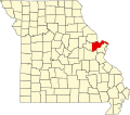
New Melle, Missouri | |
---|---|
Coordinates: 38°42′48″N90°52′36″W / 38.71333°N 90.87667°W | |
Country | United States |
State | Missouri |
County | St. Charles |
Government | |
• Mayor | Richard West (R) |
Area | |
• Total | 1.72 sq mi (4.46 km2) |
• Land | 1.68 sq mi (4.36 km2) |
• Water | 0.04 sq mi (0.10 km2) |
Elevation | 751 ft (229 m) |
Population (2020) | |
• Total | 541 |
• Density | 321.45/sq mi (124.13/km2) |
Time zone | UTC-6 (Central (CST)) |
• Summer (DST) | UTC-5 (CDT) |
FIPS code | 29-52148 [3] |
GNIS feature ID | 2395209 [2] |
New Melle is a small city in St. Charles County, Missouri, United States. It is located approximately 38 miles west of St. Louis. The population was 475 at the 2010 census.
New Melle was platted ca. 1850. [4] The community was named after Melle, Germany, the former home of a share of the first settlers. [5] A post office called New Melle has been in operation since 1850. [6] New Melle incorporated as a city in 1978. [7]
The Meier General Store and St. Paul's Church are listed on the National Register of Historic Places. [8]
According to the United States Census Bureau, the city has a total area of 1.61 square miles (4.17 km2), of which 1.57 square miles (4.07 km2) is land and 0.04 square miles (0.10 km2) is water. [9]
Census | Pop. | Note | %± |
---|---|---|---|
1880 | 264 | — | |
1980 | 168 | — | |
1990 | 486 | 189.3% | |
2000 | 124 | −74.5% | |
2010 | 475 | 283.1% | |
2020 | 541 | 13.9% | |
U.S. Decennial Census [10] |
As of the census [11] of 2010, there were 475 people, 179 households, and 143 families living in the city. The population density was 302.5 inhabitants per square mile (116.8/km2). There were 195 housing units at an average density of 124.2 per square mile (48.0/km2). The racial makeup of the city was 97.3% White, 0.6% African American, 0.8% Asian, 0.2% Pacific Islander, and 1.1% from other races. Hispanic or Latino of any race were 2.3% of the population.
There were 179 households, of which 30.2% had children under the age of 18 living with them, 74.3% were married couples living together, 2.8% had a female householder with no husband present, 2.8% had a male householder with no wife present, and 20.1% were non-families. 17.3% of all households were made up of individuals, and 10.6% had someone living alone who was 65 years of age or older. The average household size was 2.65 and the average family size was 3.01.
The median age in the city was 47.1 years. 23.2% of residents were under the age of 18; 4.1% were between the ages of 18 and 24; 20.1% were from 25 to 44; 30.1% were from 45 to 64; and 22.3% were 65 years of age or older. The gender makeup of the city was 48.6% male and 51.4% female.
As of the census [3] of 2000, there were 124 people, 44 households, and 35 families living in the city. The population density was 349.8 inhabitants per square mile (135.1/km2). There were 49 housing units at an average density of 138.2 per square mile (53.4/km2). The racial makeup of the city was 98.39% White and 1.61% African American.
There were 44 households, out of which 31.8% had children under the age of 18 living with them, 72.7% were married couples living together, 9.1% had a female householder with no husband present, and 18.2% were non-families. 15.9% of all households were made up of individuals, and 9.1% had someone living alone who was 65 years of age or older. The average household size was 2.82 and the average family size was 3.17.
In the city the population was spread out, with 25.8% under the age of 18, 4.0% from 18 to 24, 26.6% from 25 to 44, 31.5% from 45 to 64, and 12.1% who were 65 years of age or older. The median age was 41 years. For every 100 females there were 93.8 males. For every 100 females age 18 and over, there were 80.4 males.
The median income for a household in the city was $55,417, and the median income for a family was $67,917. Males had a median income of $51,250 versus. $24,167 for females. The per capita income for the city was $29,965. There were no families and 3.1% of the population living below the poverty line, including no under eighteens and none of those over 64.
New Melle is in the Francis Howell School District. Elementary school students attend Daniel Boone Elementary, middle school students attend Francis Howell Middle School, and high school students attend Francis Howell High School.
New Melle has a public library, a branch of the St. Charles City-County District Library. [12]
Brandsville is a city in southeastern Howell County, Missouri, United States. The population was 161 at the 2010 census.
Willow Springs is a city in Howell County, Missouri, in the Ozark Mountains of the United States. The population was 2,164 at the 2020 census.
Koshkonong is a city in Oregon County, Missouri, United States. The population was 196 at the 2020 census.
Cottleville is a city in St. Charles County, Missouri, United States. The population was 5,611 at the 2020 census.
Flint Hill is a town in northwestern St. Charles County, Missouri, United States. The population was 525 at the 2010 census.
Lowry City is a city in St. Clair County, Missouri, United States. The population was 613 at the 2020 census. Lowry City is the city where the Ozark Mountains meet the Great Plains.
Bella Villa is a city in St. Louis County, Missouri, in the United States. As of the 2010 census, the city population was 729.
Country Club Hills is a city in St. Louis County, Missouri, United States. The population was 1,274 at the 2010 census.
Crystal Lake Park is a Missouri Class 4 city in St. Louis County, Missouri, United States. The population was 508 at the 2020 census.
Hazelwood is a city in St. Louis County, Missouri, within Greater St. Louis. It is a second-ring northern suburb of St. Louis. Based on the 2020 United States census, the city had a total population of 25,485. It is located north of St. Louis-Lambert International Airport and is situated on Interstates 270 and 170, as well as the much-traveled Lindbergh Boulevard and Highway 370.
Jennings is a city in St. Louis County, Missouri, United States. Per the 2020 census, the population was 12,895.
Lakeshire is a city in St. Louis County, Missouri, United States. The population was 1,432 at the 2010 census.
Manchester is a city in St. Louis County, Missouri, United States. The population was 18,333 at the 2020 census.
Olivette is an inner-ring suburb of St. Louis, located in St. Louis County, Missouri, United States. The population was 8,504 at the 2020 census.
Pasadena Hills is a city in St. Louis County, Missouri, United States. The population was 930 at the 2010 census. The entire city is listed on the National Register of Historic Places.
Town and Country is a city in west St. Louis County, Missouri, United States with a population of 11,640 as of the 2020 census. It is home to Missouri Baptist Medical Center,.
Wildwood is a city in St. Louis County, Missouri, United States. It is located in the far western portion of the county. As of the 2020 census, the population was 35,417. Wildwood is the home of the Al Foster Trail, and numerous other trails, parks, and reserves such as Rockwoods Reservation and Babler State Park.
Clarkson Valley is a city in St. Louis County, Missouri, United States. The population was 2,609 at the 2020 census.
Moline Acres is a city in St. Louis County, Missouri, United States. The population was 2,442 at the 2010 census.
Dardenne Prairie is a city in St. Charles County, Missouri, United States. The population was 12,743 at the 2020 census.