
Wootton Rivers is a small village and civil parish in the Vale of Pewsey, Wiltshire, England. The village lies about 3 miles (5 km) northeast of Pewsey and 4 miles (6 km) south of Marlborough. During the 20th century its population halved and most of its facilities closed.

Edwardstone is a village and civil parish in the Babergh district, in the county of Suffolk, England. The parish contains the hamlets of Mill Green, Priory Green, Round Maple and Sherbourne Street, and Edwardstone Woods, a Site of Special Scientific Interest. The parish touches Boxford, Great Waldingfield, Groton, Little Waldingfield, Milden and Newton.

Stanford Rivers is a village and civil parish in the Epping Forest district of Essex, England. The parish, which is approximately 11 miles (18 km) west from the county town of Chelmsford, contains the village of Toot Hill and the hamlet of Little End, both settlements larger than Stanford Rivers village, and the hamlet of Clatterford End. The village is 2.0 miles (3 km) south-east of Chipping Ongar, 3 miles (5 km) south-west of North Weald Bassett and 3 miles north-west of Kelvedon Hatch. The parish covers an area of 1,749 hectares.
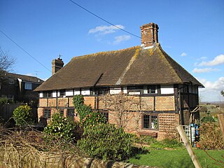
Blackstone is a hamlet in the civil parish of Woodmancote and the Horsham district of West Sussex, England. Blackstone is significant for its listed 17th- and 18th-century houses and cottages.

Matching is a village and civil parish in the Epping Forest district of Essex, England centred in countryside 3 miles (4.8 km) east of Harlow's modern town centre and 2 miles (3.2 km) from Old Harlow/Harlow Mills area of the town. The terrain is elevated and London is centred 21.7 miles (34.9 km) to the south-west.

Matching Green is a village and the largest settlement in the civil parish of Matching, in Essex, England. It is 3.0 miles (4.8 km) east of Harlow, 4.5 miles (7.2 km) north-west of Chipping Ongar and 3.9 miles (6.3 km) south-east of Sawbridgeworth.

Fiddlers Hamlet is a hamlet in the civil parish of Epping, within the Epping Forest District of Essex, England, and is 1 mile (1.6 km) south-east from the market town of Epping, separated by farm and fields. The M11 motorway runs 300 yards (274 m) to the east, with Junction 7 for Harlow being 4 miles (6 km) to the north.

Hastingwood is a hamlet in the North Weald Bassett civil parish of the Epping Forest district of Essex, England. The hamlet is centred on the junction of Hastingwood Road, which runs southwest to the A414 road and the Hastingwood Junction 7 of the M11 motorway, and Mill Street, which runs north to Harlow Common and Potter Street. Nearby settlements include the town of Harlow, North Weald and the hamlet of Foster Street.

Littley Green is a hamlet in the civil parish of Great Waltham and the Chelmsford borough of Essex, England. The hamlet is at the extreme north of Great Waltham, with the nearest settlement the hamlet of Hartford End, less than 1 mile (2 km) west in the civil parish of Felsted.

Stagden Cross is a hamlet in the civil parish of High Easter, and the Uttlesford district of Essex, England. The hamlet is 1 mile (1.6 km) east from High Easter village.

Cutlers Green is a hamlet in the civil parish of Thaxted, and the Uttlesford district of Essex, England. The hamlet is 1 mile (1.6 km) west from the town of Thaxted.

Housham Tye is a hamlet in the civil parish of Matching, and the Epping Forest district of Essex, England.
Hopesay is a civil parish in Shropshire, England. It contains 27 listed buildings that are recorded in the National Heritage List for England. Of these, one is listed at Grade I, the highest of the three grades, and the others are at Grade II, the lowest grade. The parish contains the villages of Hopesay, Aston on Clun, and Broome, and the surrounding countryside. Most of the listed buildings are houses, cottages, farmhouses, and farm buildings, many of which are timber framed dating from the 15th to the 17th centuries. The other listed buildings are a church, a bridge, four milestones and a telephone kiosk.
Loppington is a civil parish in Shropshire, England. It contains 42 listed buildings that are recorded in the National Heritage List for England. Of these, one is listed at Grade I, the highest of the three grades, and the others are at Grade II, the lowest grade. The parish contains the village of Loppington and smaller settlements, including Burlton, and is otherwise rural. Most of the listed buildings are houses and associated structures, cottages, farmhouses, and farm buildings, most of which are timber framed, and date from the 16th to the early 18th century. The other listed buildings include a church, a sundial and tombs in its churchyard, and a pound,
Minsterley is a civil parish in Shropshire, England. It contains 24 listed buildings that are recorded in the National Heritage List for England. Of these, two are at Grade II*, the middle of the three grades, and the others are at Grade II, the lowest grade. The parish contains the village of Minsterley and the surrounding countryside. Most of the listed buildings are houses, cottages, farmhouses and farm buildings, almost all those dating before the end of the 17th century being timber framed. The other listed buildings are a church, a group of tombs in the churchyard, a former toll house, a former watermill, a former malthouse, a milestone, a pump, a urinal, and a bridge.
Myddle, Broughton and Harmer Hill is a civil parish in Shropshire, England. It contains 24 listed buildings that are recorded in the National Heritage List for England. All the listed buildings are designated at Grade II, the lowest of the three grades, which is applied to "buildings of national importance and special interest". The parish contains the villages and smaller settlements of Alderton, Broughton, Harmer Hill, and Myddle, and the surrounding countryside. The oldest listed buildings are ruins; the remains of a church, a churchyard cross, and a castle. Most of the other listed buildings are houses, cottages, farmhouses and farm buildings, the earliest of which are timber framed. The rest of the listed buildings include churches and a chapel, a sundial in a churchyard, a public house, two mileposts, and a village pump and associated structures.
Onibury is a civil parish in Shropshire, England. It contains 25 listed buildings that are recorded in the National Heritage List for England. Of these, two are at Grade II*, the middle of the three grades, and the others are at Grade II, the lowest grade. The parish contains the village of Onibury and the surrounding countryside. Most of the listed buildings are houses, cottages, farm houses and farm buildings, the earliest of which are timber framed. The oldest building is a church, which is listed together with items in the churchyard. In the parish are a country house and a mansion, both of which are listed, together with associated structures. The other listed buildings include a gazebo, a former railway station, a war memorial, and a telephone kiosk.

Littlebury Green is a village in the civil parish of Littlebury and the district of Uttlesford in Essex, England.

Knowl Green is a hamlet in the civil parish of Belchamp St Paul and the Braintree district of Essex, England.

Pencombe with Grendon Warren is a civil parish in the county of Herefordshire, England. The parish was created in 1895 from the parishes of Pencombe and Grendon Warren, its only nucleated settlement being the village of Pencombe.

