Norddal

Last updated • 5 min readFrom Wikipedia, The Free Encyclopedia
Norddal Municipality
Norddal kommune
Norddalen herred  (historic name)
Eidsdal.JPG
View of Eidsdal
Norway Counties More og Romsdal Position.svg
Møre og Romsdal within Norway
NO 1524 Norddal.svg
Norddal within Møre og Romsdal
Coordinates: 62°17′32″N07°26′18″E / 62.29222°N 7.43833°E / 62.29222; 7.43833
Country Norway
County Møre og Romsdal
District Sunnmøre
Established1 Jan 1838
  Created as Formannskapsdistrikt
Disestablished1 Jan 2020
  Succeeded by Fjord Municipality
Administrative centre Sylte
Government
  Mayor (2015-2019)Arne Sandnes (Sp)
Area
 (upon dissolution)
  Total943.51 km2 (364.29 sq mi)
  Land900.46 km2 (347.67 sq mi)
  Water43.05 km2 (16.62 sq mi)  4.6%
  Rank#116 in Norway
Population
 (2018)
  Total1,670
  Rank#345 in Norway
  Density1.9/km2 (5/sq mi)
  Change (10 years)
Decrease2.svg −5.2%
Demonym Norddaling [1]
Official language
[2]
   Norwegian form Nynorsk
Time zone UTC+01:00 (CET)
  Summer (DST) UTC+02:00 (CEST)
ISO 3166 code NO-1524 [3]

Norddal is a former municipality in Møre og Romsdal county, Norway. It merged with Stordal municipality to establish the new Fjord municipality in 2020. It covered the easternmost part of the Sunnmøre region along the border with Oppland county. The municipal center of the municipality was the village of Sylte (also known as Valldal ) in the Valldalen valley.

Contents

Norddal covered an area with several distinct valleys and villages: Eidsdal and Norddal (Dalsbygda) in the south; Tafjord in the east; and Fjørå/Selboskarbygda and Sylte in the Valldalen valley in the north. Norwegian County Road 63 traverses the municipality from south to north, going through several tunnels in the mountains including the Stordal Tunnel. The Heggur Tunnel connects the isolated village of Tafjord with the rest of the municipality.

At the time if its dissolution in 2020, the 944-square-kilometre (364 sq mi) municipality is the 116th largest by area out of the 422 municipalities in Norway. Norddal is the 345th most populous municipality in Norway with a population of 1,670. The municipality's population density is 1.9 inhabitants per square kilometre (4.9/sq mi) and its population has decreased by 5.2% over the last decade. [4] [5]

General information

The prestegjeld of Norddal was established as a municipality on 1 January 1838 (see formannskapsdistrikt law). Historically, the district of Sunnylven was part of the parish of Norddal, but on 1 January 1838 when Norddal municipality was established, Sunnylven was established as its own municipality, separate from Norddal. The municipal borders have not changed since that time. [6]

On 1 January 2020, the neighboring municipalities of Norddal (population: 1,670) and Stordal (population: 972) were merged into the new Fjord Municipality. [7]

Name

The municipality (originally the parish) is named after the old Dale farm (Old Norse : Dalr) since the first Dale Church was built there. Historically, the parish was known as simply as Dale. Around the year 1600, the first element, nord , was added. This prefix means "northern". The last element of the name is dalr which means "valley" or "dale". [8] Historically, the name of the municipality was spelled Norddalen. On 3 November 1917, a royal resolution changed the spelling of the name of the municipality to Norddal, removing the definite form ending -en. [9]

Coat of arms

The coat of arms was granted on 16 February 1990 and they were in use until the municipality was dissolved on 1 January 2020. The official blazon is "Or, a strawberry branch gules" (Norwegian : På gull grunn ein raud jordbærstengel). This means the arms have a field (background) has a tincture of Or which means it is commonly colored yellow, but if it is made out of metal, then gold is used. The charge is a red strawberry branch with a three-part leaf and three berries. This design was chosen because Norddal has a tradition for producing fruits such as apples, pears, and berries, notably strawberries. Wild strawberries can be found growing all over the municipality. The arms were designed by Astor Furseth. The municipal flag has the same design as the coat of arms. [10] [11] [12] [13]

Churches

The Church of Norway had one parish (sokn) within the municipality of Norddal. It was part of the Austre Sunnmøre prosti (deanery) in the Diocese of Møre.

Churches in Norddal
Parish (sokn)Church nameLocation of the churchYear built
Norddal Norddal Church Norddal 1782
Sylte Church Sylte 1863

History

Valldal is mentioned in the historical books of Snorri Sturluson. While escaping the Danish army, Olav Haraldsson, later to become St. Olav, went ashore in Valldalen during the winter 1028/1029. Here, he supposedly came across a troublesome "sea serpent" which he tossed onto the mountainside and can today be seen as a lighter rock pattern above the town centre Sylte. On his journey up the valley towards Trollstigen, he received help from the farmers at Grønning to pass a rocky section called Skjærsura. For this help he deemed that the seed crop would never suffer from frost. Also, a natural spring in Valldal is named after St. Olav and is said to have a healing effect.

In 2008, a memorial stone was erected at the farm Døving, about 3 kilometres (1.9 mi) up the valley from the sea, where the first church and cemetery is believed to have been located.

Government

While it existed, this municipality was responsible for primary education (through 10th grade), outpatient health services, senior citizen services, unemployment, social services, zoning, economic development, and municipal roads. During its existence, this municipality was governed by a municipal council of directly elected representatives. The mayor was indirectly elected by a vote of the municipal council. [14] The municipality fell under the Sunnmøre District Court and the Frostating Court of Appeal.

Municipal council

The municipal council (Kommunestyre) of Norddal was made up of 17 representatives that were elected to four year terms. The party breakdown for the final municipal council was as follows:

Norddal kommunestyre 20162019 [15]   
Party name (in Nynorsk)Number of
representatives
  Labour Party (Arbeidarpartiet)2
  Centre Party (Senterpartiet)9
  Socialist Left Party (Sosialistisk Venstreparti)1
  Cross-party list for Norddal (Tverrpolitisk liste for Norddal)5
Total number of members:17
Norddal kommunestyre 20122015 [16]   
Party name (in Nynorsk)Number of
representatives
  Labour Party (Arbeidarpartiet)6
  Progress Party (Framstegspartiet)1
  Centre Party (Senterpartiet)3
  Cross-party list for Norddal (Tverpolitisk liste for Norddal)4
  Norddal List (Norddalslista)7
Total number of members:21
Norddal kommunestyre 20082011 [15]   
Party name (in Nynorsk)Number of
representatives
  Labour Party (Arbeidarpartiet)4
  Progress Party (Framstegspartiet)2
  Centre Party (Senterpartiet)5
  Cross-party list for Norddal (Tverpolitisk liste for Norddal)3
  Norddal List (Norddalslista)7
Total number of members:21
Norddal kommunestyre 20042007 [15]   
Party name (in Nynorsk)Number of
representatives
  Labour Party (Arbeidarpartiet)2
  Progress Party (Framstegspartiet)3
  Conservative Party (Høgre)1
  Christian Democratic Party (Kristeleg Folkeparti)2
  Centre Party (Senterpartiet)6
  Socialist Left Party (Sosialistisk Venstreparti)1
  Action List for Norddal (Aksjonslista for Norddal)4
  Norddal List (Norddalslista)2
Total number of members:21
Norddal kommunestyre 20002003 [15]   
Party name (in Nynorsk)Number of
representatives
  Labour Party (Arbeidarpartiet)4
  Progress Party (Framstegspartiet)1
  Conservative Party (Høgre)1
  Christian Democratic Party (Kristeleg Folkeparti)3
  Centre Party (Senterpartiet)9
  Socialist Left Party (Sosialistisk Venstreparti)1
  Liberal Party (Venstre)2
Total number of members:21
Norddal kommunestyre 19961999 [17]   
Party name (in Nynorsk)Number of
representatives
  Labour Party (Arbeidarpartiet)3
  Conservative Party (Høgre)1
  Christian Democratic Party (Kristeleg Folkeparti)3
  Centre Party (Senterpartiet)9
  Socialist Left Party (Sosialistisk Venstreparti)1
  Liberal Party (Venstre)4
Total number of members:21
Norddal kommunestyre 19921995 [18]   
Party name (in Nynorsk)Number of
representatives
  Labour Party (Arbeidarpartiet)4
  Conservative Party (Høgre)2
  Christian Democratic Party (Kristeleg Folkeparti)3
  Centre Party (Senterpartiet)10
  Liberal Party (Venstre)2
Total number of members:21
Norddal kommunestyre 19881991 [19]   
Party name (in Nynorsk)Number of
representatives
  Labour Party (Arbeidarpartiet)3
  Conservative Party (Høgre)4
  Christian Democratic Party (Kristeleg Folkeparti)3
  Centre Party (Senterpartiet)9
  Liberal Party (Venstre)2
Total number of members:21
Norddal kommunestyre 19841987 [20]   
Party name (in Nynorsk)Number of
representatives
  Labour Party (Arbeidarpartiet)3
  Conservative Party (Høgre)4
  Christian Democratic Party (Kristeleg Folkeparti)3
  Centre Party (Senterpartiet)8
  Liberal Party (Venstre)2
  Socialist common list (Sosialistisk fellesliste)1
Total number of members:21
Norddal kommunestyre 19801983 [21]   
Party name (in Nynorsk)Number of
representatives
  Labour Party (Arbeidarpartiet)2
  Conservative Party (Høgre)3
  Christian Democratic Party (Kristeleg Folkeparti)4
  Centre Party (Senterpartiet)9
  Liberal Party (Venstre)3
Total number of members:21
Norddal kommunestyre 19761979 [22]   
Party name (in Nynorsk)Number of
representatives
  Labour Party (Arbeidarpartiet)1
  Local list for Eidsdal (Bygdeliste for Eidsdal)6
  Local list for Valldal (Bygdeliste for Valldal)10
  Local list for Fjørå (Bygdeliste for Fjørå)1
  Local list for Tafjord (Bygdeliste for Tafjord)1
  Local list for Dalsbygda (Bygdeliste for Dalsbygda)2
Total number of members:21
Norddal kommunestyre 19721975 [23]   
Party name (in Nynorsk)Number of
representatives
  Labour Party (Arbeidarpartiet)3
  Local List(s) (Lokale lister)18
Total number of members:21
Norddal kommunestyre 19681971 [24]   
Party name (in Nynorsk)Number of
representatives
  Local List(s) (Lokale lister)21
Total number of members:21
Norddal kommunestyre 19641967 [25]   
Party name (in Nynorsk)Number of
representatives
  Local List(s) (Lokale lister)21
Total number of members:21
Norddal heradsstyre 19601963 [26]   
Party name (in Nynorsk)Number of
representatives
  Local List(s) (Lokale lister)21
Total number of members:21
Norddal heradsstyre 19561959 [27]   
Party name (in Nynorsk)Number of
representatives
  Local List(s) (Lokale lister)21
Total number of members:21
Norddal heradsstyre 19521955 [28]   
Party name (in Nynorsk)Number of
representatives
  Labour Party (Arbeidarpartiet)1
  Local List(s) (Lokale lister)19
Total number of members:20
Norddal heradsstyre 19481951 [29]   
Party name (in Nynorsk)Number of
representatives
  Local List(s) (Lokale lister)20
Total number of members:20
Norddal heradsstyre 19451947 [30]   
Party name (in Nynorsk)Number of
representatives
  Local List(s) (Lokale lister)20
Total number of members:20
Norddal heradsstyre 19381941* [31]   
Party name (in Nynorsk)Number of
representatives
  Labour Party (Arbeidarpartiet)2
  Local List(s) (Lokale lister)18
Total number of members:20
Note: Due to the German occupation of Norway during World War II, no elections were held for new municipal councils until after the war ended in 1945.

Mayors

The mayors of Norddal:

  • 1838-1844: Arne Iversen Grønningsæter
  • 1844-1847: Lars Larsen Myren
  • 1848-1879: Elias Arnesson Grønningsæter
  • 1880-1883: Elias O. Uri
  • 1884-1919: Nils E. Grønningsæter
  • 1920-1928: Gerhard Grønningsæter
  • 1929-1934: Nils J. Linge
  • 1935-1941: Gerhard Grønningsæter
  • 1941-1942: Elias Øien (NS)
  • 1942-1945: Ole K. Løvoll (NS)
  • 1945-1945: Gerhard Grønningsæter
  • 1946-1947: Elias Øien
  • 1948-1955: Karl Linge
  • 1956-1959: Nils P. Linge
  • 1960-1963: Elias Lingås
  • 1964-1967: Magnus Berdal
  • 1967-1967: Karl A. Døving
  • 1968-1971: Kåre Nerhagen
  • 1972-1973: Ragnar Lødøen
  • 1974-1975: Per Berge
  • 1976-1987: Karl A. Døving (Sp)
  • 1988-1993: Arne Sandnes (Sp)
  • 1994-1999: Gudmund Relling (V)
  • 1999-2007: Arne Sandnes (Sp)
  • 2007-2015: Bjørn Inge Ruset (Ap)
  • 2015-2019: Arne Sandnes (Sp)

Geography

The municipality was located around the Norddalsfjorden and the Tafjorden which flow west to east. They are the innermost branches off the main Storfjorden. Stranda Municipality lies to the west and south, Skjåk Municipality lies to the southeast, Rauma Municipality lies to the east and north, and Stordal Municipality lies to the northwest.

The main Valldalen valley runs to the northeast from the fjord. The valleys are surrounded by the Tafjordfjella mountain range. The mountains Puttegga, Karitinden, and Tordsnose sit on the eastern border of the municipality. The mountain Høgstolen lies in the northern part of the municipality. Reinheimen National Park is located partially in the municipality of Norddal.

See also

Related Research Articles

<span class="mw-page-title-main">Surnadal</span> Municipality in Møre og Romsdal, Norway

Surnadal is a municipality in Møre og Romsdal county, Norway. It is part of the Nordmøre region. The administrative centre is the village of Skei. Other villages in Surnadal include Glærem, Mo, Stangvik, Surnadalsøra, Sylte, Todalsøra, and Åsskard.

<span class="mw-page-title-main">Halsa</span> Former municipality in Norway

Halsa is a former municipality in Møre og Romsdal county, Norway. The municipality existed from 1838 until 2020 when it became part of Heim Municipality in Trondelag county. It was part of the Nordmøre region. The administrative centre of Halsa was the village of Liabøen. Other villages in the municipality included Todalen, Halsanaustan, Valsøyfjord, Engan, Hjellnes, and Valsøybotnen.

<span class="mw-page-title-main">Sande, Møre og Romsdal</span> Municipality in Møre og Romsdal, Norway

Sande is a municipality in Møre og Romsdal county, Norway. It is part of the Sunnmøre region. The administrative centre is the village of Larsnes on the island of Gurskøya. Other villages in Sande include Gursken, Sandshamn, Bringsinghaug, and Voksa.

<span class="mw-page-title-main">Herøy, Møre og Romsdal</span> Municipality in Møre og Romsdal, Norway

Herøy is a municipality in Møre og Romsdal county, Norway. It is part of the Sunnmøre region. The administrative centre is the town of Fosnavåg on the island of Bergsøya. The industrial area of Eggesbønes is located south of Fosnavåg on the same island. The Runde Environmental Centre is located in the northern part of the municipality on Runde island. Other population centres in Herøy include the villages of Leikong, Kvalsund, or Moltustranda.

<span class="mw-page-title-main">Hareid</span> Municipality in Møre og Romsdal, Norway

Hareid is a municipality in Møre og Romsdal county, Norway. It is part of the Sunnmøre region. The administrative centre is the village of Hareid. The other main population centers are Brandal and Hjørungavåg.

<span class="mw-page-title-main">Volda</span> Municipality in Møre og Romsdal, Norway

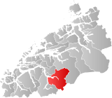
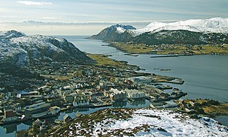
Volda is a municipality in Møre og Romsdal county, Norway. It is part of the Sunnmøre region. The administrative centre is the village of Volda. Other villages in the municipality include Dravlaus, Fyrde, Straumshamn, Leira, Bjørke, and Grodås. The municipality is located about 50 kilometres (31 mi) south of the town of Ålesund.

<span class="mw-page-title-main">Ørsta</span> Municipality in Møre og Romsdal, Norway

is a municipality in Møre og Romsdal county, Norway. It is part of the Sunnmøre region of Western Norway. The administrative centre of the municipality is the village of Ørsta. Other villages in the municipality include Hovdebygda, Flåskjer, Liadal, Urke, Barstadvik, Åmdalen, Follestaddalen, Nordre Vartdal, Vartdal, Sæbø, Sætre, Store-Standal, and Ytre Standal.

<span class="mw-page-title-main">Ørskog</span> Former municipality in Møre og Romsdal, Norway

Ørskog is a former municipality in Møre og Romsdal county, Norway. It was part of the Sunnmøre region. The administrative centre was the village of Sjøholt. The other main village was Vaksvika, about 7.5 kilometres (4.7 mi) south of Sjøholt. The European Route E39/E136 highway runs through the municipality, connecting the towns of Ålesund and Molde. Rauma Group is the largest company in Ørskog in terms of turnover.

<span class="mw-page-title-main">Stranda</span> Municipality in Møre og Romsdal, Norway

Stranda is a municipality in Møre og Romsdal county, Norway. It is part of the Sunnmøre region. The administrative centre of the municipality is the village of Stranda. Stranda consists of three smaller villages and one larger central village. The smaller villages are Hellesylt, Geiranger, and Liabygda. The central village, Stranda, has about 2,600 inhabitants. Stranda Municipality is known for tourist attractions such as Geirangerfjorden, Sunnylvsfjorden, and the ski area at Strandafjellet.

<span class="mw-page-title-main">Stordal</span> Former municipality in Norway

Stordal is a former municipality in Møre og Romsdal county, Norway. It merged with Norddal municipality to establish the new Fjord municipality in 2020. It was part of the Sunnmøre region. The administrative centre of the municipality was the village of Stordal. The historic farm and museum of Ytste Skotet lies along the Storfjorden in the western part of the municipality. Most of the municipality lies on the eastern side of the fjord.

<span class="mw-page-title-main">Sykkylven</span> Municipality in Møre og Romsdal, Norway

Sykkylven is a municipality in Møre og Romsdal county, Norway. It is part of the Sunnmøre region. The administrative centre is the village of Aure. Other villages in the municipality include Ikornnes, Straumgjerde, and Tusvik.

<span class="mw-page-title-main">Skodje</span> Former municipality in Norway

Skodje is a former municipality in Møre og Romsdal county, Norway. It was part of the Sunnmøre region. The administrative centre was the village of Skodje. The other main village in the municipality was Valle.

<span class="mw-page-title-main">Haram, Norway</span> Municipality in Norway

Haram is a municipality in Møre og Romsdal county, Norway. It is part of the Sunnmøre region. The administrative center is Brattvåg, the industrial center of Sunnmøre. Other important villages in the municipality include Austnes, Eidsvik, Helle, Longva, Hildrestranda, Søvik, Tennfjord, and Vatne.

<span class="mw-page-title-main">Vestnes</span> Municipality in Møre og Romsdal, Norway

Vestnes is a municipality in Møre og Romsdal county, Norway. Vestnes is part of the traditional district of Romsdal. The administrative centre of the municipality is the village of Vestnes. Other villages in the municipality include Vikebukt, Vik, Vågstranda, Øverås, Fiksdal, Tomrefjord, and Tresfjord.

<span class="mw-page-title-main">Nesset</span> Former municipality in Norway

Nesset is a former municipality in Møre og Romsdal county, Norway on the Romsdal Peninsula. The administrative centre was the village of Eidsvåg. Other population centers included Rausand, Boggestranda, Myklebostad, Eresfjord, and Eikesdalen.

<span class="mw-page-title-main">Sandøy</span> Former municipality in Norway

Sandøy is a former municipality in Møre og Romsdal county, Norway. It was part of the Romsdal region. The administrative centre was the village of Steinshamn. Other villages included Ona and Myklebost. The municipality was spread out over many islands in the mouth of the vast Romsdal Fjord. The Flatflesa Lighthouse and Ona Lighthouse protect the boats traveling around the municipality. The Nordøy Fixed Link project was constructed from 2018 until 2023 and it includes three undersea tunnels and several bridges that will connect the main islands of Sandøy Municipality and the islands of Haram Municipality to the mainland.

<span class="mw-page-title-main">Aukra</span> Municipality in Møre og Romsdal, Norway

Aukra is municipality in Møre og Romsdal county, Norway. It is part of the region of Romsdalen. The administrative centre is the village of Falkhytta, which is part of the Aukrasanden urban area.

<span class="mw-page-title-main">Fræna</span> Former municipality in Norway

Fræna is a former municipality in Møre og Romsdal county, Norway. It was part of the region of Romsdal. The municipality was located on the Romsdal peninsula surrounding the Frænfjorden, the eastern shore of the Julsundet strait, and includes most of the Hustadvika area. It also included the now-abandoned Bjørnsund islands.

<span class="mw-page-title-main">Eide</span> Former municipality in Norway

Eide is a former municipality in Møre og Romsdal county, Norway. It was part of the region of Nordmøre. It was located on the Romsdal peninsula, along the Kornstadfjorden and the Kvernesfjorden. The administrative centre of the municipality was the village of Eide. Other villages included Lyngstad, Vevang, and Visnes.

<span class="mw-page-title-main">Gjemnes</span> Municipality in Møre og Romsdal, Norway

Gjemnes is a municipality in Møre og Romsdal county, Norway on the Romsdal peninsula. It is part of the Nordmøre region. The administrative centre is the village of Batnfjordsøra, which lies along the Batnfjorden and it is a former steamship landing place. Other villages in Gjemnes include Torvikbukt, Flemma, Angvika, Gjemnes, Øre, and Osmarka.

References

  1. "Navn på steder og personer: Innbyggjarnamn" (in Norwegian). Språkrådet.
  2. "Forskrift om målvedtak i kommunar og fylkeskommunar" (in Norwegian). Lovdata.no.
  3. Bolstad, Erik; Thorsnæs, Geir, eds. (26 January 2023). "Kommunenummer". Store norske leksikon (in Norwegian). Kunnskapsforlaget.
  4. Statistisk sentralbyrå (2018). "Table: 06913: Population 1 January and population changes during the calendar year (M)" (in Norwegian). Retrieved 24 August 2019.
  5. Statistisk sentralbyrå. "09280: Area of land and fresh water (km²) (M)" (in Norwegian). Retrieved 24 August 2019.
  6. Jukvam, Dag (1999). Historisk oversikt over endringer i kommune- og fylkesinndelingen (PDF) (in Norwegian). Statistisk sentralbyrå. ISBN   9788253746845.
  7. Sivertstøl, Anette (9 August 2017). "Stordal og Norddal blir truleg Fjord kommune". Sunnmørsposten (in Norwegian). Retrieved 17 October 2017.
  8. Rygh, Oluf (1908). Norske gaardnavne: Romsdals amt (in Norwegian) (13 ed.). Kristiania, Norge: W. C. Fabritius & sønners bogtrikkeri. pp. 115 and 121.
  9. "Norsk Lovtidende. 2den Afdeling. 1917. Samling af Love, Resolutioner m.m". Norsk Lovtidend (in Norwegian). Kristiania, Norge: Grøndahl og Søns Boktrykkeri: 1057–1065. 1917.
  10. Store norske leksikon. "Norddal" (in Norwegian). Retrieved 28 June 2013.
  11. "Civic heraldry of Norway - Norske Kommunevåpen". Heraldry of the World. Retrieved 5 April 2023.
  12. "Norddal, Møre og Romsdal (Norway)". Flags of the World. Retrieved 5 April 2023.
  13. "Godkjenning av våpen og flagg". Lovdata.no (in Norwegian). Norges kommunal- og arbeidsdepartementet. 16 February 1990. Retrieved 5 April 2023.
  14. Hansen, Tore; Vabo, Signy Irene, eds. (20 September 2022). "kommunestyre". Store norske leksikon (in Norwegian). Kunnskapsforlaget . Retrieved 1 January 2023.
  15. 1 2 3 4 "Table: 04813: Members of the local councils, by party/electoral list at the Municipal Council election (M)" (in Norwegian). Statistics Norway.
  16. "Tall for Norge: Kommunestyrevalg 2011 - Møre og Romsdal" (in Norwegian). Statistics Norway. Retrieved 19 October 2019.
  17. "Kommunestyrevalget 1995" (PDF) (in Norwegian). Oslo-Kongsvinger: Statistisk sentralbyrå. 1996. Retrieved 26 April 2020.
  18. "Kommunestyrevalget 1991" (PDF) (in Norwegian). Oslo-Kongsvinger: Statistisk sentralbyrå. 1993. Retrieved 26 April 2020.
  19. "Kommunestyrevalget 1987" (PDF) (in Norwegian). Oslo-Kongsvinger: Statistisk sentralbyrå. 1988. Retrieved 26 April 2020.
  20. "Kommunestyrevalget 1983" (PDF) (in Norwegian). Oslo-Kongsvinger: Statistisk sentralbyrå. 1984. Retrieved 26 April 2020.
  21. "Kommunestyrevalget 1979" (PDF) (in Norwegian). Oslo: Statistisk sentralbyrå. 1979. Retrieved 26 April 2020.
  22. "Kommunevalgene 1975" (PDF) (in Norwegian). Oslo: Statistisk sentralbyrå. 1977. Retrieved 26 April 2020.
  23. "Kommunevalgene 1972" (PDF) (in Norwegian). Oslo: Statistisk sentralbyrå. 1973. Retrieved 26 April 2020.
  24. "Kommunevalgene 1967" (PDF) (in Norwegian). Oslo: Statistisk sentralbyrå. 1967. Retrieved 26 April 2020.
  25. "Kommunevalgene 1963" (PDF) (in Norwegian). Oslo: Statistisk sentralbyrå. 1964. Retrieved 26 April 2020.
  26. "Kommunevalgene og Ordførervalgene 1959" (PDF) (in Norwegian). Oslo: Statistisk sentralbyrå. 1960. Retrieved 26 April 2020.
  27. "Kommunevalgene og Ordførervalgene 1955" (PDF) (in Norwegian). Oslo: Statistisk sentralbyrå. 1957. Retrieved 26 April 2020.
  28. "Kommunevalgene og Ordførervalgene 1951" (PDF) (in Norwegian). Oslo: Statistisk sentralbyrå. 1952. Retrieved 26 April 2020.
  29. "Kommunevalgene og Ordførervalgene 1947" (PDF) (in Norwegian). Oslo: Statistisk sentralbyrå. 1948. Retrieved 26 April 2020.
  30. "Kommunevalgene og Ordførervalgene 1945" (PDF) (in Norwegian). Oslo: Statistisk sentralbyrå. 1947. Retrieved 26 April 2020.
  31. "Kommunevalgene og Ordførervalgene 1937" (PDF) (in Norwegian). Oslo: Statistisk sentralbyrå. 1938. Retrieved 26 April 2020.