Oil Trough, Arkansas

Last updated

Oil Trough, Arkansas
Independence County Arkansas Incorporated and Unincorporated areas Oil Trough Highlighted 0551410.svg
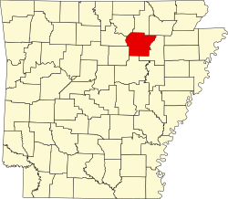
Location of Oil Trough in Independence County, Arkansas.
Coordinates: 35°37′45″N91°27′40″W / 35.62917°N 91.46111°W / 35.62917; -91.46111 [1]
Country United States
State Arkansas
County Independence
Area
[2]
  Total0.23 sq mi (0.59 km2)
  Land0.23 sq mi (0.59 km2)
  Water0.00 sq mi (0.00 km2)
Elevation
[1]
236 ft (72 m)
Population
 (2020)
  Total226
  Density986.90/sq mi (381.42/km2)
Time zone UTC-6 (Central (CST))
  Summer (DST) UTC-5 (CDT)
ZIP code
72564
Area code 870
FIPS code 05-51410
GNIS feature ID2407039 [1]

Oil Trough is a town in Independence County, Arkansas, United States. The population was 260 at the 2010 census. [3] The town is believed to have acquired its name in the early 19th century from a trough used to render bear fat, which was sold to customers in New Orleans. [4]

Contents

Geography

Oil Trough is located on the south bank of the White River along Arkansas Highway 14 between Elmo, approximately four miles to the east and Rosie, five miles to the west. Arkansas Highway 122 crosses the White River about one mile east of the community, and connects to Newark, about five miles to the north. [5]

According to the United States Census Bureau, the town has a total area of 0.5 km2 (0.2 mi2), all land. [6]

Demographics

Historical population
CensusPop.Note
1960 237
1970 524121.1%
1980 280−46.6%
1990 208−25.7%
2000 2184.8%
2010 26019.3%
2020 226−13.1%
U.S. Decennial Census [7]

As of the census [8] of 2010, there were 260 people, 95 households, and 66 families residing in the town. The population density was 443.0/km2 (1,139.0/mi2). There were 105 housing units at an average density of 213.4/km2 (548.6/mi2). The racial makeup of the town was 93.58% White, 3.21% Black or African American, 1.38% Native American, and 1.83% from two or more races.

There were 95 households, out of which 34.7% had children under the age of 18 living with them, 49.5% were married couples living together, 12.6% had a female householder with no husband present, and 30.5% were non-families. 29.5% of all households were made up of individuals, and 14.7% had someone living alone who was 65 years of age or older. The average household size was 2.29 and the average family size was 2.74.

In the town, the population was spread out, with 27.5% under the age of 18, 4.6% from 18 to 24, 27.5% from 25 to 44, 27.1% from 45 to 64, and 13.3% who were 65 years of age or older. The median age was 38 years. For every 100 females, there were 98.2 males. For every 100 females age 18 and over, there were 90.4 males.

The median income for a household in the town was $31,528, and the median income for a family was $33,750. Males had a median income of $30,500 versus $21,250 for females. The per capita income for the town was $14,079. About 13.3% of families and 11.0% of the population were below the poverty line, including 9.6% of those under the age of 18 and 22.2% of those 65 or over.

Education

Residents are zoned to the Cedar Ridge School District. [9]

On July 1, 1990, the Oil Trough School District was dissolved, with portions going to the Newark School District and the Southside School District. The Newark district, which took Oil Trough itself, merged into the Cedar Ridge School District on July 1, 2004. [10]

Related Research Articles

<span class="mw-page-title-main">Independence County, Arkansas</span> County in Arkansas, United States

Independence County is a county located in the U.S. state of Arkansas. As of the 2020 census, the population was 37,938. The county seat is Batesville. Independence County is Arkansas's ninth county, formed on October 20, 1820, from a portion of Lawrence County and named in commemoration of the Declaration of Independence. It is an alcohol prohibition or dry county.

<span class="mw-page-title-main">Greenway, Arkansas</span> City in Arkansas, United States

Greenway is a city in eastern Clay County, Arkansas, United States. The population was 209 at the 2010 census.

<span class="mw-page-title-main">Emerson, Arkansas</span> Town in Arkansas, United States

Emerson is a town in Columbia County, Arkansas, United States. The population was 368 at the 2010 census.

<span class="mw-page-title-main">Anthonyville, Arkansas</span> Town in Arkansas, United States

Anthonyville is a town in Crittenden County, Arkansas, United States. The population was 161 at the 2010 census, down from 250 in 2000.

<span class="mw-page-title-main">Edmondson, Arkansas</span> Town in Arkansas, United States

Edmondson is a town in Crittenden County, Arkansas, United States. The population was 427 at the 2010 census.

<span class="mw-page-title-main">Horseshoe Lake, Arkansas</span> Town in Arkansas, United States

Horseshoe Lake is a town in Crittenden County, Arkansas, United States. The population was 264 at the 2020 census.

<span class="mw-page-title-main">Jericho, Arkansas</span> Town in Arkansas, United States

Jericho is a town in Crittenden County, Arkansas, United States. The population was 119 at the 2010 census, down from 184 in 2000.

<span class="mw-page-title-main">Wooster, Arkansas</span> City in Arkansas, United States

Wooster is a city in Faulkner County, Arkansas, United States. The population was 860 at the 2010 census, up from 516 at the 2000 census. It is part of the Central Arkansas region.

<span class="mw-page-title-main">Magness, Arkansas</span> Town in Arkansas, United States

Magness is a town in Independence County, Arkansas, United States. The population was 202 at the 2010 census. The mayor is Jerrit Pectol.

<span class="mw-page-title-main">Sulphur Rock, Arkansas</span> Town in Arkansas, United States

Sulphur Rock is a town in Independence County, Arkansas, United States. The population was 456 at the 2010 census.

<span class="mw-page-title-main">Amagon, Arkansas</span> Town in Arkansas, United States

Amagon is a town in Jackson County, Arkansas, United States. The population was 98 at the 2010 census. It is the birthplace of former Governor of Arkansas Mike Beebe.

<span class="mw-page-title-main">Beedeville, Arkansas</span> Town in Arkansas, United States

Beedeville is a town in Jackson County, Arkansas, United States. The population was 107 at the 2010 census.

<span class="mw-page-title-main">Tupelo, Arkansas</span> Town in Arkansas, United States

Tupelo is a town in Jackson County, Arkansas, United States. The population was 180 at the 2010 census.

<span class="mw-page-title-main">LaGrange, Arkansas</span> Town in Arkansas, United States

LaGrange is a town in Lee County, Arkansas, United States. The population was 89 at the 2010 census, down from 122 at the 2000 census.

<span class="mw-page-title-main">Morrison Bluff, Arkansas</span> Town in Arkansas, United States

Morrison Bluff is a town in Logan County, Arkansas, United States. The population was 64 at the 2010 census and an estimated 81 in 2017.

<span class="mw-page-title-main">Hindsville, Arkansas</span> Town in Arkansas, United States

Hindsville is a town in Madison County, Arkansas, United States. The population was 90 at the 2020 census. It is part of the Northwest Arkansas region.

<span class="mw-page-title-main">Oden, Arkansas</span> Town in Arkansas, United States

Oden is a town in Montgomery County, Arkansas, United States. As of the 2020 census, its population was 180, down from 232 in 2010.

<span class="mw-page-title-main">Bodcaw, Arkansas</span> Town in Arkansas, United States

Bodcaw is a town in Nevada County, Arkansas, United States. The population was 121 at the 2020 census. It is part of the Hope Micropolitan Statistical Area.

<span class="mw-page-title-main">Rosston, Arkansas</span> Town in Arkansas, United States

Rosston is a town in south-central Nevada County, Arkansas, United States. The population was 265 at the 2000 census. It is part of the Hope Micropolitan Statistical Area.

<span class="mw-page-title-main">Gillham, Arkansas</span> Town in Arkansas, United States

Gillham is a town in Sevier County, Arkansas, United States. The population was 188 at the 2000 census. It is located six miles from Gillham Lake.

References

  1. 1 2 3 U.S. Geological Survey Geographic Names Information System: Oil Trough, Arkansas
  2. "2020 U.S. Gazetteer Files". United States Census Bureau. Retrieved October 29, 2021.
  3. United States Census
  4. "Colorful Names". Arkansas Department of Parks & Tourism. Archived from the original on November 24, 2013. Retrieved July 14, 2014.
  5. Newark, AR, 7.5 Minute Topographic Quadrangle, USGS, 1962 (1982 rev.)
  6. "US Gazetteer files: 2010, 2000, and 1990". United States Census Bureau. February 12, 2011. Retrieved April 23, 2011.
  7. "Census of Population and Housing". Census.gov. Retrieved June 4, 2015.
  8. "U.S. Census website". United States Census Bureau . Retrieved January 31, 2008.
  9. "SCHOOL DISTRICT REFERENCE MAP (2010 CENSUS): Independence County, AR." U.S. Census Bureau. Retrieved on October 15, 2017.
  10. "ConsolidationAnnex_from_1983.xls Archived 2015-09-12 at the Wayback Machine ." Arkansas Department of Education. Retrieved on October 13, 2017.