Magness, Arkansas

Last updated

Magness, Arkansas
Independence County Arkansas Incorporated and Unincorporated areas Magness Highlighted 0543370.svg
Location of Magness in Independence County, Arkansas
Coordinates: 35°42′11″N91°28′56″W / 35.70306°N 91.48222°W / 35.70306; -91.48222
Country United States
State Arkansas
County Independence
Area
[1]
  Total0.61 sq mi (1.59 km2)
  Land0.61 sq mi (1.59 km2)
  Water0.00 sq mi (0.00 km2)
Elevation
[2]
266 ft (81 m)
Population
 (2020)
  Total220
  Density358.31/sq mi (138.23/km2)
Time zone UTC-6 (Central (CST))
  Summer (DST) UTC-5 (CDT)
ZIP code
72553
Area code 870
FIPS code 05-43370
GNIS feature ID2406077 [2]

Magness is a town in Independence County, Arkansas, United States. The population was 202 at the 2010 census. The mayor is Jerrit Pectol. [3]

Contents

Geography

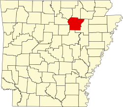
Magness is located in eastern Independence County.

According to the United States Census Bureau, Magness has an area of 0.58 square miles (1.5 km2), all land. [3] The town is named after a family, or one of its members (probably Colonel Morgan Magness), who was prominent in Independence County before the Civil War. They were the largest slaveholding family in the county, but since Independence County, located in the mountains, had few slaves, the Magnesses had less than 20.

Transportation

Arkansas Highway 69 passes through the town, leading east 2 miles (3 km) to Newark and north 3 miles (5 km) to Sulphur Rock. Batesville, the county seat, is 12 miles (19 km) to the northwest via Highway 69.

Demographics

Historical population
CensusPop.Note
1910 216
1920 199−7.9%
1930 179−10.1%
1940 22626.3%
1950 2291.3%
1960 140−38.9%
1970 139−0.7%
1980 19641.0%
1990 158−19.4%
2000 19120.9%
2010 2025.8%
2020 2208.9%
U.S. Decennial Census [4]

As of the census [5] of 2000, there were 191 people, 82 households, and 55 families residing in the town. The population density was 129.4/km2 (333.3/mi2). There were 91 housing units at an average density of 61.6/km2 (158.8/mi2). The racial makeup of the town was 98.95% White, and 1.05% from two or more races. 0.52% of the population were Hispanic or Latino of any race.

There were 82 households, out of which 28.0% had children under the age of 18 living with them, 52.4% were married couples living together, 9.8% had a female householder with no husband present, and 32.9% were non-families. 29.3% of all households were made up of individuals, and 17.1% had someone living alone who was 65 years of age or older. The average household size was 2.33 and the average family size was 2.89.

In the town, the population was spread out, with 24.6% under the age of 18, 5.2% from 18 to 24, 22.5% from 25 to 44, 24.6% from 45 to 64, and 23.0% who were 65 years of age or older. The median age was 43 years. For every 100 females, there were 91.0 males. For every 100 females age 18 and over, there were 94.6 males.

The median income for a household in the town was $27,969, and the median income for a family was $35,000. Males had a median income of $27,750 versus $16,058 for females. The per capita income for the town was $24,967. About 14.3% of families and 22.6% of the population were below the poverty line, including 23.1% of those under the age of eighteen and 32.7% of those 65 or over.

Related Research Articles

<span class="mw-page-title-main">Independence County, Arkansas</span> County in Arkansas, United States

Independence County is a county located in the U.S. state of Arkansas. As of the 2020 census, the population was 37,938. The county seat is Batesville. Independence County is Arkansas's ninth county, formed on October 20, 1820, from a portion of Lawrence County and named in commemoration of the Declaration of Independence. It is an alcohol prohibition or dry county.

<span class="mw-page-title-main">Bergman, Arkansas</span> Town in Arkansas, United States

Bergman is a town in Boone County, Arkansas, United States. The population was 439 at the 2010 census. It is part of the Harrison Micropolitan Statistical Area.

<span class="mw-page-title-main">Valley Springs, Arkansas</span> Town in Arkansas, United States

Valley Springs is a town in Boone County, Arkansas, United States. The population was 175 at the 2010 census. It is part of the Harrison Micropolitan Statistical Area.

<span class="mw-page-title-main">Oak Grove, Carroll County, Arkansas</span> Town in Arkansas, United States

Oak Grove is a town in Carroll County, Arkansas, United States. The population was 386 at the 2020 census.

<span class="mw-page-title-main">Mount Vernon, Arkansas</span> City in Arkansas, United States

Mount Vernon is a town in Faulkner County, Arkansas, United States. The population was 145 at the 2010 census. It is part of the Central Arkansas region.

<span class="mw-page-title-main">Moorefield, Arkansas</span> Town in Arkansas, United States

Moorefield is a town in Independence County, Arkansas, United States. It was named after Jesse A. Moore who owned most of the land in the area of the town at that time. The population was 137 at the 2010 census.

<span class="mw-page-title-main">Oil Trough, Arkansas</span> Town in Arkansas, United States

Oil Trough is a town in Independence County, Arkansas, United States. The population was 260 at the 2010 census. The town is believed to have acquired its name in the early 19th century from a trough used to render bear fat, which was sold to customers in New Orleans.

<span class="mw-page-title-main">Pleasant Plains, Arkansas</span> Town in Arkansas, United States

Pleasant Plains is a town in Independence County, Arkansas, United States. The population was 349 at the 2010 census, up from 267 in 2000.

<span class="mw-page-title-main">Sulphur Rock, Arkansas</span> Town in Arkansas, United States

Sulphur Rock is a town in Independence County, Arkansas, United States. The population was 456 at the 2010 census.

<span class="mw-page-title-main">Mount Pleasant, Arkansas</span> Town in Arkansas, United States

Mount Pleasant is a town in Izard County, Arkansas, United States. As of the 2020 census, the town population was 353.

<span class="mw-page-title-main">Tupelo, Arkansas</span> Town in Arkansas, United States

Tupelo is a town in Jackson County, Arkansas, United States. The population was 180 at the 2010 census.

<span class="mw-page-title-main">Minturn, Arkansas</span> Town in Arkansas, United States

Minturn is a town in Lawrence County, Arkansas, United States. The population was 109 at the 2010 census.

<span class="mw-page-title-main">Rondo, Arkansas</span> Town in Arkansas, United States

Rondo is a town in Lee County, Arkansas, United States. The population was 198 at the 2010 census, down from 237 at the 2000 census.

<span class="mw-page-title-main">Morrison Bluff, Arkansas</span> Town in Arkansas, United States

Morrison Bluff is a town in Logan County, Arkansas, United States. The population was 64 at the 2010 census and an estimated 81 in 2017.

<span class="mw-page-title-main">Hindsville, Arkansas</span> Town in Arkansas, United States

Hindsville is a town in Madison County, Arkansas, United States. The population was 90 at the 2020 census. It is part of the Northwest Arkansas region.

<span class="mw-page-title-main">Garland, Arkansas</span> Town in Arkansas, United States

Garland, also known as Garland City, is a town in Miller County, Arkansas, United States. It is part of the Texarkana, Texas - Texarkana, Arkansas Metropolitan Statistical Area. The population was 195 at the 2020 census, down from 242 in 2010.

<span class="mw-page-title-main">Marie, Arkansas</span> Town in Arkansas, United States

Marie is a town in Mississippi County, Arkansas, United States. It was founded by the R.E.L. Wilson cotton company. The population was 108 at the 2020 census.

<span class="mw-page-title-main">Victoria, Arkansas</span> Town in Arkansas, United States

Victoria is a town in Mississippi County, Arkansas, United States. The population was 20 as of the 2020 census, down from 37 in 2010. It is named after a sister of the town's founder, Robert E. Lee Wilson.

<span class="mw-page-title-main">Rosston, Arkansas</span> Town in Arkansas, United States

Rosston is a town in south-central Nevada County, Arkansas, United States. The population was 265 at the 2000 census. It is part of the Hope Micropolitan Statistical Area.

<span class="mw-page-title-main">Western Grove, Arkansas</span> Town in Arkansas, United States

Western Grove is a town in northeastern Newton County, Arkansas, United States. The population was 384 at the 2010 census. It is part of the Harrison Micropolitan Statistical Area.

References

  1. "2020 U.S. Gazetteer Files". United States Census Bureau. Retrieved October 29, 2021.
  2. 1 2 U.S. Geological Survey Geographic Names Information System: Magness, Arkansas
  3. 1 2 "Geographic Identifiers: 2010 Census Summary File 1 (G001): Magness town, Arkansas". American Factfinder. U.S. Census Bureau. Archived from the original on February 13, 2020. Retrieved March 23, 2018.
  4. "Census of Population and Housing". Census.gov. Retrieved June 4, 2015.
  5. "U.S. Census website". United States Census Bureau . Retrieved January 31, 2008.