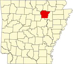
Newark, Arkansas | |
---|---|
Coordinates: 35°42′27″N91°26′36″W / 35.70750°N 91.44333°W [1] | |
Country | United States |
State | Arkansas |
County | Independence |
Area | |
• Total | 1.65 sq mi (4.26 km2) |
• Land | 1.65 sq mi (4.26 km2) |
• Water | 0.00 sq mi (0.00 km2) |
Elevation | 299 ft (91 m) |
Population (2020) | |
• Total | 1,180 |
• Density | 717.33/sq mi (276.99/km2) |
Time zone | UTC−06:00 (Central (CST)) |
• Summer (DST) | UTC−05:00 (CDT) |
ZIP Code | 72562 |
Area code | 870 |
FIPS code | 05-49010 |
GNIS feature ID | 2404368 [1] |
Website | www |
Newark is a city in Independence County, Arkansas, United States. The population was 1,180 at the 2020 census.
Newark is located in east central Independence County approximately three miles north of the White River, [3] and near the mouth of the Black River.
According to the United States Census Bureau, the city has a total area of 1.8 square miles (4.7 km2), all land. [4]
Census | Pop. | Note | %± |
---|---|---|---|
1900 | 315 | — | |
1910 | 595 | 88.9% | |
1920 | 906 | 52.3% | |
1930 | 897 | −1.0% | |
1940 | 802 | −10.6% | |
1950 | 913 | 13.8% | |
1960 | 728 | −20.3% | |
1970 | 849 | 16.6% | |
1980 | 1,128 | 32.9% | |
1990 | 1,159 | 2.7% | |
2000 | 1,219 | 5.2% | |
2010 | 1,176 | −3.5% | |
2020 | 1,180 | 0.3% | |
U.S. Decennial Census [5] |
Race | Number | Percentage |
---|---|---|
White (non-Hispanic) | 1,067 | 90.42% |
Black or African American (non-Hispanic) | 17 | 1.44% |
Native American | 3 | 0.25% |
Pacific Islander | 1 | 0.08% |
Other/Mixed | 42 | 3.56% |
Hispanic or Latino | 50 | 4.24% |
As of the 2020 United States census, there were 1,180 people, 469 households, and 302 families residing in the city.
As of the census [7] of 2000, there were 1,219 people, 500 households, and 345 families residing in the city. The population density was 696.9 inhabitants per square mile (269.1/km2). There were 562 housing units at an average density of 321.3 per square mile (124.1/km2). The racial makeup of the city was 96.55% White, 0.66% Black or African American, 0.98% Native American, 0.49% Asian, 0.08% Pacific Islander, 0.08% from other races, and 1.15% from two or more races. 0.90% of the population were Hispanic or Latino of any race.
There were 500 households, out of which 35.8% had children under the age of 18 living with them, 55.0% were married couples living together, 10.6% had a female householder with no husband present, and 31.0% were non-families. 29.0% of all households were made up of individuals, and 18.0% had someone living alone who was 65 years of age or older. The average household size was 2.44 and the average family size was 3.01.
In the city, the population was spread out, with 26.7% under the age of 18, 8.8% from 18 to 24, 27.6% from 25 to 44, 21.5% from 45 to 64, and 15.4% who were 65 years of age or older. The median age was 36 years. For every 100 females, there were 87.0 males. For every 100 females age 18 and over, there were 83.6 males.
The median income for a household in the city was $28,239, and the median income for a family was $34,545. Males had a median income of $27,404 versus $17,692 for females. The per capita income for the city was $14,392. About 9.1% of families and 14.2% of the population were below the poverty line, including 18.5% of those under age 18 and 20.1% of those age 65 or over.
Students in Newark are served by Cedar Ridge School District. It was formed on July 1, 2004, from the consolidation of the Newark School District and the Cord Charlotte School District. [8]
The local high school has won three basketball state championships, two quiz bowl state titles, and one softball state championship.[ citation needed ] NBA shooting guard Austin Reaves attended Cedar Ridge and helped them win back-to-back state championships. [9] Austin holds the single game scoring record, scoring 73 points in a triple-overtime win over Forrest City High School. [10] The first Cedar Ridge Basketball State Championship came against East Poinsett County, which at the time had Malik Monk, who went on to become a shooting guard for Kentucky.[ citation needed ]
Lawrence County is a county located in the U.S. state of Arkansas. As of the 2020 census, the population was 16,216. The county seat is Walnut Ridge. Lawrence County is Arkansas's second county, formed on January 15, 1815, and named for Captain James Lawrence who fought in the War of 1812. It is an alcohol prohibition or dry county.
Independence County is a county located in the U.S. state of Arkansas. As of the 2020 census, the population was 37,938. The county seat is Batesville. Independence County is Arkansas's ninth county, formed on October 20, 1820, from a portion of Lawrence County and named in commemoration of the Declaration of Independence. It is an alcohol prohibition or dry county.
Conway County is a county located in the U.S. state of Arkansas. Created as Arkansas's 11th county on October 20, 1825, Conway County has four incorporated municipalities, including Morrilton, the county seat and most populous city. The county is also the site of numerous unincorporated communities and ghost towns. The county is named for Henry Wharton Conway, a politician from a powerful political family who served as the delegate from the Arkansas Territory to the U.S. Congress from 1823 to 1827.
Pea Ridge is a city in Benton County, Arkansas, United States. The name Pea Ridge is derived from a combination of the physical location of the original settlement of the town, across the crest of a ridge of the Ozark Mountains, and for the hog peanuts or turkey peas that had been originally cultivated by Native American tribes centuries before European settlement, which later helped to provide basic subsistence once those pioneer settlers arrived.
Piggott is a city in Clay County, Arkansas, United States. It is one of the two county seats of Clay County, along with Corning. It is the northern terminus of the Arkansas segment of the Crowley's Ridge Parkway, a National Scenic Byway. As of the 2010 census, Piggott's population was 3,849. The town was named after James A. Piggott, one of the early settlers and initiator of the local post office.
Dierks is a city in Howard County, Arkansas, United States. The population was 916 as of the 2020 census, down from 1,133 in 2010.
Oil Trough is a town in Independence County, Arkansas, United States. The population was 260 at the 2010 census. The town is believed to have acquired its name in the early 19th century from a trough used to render bear fat, which was sold to customers in New Orleans.
Black Rock is a city in Lawrence County, Arkansas, United States, along the Black River. The population was 662 at the 2010 census.
Walnut Ridge is a city in and the county seat of Lawrence County, Arkansas, United States. The population was 5,098 at the United States Census's 2019 estimate. Walnut Ridge lies immediately north of Hoxie. The two towns form a contiguous urban area with approximately 8,000 residents. Williams Baptist University is in College City, a formerly separate community that merged into Walnut Ridge in 2017.
Austin is a city in Lonoke County, Arkansas, United States. The population was 2,038 as of the 2010 census and an estimated 3,693 as of 2018. It is part of the Little Rock–North Little Rock–Conway Metropolitan Statistical Area.
Harrisburg is a city in Poinsett County, Arkansas, United States. The population was 2,212 at the 2020 census. It is included in the Jonesboro, Arkansas Metropolitan Statistical Area. The city is the county seat of Poinsett County.
Phoenix Lake-Cedar Ridge is an unincorporated community and a former census-designated place (CDP) in Tuolumne County, California, United States. The population was 5,108 at the 2000 census.
Austin Township is a township in Mower County, Minnesota, United States. The population was 1,396 at the 2000 census. The largest city partially in the township is Austin with a population of 24,718 people. The northern parts of the city of Austin are in Lansing Township. All other population centers are unincorporated areas.
Sargeant is a city in Mower County, Minnesota, United States. The population was 63 at the 2020 census.
Bel-Ridge is a suburban city in northern St. Louis County, Missouri, United States. The population was 2,737 at the 2010 census. Bel-Ridge is part of the Normandy Schools Collaborative. Bel-Ridge became a city in 2015 by a vote of the voters.
Pleasantville, also known as Alum Bank, is a borough in Bedford County, Pennsylvania, United States. The population was 191 at the 2020 census.
Blue Ridge is a city at the intersection of state highway 78, FM 981, and FM 545 in Collin County, Texas, United States. The population was 822 at the 2010 census, and 1,180 in 2020.
West Lake Hills is a city in Travis County, Texas, United States. The population was 3,444 at the 2020 census. The city developed rapidly in the 1970s and 1980s on the south side of the Colorado River.
Cedar Hills is a city in north-central Utah County, Utah, United States. The population was 9,796 at the 2010 census, up from 3,094 in 2000. The city began growing rapidly during the 1990s and is located east of Alpine and Highland on the slopes of Mount Timpanogos.
Cedar Creek Township is a civil township of Muskegon County in the U.S. state of Michigan. The population was 3,192 at the 2020 census.
Media related to Newark, Arkansas at Wikimedia Commons