Ongerup branch railway | ||||||||||||||||||||||||||||||||||||||||||||||||||||||||||||||||||||||||||||||||||||||||||||||||||||||||
---|---|---|---|---|---|---|---|---|---|---|---|---|---|---|---|---|---|---|---|---|---|---|---|---|---|---|---|---|---|---|---|---|---|---|---|---|---|---|---|---|---|---|---|---|---|---|---|---|---|---|---|---|---|---|---|---|---|---|---|---|---|---|---|---|---|---|---|---|---|---|---|---|---|---|---|---|---|---|---|---|---|---|---|---|---|---|---|---|---|---|---|---|---|---|---|---|---|---|---|---|---|---|---|---|
![]() The heritage listed Station Master's House in Tambellup | ||||||||||||||||||||||||||||||||||||||||||||||||||||||||||||||||||||||||||||||||||||||||||||||||||||||||
Overview | ||||||||||||||||||||||||||||||||||||||||||||||||||||||||||||||||||||||||||||||||||||||||||||||||||||||||
Status | Closed | |||||||||||||||||||||||||||||||||||||||||||||||||||||||||||||||||||||||||||||||||||||||||||||||||||||||
Locale | Great Southern, Western Australia | |||||||||||||||||||||||||||||||||||||||||||||||||||||||||||||||||||||||||||||||||||||||||||||||||||||||
Termini | ||||||||||||||||||||||||||||||||||||||||||||||||||||||||||||||||||||||||||||||||||||||||||||||||||||||||
History | ||||||||||||||||||||||||||||||||||||||||||||||||||||||||||||||||||||||||||||||||||||||||||||||||||||||||
Commenced | 1911 | |||||||||||||||||||||||||||||||||||||||||||||||||||||||||||||||||||||||||||||||||||||||||||||||||||||||
Opened | 6 January 1913 | |||||||||||||||||||||||||||||||||||||||||||||||||||||||||||||||||||||||||||||||||||||||||||||||||||||||
Closed | Gnowangerup -Ongerup: 1957Tambellup-Gnowangerup : 2007 | |||||||||||||||||||||||||||||||||||||||||||||||||||||||||||||||||||||||||||||||||||||||||||||||||||||||
Technical | ||||||||||||||||||||||||||||||||||||||||||||||||||||||||||||||||||||||||||||||||||||||||||||||||||||||||
Line length | 95 km (59 mi) | |||||||||||||||||||||||||||||||||||||||||||||||||||||||||||||||||||||||||||||||||||||||||||||||||||||||
Track gauge | 1,067 mm (3 ft 6 in) | |||||||||||||||||||||||||||||||||||||||||||||||||||||||||||||||||||||||||||||||||||||||||||||||||||||||
|
The Ongerup branch railway, also known as the Tambellup, Gnowangerup to Ongerup railway is a former railway line in the Great Southern region of Western Australia.
The 94.1-kilometre (58.5 mi) Tambellup to Ongerup branch line from the Great Southern Railway main line between Perth and Albany was opened to Gnowangerup on 1 July 1912, and finally through to Ongerup on 6 January 1913. [1] [2] In 1928 there had been moves to request extension beyond Ongerup, however the proposal was not successful. [3] [4]
The line was developed to provide direct access for the expanding wheat production area to the port at Albany. The line was authorised for construction under the Tambellup-Ongerup Railway Act 1911. [5] [6] [7] A timetable from 1937 shows two trains per week leaving Ongerup on Tuesdays at 06:55 and Fridays at 04:00. Lengthy connections of around 12 hours were available at Katanning for Perth, arriving approximately 30 hours after leaving Ongerup. [8]
The line went via Tambellup, Dartnall, Toolbrunup, Pallinup, Gnowangerup, Formby, Kebaringup, Borden, Laurier, Toompup and Ongerup. [8] Water supply for the trains was provided at Formby. [9]
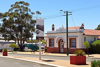
In 1918 a barracks was constructed on Eldridge Street for railway workers based in Ongerup. The building survived the closure of the railway and now houses the Ongerup and Needilup District Museum, opened in 1978. [10]
In 1954, the state government of Western Australia had compiled a list of loss-making railway operations, of which the Tambellup to Ongerup line was one, having had a total expenditure of almost four times its earnings in the financial year to June 1953, £A 64,737 expenditure versus earnings of £A 17,731. [11] The Katanning to Pingrup and Gnowangerup to Ongerup line closures in mid-1957 did result in a protest meeting in Katanning, where a number of state politicians were present to support the protest motion. [12]
In 1986 the Gnowangerup Railway Station building was closed as a working station and remained unused until 2000, when it was dismantled and moved to the Lily Vineyard, near Borden, where it was rebuilt in 2003 as a restaurant.
The section of line from Gnowangerup to Ongerup was closed on 13 October 1957. [13]
The Railways (Cue-Big Bell and other Railways) Discontinuance Act 1960, which officially closed the Gnowangerup to Ongerup line, was assented to on 12 December 1960. This act affected a number of Western Australian railways, officially closing multiple lines: [14]
The Tambellup to Gnowangerup section was closed in July 2007, with the railway line shown as "not in use" by its operator, Arc Infrastructure. [15]
Arc Infrastructure deems the railway line to be part of its Grain Freight Rail Network, which, in 2017, accounted for 50 percent of its network but only 10 percent of its freight. The line to Gnownagerup was classified as Tier 3. [16]
In 2021, it was estimated that it would cost A$55.93 million to upgrade the Tambellup to Gnowangerup section of the railway line to reopen it. [17]
Within the Shire of Broomehill–Tambellup, the entire line from Tambellup to Gnowangerup is on the shire's heritage list. [18] Additionally, the former Tambellup railway station and the station masters house as well as the railway sidings at Dartnall and Toolbrunup are on the list. The list also includes the sidings at Pootenup and Wansborough as well as the former Broomehill railway station, but these three are on the Great Southern Railway main line. [19]
In the Shire of Gnowangerup, the Gnowangerup railway station and crane, the Ongerup railway barracks and good shed and the Pallinup River railway bridge are on the shire's heritage list. [20]
Ongerup is a town and locality in the Shire of Gnowangerup, Great Southern region of Western Australia. It is 410 kilometres (250 mi) south-east of Perth and 54 kilometres (34 mi) east of Gnowangerup. At the 2021 census Ongerup had a population of 114.
Gnowangerup is a town located 61 kilometres (38 mi) south-east of Katanning in the Great Southern region of Western Australia.
The Shire of Gnowangerup is a local government area in the Great Southern region of Western Australia, about 120 kilometres (75 mi) north of Albany and about 370 kilometres (230 mi) southeast of the capital, Perth. The Shire covers an area of 4,268 square kilometres (1,648 sq mi), and its seat of government is the town of Gnowangerup.
The Shire of Tambellup was a local government area in the Great Southern region of Western Australia, about 40 kilometres (25 mi) south of Katanning and about 330 kilometres (205 mi) south-southeast of the state capital, Perth. The Shire covered an area of 1,436 square kilometres (554 sq mi), and its seat of government was the town of Tambellup.
Borden is a small town and locality in the Shire of Gnowangerup, Great Southern region of Western Australia. The town is located 325 kilometres (202 mi) south east of the state capital, Perth Western Australia, and 111 kilometres (69 mi) north of Albany on Chester Pass Road. At the 2006 census, Borden and the surrounding area had a population of 164.
The Shire of Broomehill-Tambellup is a local government area in the Great Southern region of Western Australia, 320 kilometres (200 mi) south-southeast of the state capital, Perth. The Shire covers an area of 2,609.1 square kilometres (1,007.4 sq mi), and its seat of government is the town of Tambellup. It came into existence in 2008 through the amalgamation of the former Shire of Broomehill and Shire of Tambellup.
The Great Southern Herald is a weekly newspaper published in Katanning, Western Australia. It is distributed to communities in Katanning, Kojonup, Cranbrook, Gnowangerup and Lake Grace.
The Katanning to Pingrup railway line was a state government-owned and WAGR-operated railway line connecting Katanning to Pingrup via Nyabing in the Great Southern region of Western Australia. The railway line was 95 kilometres (59 mi) long. At its western end, at Katanning, it connected to the Great Southern Railway. At Katanning, it also connected to the Donnybrook–Katanning railway, which closed in 1982.
Broomehill East is a rural locality of the Shire of Broomehill–Tambellup of the Great Southern region of Western Australia, adjacent to the town of Broomehill. The Great Southern Highway and the Great Southern Railway, for the most part, form the western border of the locality. The majority of the gazetted townsite of Peringillup and parts of the Peringillup Nature Reserve are located within Broomehill East.
Dartnall is a rural locality of the Shire of Broomehill–Tambellup in the Great Southern region of Western Australia. The Great Southern Highway and the Great Southern Railway form the far western border of the locality.
Lake Toolbrunup is a rural locality of the Shire of Broomehill–Tambellup in the Great Southern region of Western Australia. The Anderson Lake and the Three Swamps Nature Reserves are located within Lake Toolbrunup.
Ewlyamartup is a rural locality of the Shire of Katanning in the Great Southern region of Western Australia. Katanning Airport, Lake Ewlyamartup and the southern end of the Coblinine Nature Reserve are located in Ewlyamartup, while Ewlyamartup Creek runs through it.
Coyrecup is a rural locality of the Shire of Katanning in the Great Southern region of Western Australia. The Coyrecup Nature Reserve, centred around Coyrecup Lake, is located within Coyrecup.
Toompup is a rural locality of the Shire of Gnowangerup in the Great Southern region of Western Australia. Toompup borders the townsite of Borden and Chester Pass Road in the west and the townsite of Ongerup in the north-east. The Toompup Nature Reserve is located within Toompup.
Kebaringup is a town and locality of the Shire of Gnowangerup in the Great Southern region of Western Australia. Kebaringup borders the townsite of Borden to the south-east, while the Pallinup River forms much of its southern border. The Chirelillup Nature Reserve is located within Kebaringup.
Pallinup is a rural locality of the Shire of Gnowangerup in the Great Southern region of Western Australia. Pallinup borders the townsite of Gnowangerup to the east, while the Pallinup River runs through the south-west of the locality. Gnowangerup Airport is also located in Pallinup.
Magitup is a rural locality of the Shire of Gnowangerup in the Great Southern region of Western Australia. It borders the townsite of Borden in the north-east. The Pallinup River forms much of its northern border, while Chester Pass Road forms its eastern boundary.
Mills Lake is a rural locality of the Shire of Gnowangerup in the Great Southern region of Western Australia. Mills Lake borders the townsite of Ongerup in the south-west. The No.2 Rabbit-proof fence once passed through the north-east of the locality.