List
State Register of Heritage Places
The Western Australian State Register of Heritage Places, as of 2023 [update] , lists the following five state registered places within the Shire of Broomehill-Tambellup:
| Place name | Place # | Street number | Street name | Suburb or town | Co-ordinates | Notes & former names | Photo |
|---|---|---|---|---|---|---|---|
| St Elizabeth's Anglican Church | 306 | Corner | Janitor & Davine Streets | Broomehill | 33°50′48″S117°38′20″E / 33.846644°S 117.638898°E | Police Station and Court House, St Elizabeth of Hungary Anglican Church |  |
| Broomehill Shire Hall and Road Board Offices (former) | 308 | 30360 | Great Southern Highway | Broomehill | 33°50′40″S117°38′20″E / 33.844344°S 117.638814°E | Town Hall, Sheridans Hall |  |
| Jones's Buildings (former) | 310 | 10 | Journal Street | Broomehill | 33°50′43″S117°38′17″E / 33.845383°S 117.638057°E | Broomehill General Store |  |
| St Peter's Church | 2548 | Pindellup Road | Pindellup | 33°58′51″S117°29′43″E / 33.980773°S 117.495269°E | Church of the Wildwoods, St Peter's Anglican Church | ||
| Martinup | 3322 | 1841 | Broomehill-Gnowangerup Road | Broomehill East | 33°53′15″S117°51′22″E / 33.88747°S 117.856164°E | Martinup Homestead & Outbuildings, Martinup Homestead, Martinup Spring (or Soak) |  |
Shire of Broomehill-Tambellup heritage-listed places
The following places are heritage listed in the Shire of Broomehill-Tambellup but are not State registered:
| Place name | Place # | Street number | Street name | Suburb or town | Notes & former names | Photo |
|---|---|---|---|---|---|---|
| Broomehill Hotel | 307 | Jasper Street | Broomehill | Imperial Hotel |  | |
| Broomehill Post Office and Quarters | 309 | Corner | Journal & India Streets | Broomehill |  | |
| Presbyterian Church (former) | 311 | Corner | Journal & Jasper Streets | Broomehill | Road Board Hall, Historical Society Museum, Mechanic's Institute, Broomehill Museum |  |
| Crosby Agricultural Hall | 2537 | Corner | Crosby & Pindellup Roads | Tambellup | ||
| Tambellup Post Office | 2538 | Corner | Crowden & Norrish Streets | Tambellup |  | |
| Tambellup Hotel | 2539 | Garrity Street | Tambellup |  | ||
| Tambellup Police Station & Quarters (former) | 2540 | Garrity Street | Tambellup | Willow Craft Shop & Residence | ||
| Toolbrunup School (former) | 2541 | Corner | Pootenup & Toolbrunup Roads | Toolbrunup | ||
| Uniting Church & Methodist Church (former) Precinct | 2542 | Henry Street | Tambellup | Uniting Hall & Travelling Minister's Quarters | ||
| Bank of New South Wales & Quarters (NSW)(former) | 2543 | Norrish Street | Tambellup | Tambellup Health Centre | ||
| Agricultural Hall (former), Tambellup | 2544 | Norrish Street | Tambellup | Shire Hall, Road Board Offices (former) |  | |
| St Mary's Anglican Church | 2545 | North Terrace | Tambellup | |||
| Shearers Quarters | 2546 | Saggers Property | Tambellup | Hospital (former) | ||
| Tambellup Railway Station (former) Precinct | 2547 | 20 | Garrity Street | Tambellup | The Wool Station, Wool Foundation Headquarters |  |
| House, 11A Davine Street | 2960 | 11a | Davine Street | Broomehill | ||
| Nanamillup Homestead (former) & Outbuildings | 3599 | Broomehill-Kojonup Road 12 km West of Broomehill | Broomehill | Fairfield, Graham's Mill | ||
| Pindellup Pioneers Cemetery | 3995 | Corner | Pindellup & North West Roads | Pindellup | ||
| Norrish Homestead, Tambellup | 4005 | 3319 | Gnowangerup-Tambellup Road | Tambellup | Tamberllerup | |
| Corner Shop Museum | 4556 | 36 | Norrish Street | Tambellup | ||
| Infant Health Centre, Tambellup | 4557 | 18 | Crowden Street | Tambellup | Women's Friendly Rest Rooms (former) | |
| JS Roe Memorial Plaque | 6184 | Broomehill-Kojonup Road, front of Eticup | Broomehill | |||
| Eticup Memorial | 6186 | Broomehill-Kojonup Road, front of Eticup | Broomehill | |||
| Krakouer's Store, Eticup - Site | 6187 | Broomehill-Kojonup Road | Broomehill | |||
| Whitton House Ruins - Site | 6188 | Eticup Settlement | Broomehill | |||
| Thomas Francis Carmody Grave | 6189 | Condeena property | Broomehill | |||
| James Bridges Grave, Beejenup | 6190 | Pallinup Road | Broomehill | |||
| George Howard Annice Grave, Hayfield | 6191 | Flat Rocks Road | Broomehill | |||
| Hillview | 6192 | Latham Street | Broomehill | |||
| Coorinyup Bridge over Wadjeganup River | 6193 | Flat Rocks Road | Broomehill | MRWA 4238 | ||
| Beejenup Wayside Inn - Site of | 6194 | Pallinup Road | Broomehill | |||
| Broomehill Railway Station, Ficus & Ironbark Trees | 6195 | Jasper Street | Broomehill | |||
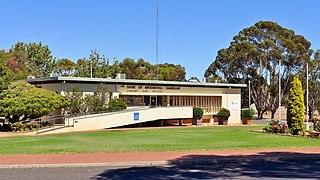
| Shire of Broomehill Offices & Library | 6196 | 30360 | Great Southern Highway | Broomehill |  | |
| Condeena Estate, Broomehill | 6198 | Broomehill-Kojonup Road | Broomehill West | Goblup Estate | ||
| Sunnyside Homestead & Men's Quarters | 6200 | Broomehill-Kojonup Road | Broomehill | |||
| Nardlah Homestead | 6202 | Nardlah Road | Broomehill | |||
| Langwell | 6203 | Brassey Road | Broomehill | Shiloh College | ||
| Moorellup (former) | 6204 | Pallinup Road | Broomehill | Fermoy | ||
| St Peter's Church, Eticup - Site | 6205 | Greenhills Road | Broomehill | |||
| Oaklands School | 6206 | Broomehill-Kojonup Road | Broomehill | |||
| Roundwood School - Site | 6207 | Beejenup Road | Broomehill | |||
| Nigalup School - Site | 6208 | Pallinup Road | Broomehill | |||
| Flat Rocks School - Site | 6209 | Flat Rocks Road | Broomehill | |||
| Eticup Cemetery | 6210 | Greenhills Road | Broomehill | |||
| Broomehill Cemetery | 6211 | Kojonup Road West of | Broomehill | |||
| Broomehill Recreational Complex | 6213 | Tie Line Road | Broomehill | |||
| Flat Rocks Tennis Club | 6214 | Flat Rocks Road | Broomehill | Flat Rocks Hall | ||
| Broomehill War Memorial | 6215 | Corner | Jasper & Ivy Streets | Broomehill |  | |
| Holland Track Memorial | 6216 | Jasper Street | Broomehill | |||
| Broomehill RSL & Citizens' Hall | 6918 | Corner | Journal & India Streets | Broomehill | ||
| Bakery - Site of | 12247 | Corner | Taylor & George Streets | Tambellup | ||
| Bessen's Garage & Residence Site | 12248 | Crowden Street | Tambellup | Tambellup Deli | ||
| Jam Creek (South) Bridge | 12249 | Garrity Street | Tambellup | |||
| Parnell St Bridge (Jam Creek) - Site of | 12250 | Parnell Street | Tambellup | |||
| Butcher Shop | 12251 | 80 | Norrish Street | Tambellup | ||
| Alan Jones' Butcher Shop | 12252 | Norrish Street | Tambellup | |||
| Butcher Shop (former) | 12253 | Garrity Street | Tambellup | Site of the goldborough Mort. Agency | ||
| Cemetery Site No. 2 | 12254 | Great Southern Highway | Tambellup | |||
| Clay Pits/Brickworks - Site of | 12255 | Saggers Road | Tambellup | |||
| Co-op Managers Residence | 12256 | Corner | Taylor & Owen Streets | Tambellup | ||
| Stirling Co-operative Store | 12257 | 28 | Norrish Street | Tambellup | ||
| Croquet Club (former) | 12258 | Corner | Taylor & Henry Streets | Tambellup | Children's Playground | |
| CWA Rest Rooms, Tambellup | 12259 | Henry Street | Tambellup | |||
| Diprose Court - Site | 12262 | Corner | Taylor/Henry/Crowden Streets | Tambellup | ||
| Flood Indicator Board | 12263 | Norrish Street | Tambellup | |||
| General Store | 12265 | Norrish Street | Tambellup | former Richardson's Store | ||
| Golf Club Clubhouse | 12266 | Bourke Street | Tambellup | |||
| Headmaster's House (former) | 12268 | 284 | Norrish Street | Tambellup | ||
| Herbert's Garage | 12269 | 31 | Garrity Street | Tambellup | ||
| Hitching Rail | 12270 | Norrish Street | Tambellup | |||
| Nurse Turner's Private Hospital (former) - Site | 12271 | Corner | Main West Road & Lovegrove Street | Tambellup | ||
| Government Cottage Hospital (former) - Site | 12272 | Saggers Street | Tambellup | |||
| Lovegrove | 12274 | Lovegrove Street | Tambellup | |||
| Masonic Hall | 12275 | 7 | Tambellup West Road | Tambellup | ||
| Migrant Transit Camp - Site of | 12276 | Great Southern Highway/Railway Line at Garrity Street | Tambellup | |||
| Nursing Post and Residence | 12277 | Taylor Street | Tambellup | |||
| Page House | 12279 | Corner | Main West & Johnston Roads | Tambellup | ||
| Pine Trees - Site of | 12280 | Corner | Norrish South & Parnell Street | Tambellup | ||
| Police Station - Site of | 12281 | Great Southern Highway | Tambellup | |||
| Tambellup Police Station & Court House Precinct | 12282 | Owen Street | Tambellup | |||
| Post Master's House | 12283 | Norrish Street | Tambellup | |||
| Tambellup Post Office (former) | 12284 | Corner | Taylor & Crowden Streets | Tambellup | House | |
| Baptist Chapel (former) | 12287 | Taylor Street | Tambellup | Priest's House, Roman Catholic Church of St Michael's Prec, Sister's of Motor Mission Convent | ||
| R.S.L. Hall | 12288 | Corner | Garrity Street & Great Southern Highway | Tambellup |  | |
| Tambellup Primary School | 12289 | Taylor Street | Tambellup | |||
| Tambellup School - First Site | 12293 | Owen Street | Tambellup | |||
| Shire Offices and Council Chambers | 12294 | Norrish Street | Tambellup | |||
| Hairdresser's Salon & Billiard Room (former) | 12295 | 34 | Norrish Street | Tambellup | Snowy Wilson's Electrical Shop, Tea Rooms/Deli, West Australian Bank | |
| Sports Ground | 12296 | East Terrace | Tambellup | |||
| Tea Rooms - Site of | 12297 | 16 | Crowden Street | Tambellup | ||
| Tennis Courts & Pavilion | 12298 | East Terrace | Tambellup | |||
| Pine Trees, Tambellup School - Minnie Saggers | 12299 | Corner | Taylor & Howard Streets | Tambellup | ||
| Turner Memorial Stone | 12300 | Corner | Main Street West & Lovegrove Street | Tambellup | ||
| Tambellup War Memorial | 12302 | Norrish Street | Tambellup |  | ||
| Water Fountain | 12303 | Norrish Street | Tambellup | |||
| Tambellup Water Tower | 12304 | Norrish Street | Tambellup | |||
| Wheat Storage Bin - Site of | 12306 | Garrity Street | Tambellup | |||
| Addison House - Site of | 12307 | North West Road, River bank | Tambellup | |||
| Agricultural Society Showgrounds No 1 - Site | 12308 | Garrity Street | Tambellup | |||
| Agricultural Society Showgrounds No 2 - Site | 12309 | Garrity Street | Tambellup | |||
| Agricultural Society Showgrounds No 3 - Site | 12310 | Main West Road | Tambellup | |||
| Lowboi (former) | 12311 | Main West Road | Tambellup | Binninup Pool | ||
| Boatshed | 12312 | Russell Street, Banks of Gordon River | Tambellup | |||
| Bobalong Sports Ground | 12313 | Corner | Crosby & Pindellup Roads | Tambellup | ||
| Bobalong Hall - Site of | 12318 | Corner | Crosby & Pindellup Roads | Tambellup | ||
| Sagger's Brickworks (Kilns with 3 fires) - Site | 12319 | Sagger's Property | Tambellup | Saggers Paddock | ||
| Brickworks - Site of | 12320 | Maninetti's Farm | Tambellup | |||
| Bush Shelter Church - Site of | 12321 | Pindellup Road | Pindellup | |||
| Cemetery Reserve | 12322 | Gnowangerup-Tambellup Road | Tambellup | |||
| Charcoal Pits - Site of | 12323 | Tambellup West Road | Tambellup | |||
| Clemies Fence | 12324 | Corner | Johnston & Nymbup Roads | Tambellup | ||
| Coach Stop - Site of | 12325 | Corner | Warrenup & Main West Roads | Tambellup | ||
| Corduroy Crossing at Wadseranhue River | 12326 | Greenhills South Road | Tambellup | |||
| Cricket Pitch | 12327 | Great Southern Highway | Tambellup | |||
| Cricket Pitch | 12328 | Pootenup Road | Toolbrunup | |||
| Crofton Soak/Well | 12329 | Great Southern Highway | Tambellup | |||
| Tambellup Dam Site No. 1, B Webster's property | 12330 | Jam Creek Road 4 km East of | Tambellup | |||
| Tambellup Dam Site No. 2 | 12331 | off | Crosby/Tambellup West Roads, Railway Reserve | Tambellup | ||
| Tambellup Dam Site No. 3 | 12332 | Tambellup-Gnowangerup R d, Dartnall Railway Res | Tambellup | |||
| Tambellup Dam Site No. 4 | 12333 | Hassell Road, Toolbrunup Railway Reserve | Tambellup | |||
| Dartnall Cottage/Shed/Mill | 12334 | Gnowangerup Road | Tambellup | |||
| Ellensfield Ruin | 12335 | North West Road, River bank | Tambellup | |||
| Golf Clubhouse - Site of | 12336 | Tambellup | ||||
| Golf Course (Saggers) - Site, Saggers Property | 12337 | Saggers Road | Tambellup | |||
| Gordon River Flying Fox & Footbridge - Site of | 12338 | Tambellup | ||||
| Grave Site, Norrish Homestead | 12339 | Gnowangerup Road | Tambellup | |||
| Grove's Cottage | 12340 | Toolbrunup Road | Tambellup | |||
| Hassell's Stock Route | 12341 | Tambellup | ||||
| Hazeldene Ruins | 12342 | Tambellup West Road | Tambellup | |||
| Hodgeson's Campsite | 12343 | Hodgson Road | Tambellup | |||
| Holme Park | 12344 | Witham Road | Tambellup | Parnell Homestead | ||
| House Ruins | 12345 | Dawson Road | Tambellup | |||
| Hull's (Tom) Homestead | 12346 | Watergarrup Road | Tambellup | |||
| Invermay | 12348 | Beejenup Road | Tambellup | |||
| Kurroing Ruin | 12349 | Tambellup | ||||
| Kylie Ruin | 12350 | Tambellup West Road | Tambellup | |||
| Manyfields | 12351 | Gnowangerup Road | Tambellup | |||
| Marlo Homestead | 12352 | North West Road | Tambellup | |||
| Minilla Ruin | 12353 | Tambellup West Road | Tambellup | |||
| Moonies Stone House | 12354 | Warrenup Road | Tambellup | |||
| The Eyrie (former) | 12355 | Paul Valley Road | Tambellup | Moree | ||
| Moree Mud Brick House | 12356 | Paul Valley Road | Tambellup | |||
| Mud Brick House | 12357 | Nymbup Road | Tambellup | |||
| Mystic Park | 12358 | Russell Street | Tambellup | Saggers Homestead | ||
| Ochre Pits | 12359 | Off | Albany Highway | Tambellup | ||
| Maslem's Orchard | 12360 | Paul Valley Road | Tambellup | |||
| Brookland Out-House Kitchen | 12361 | Crosby Road | Tambellup | |||
| Plunge Dip | 12362 | Tambellup West Road | Tambellup | |||
| Prisoner of War (POW) Control Centre - Site of | 12363 | Main West Road | Tambellup | |||
| Tambellup Power House - Site of | 12364 | Crowden Street | Tambellup | |||
| Pump Pool | 12365 | Gordon River | Tambellup | |||
| Race Club - Site of | 12366 | Paul Valley Road | Tambellup | |||
| Tingerup Race Club - Site of | 12367 | Great Southern Highway | Tingerup | |||
| Railway line to Gnowangerup | 12368 | Tambellup | ||||
| Railway Siding - Dartnall | 12369 | Dartnall | ||||
| Railway Siding - Pootenup | 12370 | Great Southern Highway | Pootenup | |||
| Railway Siding - Toolbrunup | 12371 | Toolbrunup | ||||
| Railway Siding - Wansborough | 12372 | Wansborough | ||||
| Sugar Gums, Peppercorn Trees & Gravel Pit | 12373 | Corner | Great Southern Highway & Hassell Road | Tambellup | Reserve 94 | |
| Rifle Range Mounds on Moree | 12374 | Paul Valley Road | Tambellup | |||
| Rifle Range Site | 12375 | Hankinson Road | Tambellup | |||
| Binniup School - Site of | 12376 | Binniup | ||||
| Bobalong School - Site of | 12377 | Bobalong | ||||
| Brookdale School - Site of | 12378 | Brookdale | ||||
| Moonies Hill School - Site & Moreton Bay Fig Tree | 12379 | Corner | Bessen & Moonies Hill Roads | Moonies Hill | ||
| Ornabullup School - Site of | 12380 | Greenbushes Road S | Ornabullup | |||
| Tingerup School - Site of | 12381 | Great Southern Highway | Tingerup | |||
| Shearing Shed and Men's Hut, Rosedale | 12382 | Gnowangerup Road | Tambellup | |||
| WAGR Sheep/Cattle Holding Yard Site | 12383 | Garrity Street Railway Res | Tambellup | |||
| Sheep Dip | 12384 | Tallent Road | Tambellup | |||
| Sheep Sale Yard Site No. 1 | 12385 | Taylor Street | Tambellup | |||
| Sheep Sale Yards No. 2 | 12386 | Off | Great Southern Highway | Tambellup | ||
| Jam Creek Sheep Wash Pool | 12387 | Jam Creek Road | Jam Creek | |||
| Silo at Taylor Homestead | 12388 | Tambellup | ||||
| Silo on Richardson Property | 12389 | Great Southern Highway | Tambellup | |||
| Slee House | 12390 | Tambellup | ||||
| First Sportsground - Site of | 12391 | Main West Road | Tambellup | |||
| Spring Hill Residence | 12392 | Tambellup | ||||
| Stock Route | 12393 | Paul Valley/Watergarrup Roads | Tambellup | |||
| Tang Wang Vegetable Garden, Manyfields | 12394 | Tambellup | ||||
| Tank Stand | 12395 | Main West Road | Pindellup | |||
| Tingerup Hall - Site of | 12396 | Corner | Johnson & Watergarrup Roads | Tingerup | ||
| Tunney Tennis Courts and Cricket Pitch | 12398 | Albany Highway | Tunney | |||
| Tunney Township Site | 12399 | North of | Albany Highway | Tunney | ||
| The Ranch (former) | 12400 | Binniup Road | Tambellup | Ukurrie | ||
| Uranbah Homestead | 12401 | Tambellup | ||||
| Wansbrough Hall - Site of | 12402 | Wansborough | Wansborough Hall - Site of | |||
| Well | 12403 | Albany Highway | Tambellup | |||
| White Gum & Pine Trees | 12404 | Great Southern Highway | Tambellup | |||
| Windermere | 12405 | Warrenup Road | Tambellup | |||
| Woodlands | 12406 | Pindellup | ||||
| Woolshed and Stone Plunge Dip | 12407 | Nymbup Road | Tambellup | |||
| Broomehill Town Centre Precinct | 12413 | Ivy, Jasper, Journal and India Streets | Broomehill | |||
| Holland's Track | 16818 | Multiple LGAs | ||||
| Tambellup Police Station | 17357 | Owen Street | Tambellup | |||
| Uniting Hall & Travelling Ministers Quarters | 23824 | Henry Street | Tambellup | Methodist Church | ||
| Workmen's Cottage | 23831 | Broomehill-Kojonup Road | Broomehill | |||
| Moreton Bay Fig Tree | 23832 | Corner | Bessen & Moonies Hill Roads | Moonies Hill | ||
| Ficus and Ironbark Tree | 23838 | Jasper Street | Broomehill | |||
| Woolshed and Yards | 23873 | Tambellup-Gnowangerup Road | Tambellup | |||
| Sunnyside Men's Quarters | 23908 | Broomehill-Kojonup Road | Broomehill | |||
| Tambellup Railway Stationmaster's House | 23939 | Norrish Street | Tambellup |  | ||
| Broomehill Railway Station | 24407 | Jasper Street | Broomehill | |||
| Uniting Church & Methodist Church (former) | 24426 | Henry Street | Tambellup | |||
| Tambellup Railway Station (former) | 24436 | Norrish Street | Tambellup |  | ||
| Sunnyside Homestead | 24449 | Broomehill-Kojonup Road | Broomehill | |||
| House, 56 Leathley Street, Broomehill | 25331 | 56 | Leathley Streetreet | Broomehill | ||
| Wadjekanup River Road Bridge, Broomehill West | 25490 | Broomehill West | MRWA Bridge 4233 | |||
| Pallinup River Road Bridge | 25491 | Broomehill East | MRWA Bridge 4241 | |||
| Broomehill Council Machinery Shed (former) | 25911 | 30374 | Great Southern Highway | Broomehill | ||
| MRWA Bridge 354, Northam Cranbrook over Ewlyamartup Creek, Broomehill East | 270202 | Northam Cranbrook over Ewlyamartup Creek | Broomehill East |